“From West of Casper, WY to outside of Sacramento, CA free camping on public lands can happen almost anywhere you can find a place to put your sleeping bag down. I wouldn’t necessarily suggest a hammock as there aren’t very many tall things to tie off to out in the high desert.
“The amount of earth and sky in view at once was rather appalling. Something familiar about the situation kept ringing a bell in my memory, and suddenly I audibly recalled the ‘tiny moving speck of humanity in the great, rolling waste of sage,’ without which no self-respecting western novel can get past its first page. Thus oriented into the picture, we went on slowly in approved style. . . .
In spite of its easy grades, the Rock Mountain chain at South Pass is quite a hurdle to cross. To the emigrants it was also a symbol, and many an Argonaut forgot his quest for gold and only remembered in these las few miles of the Atlantic watershed that the backbone of the continent would soon divide him from his family, perhaps forever.
As the teams drew near the top it became increasingly cold, and men shivered around the insufficient sagebrush fires at night thinking wishfully of the extra blankets they had thrown away. The encampment of Shoshones which the gold-seekers found near the top of the mountain got many requests for buffalo robes. . . .
Far to our left, on the rim of the pass, the Oregon Buttes raised their rugged crests. The name, when given, was descriptive, for in early trail days all the shaggy wilderness that lay between the mountain top and the mouth of the Columbia was Oregon. Before us, through the flat sage land, the great emigration road unrolled in an enormous ribbon one hundred feet wide. We paralleled its resistless onward sweep. The omnipotent Artist who created this mighty picture used bold stokes. The swelling summits on each side are too huge for detail . . .
So muc earth; so terrifically much sky; and so close together! The first few wagon trains across the God-given pass feel that they are squeezing between the two.”
Irene D. Paden, The Wake of the Prairie Schooner, p. 225, 228, 231
Mile 1005: Three Crossings Station
Three Crossings Station, WY 1870
“Incredibly, there are places that are now less developed in the Western United States than when the Pony Express went through over 150 years ago! Pictured below is Three Crossings Station in Wyoming. The black and white photo is from 1870 and the colored photo (of the same area) is from this year!”
Three Crossings Station, WY – 2018
[N.B. Source of the name? “Wagon-train emigrants traveling the Oregon Trail along the Sweetwater River in the mid-1800s came to a place called the Narrows, where steep hills close to the river forced the trail to cross it three times within two miles.” From wyominghistory.org]
“Here is a map of the section in Wyoming that I wasn’t able to scout myself. I’d love to have the route go through the Burnt Ranch station, but it appears that it is on private land. When I arrived at the fence on the road there were 4 signs warning people that the land was private. It was dark and I wasn’t about to enter their land to ask for permission.”
“The road continually crossed and recrossed the conspicuous ruts left by the caravans which at this point had saved weary miles by cutting off a bend in the river. Men and women both, and especially children, here had looked forward with a the keenest anticipation to the hour they would spend at Icy Slough.
We have many descriptions of the place, for inevitably it proved a diversion. Delano wrote that they here encountered a ‘morass, perhaps a mile in length by half a mile in breadth. Some of the boys, thinking that water could easily be obtained, took a spade, and going out on the wild grass, commenced digging. About a foot from the surface, instead of water, they struck a beautiful layer of ice, five or six inches in thickness.’ . . .
Companies planned to noon there for the sake of genuine enjoyment afforded. The travelers could use a little diversion; and, as a morale booster, Icy Slough, the last of the trail landmarks that everyone must pass, had few equals.”
Irene D. Paden, The Wake of the Prairie Schooner, p. 221
Mile 1043: St. Mary's Crossing
“In the flat was a small marker for the site of old St. Mary’s stage station, usually referred to as St. Mary’s Crossing. Two buffalo horns, gray and scaly from long exposure, lay beside it. . . .
There are no evidences remaining of the old station house; but tradition at the Ellis ranch places it in that particular spot, and we saw no reason to doubt the accuracy of the marker.”
Irene D. Paden, The Wake of the Prairie Schooner, p. 226
Mile 1045: Rocky Ridge
Rocky Ridge, WY
“Rocky Ridge. Yes, the trail goes up this ridge. Climbing over 700 feet in less than 2 miles, this ridge caused a lot of problems for pioneer hand carts and wagons alike.
In 1856, the rescue of the Mormon Willie and Martin Handcart companies crossed this ridge. From the base of Rocky Ridge to Rock Creek took the parties over 27 hours to travel the roughly 15 miles, partially due to a winter blizzard and a lack of adequate clothing. The hand carts companies had to be rescued before this point as 21 individuals perished in the valley below.
This section of the trail is known as the “Trail of Blood.” While I would say it’s possible to traverse the entire South Pass section, from Sweetwater station to Farson, in a single day, it’s not a trek to be taken lightly. Be sure to have a water filter and/or treatment with you and keep an eye to the sky. The weather can change quickly as you’re around 7,000 feet of elevation and at the foot of the Wind River mountain range, which is the edge of the Teton mountains. Oh, and pack plenty of food. You may find yourself out there a little longer than you plan initially.”
[N.B. There are two markers: Rocky Ridge Lower Marker and Rocky Ridge Upper Marker. These are not on the Pony Express Bikepacking Trail. To see these, take a turnoff at about Mile 1045 1/32. The detour rejoins the Bikepacking trail just past Mile 1049.]
“Rock Creek Hollow. A stop along the trail that holds significance for the Mormon faith.
Mormons made the trek to Salt Lake City with only hand pushed carts. They could only carry about 25 lbs [250lbs?] of items on these carts total. The cost was a fraction of that of a wagon and oxen or mule team. They could also make the journey in far less time as they could move at a quicker pace.
Along this section of the trail, from Casper, one will find a number of Mormon monuments and campgrounds.
I came upon this one with 4 hours of daylight left but decided I would set camp. There is a bubbling stream that I filtered water from and sat and watched a storm brew at the base of the Wind River range.
One of the best nights I’ve ever had in the back country!”
“The air is so dry out here that it takes forever for wood to rot. Some of these structures have been around for well over 100 years and haven’t been touched. They’re pretty cool to see.”
“It is all part and parcel of the unsatisfactory nomenclature of the trail that South Pass is by no means to the south.
The descriptive title was first used by trappers who had moved into the untimbered, Indian-infested prairies along the northern reaches of the Missouri River. In 1823 trouble with the Arikaras closed this route, and a picked group of William Ashley’s mountain men, desirous of reaching the new trapping fields of the Green River, set out to locate the strange, smooth gap through the Rocky Mountains of which they had heard from the Indians. It lay to the south, in the country of the Crows, and they spoke of it as the South or Southern Pass.Directions of a kind were obtained at a Crow village and, after wintering as best they could, the trappers left the headwaters of the Sweetwater River, moving west across the mountains.The country was oddly flat, but sometime in March 1824, they discovered to their joy that the creeks were flowing westward under their sheaths of ice, and knew that they had reached the Pacific watershed. From this date the pass was known and used by white men.
The crossing of the Rockies was not dreaded by the emigrants, who knew from their guidebooks that the grade was easy and the summit flat and unbroken. That there might be exigencies on a mountain top beyond the danger of falling off did not occur to travelers to whom an elevation of seven thousand feet was an unheard-of experience. It was with as few misgivings as the uncertainty of the trail ever permitted that the wagon trains ascended the valley of the Sweetwater on their way to the pass.”
Irene D. Paden, The Wake of the Prairie Schooner, p. 223
Mile 1075: South Pass
“Ten miles beyond Ford No. 9, hilly miles, ending in a long champaign having some of the characteristics of a rolling prairie . . . led us to the South Pass, the great Wasserscheide between the Atlantic and the Pacific, and the frontier points between the territory of Nebraska and the State of Oregon. . . .
“The last part of the ascent is so gentle that it is difficult to distinguish the exact point where the versant lies : a stony band crossing the road on the ridge of the table-land is pointed out as the place, and the position has been fixed at N. lat. 48 19′, and W. long. 108 40′. The northern limit is the noble chain of Les Montagnes Eocheuses, which goes by the name of the Wind River; the southern is called Table Mountain, an insignificant mass of low hills.
A pass it is not : it has some of the features of Thermopylge or the Gorge of Killiecrankie ; of the European St. Bernard or Simplon; of the Alleghany Passes or of the Mexican Barrancas. It is not, as it sounds, a ghaut between lofty mountains, or, as the traveler may expect, a giant gateway, opening through Cyclopean walls of beetling rocks that rise in forbidding grandeur as he passes onward to the Western continent. And yet the word ‘Pass’ has its significancy. In that New World where Nature has worked upon the largest scale, where every feature of scenery, river and lake, swamp and forest, prairie and mountain, dwarf their congeners in the old hemisphere, this majestic level-topped bluff, the highest steppe of the continent, upon whose iron surface there is space enough for the armies of the globe to march over, is the grandest and the most appropriate of avenues.
A water-shed is always exciting to the traveler. What shall I say of this, where, on the topmost point of American travel, you drink within a hundred yards of the waters of the Atlantic and the Pacific Oceans—that divides the ‘doorways of the west wind from the ‘portals of the sunrise? . . .
It is a suggestive spot, this ‘divortia aquarum:’ it compels Memory to revive past scenes before plunging into the mysterious ‘Lands of the Hereafter,’ which lie before and beneath the feet. The Great Ferry, which steam has now bridged, the palisaded banks of the Hudson, the soft and sunny scenery of the Ohio, and the kingly course of the Upper Mississippi, the terrible beauty of Niagara, and the marvels of that chain of inland seas which winds its watery way from Ontario to Superior; the rich pasture-lands of the North, the plantations of the semi-tropical South, and the broad cornfields of the West; finally, the vast meadow-land and the gloomy desert-waste of sage and saleratus, of clay and mauvaise terre, of red butte and tawny rock, all pass before the mind in rapid array ere they are ihrust into oblivion by the excitement of a new departure.”
Richard Burton, The City of Saints, p. 161-163
Mile 1075: South Pass
“The Sweetwater Valley took the emigrants smoothly uphill 1oo miles to the Continental Divide at South Pass. This fortuitous gap in the Rockies exists because of geologic happenstance. A Wind River-sized mountain range—the Sweetwater Range—once filled the east-west gap where the Sweetwater Valley is now. Several million years ago, it foundered to form the valley, thus opening the way west to South Pass. The Sweetwater Hills represent the exposed ridgeline of this buried range. These granite hills include two of the most famous landmarks on the Oregon-California Trail: Independence Rock and Devils Gate.”
Keith Heyer Meldahl, Hard Road West, p. 96
Mile 1075: South Pass
“But South Pass was the halfway mark on the wagon journey [to Oregon], and by now the pioneers had survived two months of Platte River storms, the outdoor cholera wards, and the high-altitude weariness of the Rockies. There had to be something to say about reaching such an important milestone. For the gifted Margaret Frink, who understood that the small, telling detail is everything, the spare surroundings at South Pass presented few problems. In her Journal of the Adventures of a Party of California Gold Seekers, she reported finding the first post office in almost a thousand miles along the trail, and in the disance she heard live music at the summit . . .”
Rinker Buck, The Oregon Trail, p. 328
Mile 1078: Pacific Springs
Pacific Springs, WY
“Pacific Springs is a marshy area just beyond South Pass in Wyoming. Seemingly unassuming, it was the first source of water for riders on the western side of the continental divide. And the Pony Express station that was built here in 1860 was the first station on the Pacific side of the United States encountered by west-bound riders! This station burned to the ground in 1862, but the remains of a cabin built in the late 1800s/ early 1900s marks its general location.”
“All the time that my brain was wandering in this pleasant fog of confused ideas, my feet were carrying me out of the troubled times of ’49 and into the comparative luxury of the sixties (for the log houses, toward which my gregarious husband started some time ago, date from the original staging days, when they constituted the important Pony Express and stage station called Pacific Spring). There are four buildings—two on each side of the old road—widely spaced so that they form the four corners of a rough rectangle. The house faces the old store and bar. The blacksmith shop stares across at the stables. It is now the John Hays horse ranch, and the buildings are in everyday use.”
Irene D. Paden, The Wake of the Prairie Schooner, p. 236
Mile 1086: Parting of the Ways
Parting of the Ways, WY
“About 18 miles after travelers on the Oregon Trail crossed the Continental Divide at South Pass, they reached a junction known now as the Parting of the Ways. The right fork went west toward Fort Hall in present southern Idaho, while the left continued southwest toward Fort Bridger and Salt Lake City. The Fort Hall route was a cutoff, opened in 1844. It saved about 46 miles and two and a half days’ travel, but only by crossing a waterless, sagebrush desert.”
“From Pacific Creek the modern road parallels the trail to Dry Sandy Creek. This disappointing watercourse is ordinarily all that its name implies; but we, like the Forty-niners, were regarding it in the summer of a wet year, and the hot, sandy bottom between steep banks boasted a string of unappetizing stagnant ponds.
The emigrant ford is right at the bridge, and the trail, continuing north of the road for some time, angles to the south side and meanders through a wide curving gap toward the Little Sandy. In the gap, Sublette’s Cutoff splits from the original trail and wanders down the mountain, keeping to the right. Well within our view as we stood on the mountain it strikes the sage flat, passes the small rocky trail landmark called Haystack Butte and goes on and on interminably through a dreary waste.
We came to the forks and paused there, realizing that the solid unit of trail, which had come up the Sweetwater so heavily burdened with wagons and stock, had again frayed out into loose ends. First the long thread of Lander’s Cutoff had unloosed itself toward the north, and now the main cord was parting into two strands. As we had planned, we bore left with the road to Fort Bridger where the light soil of the mountain side was, in the old days, so pulverized that gusty dust clouds often hid from the bewildered driver all of his team except the wheelers.”
Irene D. Paden, The Wake of the Prairie Schooner, p. 237
Mile 1095: Parting of the Ways
“About 20 miles west of the Continental Divide, the main road forked at a spot called Parting of the Ways—a point of decision. From there, travelers could either follow the Sublette Cutoff heading due west toward the trading post at Fort Hall, or take the original, better-watered route southwest toward Fort Bridger and Utah. “
“Between mountain and desert the emigrants found the Big Sandy, lovely dependable stream that it was, and went hunting for rabbits and sage hen and big plump gooseberries for pies. The ford was at modern Farson just above the junction of the Little Sandy. . . .
The Big Sandy was, of itself, clear and wholesome, but during rush years was fouled by the rotting flesh of animals that died trying to fill their baggy hides with green willow from the banks. . . .
Just where the Fort Bridger road swung over to touch the Big Sandy for the second time, the emigrants of the fifties found a fork in the trail. By turning right they might travel Kinney’s Cutoff, favored above the Sublette Cutoff because of its commendable manner of arriving at water every fifteen or twenty miles. At the fork was a trading post of logs elegantly roofed with poles and brush, and from there to the Green River was sixteen miles of dry and lusterless desert growth.”
Irene D. Paden, The Wake of the Prairie Schooner, p. 237-238
Mile 1113: Big Sandy
“After a long stage of twenty-nine miles we made Big Sandy Creek, an important influent of the Green River; the stream, then shrunken, was in breadth not less than five rods, each = 16.5 feet, running with a clear, swift current through a pretty little prairillon, bright with the blue lupine, the delicate pink malvacea, the golden helianthus, purple aster acting daisy, the white mountain heath, and the green Asclepias tuberosa, a weed common throughout Utah Territory. The Indians, in their picturesque way, term this stream Wagahongopa, or the Glistening Gravel Water.
[Note: Asclepias tuberosa, “Locally called milkweed. The whites use the silky cotton of the pods, as in Arabia, for bed-stuffings, and the Sioux Indians of the Upper Platte boil and eat the young pods with their buffalo flesh. Colonel Fremont asserts that he never saw this plant without remarking ‘on the flower a large butterfly, so nearly resembling it in color as to be distinguishable at a little distance only by the motion of its wings.'”
Richard Burton, The City of Saints, p. 167 and note
Mile 1113: Big Sandy Station
“It was here [Big Sandy Station, Farson, WY], in 1847, that mountain man Jim Bridger gave Brigham Young advice on leading the first Mormon trains into Salt Lake. In the 1860s, Mark Twain, Horace Greeley, and Sir Richard Burton stopped here on their stagecoach trips west.”
Rinker Buck, The Oregon Trail, p. 340
Mile 1115: Farson and the Green River Basin
“Crossing the Green River Basin redefines monotony. The plains roll on endlessly, blanketed by the same wearisome mantle of sagebrush and greasewood. Outside of the river bottoms and the few towns, there is not a tree in sight. Scabby buttes, eroded from the stacked limestone and shale layers of an ancient lakebed, pop up here and there across the plains. The landscape is riven with ravines, most of them bone-dry in summer. The scenery has hardly changed since emigrant days. For Edwin Bryant, it was “scarcely possible to conceive a scene of more forbidding dreariness and desolation than was presented to our view on all sides.” Only the wind seems happy in the Green River Basin. It shrieks with glee across the plains, sweeping up wraithlike clouds of grit. “It has
been windy, and there is nothing but sand—sand all around us, which is drifting constantly, filling our eyes and ears, as well as the frying pan,” A. J. McCall groused, adding, “It is not strange that it affects the temper of the men—marring all good fellowship.”
After a day of pummeling by Wyoming’s biggest bully, I can vouch that nothing is more welcome than a building-shelter!—even if it is a run-down gas station in a run-down town like Farson, a forlorn little hamlet marooned in the sagebrush wilderness of the Green River Basin. I sipped burnt coffee there one afternoon,
hiding from the wind, while leaves, newspapers, and other flotsam flew past the windows. Was this typical? Oh yes, the attendant sighed. The windows appeared cloudy. A closer look showed that they had been etched by windborne sand. Merciless wind and winter beat up the small rural towns of Wyoming. The results are evident as potholes, peeling paint, broken roofs, leaking pipes, and plywood windows. Yards spill over with rusted cars, wrecked parts, writhing heaps of hose and pipe, and tires-many, many tires. Anything that might be useful, might a save a few dollars one day, joins the heap. But local folk brim with friendship and conversation, a pleasant upshot of life with so much open space and so few people to fill it.”
Keith Heyer Meldahl, Hard Road West, p. 142
Mile 1119: Simpson's Hollow and Simpson's Gulch
“One other landmark caught our attention on the trek toward Green River—the graves in the stretch of river bank where the coulee of Simpson Hollow opens out to the Big Sandy. We were on the bridge over Simpson Hollow when we saw, coming up the gulch, a flock of soft dun sheep that blanketed the rolling banks on either side like a spread cloth of nubbly wool. A herder followed . . . Yes, there were graves there—quite a lot, he told us, getting more and more indistinct as years passed until now he only remembered where to find one or two. As a boy he had considered it almost a trail cemetery.
And how did travelers know that it was ahead? Well, word of tomorrow’s travel and what it would bring seems to have sifted throughout the whole line of wagons, probably from those favored trains who had guides or from travelers who had crossed the continent before. So, because of the overwhelming need to leave their dear ones in some place which they might some day find again, they sometimes carried them many miles to be buries at tis accepted spot—where a stretch of hard-baked sage land at the end of a smudgy coulee still holds the now forgotten dead.”
[N.B. There is a marker for Simpson’s Hollow on Route 28 just past Mile 1119 on the Pony Express Bikepacking Route. Just past there is a dirt road that seems to lead to Simpson’s Gulch (about 3/4 of a mile to the Gulch)]
Irene D. Paden, The Wake of the Prairie Schooner, p. 239
Mile 1134 to 1160: Green River to Black's Fork
“From the original Oregon trail crossing [about twenty miles upriver, near present-day Fontanelle], the early wagon trains converged toward what was later known as the Lombard ferry trail. the two routes form a wedge like a slice of pie, of which Green River is the fluted crust and the point is at Black’s Fork. near the point Ham’s Fork cuts diagonally across [at present-day Granger] as if serving the first crooked bite. The whole section of country between the two routes is a broken, barren prairie, covered with sand and gravel. The emigrants often found it difficult. We found it almost impassible: it had recently rained, or perhaps I should say ‘cloudbursted.’ The inefficient roads had been washed over by torrents just strong enough to carry perfectly strange boulders as far as the middle of the wheel tracks, but under no conditions able to take them on across. . . .
This part of the country is seen at its best either at sunrise or sunset. When traveling east we often stay all night at Green River and leave very early in the morning in order to enjoy the really exquisite light effects on the weird castlelike rock formations that are its dominant feature.”
[N.B. at around Mile 1147, the Pony Express Bikepacking Route carries a warning: “Road has multiple dangerous washouts—keep looking ahead.”]
Irene D. Paden, The Wake of the Prairie Schooner, p. 242-243
Mile 1134: Green River
“The trouble with the Green River Desert was not lack of water. There was plenty, but it was all in the Green River—’by far the most formidable stream to be met on this entire journey,’ said William Johnston, whose company was well in the forefront of the gold rush. He found it in full flood, a rushing torrent three hundred to four hundred feet wide and ten to twenty feet deep. . . .
The traders’ caravans and the early wagon trains skirted the desert proper to the southeast, remaining timidly near the Big Sandy until well within the angle of its confluence with the Green an then striking up the east bank of the great river about twenty miles to a crossing near the mouth of Slate creek. Later companies crossed almost at the mouth of the Big Sandy at what was called the Lombard Ferry. . . .
The Green in the month of June is a rare sample of a watercourse born of perpetual snowbanks. Its swollen current, racing down from icebound peaks and crisp and sparkling upland meadows, arrives in the hot sage flats swiftly but ponderously, and as cold as Greenland’s icy mountains.
It is almost unimaginable, but on this torrential sluice ordinary men, butcher, baker, and candlestick maker, launched their wives and young families in wagon beds. Taking such a liberty with the Green was surely the quintessence of something or other—maybe heroism, maybe just foolhardiness. . . .
Later there were ferries, but the earliest pioneers had to do with substitutes: catamaran rafts, made of braced logs dug out to hold the wagon wheels; ordinary rafts constructed hastily of any small timber available; sheet-iron or wooden boats fitted with wheels and previously driven in the caravan as vehicles.; and, most common, wagon beds caulked tight and with the naked bows stripped of canvas. . . .
And then, in the summer of ’47 came the ubiquitous Mormon and his ferryboats. By ’49 several were needed at the main crossings. It was a money-making venture, but the prices were ordinarily fair, ranging from three to four dollars a wagon.
[N.B. The Big Timber Pony Express Station site lies near Mile 1126 on the Pony Express Bikepacking Route, but is off the route to the southeast. To reach it, it looks like there is a cutoff road at about Mile 1123 that rejoins the Route around Mile 1127.
Irene D. Paden, The Wake of the Prairie Schooner, p. 240-241
Mile 1140: Green River
“The Green River is the Rio Verde of the Spaniards, who named it from its timbered shores and grassy islets: it is called by the Yuta Indians Piya Ogwe, or the Great Water; by the other tribes Sitskidiagi, or ‘Prairie-grouse River.’ It was nearly at its lowest when we saw it; the breadth was not more than 330 feet. In the flood-time it widens to 800 feet, and the depth increases from three to six. During the inundation season a ferry is necessary, and when transit is certain the owner sometimes nets $500 a week, which is not unfrequently squandered in a day. The banks are in places thirty feet high, and the bottom may average three miles from side to side. It is a swift-flowing stream, running as if it had no time to lose, and truly it has a long way to go. Its length, volume, and direction entitle it to the honor of being called the head water of the great Rio Colorado, or Colored River, a larger and more important stream than even the Columbia.”
Richard Burton, The City of Saints, p. 171
Mile 1160 to 1193: Hams Fork to Fort Bridger
“The wagons had various routes as the years went by, but these all tended to center near the confluence of Hams and Blacks Forks. Both the original trail and the later road from Lombard Ferry crossed Hams Fork first, just above the junction, and then negotiated the more difficult Blacks Fork which curved like a frightened snake as it hastened through the low sage. Its waters were swift, cool, and deep, and the wagons turned and followed up its south bank, sometime close to the stream but oftener out in the hot sage and choking dust. The abumdance of small green willows surprised the sage-accustomed cooks with very little fire and a terrific smudge—which was not without its uses, the mosquitoes being recorded as smaller than hummingbirds but decidedly larger than crickets.”
Irene D. Paden, The Wake of the Prairie Schooner, p. 245
Mile 1165: Ham's Fork
“At midday we reached Ham’s Fork, the northwestern influent of Green River, and there we found a station. The pleasant little stream is called by the Indians Turugempa, the “Blackfoot Water.”
Richard Burton, The City of Saints, p. 174
Mile 1165: Ham’s Fork Pony Express Station
Granger Stage Station State Historic Site/Ham’s Fork Pony Express Station Locale (Granger, Wyo.) was an original stagecoach station built by the Ben Holladay Stage Company in 1862. It later was purchased by Wells Fargo and continued to function as a stage station through the early 1870s. A Pony Express marker commemorates the long-gone Ham’s Fork Pony Express station that stood about a half-mile away, south of the river.
“The majority of the migration arrived at Fort Bridger in the month of July. . . . The valley of Blacks Fork is beautiful out of all reason, like a charming but improbable stage setting, for which the snow-topped Uinta Mountains provide a magnificent backdrop. Apparently from sheer altruism the river divides near the head of the valley and sends its cool waters through this lovely flat land in several clear-flowing channels which unite again some miles below, forming a group of islands. On the westernmost of these we found the fort.
When, in the early forties, Jim Bridger built his first rude cabins at this garden spot and fenced them in with a stockade of small logs, he executed quite a stroke of business. . . .
There is evidence that he had completed something in the way of building by the summer of 1842, because an eccentric minister, Williams by name, returning from Oregon, passed on July 3rd of that year and made mention of reaching Bridger’s fort. . . .
Dirty little log outposts of civilization such as this, chinked with mud and roofed with sod, were the first exponents of a new type of business, the emigrant trade, which rolled merrily along throughout all the years of the migration, amassing fortunes for those who embraced its opportunities. Fort Bridger was the first trading post west of the Missouri built especially to cater to this business, and it was a blow when the opening of Sublette’s Cutoff to wagons drew thousands of prospective customers away. In the summer of 1849 Bridger’s partner, Louis Vasquez, with a retinue of Indians camped at South Pass, trading with the emigrants and trying to persuade them to go by way of Fort Bridger.”
Irene D. Paden, The Wake of the Prairie Schooner, p. 246-247
Mile 1215: Needle Rocks and Echo Canyon
“After fording Bear River [At Evanston, Wy?] this part of the land was quite a grave-yard we passed over rough ground, and, descending into a bush, were shown on a ridge to the right a huge Stonehenge, a crown of broken and somewhat lanceolate perpendicular conglomerates or cemented pudding-stones called not inappropriately Needle Rocks. At Egan’s Creek, a tributary of the Yellow Creek, the wild geraniums and the willows flourished despite the six feet of snow which sometimes lies in these bottoms. We then crossed Yellow Creek, a water trending northeastward, and feeding, like those hitherto forded, Bear River: the bottom, a fine broad meadow, was a favorite camping-ground, as the many fire-places proved. Beyond the stream we ascended Yellow-Creek Hill, a steep chain which divides the versant of the Bear River eastward from that of Weber River to the west. The ascent might be avoided, but the view from the summit is a fine panorama. The horizon behind us is girt by a mob of hills, Bridger’s Range, silver-veined upon a dark blue ground ; nearer, mountains and rocks, cones and hog-backs, are scattered about in admirable confusion, divided by shaggy rollers and dark ravines, each with its own little water-course. In front the eye runs down the long bright red line of Echo Kanyon, and rests with astonishment upon its novel and curious features, the sublimity of its broken and jagged peaks, divided by dark abysses, and based upon huge piles of disjointed and scattered rock. On the right, about half a mile north of the road, and near the head of the kanyon, is a place that adds human interest to the scene. Cache Cave is a dark, deep, natural tunnel in the rock, which has sheltered many a hunter and trader from wild weather and wilder men: the wall is probably of marl and earthy limestone, whose whiteness is set off by the ochrish brick-red of the ravine below.”
[Note: Needle Rock Station is off the Pony Express Bikepacking Trail. It is southwest of Evanston, WY, and would require turning off the Route at about Mile 1215, or, if you want to catch an addition two stations, Mile 1237]
Richard Burton, The City of Saints, p. 183-184
Mile 655: Chimney Rock Landmark
“Chimney Rock was the most famous of all the landmarks on the Great Platte Road. This is not idle rhetoric. . . . Chimney Rock is mentioned of described in 97 percent of [known emigrant journals and guidebooks]. The nearest competitor is Scott’s Bluff, with a figure of 77 per cent. Then comes Independence Rock with 65 per cent, South Pass, 51 per cent, the Court House, 46 per cent, and Ash Hollow, 44 per cent.”
Merrill J. Mattes, The Great Platte River Road, p. 380
Mile 753: Fort Laramie Ferry
“Robert Campbell [who built the original fort that became Fort Laramie] had cannily built his picketed stockade in the angle of the two rivers [Laramie and North Platte], so that all who approached from the east must either ford the Laramie or ferry the North Platte. Both projects provided plenty of exercise and some risk. Thos companies who had attained the west bank of the Missouri River at Independence, St. Joseph, Nebraska City, or nearby ferries, and who consequently traveled south of the Platte must now ford the Laramie. And the Laramie was deep, swift-flowing, and ice-cold. Those who ferried the Missouri at Kanesville or Council Bluffs, and remained north of the Platte were now faced with the thankless job of ferrying to the south side only to cross back again just west of the Black Hills, where the river swung too far south for their purpose, and the road left it definitely and forever. The did so up to and including the year 1849. . . .
There was no necessity, as it later proved, for any man to risk (and sometimes lose) his life in ferrying the Platte at Fort Laramie: there was an easy route on the north side. The officers [at Fort Laramie] were suspected of giving out misleading information to induce the emigrants to cross—at first, on account of the profit they could make from selling supplies at exhorbitant prices, and later because they ran a government ferry at five dollars per wagon and had unlimited opportunity to line their pockets.”
Irene D. Paden, The Wake of the Prairie Schooner, p. 161
Mile 753: Crossing Fort Laramie
“Most travelers approached Fort Laramie from the main Oregon and California roads along the south bank of the North Platte River. This required fording a tributary, the Laramie River, just east of the fort. Today, dams have tamed the Laramie, but in the mid-1800s the river’s spring current sometimes toppled wagons and drowned emigrants and livestock. Looking for the safest places to ford, travelers used at least nine different crossings of the Laramie, and bridges and ferries eventually served some locations.
In the early years of the emigration, the terrain on the north side of the river was thought to be impassable west of Fort Laramie. Mormon emigrants and others entering Wyoming on the north-bank road were forced to ford the deep, swift North Platte near the fort. Starting in 1850, north-side emigrants had the option of loading their wagons onto a ramshackle flatboat and pulling the contraption along a rope stretched across the river — unassisted, and at the outrageous fare of $1 per wagon. The price of passage drove some offended emigrants to blaze a new trail, Child’s Cutoff (also called Chiles’s Route), which continued west on the north side of the river. Travelers who stayed on the north bank via Child’s Cutoff could avoid crossing the North Platte altogether, while those following the original south-bank road had to cross upstream, near today’s city of Casper. By 1852, most wagons arriving on the north side continued up Child’s Cutoff, though many travelers still crossed the river to visit Fort Laramie. A graceful iron military bridge, built in 1875, still spans one of four emigrant crossings of the North Platte near the fort.”
“Recorded history of the section immediately west of Scott’s Bluff begins about the year 1818 when Jaques La Ramie, a French Canadian, built a trapper’s cabin near the junction of the North Platte and the Laramie River. He was trapping in the vicinity of Laramie Mountains when the erection of the tiny dwelling established him as the first permanent resident of the section. Four years later the Indians clinched his claim to permanence by leaving his bones to bleach on the headwaters of the river that bears his name. . . .
[In 1834, Robert Campbell and William Sublette stopped to trade at the Laramie River on their way to the rendezvous at Green River.] At Laramie River, the trading was excellent. Sublette left Campbell to hold down the situation and hurried on. Campbell, getting help, built a small trading post consisting of a high stockade of pickets and a. few tiny huts inside. . . .he named the place Fort William, after his partner; but in two years, it evolved into what history knows as Old Fort Laramie. . . .
In 1835 . . .Fort William passed into the hands [of the American Fur Company] and was rechristened Fort John after John B. Sarpy, an officer in the company. . . .In 1836 the American Fur Company deserted the the stockade of Fort John and built a better one a few hundred yards up Laramie River on a small plateau. The name went with it but ‘Fort John on the Laramie’ was soon corrupted to the simple ‘Fort Laramie’ that has remained in use ever since. It was of adobe, copying those forts farther south that had been built with Mexican labor. . . .
By the year 1845 the fur traders dealt mostly in buffalo robes, beaver having passed gradually from its position of importance, and although the other forts did a brisk business, the preeminence and prestige of Fort Laramie was unquestioned. [Francis] Parkman wrote of the American Fur Company at Fort Laramie that they, ‘well-nigh monopolize the Indian trade of this whole region. Here the officials rule with an absolute sway; the arm of the United States has little force; for when we were there, the extreme outposts of her troops were about seven hundred miles to the eastward.’ . . .
The lack of governmental protection mentioned by Parkman was felt so keenly that in the summer of ’49 the United States purchased Fort Laramie and garrisoned it for the avowed purpose of giving advice, protection, and the opportunity of buying supplies to the emigrants. It had a monthly mail service, and the marching thousands moved perceptibly faster the last few miles, hoping for a letter from home. Comparatively few were received, for they were apt to be longer en route that the would-be recipients; but the myriads of letters sent eastward fared better, and, if the addressee stayed long enough in one place, they arrived in the fullness of time.”
Irene D. Paden, The Wake of the Prairie Schooner, p. 151-156
Mile 753: Fort Laramie
“Fort Laramie, the American Fur Company’s post near the junction of Laramie Creek and the Platte, was by far the largest and most celebrated post in this region and was only less important to the mountain trade than Bent’s Fort on the Arkansas. The confluence of these creeks was extremely important in the fur trade. It was central in the no man’s land described above, where the plains and mountains meet, at a decisive curve in the route to South Pass, near the immemorial trade route, and within reach of a number of Indian tribes. The Rocky Mountain Fur Company, Astor’s principal rivals, had built a post there, named Fort William after Bill Sublette. It passed to various successors and finally was sold to the American Fur Company, which named it Fort John. Neither name ever stuck – it was always Fort Laramie in the trade. It had recently been torn down and rebuilt on a larger scale a mile or so farther up Laramie Creek, and this later building is the one which our travelers saw, which had become vitally important to emigrants, and which, three years later, was sold to the government as the nucleus of the military establishment that rose on the site.”
Bernard De Voto, The Year of Decision, 1846, p. 174
Mile 753: Fort Laramie Milestone
“Fort Laramie marked the end of the High Plains, the beginning of the long upgrade haul to the Rocky Mountains. It was the end of the line for the sick, the tired, the downhearted. Tempers, frayed by weeks of mud, dust, sunglare, and Indian alarms, snapped. . . .
Fort Laramie was about an even one-third of the 2,000 mile distance from St. Joe to Sacramento—665 miles according to J.H.Clark, and during the 37 days it took him to travel this he tabulated also 248 graves and 35 abandoned wagons. . . .
While California gold was (hopefully) at the end of the continental rainbow, it could only be reached step by painful step, and Fort Laramie was the most important mile-stone to date. If you made it to Fort Laramie you were already entitled to spit in the Elephant’s eye; to reach Laramie was like crossing the equator on an ocean voyage. Accordingly, you approached the fabled spot with some ceremony.”
Merrill J. Mattes, The Great Platte River Road, p. 492, 502, 504
Mile 760: Mexican Hill
“For the better part of a mile we kept to the edge of the bluffs, separating and spreading over a wide strip of territory as we hunted for the place where our maps showed that a right-hand fork of the trail made its descent to the river bottom. . . .
The men were the first to find the descent, which is merely a steeply washed break in the bluffs. But it bore evidence that the wagons had descended at this point and it is called (we found later) Mexican Hill.
[N.B. The mileage is an approximation. Mexican Hill appears to lie somewhere between the Pony Express Bikepacking Route and the North Platte River off one of the tangential dirt roads. More info here . . .]
Irene D. Paden, The Wake of the Prairie Schooner, p. 171
Mile 764: Center Station and Register Cliff
Center Station, WY
“A PonyExpress monument along the North Platte River near Guernsey, Wyoming and near the famous RegisterCliff where passing emigrants carved their names in the soft claystone rock. . . This station went by a variety of names: Nine Mile, Sand Point, Ward’s, Central Star, and Centre Star. It served as a swing station and the site of the Sand Point Trading Post and a 1850s stage station.”
“Later investigation proved that the jutting points of the bluffs all had initials, and sometimes full name and address and date, carved upon the soft stone surfaces. They are called Register Cliffs, and lie directly across the river from Guernsey, Wyoming. Until very recently [in the mid-1930s] they have received little publicity but are among the best of the ‘guest-book’ rocks of the overland road. It may be fittingly remarked, just here, that the hurrying, tired travelers who passed this way did not spend their time carving names for the fun of it, nor risk their necks to put their carving in the most conspicuous place possible for the thrill. The imperfect hieroglyphics gave reassurance to the friends and relatives who came, possibly, a few weeks later. Finding the one beloved name meant that its owner had reached this stage of the journey alive, and preumably well. It was one of the surging joys of the anxious journey.”
[N.B. This spot is noted on the Pony Express Bikepacking Route as the site of the Sand Point Stage, and notes that there is a Pony Express marker here as well. Irene Paden notes, “Near one of the great rounded points of the cliff a group of forgotten pioneers sleep in unmarked graves. We passed them on our way to the ranch house for information. Farther along, and out in the open, is a large Pony Express marker. No name is given on the plaque, but it commemorates the old Point of Rocks station.” (Wake of the Prairie Schooner at 174). I believe Ms. Paden is mistaken; there is a Point of Rocks station in western Wyoming.]
Irene D. Paden, The Wake of the Prairie Schooner, p. 173
Mile 767: Lucinda Rawlins Grave
“A knoll wedged itself between us and the river. On the summit was a conspicuous new monument, and we went up to look at it. The cement gravestone was just completed and been built with the evident purpose of attracting attention. Sunk into the glass-fronted recess in the cement was an ordinary and irregular rock. It’s still legible inscription read: ‘Lucinda Rollins—Died June 1849.’
Some family, in those far-gone days stayed in this beautiful spot long enough to lose a loved one, to bury her, and to drive on. Some one in this family could not bear to leave her in an unmarked grave, and so it has norne a headstone—small and insignificant, ut miraculously remaining for all these years. The marked graves are greatly in the minority. In years when the trail was crowded, the trains were so hurried and sickness so prevalent that common decency could hardly be observed. . . .
It was during the small migrations at the beginning and at the end of trail history that deaths occurred singly and burial was a special and tragic ceremony. Because wagons were few and the trail at the mercy of marauding Indians the graves had need—a dreadful, ghastly need—to be completely obliterated.
Picture a trail-side camp in the early morning. In the trail itself a grave has been dug during the night. Wrapped only with blankets and soft buffalo robes the precious contents are gently lowered into it. If the neighborly occupants of near-by wagons have been able to find cactus, a layer of its protecting spiny joints is carefully tamped in next to the beloved dead and a shuddering prayer breathed that it may be enough. Next, the earth is packed above it firm and smooth. The bereaved family must go on. There is no help for it. The wagons are loaded and ready, and wait for the word which must be given. It is given. The slow-moving oxen move forward and onward. The creaking, rambling wagons lurch and roll. The whole inexorable march, from this moment on, flows westward over all that was mortal of their loved one—forever obliterating the last resting place and effacing it from the memory of man.”
[N.B. The gravesite is along the Guernsey Ruts hiking trail, which is marked on the Pony Express Bikepacking Route.]
Irene D. Paden, The Wake of the Prairie Schooner, p. 175-176
Mile 767: Register Cliff and Guernsey Ruts
Register Cliff, WY
“Register cliff is within sight distance of Centre Star station. The family that lived there carved a cave into the cliff and used it for cold storage during the summer months. Pioneers would carve their names into the soft stone as a sort of social media wall for those who came after them.
On the route out of Guernesy you can take a short detour and visit the Guernsey ruts. These are the ruts that were carved by the hundreds of thousands of pioneers and their wagons as they made the trek across the country. If you look closely, you can see where the wagon wheels dug a clear path through the soft rock.
Slightly off route, and a great stop for some pictures and a snack in the shade, in Wendover. There is some debate as to the official location of the station in this area. Some historians place the station in the vicinity of Wendover. Either way, it’s a neat little detour, especially if you’re a fan of trains.”
“The next important stopping point, according to the diaries, was the Bitter Cottonwood Creek. Maps located it in Wendover, Wyoming, a railroad stop . . . Many miles to the left, Laramie Peak loomed high—the most famous single mountain on the trail. . . .
The name Bitter Cottonwood came, they say, from the narrow-leaved cottonwoods of bitter taste along the banks for the clear, pretty stream. . . . Camping was good, but the fast horse and mule outfits went on to Horseshoe Creek where the feed was better.”
Irene D. Paden, The Wake of the Prairie Schooner, p. 178-179
Mile 777: Bitter Cottonwood Station
Bitter Cottonwood Station, WY
“Mystery and murder at Bitter Cottonwood Station in Wyoming!
Pony Express station keepers did not lead an easy life. For most, danger lurked around every corner. And sometimes it came from unexpected sources, such as what happened in eastern Wyoming.
Hod Russell was the station keeper at Bitter Cottonwood station. Like most keepers, he purchased meat from local hunters to keep the station stocked for Pony Express Riders. One of these hunters was Bob Jennings, who hunted for six Pony Express Stations in eastern Wyoming. For reasons now lost to history, Jennings killed Hod Russell. Was there an argument that got heated? Was there dispute over prices and/or goods? Did the two just not like each other, or did Russell do something to provoke the attack? We will never know- Jennings was convicted and hanged for the crime in 1865.”
“From Horseshoe Creek to La Bonte (sometimes called Big Timber Creek) was fifteen and a half miles by the Mormon’s roadameter. The casual estimate was two to three miles longer, and the road varied from year to year . . .
The rocks of this section were particularly vicious and abrasive. They wore the animal’s hoofs to the quick, cut and otherwise lamed them. So far the road had been full of large ragged chunks, but the last five or six miles before reaching La Bonte were packed hard and smooth, ‘equal to McAdam roads’ or, as some said, like pounded glass. Arrival at La Bonte were equivalent to a victory. The worst pulls of the Black Hills were now behind. But, in the heavy years of travel, the grass supply as not adequate and many drove on to greener pastures or camped sketchily only to move on at daylight.
Irene D. Paden, The Wake of the Prairie Schooner, p. 183
Mile 804: Horseshoe Creek
“That portion of the Platte Valley into which the wagons dropped after leaving the Bitter Cottonwood was a common stretch on the two roads south of the river and afforded the best grass the pioneers had seen since leaving their own planted meadows. With the possible exception of Bear River Valley, Carson Valley, Fort Bridger, and the Fort Hall Bottoms, it was the most luxuriant of the two-thousand mile trek. It extended no doubt from the lovely meadows near Bull’s Bend to Horseshoe Creek and beyond. Men diarists, especially, wrote of it in glowing terms, for it gave the animals a much-needed ‘chirking-up’ right in the middle of the hard grind of the Black Hills.”
[N.B. Bull’s Bend is on the North Platte River (about two miles to the east) at roughly Mile 800 on the Pony express Bikepacking Route]
Irene D. Paden, The Wake of the Prairie Schooner, p. 181-182
Mile 841-878: La Bonte to Box Elder Station
“[We] headed for the succession of creeks which the pioneers had crossed in the next three days’ journey.
The first was Wagonhound [near Mile 844]. Few knew the name, but none ever forgot the creek, and it could always be identified by description, for it was red. The soil and the rock were almost audibly red, from the burnt hue of Mexican pottery to the clear vivd tone of a madrone trunk. . . . One woman was impressed by the lurid color and the general look of drastic upheaval that she painfully crawled to the top of one of the ‘mountains of red stone’ and inscribed upon it, ‘Remember me in mercy O Lord.’ . . .
A stream just beyond Grindstone Butte, modernly called Bed Tick Creek, was apparently nameless to the emigrants; but it furnished water and a little much-needed grass. Next came La Prelle, the first large stream after Le Bonte Creek, boasting a natural bridge of rock.
After La Prelle came Little and then Big Box Elder. . . .
Through all the years it was a great moment for the throngs of emigrants as they struggled over the last elevation [near Box Elder Creek]. Behind them, low ridge after low ridge, in serried order, marched the Black Hills. Ahead, the Platte twisted through the lowland, gleaming silvery on the curves: a strange river, blurred gray and untrustworthy . . .”
[N.B. There were Pony Express stations at La Prelle and Box Elder. Both sites, however, are off the Pony Express Bikepacking route]
Irene D. Paden, The Wake of the Prairie Schooner, p. 185-191
Mile 890: Billboard on the Emigrant Trail
“[In 1847] at Deer Creek, you saw a billboard! Of course, it was a poor thing compared those magnificent ones now lining our highways over the mountains and across the deserts, giving our city-dwelling drivers a feeling of comfort and security. Still, great oaks can only grow from little acorns, and this beginning at Deer Creek stood thus:
Notice
The the ferry 28 ms the ferry
good and safe, maned by experienced
men, black smithing, horse and ox
shoing done al so a wheel right
This was the Mormon ferry, near the site of present Casper, Wyoming, established by order of Brigham Young on June 18, thus to turn an honest penny for the benefit of the Saints.
[N.B. Deer Creek Station later became a home station for the Pony Express. It is located in present-day Glenrock, WO, at about Mile 890 on the Pony Express Bikepacking Route]
George R. Stewart, The California Trail, p. 187-88
Mile 890: BYX and Other Historical Facts
MORMAN SETTLEMENT: Anxious to obtain better mail service from the States, Hyrum Kimball, acting as agent for the Mormon BYX operation headquarters at Salt Lake City, was low bidder for a U.S. Postal contract to carry mail between western Missouri and that city. The contract was formally awarded October 9, 1856. Notice was not delivered until the following spring. Construction of a “Mail Station” at Deer Creek, south of present day Glenrock, began the following spring. Elder John Taylor reported on the progress on July 24, 1857 as fifteen acres of planted crop, a corral of 150 feet square made of logs 12.5 feet long with their ends dovetailed together near the top, a stack-yard of the same dimensions nearly completed and a fort of 320 feet square with a stockade enclosing 42 houses not yet completed. A survey plat prepared by Thomas D. Brown for the Mormons, dated July 11, 1857 showed the Trading Station, known as “Bissonette’s Trading Post, to be 3.5 miles to the north on the Oregon Trail. The project was never finished due to the U.S. Government issuing federal troops to march against Utah that very summer acting on rumors of a Mormon insurrection. Upon learning of Col. Albert Johnson’s advancing army, the Mormons withdrew from Deer Creek and returned to the sanctuary of the Salt Lake Valley.
TWISS INDIAN AGENCY: A major influence in shaping the decision of President Buchanan was a letter written by Major Thomas S. Twiss, Indian Agent for the Upper Platte District located at Fort Laramie. It read, “On the 25th May, 1857, a large Mormon colony took possession of the valley of Deer Creek, one hundred miles west of Fort Laramie, and drove away a band of Sioux Indians whom I had settled there in April.” He estimated the settlement contained “houses sufficient for the accomodation of five hundred persons…. He summed up by saying, “I am powerless to control this matter, for the Mormons obey no laws enacted by Congress.” No sooner had the Mormons left, than Agent Twiss penned a letter to Washington dated November 7, 1857, showing his return address as: “Indian Agency of the Upper Platte, Re: Deer Creek”. It began, “I have the honor to report that I have arrived at this post on the 29th and shall remain here for the present.” And remain, he did, conducting all the Indian Affairs business from his Deer Creek headquarters for several years thereafter, including the distribution of yearly annuities to various Indian tribes and entering into a treaty which would have made the Deer Creek Valley into an Indian Reservation had the treaty been ratified by Congress.
LUTHERAN INDIAN MISSION: Sharing the Twiss Agency were several missionaries who established an Indian Mission within its stockades, later building five structures 1.5 miles above the old fort. History records that these missionaries conducted the first formal Christmas ceremony in 1859 in what would later become Wyoming. Their efforts enjoyed only limited success and the mission was officially closed in 1867.
“After ten miles of the usual number of creeks, ‘Deep,’ ‘Small,’ ‘Snow,’ ‘Muddy,’ etc., and heavy descents, we reached at 10 A.M. Deer Creek, a stream about thirty feet wide, said to abound in fish. The station boasts of an Indian agent, Major Twiss, a post-office, a store, and of course a grog-shop. M. Bissonette, the owner of the two latter and an old Indian trader, was the usual Creole, speaking a French not unlike that of the Channel Islands, and wide awake to the advantages derivable from travelers: the large straggling establishment seemed to produce in abundance large squaws and little half-breeds. Fortunately stimulants are not much required on the plains: I wish my enemy no more terrible fate than to drink excessively with M. Bissonette of M. Bissonette’s liquor. The good Creole, when asked to join us, naively refused: he reminded me pf certain wine-merchants in more civilized lands, who, when dining with their pratique, sensibly prefer small-beer to their own concoctions.’
Richard Burton, The City of Saints, p. 138-139
Mile 890: Deer Creek Ferry
“From the time that the wagons left the Black Hills behind until they had either crossed the North Platte or had been bested in the attempt, the emigration was really functioning on all sixteen cylinders. Progress was faster, and the sure-footed oxen were urged to more miles per bushel as the wagon masters speeded up for the ferries.
They encountered the first doddering specimen near Deer Creek [present-day Glenrock] . . . It was a poor affair, too small for its burdens, creaking and rheumatic. It staggered painfully across troubled waters broken out in an eczema of froth and foam, but the travelers were incomprehensibly optimistic. They either inserted themselves, complete with vehicles, into the confines of the river, or dared the dirty gray flood in their own, just calked wagon. . . .
“C.A. Kirkpatrick arrived at the mouth of Deer Creek in June of ’49 and was horrified at the setup. ‘Already within our hearing today,’ he wrote, ‘twelve men have found a watery grave while crossing with their stock and effects; and yet this makes no impression on the survivors. . . .
It was a commonly accepted premise among the emigrants that the well-to-do trains ignored the Deer Creek ferry and, trekking two more days upstream, crossed at the Mormon or Upper Ferry. Sometimes large and efficient companies built their own rafts, afterward leaving them behind for general use; and yet, at the peak of the traffic, wagons poured so fast along the overlnd road that there was a complete stoppage of two or three days at any ferry with a hundred or so wagons and their attendant stock around each landing place. No wonder, with the grass gone and a score of dead cattle lying here and there to greet the newcomers, that worried captains took a chance on ferrying in their wagon beds.”
Irene D. Paden, The Wake of the Prairie Schooner, p. 192
Mile 890: Glenrock
“Glenrock has been a vital part of Wyoming history for some time now. This short video [PBS video from Wyoming PBS, embedded in post] helps to explain its significance. As an aside, if you can plan for an overnight in Boxelder canyon I would highly recommend it! It’s definitely worth a short climb from the road in order to view this wonder.”
“Casper is definitely on my list for an off day or two for anyone looking for suggestions. Good food, lots of bike shops, campground with cabins right in the middle of town, as well as plenty of hotels. There’s even a handfull of outdoor stores that stock things one would need to head off on a few days ride without real resupply options, which is a definite added bonus. It’s like Salt Lake City on the route in that regard, only smaller! Bonus points for renting a car and driving up to Devil’s Tower for the day one day. Definitely worth the drive (or as an addition to the whole route…hrmm).”
Comments by Angela Paterna: “I highly recommend a visit to the National Trails Museum in Casper, Wyoming. I addition to a display on the Pony Express, it also has displays on the Oregon Trail, California Trail, and The Mormon Pioneer Trail. They have a pretty good bookstore and free literature that details the auto route. I have stopped twice on different driving trips I have made between Colorado and Montana. And the view over Casper isn’t too shabby either.”
[N.B. These statements are all in the Comments section of the post]
“Considered historically, the year 1858 is the beginning of the end of the picturesque extravaganza at the [North Platte] river crossing. First a prosaic military encampment, known as Mormon Ferry Post, appears in the picture. Then, in the winter of 1858-59, a bridge presents itself apologetically for our consideration. . . .
The first name, Mormon Ferry Post, was supplanted naturally enough by Platte Bridge Station; but its final appellation, Fort Caspar, was bestowed after the heroic death of Lieutenant Caspar Collins, and is the one which proudly comes down through history.”
[N.B. The Fort Caspar site is just to the south of the Pony Express Bikepacking Route and Mile 917]
Irene D. Paden, The Wake of the Prairie Schooner, p. 198
mIle 917: Fort Casper
Site of Fort Caspar/Platte Bridge Station, Fort Caspar Museum, 1847 Mormon Ferry, and Guinard Bridge. Fort Casper was a focus of 19th century emigration, commercial, and military activity. In 1847, Brigham Young’s Mormon pioneer party made a difficult crossing the North Platte River near this location, then left behind a small party to establish a ferry service there. Later, a toll bridge, trading post, Pony Express relay station, and telegraph officewere built nearby. In 1862, the Army established a small military post at the station. The Fort Caspar Museum now provides on-site orientation and self-guided tour brochures for the reconstructed fort. A modest admission fee is charged.
Beyond Fort Caspar, travelers left the Platte River lifeline to strike out for the Sweetwater, which would take them to the Continental Divide at South Pass. Once in the Pacific watershed, the main trail followed smaller drainages to the Green River, west of today’s Farson.
“Twenty-eight miles from /Deer Creek was the Upper or Mormon Ferry on the North Platte, near modern Casper. The eaarliest travelers found it, of course, in a state of nature and were utterly dependent on their own efforts. Tradition tells us that the crossing selected in pre-prairie-schooner days was three miles down from the later ferry site.
It was a favorite with the Indians, who would make rafts of their lodgepoles, pile them with household goods and attach thongs of buffalo hide, with which swimming braves towed them across the river. The fur traders usually waited for a favorable day and crossed with their goods packed in bullboats, floating the heavy carts.”
Irene D. Paden, The Wake of the Prairie Schooner, p. 195
Mile 927-946: Emigrant Gap to Willow Station
“By either the Emigrant Gap route or the older road it was in the neighborhood of fifty miles from the ferry to Independence Rock on the Sweetwater River—a forced march of two days. The emigrants of both routes softened this somewhat by making a short drive after crossing the [Platte] river and camping at the last drinkable water, so that repellant Poison Spider Creek was populous if not popular in its day. Both routes led to Willow Springs on the second night, and from there it was possible to make the Sweetwater by the end of the next afternoon.”
Irene D. Paden, The Wake of the Prairie Schooner, p. 203
Mile 927: Emigrant Gap
“This leg of the trip, Emigrant Gap (today sometimes called the Poison Spider Route), was a bitter introduction to what lay ahead: long stretches of hot, hilly trail with little feed for the animals, punctuated with stinking, toxic alkali waterholes. That poisonous 30-mile stretch between the North Platte and lovely Sweetwater Valley would kill many an ox and emigrant through the overland trail years.”
All the air is strongly impregnated with effluvia from dead oxen it is like walking over a field of battle after three hot suns have [beat] upon the thousand dead. —Charles B. Darwin on the Emigrant Gap segment, 1849 California emigration
Here [at Poison Slough, west of Willow Spring] are the graves of some five or six persons who drank of the water and died in a few minutes. Notices are stuck over the graves and at the road side… “He drank of this water and died.” “Drank at this spring and died.” “This water is poison.” “Death!” “Poison!” “Beware! For God’s sake do not taste this water! Happy is the man who can read!” —James W. Evans, 1850 emigration
“Our road started uphill and rose higher and higher, but very gently. Wyoming makes less fuss about its elevation than any place I know. To our left was the wide sandy pass used by migrants of the sixties. A later generation of indigenous Casperites have named it Emigrant Gap, one of a long series of Emigrant Gaps that puncture the trail clear to the Pcific coast. The highway uses a parallel pass nearby. Just beyond it we found Poison Spider Creek, all the wrong colors for respectable water and very scummy, but wholesome in comparison with the neighboring supply, for the emigrants now had a new trail bugbear—alkali.
The travelers had seen alkali water along the Platte, but with the river running near by, the discolored pools were little temptation to the cattle. Now the migration wallowed in billowing dust (also tinctured with alkali) that choked and almost blinded the animals. Their ears, ey rims, and nostrils were coated an eighth of an inch thick, and the implacable brassy sun baked it solid. Anyting that looked like water caused a rush in its direction. . . .
And here again, it was all a matter of preparedness. After the enormous migrations of ’49 and ’50 had learned what not to do, later comers handled the fifty-odd miles of semidesert much better. After all the was good water at short enough intervals to preserve the stock if they could be kept from the poison pools between.”
Irene D. Paden, The Wake of the Prairie Schooner, p. 202
Mile 930: Red Buttes Station
Red Buttes Crossing/Bessemer Bend (south of Casper) is one of the places where travelers forded the North Platte River— then 300 yards wide—for the last time and started the push toward the Sweetwater River. This crossing was used mostly in the early years of the emigration. After 1847, ferries were available between Casper and Glenrock (Deer Creek). The Red Buttes Pony Express station and an Overland Stage station also were located in this vicinity. Wayside exhibits at this BLM site tell the story. While visiting the crossing, look toward the east to see the Red Buttes, the noted emigrant-era landmark that gave the crossing its name.
[NB. This station os near Bessemer Bend, off hwy 220. The XP Bikepacking Route sticks to Emigrnt Trail/Poison Spider road a few miles to the west.]
Located 10 miles from North Platte Station and 12 miles from Willow Springs Station about 200 feet southwest of the Red Buttes Oregon Trail Marker and south of the old Goose Egg Ranch house. Red Buttes Pony Express Station was located on a ridge overlooking the North Platte River at Bessemer Bend. Explorers, fur traders, mountain men and emigrants camped at this site. Although the main route of the Oregon Trail was located a few miles north of this site, many emigrant travelers crossed the North Platte River here for the last time on their trek to the west. They preferred using this favorable ford rather than waiting in line and paying the tolls and ferry fees required at lower crossings. Ample grass, good water and pleasant surroundings made this a favorite campsite for some travelers, since the route to and from the Sweetwater River was three days of rough, dry country and poisonous alkali water.
Pony Express lore recalls than William “Buffalo Bill” Cody, one of the youngest Pony Express riders at the age of 14, made the longest non-stop ride from this station. Completing his own run of 116 miles between Red Buttes and Three Crossings, he found his relief rider had met any untimely death, causing Cody to ride an extra 76 miles to Rocky Ridge Station. He immediately returned from Rocky Ridge to Red Buttes, completing the route in record time. http://www.expeditionutah.com/featured-trails/pony-express-trail/wyoming-pony-express-stations/
Sources generally agree on the identity of Red Butte(s) as a C.O.C. & P.P. Express Co. or Pony Express station, also largely because this name appears on the 1861 Overland Mail Company contract. Franzwa specifically lists Red Buttes as a Pony Express stop on his maps.
About nine miles west of Emigrant Gap, the Oregon Trail wound through a narrow gap between two ragged ridges of sandstone and shale rocks, upended strata we now would call hogbacks.
British travel writer Sir Richard Burton, traveling by stagecoach to Utah in 1860 to interview Mormon leader Brigham Young, called the formation “the Devil’s Backbone.”
W.H. Stephens of Winnebago County, Illinois, left his name at Rock Avenue July 5, 1849. A day later, he carved his name at Independence Rock. Richard Collier, Wyoming SHPO.“It is a jagged, broken ridge,” Burton wrote, “of huge sandstone boulders, tilted up edgeways, and running in a line over the crest of a long roll of land … like the vertebrae of some great sea-serpent or other long crawling animal; and, on a nearer view, the several pieces resolve themselves into sphinxes, veiled nuns, Lot’s pillars, and other freakish objects.”
More common were the names “Rock Avenue,” “Avenue of Rocks” and “Rock Lane.” The pioneer Mormon companies of 1847, first to make the trek to the Salt Lake Valley, seem to have been the ones who coined “Rock Avenue.”
“[T]here is a steep descent from a bluff and at the foot there is a high ridge of sharp pointed rocks running parallel with the road for near a quarter of a mile, leaving only sufficient space for wagons to pass,” official Mormon diarist William Clayton, traveling with the first of those companies, wrote June 19 of that year. “At the sought [south] point there is a very large rock lying close to where the road makes a bend, making it somewhat difficult to get by without striking it. The road is also very rough with cobble stones.”
The following year Clayton condensed his description when he published it in his guidebook: “Rock avenue and steep descent. The road here passes between high rocks, forming a kind of avenue or gateway, for a quarter of a mile.”
In these stretches, the road was generally good, “though rather too hard and gravelly for the cattle,” wrote another diarist, Israel Lord, in July 1849. The country was dry in all directions, and what little water the travelers found was potentially deadly.
“Passed through a very singular defile, called ‘Rock Avenue,’ wrote J. Goldsborough Bruff July 23, 1849. Bruff, with 25,000 other forty-niners, was headed to the gold fields of California that year of extremely heavy traffic on the trails. “After emerging from the Defile, the road descended a very steep hill (had to double lock the wheels), here a wagon broke the fore-axle, and 4 of the mules exhausted, so they had to camp on a barren waste until morning, without feed or water. At base of these hills was the ‘Alkali Swamp & Spring,’ 2 miles from the Defile, and 7 1/2 from the Mineral Spring.” Bruff here is using the place names from Clayton’s Mormon Guide, as it was generally known, thus his use of quotation marks. Its more formal title was The Latter-Day Saints’ Emigrants’ Guide.
“The water here—strong alkali was the color of coffee,” Bruff continued. “And piled around were hundreds of dead animals, chiefly oxen.”
A month earlier diarist Jonas Hittle had noted, “It is very warm. We moved on and passed several oxen given out. We passed through Rock Lane which is two lines of Rocks rising perpendicular out of the ground … They are about 40 yards apart. At the far end of this I cut my name dated June The 24th 1849.”
The Hittle inscription no longer exists, though his was one of a great many that once existed along this stretch of trail. Unfortunately, many were lost when portions of the rock formation were blasted away in the 1960s to upgrade the county road. The entire left-hand section of the ridge, or wall, was obliterated. Several miles of pristine trail ruts were destroyed by pipeline construction around the same time.
Trails historian Aubrey Haines called the destruction “calculated vandalism,” in a report he wrote for the National Park Service in 1972. More recently, road graders knocked off the end of the right-hand bluff near the road, taking most of the remaining inscriptions with it.
Nonetheless, sections of the county road, following closely the route of the older trail, still offer a glimpse into the past uncluttered by modern visual intrusions.
“On the high, dry Wyoming plains, the Earth sheds her former grassland modesty and bares her rocky skin, wrinkled by time and mountain upheaval. The beveled edges of bent, tilted strata poke up everywhere as irregular fins and ridges. At Avenue of Rocks, about 20 miles west of present Casper, the trail twists between ghoulish hogbacks cut on upended sandstone beds, looking “like the vertebrae of some great sea serpent.” Edwin Bryant described passing “immense piles of rocks, red and black, sometimes in columnar and sometimes in conical and pyramidal shapes, thrown up by volcanic convulsions. These, with deep ravines and chasms, and widespread sterility and desolation, are the distinguishing features of the landscape.”
The trail passes through the eroded cores of anticlines—huge arching folds of rock strata, like a stack of magazines bowed up in the middle—and through synclines, the reverse of anticlines, where the strata bow down in the middle. Lonesome pump jacks bob gracefully on the sagebrush hills. They are parked over anticlines, sucking up the crude oil trapped in the bowed-up layers. Oil underground percolates upward until it runs into rock that stops it. Rising droplets of oil collect against impermeable rock layers within the arching anticlines, forming caches of black gold. More than anything, oil has put Wyoming on the map. And more than any other rock formation, the Mowry Shale has put the oil in Wyoming. You can’t miss the Mowry. It ranges dusk-gray to nightblack from organic residue and smells faintly of decay.”
Keith Heyer Meldahl, Hard Road West, p. 90
Mile 937: Horse/Greasewood/Sage Creek
Horse/Greasewood/Sage Creek was a Pony Express and stagecoach stop. This is also where the Martin handcart company, struggling west through early blizzards, first met rescue wagons from Salt Lake City.
“We left Poison Spider about the middle of the morning, heading for the next landmark, Rock Avenue. It proved satisfyingly true to its advanced advertising—a hideous stretch of deformed rock strata bursting jaggedly from the torn earth—and formed a real point of interest for the travelers in the midst of the sprawling sage-studded grayness. We left the car to look it over. A pushing wind flowed like swift, deep, warm water across the plateau. Its force on the west side of the upthrust points of rock was surprising. It was difficult to walk or even breathe when facing it. . . .
From Rock Avenue the wagons rumbled down a steep pitch into a six-mile stretch of intermittent alkaline puddles and swamps. The animals were thirsty, and this hodgepodge of impossible water was torture. Steaming marshes alternated with pestilent pits of semifluid that shook and smelled like spoiled neat jelly. Mineral springs of complicated parentage comprised salt, soda, and sulphur exuded warm and indescribable odors. Some, if undisturbed, lay clear and brandy-colored. The loose stock got into these and often died as a result, although the antidotes for alkali poison had the merit of being simple. Gobs of bacon pushed down the gullet with a blunt stick and swigs of vinegar saved many—temporarily at least, for these weakened cattle fell easy victims to the rarified air of the mountains just ahead.”
Irene D. Paden, The Wake of the Prairie Schooner, p. 203, 205
Mile 939: Clayton's Slough
West of Rock Avenue on the Oregon Trail in what’s now central Wyoming, emigrants came to an odorous, swampy place where their livestock often got stuck in the mud and risked poisoning if they drank the alkaline water.
William Clayton, diarist for the first Mormon pioneer company in 1847 and author of a guidebook to the trail published a year later, called it Alkali Swamp; other travelers called it Alkali Spring. A more recent historian in Casper, Wyo., the late Lee Underbrink, amused by the disgust Clayton’s journal expressed for the site, dubbed it Clayton’s Slough.
Clayton’s Slough in emigrant trail days often trapped livestock and sometimes poisoned them. In wet times, above, and drier, below, it is still noticeable today on Natrona County 319 between Rock Avenue and Willow Spring. The posts are pilings from an earlier bridge. Wyoming SHPO.“It is strong of salt or rather saleratus and smells extremely filthy,” Clayton wrote June 19, 1847, of one of the two small streams that join at the place. “Its banks are so perfectly soft that a horse or ox cannot go down to drink without sinking immediately nearly overhead, in thick, filthy mud, and is one of the most horrid, swampy, stinking places I ever saw.”
So miry was the place that men, mules and oxen often got badly stuck.
August 13, 1843, was very hot, diarist Theodore Talbot wrote, and one man, leading a horse and mule and spying the little stream, turned off to give them a drink.
“We had hardly reached it,” wrote Talbot, “when he suddenly found the ground giving way under him, alarmed at so unusual an occurrence which appeared nothing less than a special and pressing invite to the company of his very Satanic Majesty, he retraced his steps pretty nimbly, once more reaching Terra Firma safe and sound.”
Not so the horse, Old John, nor Jane the big-headed mule, Talbot wrote. “On looking round he could see but the nose of the one, and the head of the other floating round in a sort of white, semi-fluid lake.” The man called for help, other men brought ropes and after much pulling and hauling, with some of the men partly sinking in as well, “forth came the two animals, looking exceedingly miserable and covered with a white coat, which grew hard very rapidly in the air. This little incident, together with [Thomas] Fitzpatrick’s heartfelt regrets that the trio, mule, horse and man, alike worthless, hadn’t gone to _____ in a family party, afforded much amusement to the rest of the men, at Sam Neal’s expense.”
On current maps the little creek of alkali water coming from the northwest is named Poison Spring Creek. Ironically, this is the creek that Clayton says was of “not very bad water,” while the much smaller stream, now unnamed, coming from the southwest, was much more alkali, so much so that according to Clayton, “the cattle wouldn’t drink it.”
Any parties unlucky enough to camp at the spot had to post guard at night to keep the animals away from the muck.
“The grass was tolerable but we had to keep a guard with the mules all the time to keep them from swamping in the spouty places,” James Pritchard wrote on June 13, 1849. “A man would sink to his neck instantly. Several of the men fell in during the night. I saw 5 head of Oxen sunk down to their hornes, and their owners had to extricate them by attaching ropes to their heads & pulling them out.
Some men and livestock did drink the water, as they had just come more than 20 miles from the last good water at the North Platte, and were very thirsty.
During the peak years of the California gold rush, 1849-1852, the water seems to have become entirely unfit for use. Emigrant accounts testify to the dozens of dead and dying animals around the slough and all along the road the next four miles to good water at Willow Spring—and beyond.
“All along the road lay ox after oxen dead,” wrote Patrick McLeod June 26, 1849. “Within a few miles of the spring lay dead 4 yoke of oxen killed by lightning. They lay as they stood in the yokes– two by two– twas a sorrowful sight.”
Eleven days later, emigrant Charles Darwin—no known relation to the famous naturalist—reported he “saw in one place where a whole team of eight had fallen in the yoke & died in their tracks,” apparently the same ones McLeod had seen earlier. But they were by no means the only ones. “Dead oxen marked all the road & no mile but offended the nostril with its effluvia. At one of those springs being very thirsty I was strongly tempted to drink but [it] seemed prudent to enquire of some wagon camped there who told me it was poison,” Darwin wrote.
The swamp itself is apparently much diminished since trail days. It is now partially filled in by road construction, and it’s likely that the two streams converging to form the swamp run far less water than they did during the trail era. An earlier road crossed directly over the slough where a few bridge pilings are still visible now.
“In time [the emigrants] passed. out of the poison-spring region, went over a snappy ridge, and came to Willow Springs at a distance of twenty-six miles from the ferry. In years of little travelit was the perfect oasis, pure water in a tiny willow grove surrounded by untainted grass. During heavy migrations the grass soon disappeared, and the cattle of the poor or improvident man went unfed at the end of a grueling day’s work. The water never failed.”
Irene D. Paden, The Wake of the Prairie Schooner, p. 205-206
Mile 947: Prospect Hill
“Another mile [from Willow Springs] brought the emigrants to the summit of Prospect ill. Often they had spent the night near Willow Springs and climbed the hill in the early morning, thus getting their first view of Sweetwater Mountains, the vanguard of the Rockies, by the optimistic rosy light of dawn. A full twenty miles still separated them from the Sweetwater River, and they could catch no glimpse of it.”
[N.B. The Bureau of Land Management maintains a lookout at the top of Prospect Hill, between Mile 947 and Mile 948 on the Pony Express Bikepacking Route. The area is about 1/4 mile off the Route. More info about the lookout and Prospect Hill here.]
Irene D. Paden, The Wake of the Prairie Schooner, p. 206
Mile 957: Greasewood Creek
“Greasewood Creek was a welcome sight, a rapid ten-foot stream, midway of the twenty-mile stretch, where the oxen sunk their muzzles deep and drank as they crossed. After a slow five miles more the alkali lakes came into view—paper-flat deposits of a pure fiery-white soda that ate the soles from the shoes of the luckless herder who must go among them after cattle. The biggest one was called Saleratus Lake. here the cooks replenished their supply of cooking soda and sometimes encountered wagons from the Mormon colony at Salt Lake shoveling it up for home consumption.”
Irene D. Paden, The Wake of the Prairie Schooner, p. 206
Mile 962: Permission to Cross Pathfinder Ranch
According to the Pony Express Bikepacking Route map on ridewithgps.com, the Route enters private property just before Pathfinder National Wildlife Refuge:
“Like the emigrants, we approached the rock from the east side—a lusty monolith, a mile in circumference, and seemingly one solid piece of gray granite. No wonder that this tremulous outpost of the hard-rock country struck sparks from the sandstone-weary migration. For that matter there is nothing frivolous about the Sweetwater Range, or, as the emigrants called it, the Rattlesnake or Granite Mountains—a substantial little item rising in full view to the right and flaunting its nakedness in the teeth of the Rockies. It is a bars ridge of solid rock, and on the occasion of this, our first visit the knuckle ends of its protruding bones were slowly mellowed by reflected light from the vast copper bowl of the gathering sunset to a pale polished coffee color. . . .
Most people know that Independence Rock is called the Great Register of the Desert. Even so, a few facts about it and the thousands of names that at one time appeared upon it, may not come amiss. From earliest days it was noted as a landmark and a camping place for the fur trader’s expeditions. Not a man among them but knew every foot of its surrounding country. Many of the early travelers thought that its name might have been evolved because of its sturdy isolation; but Asahel Munger, a missionary Oregon-bound in 1839, was told by Harris, well known mountain man, that the name Independence was bestowed upon it in 1830 by trappers of the American Fur Company who happened to spend the Fourth of July camped in its shadow.
Until after 1849, the Sweetwater ford was immediately at the rock . . .”
Irene D. Paden, The Wake of the Prairie Schooner, p. 208-209
Mile 969: Sweetwater River
“It was four miles and more from the end of the alkali stretch to the Sweetwater River—a beautiful mountain stream, swift, clear and full, which received its name from the accidental loss in its waters of a pack containing all the sugar of an early-day trading expedition. Then the travelers had drunk and bathed they went up its bank a mile to Independence Rock, the most famous of all the landmarks—the first and almost the only trail bulletin board of names and addresses that absolutely everybody had to pass. For the first time since leaving home the migration was now in one set of wheel tracks.”
Irene D. Paden, The Wake of the Prairie Schooner, p. 207
Mile 970: Independence Rock
“A few miles upstream from where they gained the Sweetwater River, the emigrants came to Independence Rock—a half-mile-long ridge of granite that rises like a whaleback from the sagebrush sea of the Sweetwater Valley. It was a rite of westward passage to write one’s name on Independence Rock. Thousands of signatures plastered its surface during the emigration years, and many remain today. Emigrants carved their names with hammers or chisels, or painted them with sticky mixtures of black powder and buffalo grease. . . .
A party of 1830 trappers and traders lead by William Sublette probably gave Independence Rock its name when they celebrated Independence Day at its base. For the emigrants, the name signified westward progress. If you reached Independence Rock by the Fourth of July, you were on schedule to get over the western mountains before winter snows.”
Keith Heyer Meldahl, Hard Road West, p. 92
Mile 970: Independence Rock
“The great granite loaf of Independence Rock signaled temporary relief from the thirsty barrens, for it stands where the emigrant trail meets the Sweetwater River. Trail tradition held that reaching this milestone by the Fourth of July meant the emigrants would arrive safely in Oregon or California before early blizzards blew.
Independence Rock also marked the beginning of South Pass, for the pass was not just the single point where the trail crested the Continental Divide. It was, in the minds of emigrants, the entire 100- mile climb up the Sweetwater to the divide. “
“Devil’s Gate, a 370′ high, 1500′ long cleft, carved over the centuries by the Sweetwater River, was a major landmark on the Oregon Trail. It provided a pleasant change for weary travelers coming across the rough, dry country from the North Platte River, a four-day trek from the east.”
[N.B. “Devil’s Gate is a narrow cleft carved by the Sweetwater River through a ridge called the Sweetwater Rocks – 370 feet deep, 1,500 feet long, and only 50 feet wide in places! The gorge was impassable to wagons and they weren’t about to try to raft it! Though some folks do attempt the whitewater these days, the flow is typically too low. . . So instead, the trail passed to the south of the ridge, but this dark, gloomy canyon intrigued the emigrants. Many camped here, and almost all took the detour to inspect the gorge.” –posted on the Pony Express National Historic Trail Facebook page , 9/26/19.]
“The route . . . lay along the southwest bank of the Sweetwater for some five miles after leaving the rock [from Independence Rock]. Here [the emigrants] must negotiate a passage through the Sweetwater Range. For the Indians and the emigrants this was not difficult. Even the prairie schooners moved up into the low unimpressive pass without stress or strain. But the river made heavy going of it and chose a near-by gap in the range, so tremendous and so narrow that it seemed to have been jacked through the low mountains with two strokes of a giant cleaver. The inadequate opening and the damming cliffs lashed the water to a raging frenzy, as wild as it was short-lived. The shining segment of western sky, visible through the narrow gorge, extended in a slim wedge to the very base of the sold granite mountain. The emigrants saw this slit in the horizon—fourteen miles away, or so they said—and commented on it with interest, for Devil’s Gate was one of the major landmarks of the trail.
Most of the pioneers took it for granted that the gate itself was impassable and let it go at that—it was not of the slightest importance; but to the dare-alls of the migrations it was a continuous challenge.”
Irene D. Paden, The Wake of the Prairie Schooner, p. 213
Mile 975: Martin's Cove
“This modest marker, labeled ‘Martin’s Cove,’ indicated a little recess in the hills here in 1856 an unfortunate company of Mormons were caught by early snows and suffered from exposure and starvation. A great many died. Just as the Donner party epitomizes the suffering of the California-bound emigrants, so this story of the handcart brigade is the crowning tragedy of the Mormon Trail.”
Irene D. Paden, The Wake of the Prairie Schooner, p. 215
Mile 981: Plante's Station
“At this stage of the journey, especially in the headlong gold-rush years, the pioneers experienced a general unhingement. Teams heretofore considered indispensable were dead. The migration would have been face to face with impossibility except for the canny traders who appeared at strategic spots with fresh animals to sell and to swap for tired ones. Two or three exhausted horses, for instance, could be exchanged for one in good condition. A few weeks on good pasturage in the mountains out them in shape to be retraded. It was a lucrative proceeding and ethical enough from a trader’s point of view. Kit Carson was one of the first to anticipate this crying need and was mentioned by several trail diarists—never, that I can recall, in terms of recrimination. This was not true of the other traders encountered, who were often cursed up one side of the calendar and down the other. Nevertheless, with their expensive help, the emigrants reorganized their teams, often changing from horse or mule power to that of the stronger and more easily cared-for oxen. Just one little blessing had resulted from the alkaline marshes and hot sands—infections and hoof-rot had now disappeared from the feet of the animals.
They had another spree of discarding weighty articles. Out went the assorted hardware that had survived previous holocausts. Heavy ox chains were the main sacrifice, the lighter ones being kept with the general, if unspoken, idea that by the time they wore thin and parted another team would be dead anyway.”
Irene D. Paden, The Wake of the Prairie Schooner, p. 216-217
Mile 996: Split Rock
“Once we stopped on the indefinite summit of a foothill swell to look our last at Split Rock, one of the less known trail landmarks. From this distance, it was merely a small excrescence among other similar bumps on top of Granite Range, different only in the cleft that split it vertically through the middle.”
Irene D. Paden, The Wake of the Prairie Schooner, p. 220
Mile 997: Split Rock
Split Rock, WY
“Split Rock, in the distance, was one of the geographic markers that the Pony Express riders and the pioneers used to help navigate the trail. All along the way you can still find historic buildings still standing.”
“The road leading west from Fort Laramie was anathema to the overloaded Argonauts, for it marked the beginning of the Black Hills, whose low, rough summits shouldered the sky just ahead. The travelers . . . were tired and (in cholera years) badly frightened. Their sense of values had changed. things that had been great treasures when they were carefully packed for transportation to the new land, were now only extra weight wearing out the suddenly precious draught animals. . . .
Excess supplies of food were thrown away here too. The wagon masters had repacked at Fort Laramie, but it took the pressure of actual present necessity to key them up to the wholesale abandonment that was now in progress.
Irene D. Paden, The Wake of the Prairie Schooner, p. 168-169
“From West of Casper, WY to outside of Sacramento, CA free camping on public lands can happen almost anywhere you can find a place to put your sleeping bag down. I wouldn’t necessarily suggest a hammock as there aren’t very many tall things to tie off to out in the high desert.


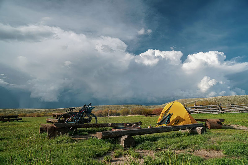

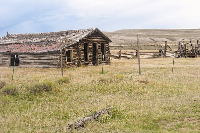
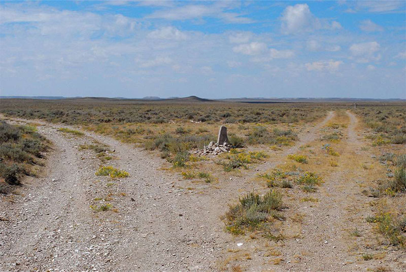
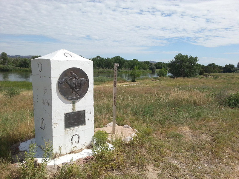

“Casper is definitely on my list for an off day or two for anyone looking for suggestions. Good food, lots of bike shops, campground with cabins right in the middle of town, as well as plenty of hotels. There’s even a handfull of outdoor stores that stock things one would need to head off on a few days ride without real resupply options, which is a definite added bonus. It’s like Salt Lake City on the route in that regard, only smaller! Bonus points for renting a car and driving up to Devil’s Tower for the day one day. Definitely worth the drive (or as an addition to the whole route…hrmm).”
W.H. Stephens of Winnebago County, Illinois, left his name at Rock Avenue July 5, 1849. A day later, he carved his name at Independence Rock. Richard Collier, Wyoming SHPO.“It is a jagged, broken ridge,” Burton wrote, “of huge sandstone boulders, tilted up edgeways, and running in a line over the crest of a long roll of land … like the vertebrae of some great sea-serpent or other long crawling animal; and, on a nearer view, the several pieces resolve themselves into sphinxes, veiled nuns, Lot’s pillars, and other freakish objects.”