My plan over the course of this summer is to pre-ride the PX Bikepacking Route from Echo Summit (above South Lake Tahoe) to Old Town Sacramento. That's about Mile 2072 to Mile 2203. A couple of weeks ago (6/29/20) I rode the American River bike trail along the last portion of the route (from Folsom to Old Town, or Mile 2176-2203). That report is here. Yesterday (7/10/20) I scouted the section between Shingle Springs and Folsom (Mile 2156-2176).
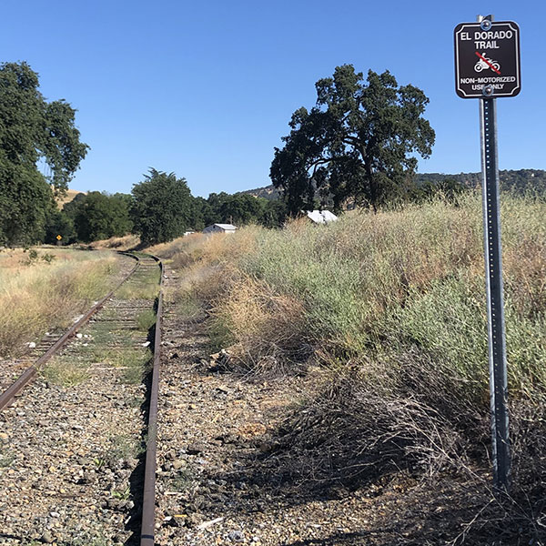
In addition to the PX Bikepacking Route, I wanted to scope out an alternate route. The alternate runs along the El Dorado Trail, a rails-to-trails conversion on an abandoned Southern Pacific line (for this portion of the trail anyway). In 2017, some local dirt riders recreated a 1917 ride from Sacramento to Echo Summit, and this is the route they took. (You can see the 2017 Centennial route here, and their Facebook page has some good pictures from the ride.) I wanted to see if there were some better roads that the locals had scoped out.
So I set up two maps to ride as a loop: the 2017 Centennial Route east from Folsom to Shingle Springs, and the PX Bikepacking Route west from Shingle Springs to Folsom.
Folsom to Shingle Springs

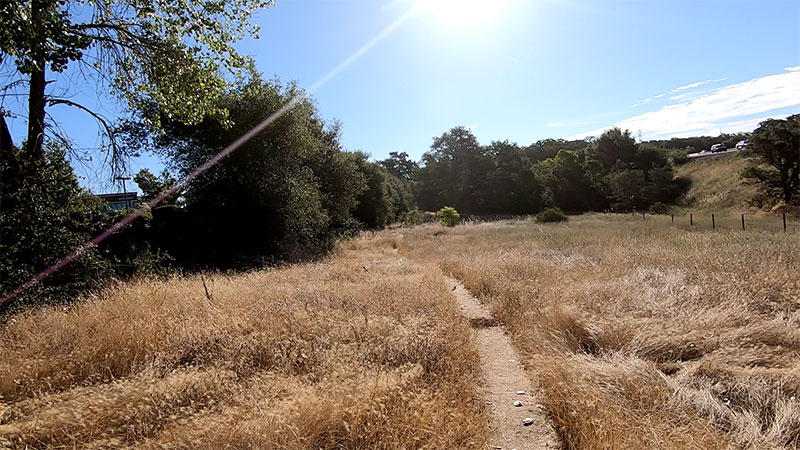
I parked on Sutter Street in Old Town Folsom and picked up the 2017 Centennial ride at Willow Creek Reservoir Community Park (about Mile 27 on the 2017 Centennial Route map). For the first few miles, this route runs along singletrack between US 50 and Iron Point Road. It's not marked on Google Maps, but is easy enough to follow. As I was scouting, and not camping, I was not towing a trailer, and was able to ride this as a MTB trail. As such, it was fun. I am not sure how fun it would be to a rider who has come 2000 miles from St. Joe to this point, but one could easily stick to the pavement on Iron Point as an alternate.
Around Mile 30 (remember, the Centennial Route starts on Old Town Sacramento, so this is only a few miles from downtown Folsom), the route heads south until it picks up the El Dorado Trail. The Ride With GPS route does not include a lot of commentary, so I missed this connection and rode past it, upsetting a lot of farm dogs, until I reached a dead end. You can see my over-ride on my rwgps track here, around Mile 7). From this point, you ride along the old railroad tracks the rest of the way to Shingle Springs.
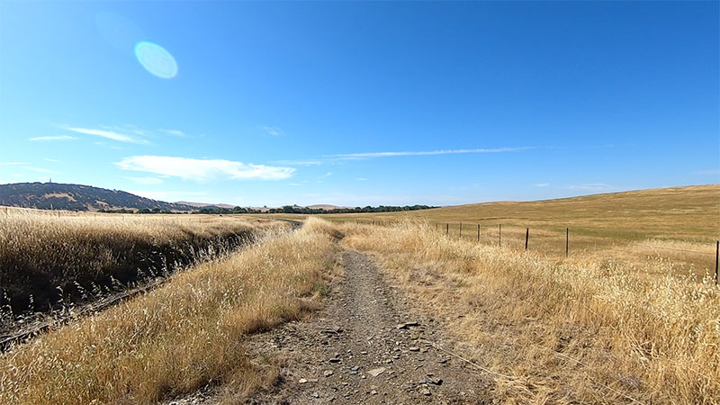
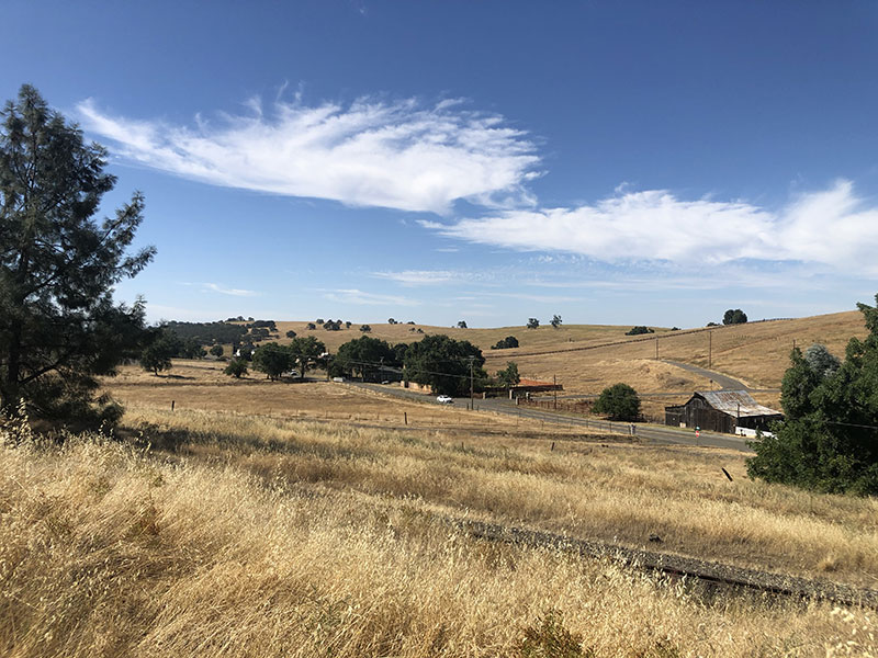
On the plus side, there are no cars. In fact, I only saw two other cyclists the entire ride. Most of it is beautiful. It is certainly bucolic. The tracks are bordered by ranch land (and by vineyards, near Latrobe). It crosses a few creeks, there are some interesting rocks in the cuts, and some nice views to the southwest.
On the downside, going can be slow.
First, the route dips to the southeast. By the time you start to head to the northeast—in other words, toward Shingle Springs— you will have deviated for 10 to 12 miles. Not a problem on a day when this is the only stretch you're riding. But it could be obnoxious at the end of a six-week trip.
Second, the railroad bed is partially filled with gravel, but not very thoroughly. As a result, it's very bumpy. There are dirt singletracks along one and often both sides of the rails. In the flats, these are pockmarked; even with a full-suspension bike, they were annoying. And once you get toward the foothills, the rises and drops are pretty steep. Easy enough on fresh legs and a good bike, but between the steepness of the climbs and the condition of the dirt, there were quite a few that I do not think I could have made pulling a laden trailer. Either way, there were quite a few places along this route where I was slowed to well below 10 mph.
Third, though more as a heads up than anything else, the tracks cross a few roads. The roads are easy to spot, so it's not as if you're going to accidentally ride into the middle of one. But it seemed as if on all but the smallest, people were driving exceedingly fast. Why people drive on a two-lane road with no shoulder at breakneck speed is beyond me, but they were, so I took extra time at each of these crossings.
In the end, it took my 2:40 to ride these 25 miles. At times it felt even slower than that. It was a beautiful ride, but certainly not for everyone in every situation.
Shingle Springs to Folsom
I stopped to refuel in Shingle Springs, then headed back to Folsom along the PX Route. That is, a variation of the route. As I was planning my ride, I discovered that some of the bike trails in Folsom were closed due to COVID. So I mapped out detours around the closed areas. (Here's a link to the planned route I created).
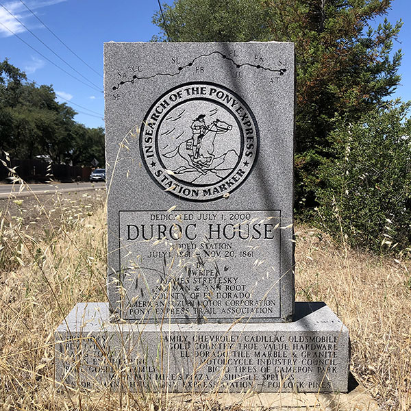 The first part of the route is the same as the PX Route. It starts on Duroc Road in Shingle Springs. There is a Pony Express marker for Duroc Station about two miles along this road (around Mile 2157 on the PX Bikepacking Rote map), so I set out in search of that. (N.B. there is one other PX station between Shingle Springs and Folsom. It's called Mormon Tavern, and is located here. Notably, neither of the routes I rode go by the marker; either way, you'd have to detour, though it is only really accessible from the PX Bikepacking Route. You can see my report on this marker here.)
Well, as you might be able to tell if you zoom in on my ride map, I rode back two or three times until I finally found the damn thing. One reason is that it is a small marker off the side of the road, behind a bush, partially obscured in front by dead grass. Also, it lies just past a culvert big enough to swallow a bike, and so, where my attention was focused as I passed.
The second reason I missed it is because I would classify Durock Road as suicidal for cyclists. It is another two-lane with no shoulder and a 55 MPH speed limit that locals seem to treat as a minimum speed. It is also a frontage road for US 50, and as such, carries a lot more traffic than the two-lanes further south along the El Dorado Trail.
Then, I somehow loaded the wrong route into my app and started back down the El Dorado Trail a mile and a half or so until I figured out my mistake and got back to Duroc Road and the correct route . . .
After you escape Duroc, you end up on Country Club Drive, which is tame for a while, at least until it nears Bass Lake Road, where it again opens up into freeway-speed traffic on a shoulderless two-lane.
Now, I have ridden plenty in these conditions. I am not squeamish about marginal riding conditions. But neither do I enjoy them. One large reason for bikepacking, to me, is to get away from fast cars, especially on narrow roads. There was nothing at all I enjoyed about this part of the ride.
 Bass Lake Road was closed due to construction. I took a dirt path marked for emergency vehicles only, and started to climb my way into Folsom. Which brings up another problem I have with this route. The PX Route runs, essentially, northwest from US 50 to Old Town Folsom. This area is El Dorado Hills. Appropriately, it was hilly. I don't mind hills, but I prefer not to ride them if there's an alternate. Plus, at this point, it was about 100º. So I became pretty cranky about riding these particular hills.
The PX Route sends you through a huge gated community until you come to some fire roads (Walker Ridge). Somehow, in mapping out my alternative to go around a closed area, Ride With GPS put me (or allowed me to mistakenly put myself) on a parallel singletrack that turned out to be very technical (about Mile 16 on my ride map). So, whatever. My bad.
So at this point—tired, hot, hungry, no doubt dehydrated) I reached the point in my ride where I had to go around the closed offroad area of the PX Route (the New York Creek) area. On my map, it was all straightforward enough. But instead of through roads, I found myself in Gated Community Hell. It seemed as if every street I needed to tun on had a guarded gate. None of these are marked on Google Maps of Ride With GPS. So I entered into a series of frustrations as I had to remap my way around my re-mapped route. In hilly neighborhoods. On a really hot afternoon. (If you look at the route around Mile 9 on my ride map, you can see some of my back-and forth paths).
I finally made my way to Sophia Parkway and rejoining my and the PX Routes and rode into the Mormon Island Wetlands Nature Preserve (around Mile 22). near this entrance is the Mormon Island Relocation Cemetery, created when Folsom Dam was built. From there, the PX Trail continues through a break in a fence, and crawls along an overgrown singletrack (I have some lovely lacerations on one arm from the branches of something with thorns) until it finally hits the Humbug-Willow Creek Trail.
From here to the end you are on paved multi-use trails (including the Johnny Cash Trail—this is Folsom, after all). The climbs are reasonably gentle, and broken into switchbacks for lightweights (or burned out riders like I was yesterday). The trail leads right into the heart of Old Town Folsom.
Recommendation
On balance, I can't recommend either route. In fact, I am getting in touch with the organizer of the 2017 Centennial ride and plan to reach out to other Folsom-area bikepackers to see what other options there might be. There may be none better. The US 50 corridor swallows up the best and most direct route. There are no through-roads alongside the freeway. And given the terrain, all other roads are circuitous. Probably the easiest way to get through this area would be to take the route Jan Bennett actually rode in 2018 (though with some variation to avoid the climb on Bass Lake Road - around Mile 37 on that map). If I find a better alternate, I'll post it here and add a link to the PX Facebook page.
More Pictures from the ride: