I’m in Salt Lake City, waiting for a train back to Davisville (which doesn’t leave for another three days). In the meantime, I’m trying to backfill the last few days of the trip.
=============
July 5, 2021
Lyman, WY to Evanston, WY
54.5 miles/1,960 feet
high 70s/wind 10-15 west
https://ridewithgps.com/trips/70638764
Day 35 of the trip I deviated from the Pony Express Bikepacking Route again. I could not find a place to stay or camp between Lyman and the Echo Lake area, and I didn’t want to ride that entire distance (85 miles), so I detoured to Evanston, WY. This was also the eighth straight day of riding, so I planned to stay in town two nights and rest up from pushing across the western Wyoming high desert before making the final push over the mountains to Salt Lake City.
It had rained the night before, or early in the morning. Sometime after I went to bed anyway. The ground was wet and the sky still cloudy. The chance of rain was slight, but given the choice between that and another day in Lyman, I decided to chance it. I left around six-thirty because it was a longer ride to Evanston (about 55 miles) and after so many days on the road I finally figured out that it’s better to be somewhere hours before check-in time than to wait until later and fight the wind getting there.
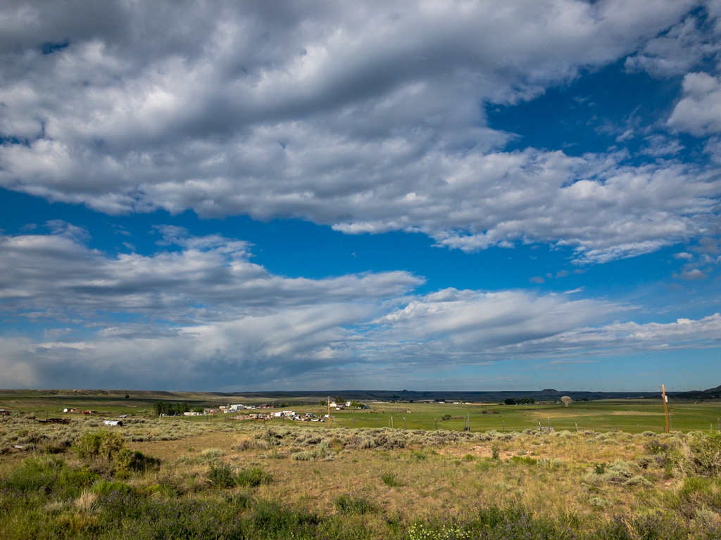
It was calm, just a very light breeze (in the wrong direction, of course). The sky to weather (west) was full of clouds, but they were further to the south, and as they neared they lifted and dissipated. I never saw any rain at all that day. What I did see, which was unexpected, was a lot of climbing. There are a series of buttes that form something of a wall west of Fort Bridger, and there were wind generators in the area. Two bad signs for riding. I’d been looking at those generators since the day before, and how high up they were. I never would have guessed I’d be climbing up to that point.
In absolute terms, the climb was not huge (6,700’ to 7,350’ over about 10 miles), but I wasn’t ready for it so early in the ride. I kept an eye on the wind generators as I approached, silently praying they’d still not be turning by the time I got there and passed. They stayed still.
The payoff was a good downhill on the far side, which led to Muddy Creek. (The name is not unique on the trail. As Richard Burton carped, “After ten miles of the usual number of creeks, ‘Deep,’ ‘Small,’ ‘Snow,’ ‘Muddy,’ etc., and heavy descents, we reached at 10 A.M. Deer Creek, a stream about thirty feet wide, said to abound in fish.”)
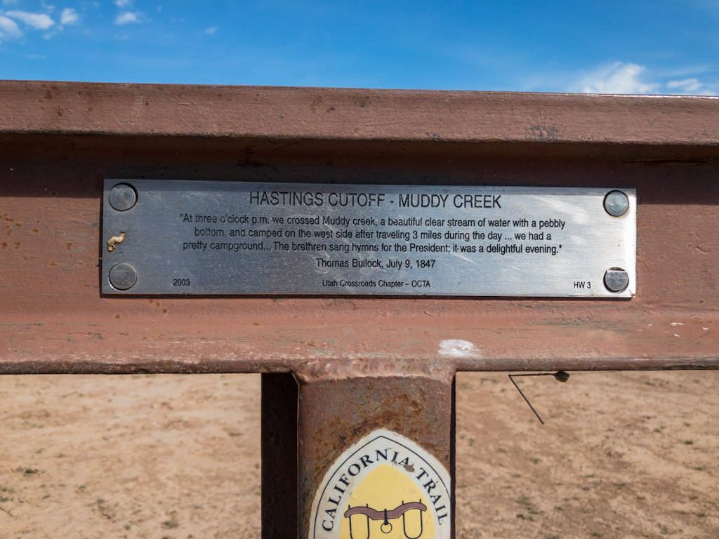
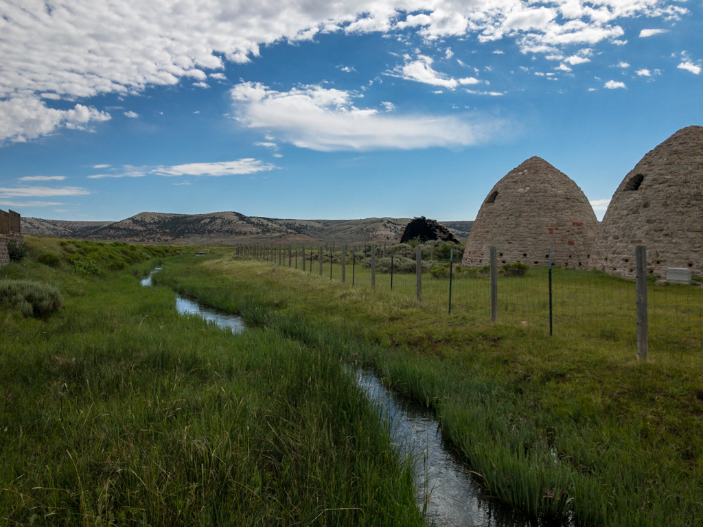
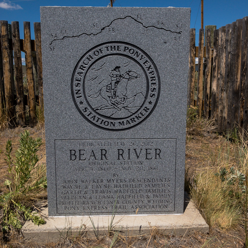
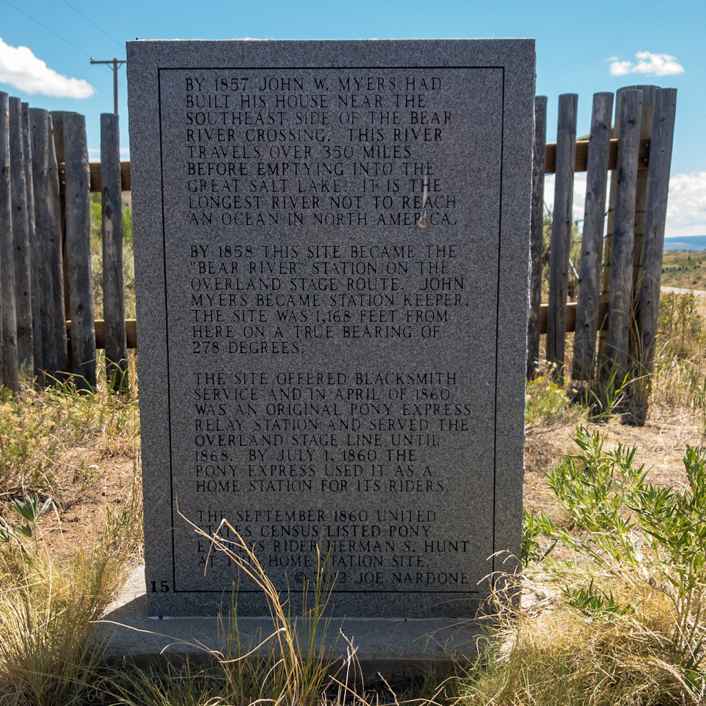
The road along here was part of the Donner and the Mormon Trail, and as such, also Hasting’s Cutoff. There were quite a few historical markers, some charcoal kilns (huge ovens for making charcoal), and a lot of Mormon handcart camps. As the camps are closed this summer, there were very few people about, and all of them in cars.
The river canyon and surrounding hills were beautiful, and the rise was not too steep. In fact, at one point it finally donned on me that this might have been the first real improved gravel road I had been on. That is, instead of just scraping a swath through the sand and maybe pouring gravel on top, as the road climbed further up the valley, instead of dipping into and climbing up out of every cross-ravine, the ravines were filled in to keep the road at an even grade for a steady climb. And it’s a good thing, because those drops and climbs became steeper as we ascended. It would have been a very long, hard ride up the Muddy Creek valley without those improvements.
So instead of wearying from the climb, I felt a little rejuvenated, grateful to the Wyoming Department of Transportation, and maybe even the Mormons who may have hand in making the road an easier one to travel to get to their camps. The surface was bad at times, but I didn’t care. The drop-offs the side where the road crossed a ravine were pretty steep, but so what? That could be me down there, struggling up that steep, sandy bank, but instead I’m up here, spinning easily. A little slowly, perhaps, because I am not a great climber, but that was okay. I wasn’t in the actual tracks of the emigrants, but who cares? I felt as if I had dodged a bullet I didn’t even know had been fired in getting to ride that steady grade. There is nothing like a decent road to improve a cyclist’s mood.
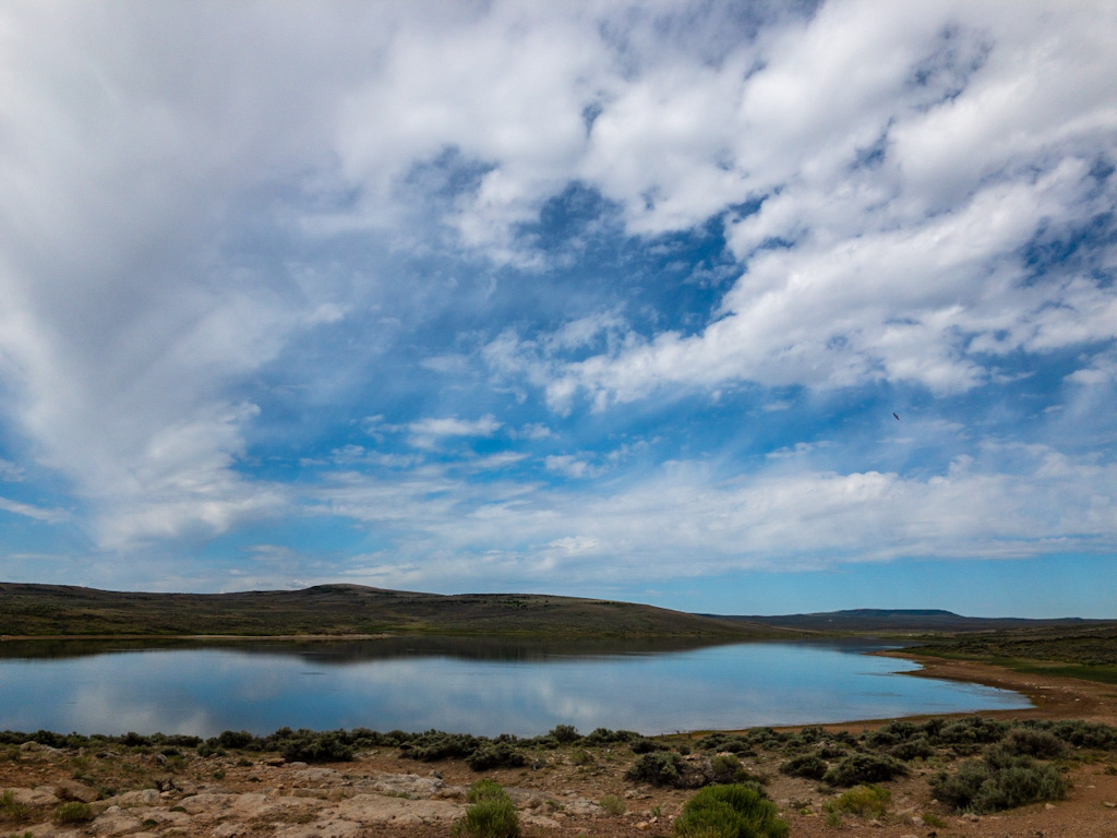
Just before I turned off the route, I came to Sulphur Creek Reservoir. I stopped by the boat launch area to use the pit toilet. There were some bass boats on the water, and a family or two (hard to tell) trying to herd their kids toward the water while dealing with complaints about sunblock and toys and lunch, a diaper that needed changing . . . It was such a familiar scene, the chaos of excited young children and harried young parents, but seemed so out of place given the terrain I had just crossed. I was only about fifteen miles from Evanston by this point, but because we came from two different worlds that morning—mine from 170 years ago and theirs from 15 miles—it felt incongruous.
What seemed even more incongruous, however, what that here on the edge of the reservoir, there was no drinking water available.
I moved on, turning off the Pony Express Bikepacking Route to follow the Bear River down to Evanston. This route was back on state highway. This was also Monday, July 5—a national holiday. All those patriotic revelers, including the people above me the night before, presumably, headed home with their caravans of trucks and RVs, trailing behind them fifth-wheels, OHVs, motorcycles, waterskiing and fishing boats, kayaks, paddle boards, and bicycles, all of them racing back to god knows where, whooshing by me at 70 mph, sometimes moving over, more often not. A headwind had risen, but it wasn’t nearly as bad as it could have been.
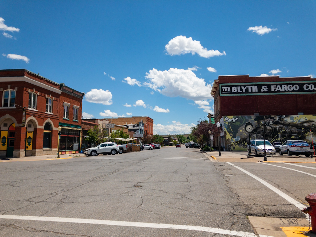
I arrived in Evanston much earlier than I had planned, around 12:30. That meant two-and-a-half hours before check-in time. The town sits on US 80, and the roads around the interchange were a little hairy with all the mammoth recreational vehicles lumbering around for gas, snacks, etc. Further up from the freeway, the old downtown was a quieter. A little lunch and pie seemed to be in order, and from the looks of downtown, the prospects seemed promising.
As it turned out, the choices were few. There weren’t many restaurants to begin with, and most of those decided to take the holiday off. I found a coffee house, Ana’s on Main, and decided that would do. I ordered a double Americano and a double chocolate muffin, then sat out on the sidewalk in the shade to keep an eye on my bike.
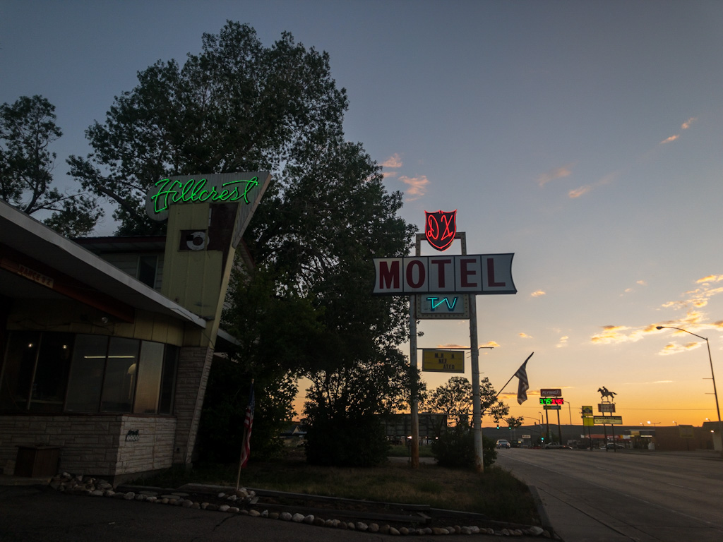
Downtown Evanston is a lot like many of the old downtowns I’ve seen on this trip. Lots of stone and brick buildings, old advertisements painted on the walls, wide streets, a cool theater, probably from the 40s or 50s. Also, music piped through speakers mounted on light posts. I will never get that (who gets to choose the playlist?), but here it was again. Hilarious.
Unlike other towns, however, Evanston houses the headquarters of the Jamaican Bobsled Team (remember the movie Cool Runnings?). It turns out that Park City, Utah (45 minutes away) has one of the few bobsled tracks in the US, so a local attorney coaxed the team to locate in Evanston with the promise of a few perqs. The things you learn when you sit down and take a few minutes to look around.
I relaxed for quite a while out there, talked a little with a couple traveling home from Boise to Cheyenne . . . but you can only drink a coffee and eat a muffin so slowly. I mounted up and rode the half mile up to the hotel an hour before check-in time.
By mounting up, I’m not being facetious. It’s a bit of a process. I have my backpack with water and a drinking tube so I can stay hydrated while riding. That goes on first, and I have to remember to secure the chest and belly straps so it doesn’t slide all over. Then gloves on my hands, sweat cap on my head, and over that, the helmet. Fully dressed, I go to the back of the trailer and turn on the tail light (press the button four times to get to the intermittent blinking pattern), turn on the radar/taillight under my saddle (press once to turn on, then three more times for the blinking pattern), twist the running light on my handlebars (for traffic coming toward me), reactivate the iPhone on my handlebars and make sure my nav app is still active, check that I haven’t left anything on the table or resting on the trailer (which I have done in the past—I once rode a quarter mile before I realized my backpack was still resting on the trailer). At the end of a day’s ride like this, I tend to be a little spacey, so I go double check by touching everything I just mentioned just to make sure. Everything on, attached, and secure, I check traffic in both directions (pedestrian and vehicular) to make sure I won’t hit anything or anyone, and vice-versa, and only then do I roll forward to raise the trailer kickstand and get going.
The hotel was uphill (figures) and I was still an hour early. A woman before me in line was doing the same thing, but was told her room wasn’t ready. When my turn came, I told the clerk I’d heard his speech about being over-capacity over the weekend and still trying to clean the rooms and that I was happy to sit in the adjacent restaurant, but he told me no problem, my room was ready to go. Cool.
Sorted, showered, devices charging, I went down to the restaurant, Legal Tender, for an early dinner. What a weird place. The theme was early- to mid-Twentieth Century gangsters (Capone, Baby Face Nelson, etc.), with huge pictures of these guys staring at you from the walls. I had a Beyond Burger (meatless), which the server tried to charge $16 for because I asked to substitute lettuce for mushrooms, and pie a-la-mode with a bare spoonful of ice cream (Oh, for the fat ice-cream days of Farson).
Around sunset I went for a walk to get some supplies for the evening (chocolate) and the next day (Gatorade). This was back by the freeway, so the only stores (other than two smoke shops and a gun store) were rest-stop C-Stores. It was strange shopping in the little store while overhead a recorded announcement told truckers there was no wait for a shower. One room off to the side was dark, with lounge chairs; another had a small video arcade. The world of long-haul trucking.
Tomorrow would be a rest day. I had a downtown diner still to try out, and a coffee place I liked where I could sit and write. The crowds and their cars and trucks would be long gone. I went to sleep looking forward a lovely day off.


I haven’t been on a bike for about 5 years. -brenda
Did you buy a flag?
I was afraid to.
Talk about the past being incongruous with the present, piped music on the street, and that list of what you do to mount up, leaves me imagining a pony express rider walking into the Twilight Zone.
Ooh, that’d make a great episode! Funny about the Twilight Zone though, as I reference it in the post I’m drafting.
The street-centered view resembles Cicily, the fictional town in Northern Exposure. It just needs a moose!
Maybe the show was filmed there! I meant to mention that back at Sweetwater Station the guys I rode with said they sometimes see a moose out by the river. Kind of hard to picture a moose in sagebrush, but who knows? Then again, one of them kept talking about the legend of a murderer in the area—I forget the name—and all the bodies he had buried. Needless to say, no moose, no bodies. Rabbits and antelope and eagles and owls, but no moose.