June 13, 2021
North Platte, NE to Ogllala, NE
63.5 miles/1575 feet
94º/Wind S @12-19 mph
https://ridewithgps.com/trips/69219129
I rose at six this morning, prompted by birds and the fact that I had oriented my tent to face the rising sun. I broke down the tent and stuffed the sleeping bag and went about packing everything as efficiently as I could. I skipped making coffee and oatmeal, thinking I would stop in at the local Denny’s on US 80 and have a Grand Slam breakfast there. I knew it was going to be a long (for me), hot, and windy ride today. I also knew that the route wouldn’t pass through any towns, so I filled the spare water bottles I carry on my forks for the first time. It still took me over an hour to get rolling. Normally, though, it takes two. Packing is just not a quick process for me.
The Denny’s turned out to be Flying J-adjacent, built into the gas station convenience store (like Taste of India back in Overton). Only Denny’s hadn’t opened yet, and didn’t look as if it would anytime soon.
I rummaged around Flying J for something to eat without sausage, bacon, or any other type of breakfast meat. I finally came up with a sort of Egg McMuffin with french-toast bread. There was a coffee dispenser (the kind that grinds the beans on the spot) that promised organic Sumatra. What the hell. Bought everything, went outside, and started breakfast . . . Only to find that I had not read the label close enough on the sandwich. I opened it up and discarded the bacon.
In case you were wondering, standing outside a gas station convenience store in a truck stop off US 80 isn’t a very pleasant experience. The air is filled with noise and fumes. The traffic rushing by, the idling diesels, the lumbering trucks moving in and out of the gas bays. A homeless man sat on a bench next to my bike, mumbling to himself until he rose to go inside, maybe to use the rest room or shower. Three men wearing orange safety vests slept nearby in a rusty crew-cab pickup with the windows rolled half-way down. Then there was me. The nut with the bike eating and drinking and taking it all in while wanting none of it, but thankful to have something to eat and drink before riding.
And I have to say, both tasted pretty good. Possibly less-discerning taste buds is one benefit of a constant, seemingly insatiable hunger. Either way, I was soon tanked up and ready to go.
North Platte, I thought as I turned my back to it, you might be a lovely city, but I did not give you the chance. Your interstate interchange convenience stores and gas stations are as unpleasant as any. But it’s not your fault.
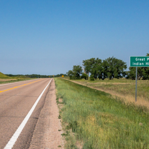
The first five or so miles of the route was on pavement, nearly all the rest gravel and sand. The wind had clocked a little so it was pretty much due south all day: Tailwinds on the few northerly legs, headwinds on a few mile-long southward legs, crosswinds the rest of the time, which was most of the route.
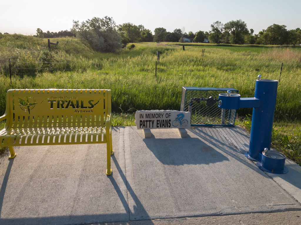
I passed a drinking fountain dedicated to a cyclist, Patty Evans. I silently prayed that it wasn’t installed, like a ghost bike, because she had been killed by a car on that street. Later research found she wasn’t, but rather was an avid cycling advocate, mostly for women. Still, she was my age when she died, 62, which gives pause for thought.
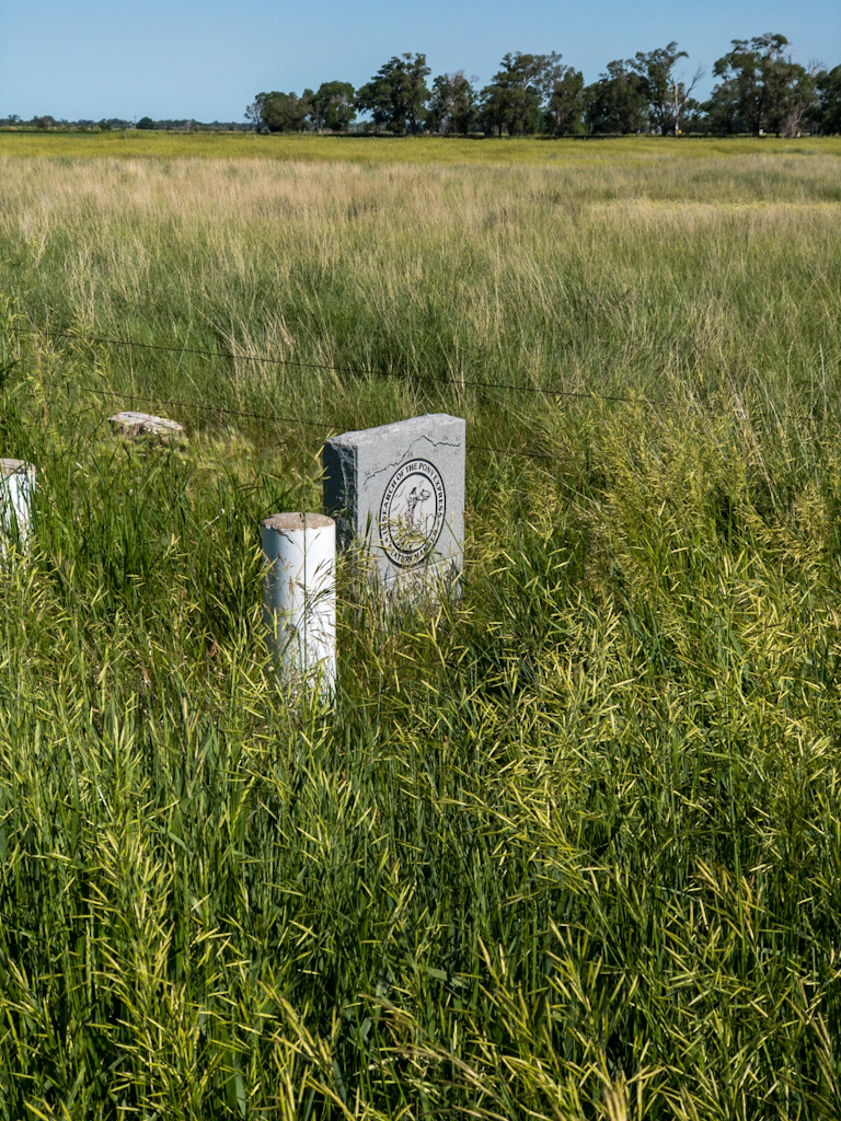
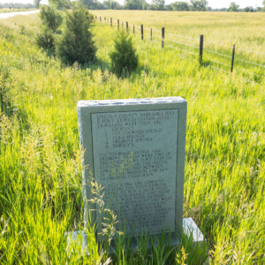
I passed by a memorial for the Cold Springs Pony Express Station, buried in weeds off a road with no turnout to allow someone driving to stop and pay heed. Seems like a waste of the cost and effort of marking the spot, but that’s up to North Platte, I guess.
About that point, I realized I had forgotten to send my morning GPS message and to turn on my tracker. I’m sorry good people. Some mornings I’m a little more scattered than others. Communication duties attended to, I moved on.
Once I settled into the ride it went reasonably well. Some of the low roads were sandy, but not horribly so. Then I arrived at the next landmark of the mid-1800s emigration: O’Fallon’s Bluffs. The sand bluffs of the Platte River Vlalley that have to this point been so well behaved now crowded the Platte River leaving no way to get to the Pacific Coast but to go over them.
We all stopped to get a drink of the delicious water [at Cottonwood Springs], which tasted like nectar to us who had for so long quenched thirst with the yellow, tepid water of the Platte, and then moved on, encamping at sunset on the summit of O’Fallon’s Bluffs, whose steep declivities we climbed with difficulty. These bluffs are opposite the junction of the north and south forks of the Platte, and extend to the edge of the river.
Thaddeus S. Kenderdine, A California Tramp and Later Footprints, p. 56
Note the phrase, “steep declivities we climbed with difficulty.”
It turns out that most of the bluffs were mowed down for US 80. The sand hills I rode were part of the same formation, but were far enough away from the interstate not to carry any tracks of the emigrants. If you travel US 80 east, there is a well-marked pull-out, and apparently you hike a little and can still see some wagon wheel tracks.
But just as O’Fallon’s Bluffs signaled the end of the easy-going Platte River Valley for the emigrants, so did they, or what’s left of them, for me. I was back to hill-and-dale, climb, then climb some more, drop to the foot of the next hill only to start the process over again. Endlessly. Plus, being sand hills, the road was sandy as well. Very slow in places. This was a tedious section of trail. The tops of the hills were windy, the bases stiflingly hot for the absence of wind, the scenery bland. At points I rode south, into the wind, and my pace was even slower.
People, this was not a great time.
Finally, at one point I topped a hill, tongue probably hanging out from thirst even though I was drinking constantly, and I saw . . . A golf course. There were two couples just then at a hole nearby, sitting in two golf carts: middle-aged, white, wearing polo shirts and khaki shorts and golf visors and laughing about something. Probably the guy on the orange bike with his tongue hanging out. It was like that scene in Lawrence of Arabia where Peter O’Toole is half out of his mind from wandering the desert and all of a sudden the top of a freighter goes by because he is near the Suez Canal. It felt that out of place.
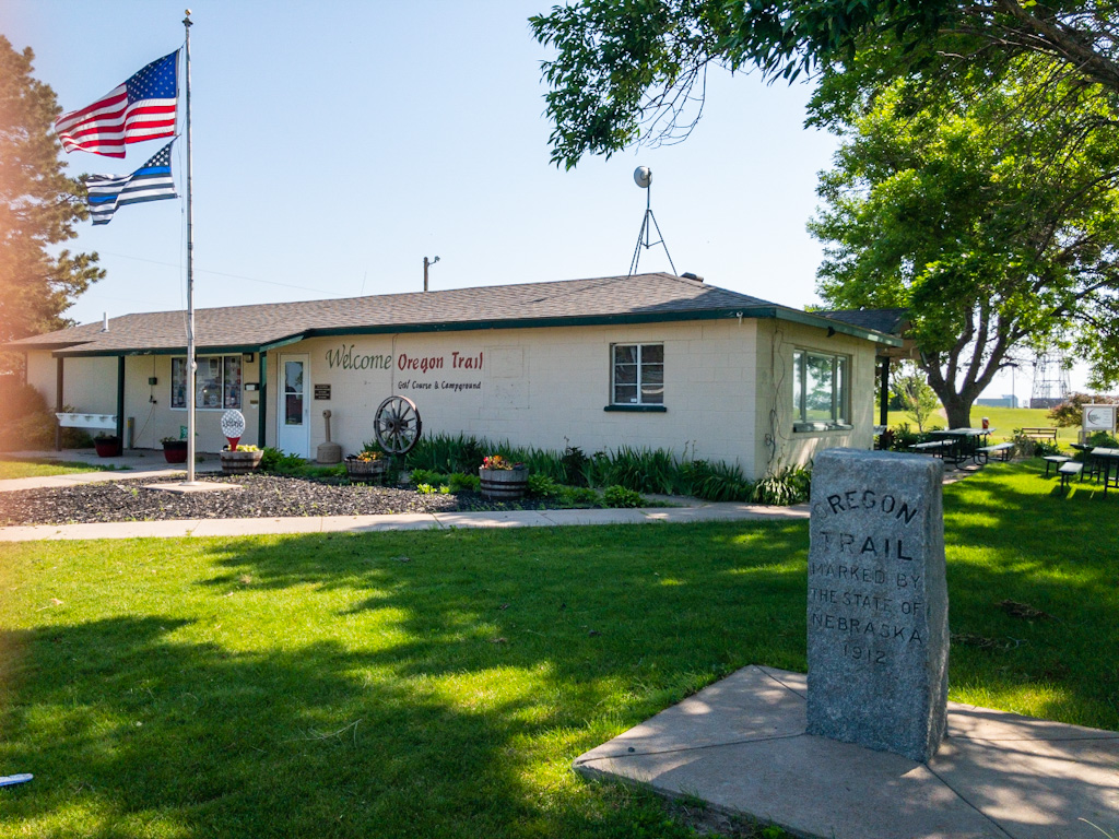
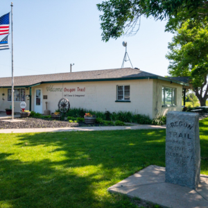
The golf course lies in a recreation area on the northern edge of a reservoir. Around the corner from it is the office for the Oregon Trail Golf Course and Campground. This campground wasn’t on my map, so I stopped in to investigate. The woman working there had no time for me. She was tall, her hair close-cut in back, which looked military. Or maybe I just made that connection in light of the Blue Lives flags out front and inside the office. In any case, she glanced over her shoulder at me, then kept her back turned while she counted money or sorted receipts or who knows what while she answered my questions in as few words as necessary. They allow tents. Seven dollars a night. Tents go on the beach. Sometimes there’s not enough room because the RVers (who have their rented spaces) spread out all over the beach. In fact, a tent camper was unable to find a spot the night before. Do they have water or restrooms or showers? No.
So much for the Oregon Trail Campground. The golf course must be a hoot though. Signs scattered about said all the alcohol you drink on it must be purchased at the golf course store.
Just after this, I was on a paved road again, a highway with a rumble strip that dropped off the edge onto an uneven, unpredictable shoulder. The road was a lovely sweeping downhill turn. But almost as soon as I was on it, I wished I wasn’t. One truck was approaching, another was closing in behind me. I judged that we would all meet at about the same point. The truck ahead wasn’t moving over; the truck behind wasn’t slowing. There wasn’t enough room for the three of us. So I had a choice: Move into the middle of the lane to control it; cross the rumble strip and take my chances on the dirt; or do nothing and either have an uncomfortably close brush with the truck or be shunted over to the shoulder at a time not of my choosing, which is always bad. I slowed and crossed the rumble strip to the rough shoulder, taking care not to go too far toward where it dropped off. It was uncomfortable, but everyone survived.
Now, the only reason I’m taking the time to describe this vehicular encounter is because this is the first time anything so dangerous has happened to me on this trip. In California, this situation comes up all the time. Ask any cyclist how many times in a given week they find themselves in a situation where getting hit by a car or run off the road is one of the likely outcomes. But there was something about this entire area, which I’m lumping under the heading of O’Fallon’s Bluffs—the dry, sandy hills, the dismissive woman at the campground, the truck driver’s impatience and insistence—that left a bad taste in my mouth. And I wondered, is it living in this area? Are people who live out here where the weather and topography are a little harsher a little harsher themselves? Maybe my fatigue was causing me to judge more harshly than I might otherwise. Regardless, I marked O’Fallon’s Bluffs as a place I didn’t much care for.
And that was before the bugs.
On the back side of the reservoir I started picking up insects that seemed to want to hitch a ride, then bite me by way of saying thanks. While I struggled up sandy hills. In the heat. That, friends, is O’Fallon’s Bluffs.
Things went on like this for a while, improving a little with the miles. The bug population decreased, the hills flattened some, but by then I was in bad shape. Feeling very tired with twenty-five or so miles of a sixty-five mile day still to go.
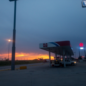
Then, like a beacon, I saw a Shell sign. And it made me so happy! All day long the route had been playing tag with US 80, touching it then running away south only to meet it again further ahead. This station sat at an intersection for the town of Paxton. I was sure there’d be a convenience store there. Food, drink, air conditioning! I had water and electrolyte mix, I had Clif bars and Lara Bars handy. I had everything I needed. But . . . Something different and cold sounded so good.
And it was. I pulled in, bought nearly ten dollars worth of drinks and snacks, and got permission from the owner to sit in the empty lobby of the adjoining Days Inn to enjoy it all in the cool air. It was very rejuvenating
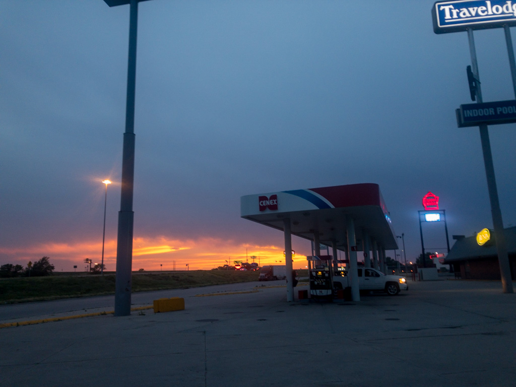
Jan has marked convenience stores on her route (though not this one). Until today, I had seen them as a last resort, maybe a place to go due to bad planning and running short on supplies. Not any more. This little store was like an oasis of respite. A temporary sanctuary. A really well-needed place to rest. And part of me is going to miss that feature of US 80 when I leave it behind a couple of days from now.
Back out into the heat, starting with recrossing US 80 into the face of the wind. I passed the Paxton Cemetery, where the ropes on a series of two dozen or so flagless flagpoles lined up alongside the road clanged against the metal poles like halyards on masts in a harbor. Each pole rang out in a different tone, and together it made a beautiful music. When I tried to record it, mostly the camera picked up the howl of the wind, so unfortunately I don’t have the sound to share.
I took a detour off the Pony Express Trail to follow a canal to see another Pony Express Station spot. It turned out not to be a shortcut, which was disappointing. Worse, the first mile or so reeked as if I were riding just downwind from a feed lot, which I’m sure I was. When it came time to turn of to go to the station spot, I weighed whether it was worth the detour. The station was two miles downwind, which meant two tough miles back upwind. I decided to pass. I passed two stations today for that exact reason. I wasn’t even sure if there was even a marker at either, and under the conditions, didn’t care enough to find out.
From there, I had one more upwind mile, then an unbroken straight line of hills for twelve torturous miles to get to Ogallala, Nebraska. Those miles dragged on and on. Talk about tedious.
I rolled downhill toward 80 and Ogallala and saw an Ace Hardware. Stopped in to pick up the one electrical cord I forgot to pack. Went across the street to Dairy Queen, but the line was too long. Further down the hill to my motel, because I rented a motel room the night before while sitting in that scruffy little campground in North Platte knowing it was going to be a long hot day and thinking that at the end of that day a primitive or rustic or grassy or undeveloped or remote tent campsite just wasn’t going to cut it. Also, both campgrounds near Ogallala wanted $30 for that undeveloped spot, and for twice that, I could get air conditioning and (mostly) escape flying bugs. The choice seemed easy.
It turned out that somewhere along the way today I passed out of Central and into Mountain Daylight time, so I was too early to check in. I found a place nearby to get a salad and a shake while I waited because . . . Here I was again! A US 80 interstate interchange, crammed full of places to eat, shop, fill-up . . . whatever! Three C-Store interchanges in one ride. I think it’s a record.
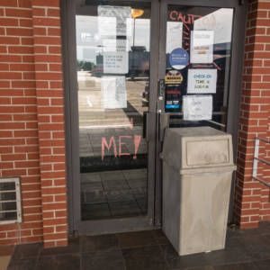
Back to the motel. One door to the lobby was broken, so management put a trash can in front of that side. Classy. The clerk asked about my bike and my ride and told me she’d read Cheryl Strayed’s book [Wild] about hiking the Pacific Crest Trail in prison and had always wanted to try something like that. She smiled. “Maybe after my next divorce.”
The rest is routine. Shower, clean some clothes, go out in search of food. There is a heat wave rolling in that will peak somewhere over 100º Wednesday. I’ve decided I need to stay in a motel each one of those nights, so I started planning the next few days’ stays.
Oh yes, after all that I was finally free to work on my blog.


Beauty, eh.
Can you tell me more about the GPS “update”??
What would you like to know?
How does it work? Are you using a “tracker”? Is it using cell towers?
It works off satellite gps. Look up “find me spot” or Garmin InReach. I have the spot device, but my guess is Garmin functions better for messaging.
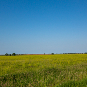
I’m glad that at least you came upon the sea of grass.
Valerie
Agreed! Though that wind was killing me when I had to ride into it.
O’Fallon’s Bluffs. . . . I will make a point of avoiding it. Your impressions remind of other godforsaken places I’ve run into on various trips. We had a lovely trip to Ireland a couple of decades ago and planned our trip so we’d have a night in a western town where we could turn our car in and hop on a train. First, the hotel clerk was a miserable sort who barely acknowledged us when we checked in. Then we’re walking through town at dusk and it became Hitchcockian when the sky turned black from a massive flock of ominous birds. And then we walked into a packed restaurant that was silent except for the sound of a bad gameshow on a small TV that everyone seemed to be glued to (except when their heads turned to look at us when we walked in). . . . .It’s on a “must avoid” list that I’ll add O’Fallon’s Bluffs to.
I admire your perseverance. Your journey does remind me of Cheryl Strayed’s book. Sorry about the bugs ! -brenda
Yep, still following you on the trail. So happy for those motel stops, I needed the breaks.
Stu
What a day. Kinda confirms your nut status. But we’re so very glad you made it in good shape.
What she said!? (Lily)
brutal