A collection of historical tidbits about the Pony Express taken mostly from books, except as otherwise noted. This slider cycles through all of the Quick Facts in random order. I will be adding to these as I read through more sources. You can pause a slide by hovering your mouse over the Fact. To find Quick Facts on a particular topic, click on the appropriate tag in the sidebar. All Facts connected with places on the trail also appear under the appropriate state in the Route Reports section.
Majors' Freighting Experience
Among the freighters of civilian goods to Santa Fe in 1848 was Alexander Majors making his first trip over the Santa Fe trail with six wagons loaded with merchandise, 30 or 40 oxen, and ten or twelve men. A small beginning indeed for a man who in less than ten years would estimate the number of great Conestoga and Murphy prairie schooners under his command by the acre, count his oxen by the thousands, and employ several regiments of bull-whackers. In 1849 his business required about the same number of wagons as in 1848. In 1850, however, it had grown until ten wagons and 180 oxen were used.
Upon returning home in the fall of 1850 Majors learned that Q. M. Maj. E. A. Ogden at Fort Leavenworth wished to send 20 wagon loads of supplies to Fort Mann at the Cimarron crossing on the Arkansas river, 400 miles down the Santa Fe trail. Although the time for starting on a journey of that kind was long past he took the contract and reached his destination without difficulty. Before leaving for home he hired his train at Fort Mann to the commandant of the fort, which was under construction, to haul logs from a creek 25 miles away. He returned home in time to celebrate Christmas with his family. In 1851 Majors was again on the Santa Fe trail with 25 wagons loaded with merchandise. When he returned he corraled his wagons, sold his oxen to California immigrants, and remained at home in 1852. The following year he bought a new outfit of oxen for his train, hired some 80 bullwhackers, and freighted civilian goods to Santa Fe. Again he returned home in time to make a second trip to Fort Union, N. M. In 1854 he freighted no mer-chandise, but transported 100 wagon loads of military supplies to New Mexico. This work required 1,200 oxen and about 120 men,** a creditable showing indeed for a man who only six years before owned only six wagons and employed a dozen men or so. This, in brief, is the story of the rise of the man who became the partner of Waddell and Russell in 1854.
About nine miles west of Emigrant Gap, the Oregon Trail wound through a narrow gap between two ragged ridges of sandstone and shale rocks, upended strata we now would call hogbacks.
British travel writer Sir Richard Burton, traveling by stagecoach to Utah in 1860 to interview Mormon leader Brigham Young, called the formation “the Devil’s Backbone.”
W.H. Stephens of Winnebago County, Illinois, left his name at Rock Avenue July 5, 1849. A day later, he carved his name at Independence Rock. Richard Collier, Wyoming SHPO.“It is a jagged, broken ridge,” Burton wrote, “of huge sandstone boulders, tilted up edgeways, and running in a line over the crest of a long roll of land … like the vertebrae of some great sea-serpent or other long crawling animal; and, on a nearer view, the several pieces resolve themselves into sphinxes, veiled nuns, Lot’s pillars, and other freakish objects.”
More common were the names “Rock Avenue,” “Avenue of Rocks” and “Rock Lane.” The pioneer Mormon companies of 1847, first to make the trek to the Salt Lake Valley, seem to have been the ones who coined “Rock Avenue.”
“[T]here is a steep descent from a bluff and at the foot there is a high ridge of sharp pointed rocks running parallel with the road for near a quarter of a mile, leaving only sufficient space for wagons to pass,” official Mormon diarist William Clayton, traveling with the first of those companies, wrote June 19 of that year. “At the sought [south] point there is a very large rock lying close to where the road makes a bend, making it somewhat difficult to get by without striking it. The road is also very rough with cobble stones.”
The following year Clayton condensed his description when he published it in his guidebook: “Rock avenue and steep descent. The road here passes between high rocks, forming a kind of avenue or gateway, for a quarter of a mile.”
In these stretches, the road was generally good, “though rather too hard and gravelly for the cattle,” wrote another diarist, Israel Lord, in July 1849. The country was dry in all directions, and what little water the travelers found was potentially deadly.
“Passed through a very singular defile, called ‘Rock Avenue,’ wrote J. Goldsborough Bruff July 23, 1849. Bruff, with 25,000 other forty-niners, was headed to the gold fields of California that year of extremely heavy traffic on the trails. “After emerging from the Defile, the road descended a very steep hill (had to double lock the wheels), here a wagon broke the fore-axle, and 4 of the mules exhausted, so they had to camp on a barren waste until morning, without feed or water. At base of these hills was the ‘Alkali Swamp & Spring,’ 2 miles from the Defile, and 7 1/2 from the Mineral Spring.” Bruff here is using the place names from Clayton’s Mormon Guide, as it was generally known, thus his use of quotation marks. Its more formal title was The Latter-Day Saints’ Emigrants’ Guide.
“The water here—strong alkali was the color of coffee,” Bruff continued. “And piled around were hundreds of dead animals, chiefly oxen.”
A month earlier diarist Jonas Hittle had noted, “It is very warm. We moved on and passed several oxen given out. We passed through Rock Lane which is two lines of Rocks rising perpendicular out of the ground … They are about 40 yards apart. At the far end of this I cut my name dated June The 24th 1849.”
The Hittle inscription no longer exists, though his was one of a great many that once existed along this stretch of trail. Unfortunately, many were lost when portions of the rock formation were blasted away in the 1960s to upgrade the county road. The entire left-hand section of the ridge, or wall, was obliterated. Several miles of pristine trail ruts were destroyed by pipeline construction around the same time.
Trails historian Aubrey Haines called the destruction “calculated vandalism,” in a report he wrote for the National Park Service in 1972. More recently, road graders knocked off the end of the right-hand bluff near the road, taking most of the remaining inscriptions with it.
Nonetheless, sections of the county road, following closely the route of the older trail, still offer a glimpse into the past uncluttered by modern visual intrusions.
Great Plains and the Balance Between North and South
“The Great Plains presented a barrier which arrested for a time the whole westward movement, but the barrier was greater for the South than for the North. The Northern system, founded in individual ownership of land and free labor, was modified when it entered the Great Plains region, but its essential character was not changed. The Southern system, founded on slavery and cotton, was barred by an infrangible law – bounded on the west by aridity just as effectually as it was on the north by cold. Thus did the Great Plains break the balance between the North and the South and turn the advantage to the Northern section, making its ideals, rather than those of the South, national.”
Walter Prescott Webb, The Great Plains, p. 155
Mile 917: Upper of Mormon Ferry
“Twenty-eight miles from /Deer Creek was the Upper or Mormon Ferry on the North Platte, near modern Casper. The eaarliest travelers found it, of course, in a state of nature and were utterly dependent on their own efforts. Tradition tells us that the crossing selected in pre-prairie-schooner days was three miles down from the later ferry site.
It was a favorite with the Indians, who would make rafts of their lodgepoles, pile them with household goods and attach thongs of buffalo hide, with which swimming braves towed them across the river. The fur traders usually waited for a favorable day and crossed with their goods packed in bullboats, floating the heavy carts.”
Irene D. Paden, The Wake of the Prairie Schooner, p. 195
Indian Difficulties in the mid-1860s
“Overland staging had met some Indian difficulties previously, but not until the sixties did these become chronic. The isolated depredations of the fifties were but preliminaries of the general uprisings of the middle sixties.”
LeRoy Hafen, The Overland Mail: 1849–1869, p. 242
Butterfield Wins the Bid
“The victory of advocates of an overland mail to the Pacific Coast, as represented by the passage of the Post Office Appropriation Bill and its amendments in 1857, appeared to offer an opportunity for the express companies not only to rid themselves of the obnoxious steamship monopoly but also to enter into the business of carrying the overland mail. Therefore the great companies, Adams, American, National, and Wells, Fargo & Company pooled their interests to form Butterfield & Company, or, as more commonly known, the Overland Mail Company . . .
Postmaster Aaron V. Brown, a Tennesseean, was strongly in favor of the [southern] route Butterfield named. On September 16, 1857, he awarded the contract to the Overland Mail Company for six years . . .
The line was gotten ready within the required time and service began September 5, 1858. The coaches ran regularly the year round and not great difficulties with Indians were encountered. The line rendered good service on a reasonably well kept schedule. Northern interests, anti-Administration newspapers, and friends of the Central Route, however, maintained an uproar of criticism and ridicule. Since they could find no fault with the efficiency of the service, their main complaint was against distance and time consumed. In reply, friends of the Southern Route, and even Butterfield himself, admitted that the Central Route was shorter but argued that it could not be traveled in winter time.”
Settle and Settle, Empire on Wheels, p. 68-69
Mile 636: Courthouse Rock and Jail Rock
“Late in the afternoon, when the evening sky was lemon-colored and placid, we distinguished the dark bulk of Courthouse Rock outlined against the sunset and knew that this day’s journey was ending, as hundreds had ended in years past, within sight of the first great monument of the Oregon Trail. Tomorrow we would imitate the thousands of encamped travelers who took time out for a jaunt to ‘the courthouse’ intending to see for them selves how far away in the deceptive prairie distance it might be. No well conducted tour of the Emigrant Trail, either now or one hundred years ago, would be complete without the inclusion of a pleasure excursion on the side to Courthouse Rock.”
Irene D. Paden, The Wake of the Prairie Schooner, p. 129
Camp Scott
The advance reached Fort Bridger on the 16th or 17th of November, having consumed ten days in moving thirty-five miles. Fortunately for the Army, the Mormons, after seizing the place the preceding May, had enclosed the original structure in a stone wall 15 feet high. Attached to this was another enclosure 100 x 80 feet with walls seven and a half feet high. As the wagons were unloaded the boxes were knocked to pieces, which, together with their sheets, were used in making shelters against the stone walls for their stores. Tents were pitched around the Fort and the place was called Camp Scott.
Settle and Settle, "Napoleon of the West," Annals of Wyoming Vol. 32, No.1, April 1960, p. 21
Fastest Pony Express Time
“Perhaps the greatest feat of the Pony Express service was the delivery of President Lincoln’s inaugural address in record-breaking time. In order to surpass all previous performances, each horse along the line was led out from the different stations, and each traveled a stretch of only about 10 miles. Every precaution being taken to prevent delay, a transit was accomplished in the unprecedented time of seven days and seventeen hours over the 1,950-mile course.”
George Root, "Pike's Peak Express Companies," Part IV, Kansas Historical Quarterly, Vol. 14, No. 1 (1944) p. 64
Grasshopper Meal
“The Indian women at the squaw camp were catching these grasshoppers, roasting them, drying them, and pounding them up into meal to make bread of during the winter. The Indians seemed to be anxious to utilize all the grasshoppers they could catch, and they made up a great many hundred pounds of them. There was also a berry which grew on the bushes along the broken lands which was called the ‘buffalo-berry,’ not unlike a cherry; these the Indian women usually gathered, and put into parfleches. These berries had a sort of tart flavor something like a cranberry. The Indian women gathered these berries and put them away for winter by the thousand pounds, and it was said that the berries were taken out as good as when they were put in. They did not become dry. I was told that they also mixed with them in the parfleches the fat from deer, antelope and buffalo, and ate the combined fat and berries during the winter. A parfleche was a half-tanned hide of some animal, with the hair all taken off and the inside scoured or scraped down smooth.”
Eugene Ware, Indian Wars of 1864, p. 275-76
Preemption
What a farm family wanted most was a government policy that would permit a farmer to “squat” on a piece of land. that is, to build a house and clear the trees, and then after the region had been surveyed, to purchase his land at the minimum auction price without being outbid by the speculator. In 1842 the first “Preemption Bill” was passed. It protected the farmer who had made improvements. It also whetted his appetite for free land. If a farmer improved new land. “homesteaded,” was he not performing a national service and benefiting the national economy by bringing the wilderness under cultivation?
Lillian Schlissel, Women's Diaries of the Westward Journey, p. 20
Fort Leavenworth
“In May 1846] legislation authorizing the fixed-post concept finally cleared congressional hurdles . . . Prior to the 1846 measure, Fort Leavenworth—located on the Missouri River in 1827 primarily as protection for the Santa Fe Trail—had been the only military establishment anywhere near the Oregon-California Trial.”
John D. Unruh, Jr., The Plains Across, p. 205
California Money for the Union
As has been mentioned, the Golden State was very liberal with her gold in aiding the national cause. No claim or demand made by the national government was ever delayed or questioned. When Lincoln came to the Presidency, the finances of the country were in so deplorable a condition that Chase, Secretary of the Treasury, found it necessary to call on the people for contributions to keep the wheels of government in motion. California responded gladly and substantially. In all monetary matters—except the “Specific Contract” act, she (through the legislature) declared her devotion to the government; e. g., $24,600 was appropriated by the legislature to aid recruiting officers in filling up volunteer regiments, $100,000 to place the Coast in a more efficient state of defense, $600,000 for a soldiers’ relief fund, etc. Even the tax in 1864 on gold and silver bullion was patriotically paid without murmur of objection. And, it is generally conceded that the war could not have been carried oq by the North, had California not given of her wealth to the national treasury. General Grant, in fact, said: “I do not know what we could do in this great national emergency, were it not for the gold sent from California.”
Imogene Spaulding, "The Attitude of California to the Civil War," Annual Publication of the Historical Society of Southern California , 1912-1913, Vol. 9, No. 1/2 (1912-1913), pp. 125
Mile 890: Deer Creek
“After ten miles of the usual number of creeks, ‘Deep,’ ‘Small,’ ‘Snow,’ ‘Muddy,’ etc., and heavy descents, we reached at 10 A.M. Deer Creek, a stream about thirty feet wide, said to abound in fish. The station boasts of an Indian agent, Major Twiss, a post-office, a store, and of course a grog-shop. M. Bissonette, the owner of the two latter and an old Indian trader, was the usual Creole, speaking a French not unlike that of the Channel Islands, and wide awake to the advantages derivable from travelers: the large straggling establishment seemed to produce in abundance large squaws and little half-breeds. Fortunately stimulants are not much required on the plains: I wish my enemy no more terrible fate than to drink excessively with M. Bissonette of M. Bissonette’s liquor. The good Creole, when asked to join us, naively refused: he reminded me pf certain wine-merchants in more civilized lands, who, when dining with their pratique, sensibly prefer small-beer to their own concoctions.’
Richard Burton, The City of Saints, p. 138-139
Petitioning for Postal Service
Encouraging the people’s expectation of a place on the country’s communications grid was essential to the republic’s physical and political development as well as the post’s. Pioneers were likelier to venture into the wilderness if they anticipated maintaining a link to the great world and having an outpost of the federal government, a place on the map, and a civic identity. The first step in the so-called petitioning process for mail service required a community to badger the Post Office Department or their congressman for it. In many instances, the congressman then submitted the constituents’ appeal to the postmaster general, who had retained the constitutional power to establish post offices. If service was deemed warranted, he authorized a new post office, and Congress, responding to the direct will of the local people, determined the route by which the mail would reach it.
Petitioning processes were very often successful, especially in the freewheeling territories, as areas under federal jurisdiction but lacking the status of an official state were called. Indeed, complaints about the overabundance of post offices created by legislators’ pork-barreling were voiced by the turn of the century. Nevertheless, Americans had objective proof of their national government’s responsiveness to their direct input, which not only brought them mail but also turned clusters of cabins in the middle of nowhere into villages with names, and rutted trails through dense forests into roads on a map.
Winifred Gallagher, How the Post Office Created America, p. 35
Burton on Slade
“Her husband was the renowned Slade:
‘Of gougers fierce, the eyes that pierce, the fiercest gouger he.’
His was a noted name for ‘deadly strife;’ he had the reputation of having killed his three men; and a few days afterward the grave that concealed one of his murders was pointed out to me.”
Richard Burton, The City of Saints, p. 92
Mile 777: Bitter Cottonwood Station Bitter Cottonwood Station, WY
“Mystery and murder at Bitter Cottonwood Station in Wyoming!
Pony Express station keepers did not lead an easy life. For most, danger lurked around every corner. And sometimes it came from unexpected sources, such as what happened in eastern Wyoming.
Hod Russell was the station keeper at Bitter Cottonwood station. Like most keepers, he purchased meat from local hunters to keep the station stocked for Pony Express Riders. One of these hunters was Bob Jennings, who hunted for six Pony Express Stations in eastern Wyoming. For reasons now lost to history, Jennings killed Hod Russell. Was there an argument that got heated? Was there dispute over prices and/or goods? Did the two just not like each other, or did Russell do something to provoke the attack? We will never know- Jennings was convicted and hanged for the crime in 1865.”
On July 1st [1861] the changeover was official. The country’s first daily overland stage service commenced from either end of the long route to the west. And the Pony Express, for the first time,\ became a subsidized postal operation.
Roy S. Bloss, Pony Express—The Great Gamble, 128
The Platte River
“The Platte is a wonderful river. For several hundred miles before it empties into the Missouri it is a very shallow stream, and in many places it has the appearance of being a very sluggish stream. It has a sandy bottom, and the channel frequently shifts from one locality to another. Within sight of Fort Kearney, where the stream ran through the military reservation, there were scores of islands in the early ’60’s. Some called that vicinity ‘The Thousand Islands.’’ In some places the stream is from one to two miles wide, and one can easily wade it except when it is on its annual ‘rise.’
“Along its banks, at intervals of a few miles, in the early days, there were occasional belts of young timber, the cottonwood predominating. There were frequent groves of willows on the islands for hundreds of miles and Willow Island was the name of one of the stage stations about fifty miles west of Fort Kearney. The few resident trappers, pioneers, traders, and ranchmen, followed by the steady march of civilization westward, soon thinned out most of the timber. Farther up the stream, along the north and south forks, was a vigorous growth of sagebrush and cacti, in the early ’60’s, but freighters and pilgrims grubbed out much of the sage-brush for fuel.”
Root and Connelley, The Overland Stage to California, p. 233
Yclepted
“On August 22 [1849] the Missouri Republican correspondent ‘Nebraska’ told of a fiasco ‘of our last Indian war, in which the chivalry of Missouri, yclepted the Oregon Battalion [out of Fort Kearny], was arrayed on one side, and the squaws, pappooses, and decrepit warriors of the Pawnee nation, on the other.'”
Merrill J. Mattes, The Great Platte River Road, p. 170
Polk's Objectives
“[T]he revision of the protective tariff of 1842, the re-establishment of the independent treasury, the settlement of the Oregon question, and the acquisition of California.”
Bernard DE Voto, The Year of decision, 1846, p. 10
Mile 178: Rock Creek Station
“Rock Creek station was established along the Oregon-California Trail in 1858 to sell supplies and other services to the emigrants. The station subsequently served as a relay station for the Pony Express, and finally as a stage station for the Overland stage. To the northwest of the old station site is the finest stretch of pristine trail ruts in southeastern Nebraska. These ruts, which cover 1600 feet, are quite dramatic in appearance.”
“Near Kiowa Station the nature of the terrain changed. The hitherto smooth slopes broke into rain-gutted saddles and deep-washed gullies. The wagons had steered a dizzy course like a line of ants disturbed.”
Irene D. Paden, The Wake of the Prairie Schooner,p. 75
Burnt Thighs
“The word Brulé, which is a French word, means ‘sun-burnt’ ; it was derived from the Indian name which in the Indian tongue meant ‘burnt-thighs.’ Their thighs exposed to the sun were sunburned in their constant riding on horseback. The words meant more than at first appeared; for, Indians who walked on the ground did not get their thighs burned more than other parts, especially as the Indians went practically naked when the sun was hot. Hence the words ‘burnt-thighs’ meant that the Brule Indians were riders; that they belonged to the cavalry, that is, the Chivalry ; in other words, they were of the equestrian class. The words constituted a boast that they were better than others and were the Rough-Riders of the plains. Such was the tradition of the name.”
Eugene Ware, Indian Wars of 1864, p. 149
Mile 290: Thirty-Two Mile Creek Stage and Pony Express Station
This location is almost exactly in the center of Adams County and the Thirty-Two Mile Creek Station name indicates the distance to Ft. Kearny. Russell, Majors, and Waddell formed the Leavenworth and Pikes Peak Express company in 1859 and most likely constructed the Thirty-Two Mile Station that year. Samuel Word kept a diary of his 1863 trip across the plains and the following words are from May 28: “We are now 32 miles from Fort Kearny. Am most anxious to reach Kearny for I expect to hear from home. Have just returned from a ranch close by, where immigrants and settlers to the number of 100 are congregated engaged in a genuine old-fashioned back woods dance. . . . The ranche was about 12 by 14 feet square covered with sod. . . . The house had what it would hold, the rest stood outside. . .many of the men were drunk from rifle whisky sold them by the proprietor of the ranche. His grocery was in one corner of the room. I left them dancing.” (Word in Renschler, 1997)
Ted Stutheit (1987) of Nebraska Game and Parks offers the following description: “. . . consisted of one long, low sod building. In 1860 became a Pony Express Station (Nebraska Pony Express Station No. 10). In 1861 it was a ‘Home’ station for the Overland Stage where hot meals were served to travelers.”
===========
“Thirty-Two Mile Station” is the site of another of the series of way-stations established during 1858 and 1859 along the Oregon Trail to serve the growing numbers of stagecoaches and freighter wagons which were joining the emigrant trains along the great roadway west. Named for its distance from Fort Kearny, Thirty-Two Mile Station never consisted of more than one long, low log-building In 1860 it became a Pony Express Station (Nebraska Pony Express Station No. 10). In 1861 it was a “Home” station for the Overland Stage, where hot meals were served to travelers. The station operated by George A. Comstock was abandoned in August of 1864, its proprietors and visitors fleeing to Fort Kearny for safety, and the Indians subsequently burned the station to the ground. 32 Mile Station, site of Pony Express Station (Nebraska No. 10 — Sec. 6, T.6N, R.10W — Adams County) is now in the middle of a plowed field, just off a county road A small marker at the side of the field commemorates the site. This site is on the National Register of Historic Places as an archeological site.
—The Oregon Trail, Rock Creek Station, Nebraska to Fort Laramie, Wyoming, p. 5
=========
The location is marked on the XP Bikepacking Route map just before Mile 290.
“Massive in scale, each monument towers hundreds of feet above the floor of the North Platte Valley. Each is made of stacked layers of sandstone, siltstone, mudstone, and volcanic ash. Differential erosion of these layers-some soft, some hard-gives each monolith a distinct shape. Courthouse Rock and Castle Rock are blocky and rectangular, reminiscent of colossal buildings. Chimney Rock looks like an upside-down funnel. Its lower section consists of soft strata that erode into slopes, whicle the upper chimney section is composed of sandstone tough enough to stand as a vertical column.
The local Sioux knew what they saw in the towering phallus of Chimney Rock. They called it Elk Penis. This was too graphic for most white sensibilities, even those of the rough fur traders who, in the 1830s, were among the earliest whites to report on the rock.”
Keith Heyer Meldahl, Hard Road West, p. 59-60
Oxen Pulled Freight Wagons
“[O]xen were strong, inexpensive, and—as one early Santa Fe trader discovered in 1851—served three useful purposes: ‘1st, drawing wagons; the Indians weill not steal them as they would horses and mules; and 3rdly, in case of necessity part of the oxen will answer for provisions.'”
Dan Rottenberg, Death of a Gunfighter, p. 65
Mile 1835: Dry Creek
“Twenty miles farther led to the west end of the Sheawit Valley, where we found the station on a grassy bench at the foot of low rolling hills. It was a mere shell, with a substantial stone corral behind, and the inmates were speculating upon the possibility of roofing themselves in before the winter. Water is found in tolerable quantities below the station, but the place deserved its name, ‘Dry Creek.’ . . .
“Dry-Creek Station is on the eastern frontier of the western agency; as at Roberts’ Creek, supplies and literature from Great Salt City east and Carson City west are usually exhausted before they reach these final points. After a frugal feed, we inspected a grave for two, which bore the names of Loscier and Applegate, and the date 21st of May. These men, employes of the station, were attacked by Indians Panaks or Shoshonees, or possibly both: the former was killed by the first fire; the latter, when shot in the groin, and unable to proceed, borrowed, under pretext of defense, a revolver, bade good-by to his companions, and put a bullet through his own head: the remainder then escaped. Both these poor fellows remain unavenged. The Anglo-American, who is admirably protected by the officials of his government in Europe, Asia, and Africa, is systematically neglected—teste [witness, for example] Mexico—in America. The double grave, piled up with stones, showed gaps where the wolves had attempted to tunnel, and blue-bottle flies were buzzing over it in expectation. Colonel Totten, at our instance, promised that it should be looked to. . . .
“Shortly after 8 A.M. we were afield, hastening to finish the long divide that separates Roberts’ Creek Valley from its western neighbor, which, as yet unchristened, is known to the b’hoys as Smoky Valley. The road wound in the shape of the letter U round the impassable part of the ridge [i.e., via the Cape Horn route south of Simpson Mountains rather than over Eagle Butte, which is the Pony Express rote]. Crossing the north end of Smoky Valley, we came upon rolling ground, with water-willows and cedars ‘blazed’—barked with a gash—for sign-posts.”
Richard Burton, The City of Saints, p. 483-484
Talk About Slade
“‘I tell you it’s as much as Slade himself wants to do !’
This remark created an entire revolution in my curiosity. I cared nothing now about the Indians, and even lost interest in the murdered driver. There was such magic in that name, Slade ! Day or night, now, I stood always ready to drop any subject in hand, to listen to something new about Slade and his ghastly exploits. Even before we got to Overland City, we had begun to hear about Slade and his ‘division’ (for he was a ‘division-agent’) on the Overland; and from the hour we had left Overland City we had heard drivers and conductors talk about only three things—’Californy,’ the Nevada silver mines, and this desperado Slade. And a deal the most of the talk was about Slade. We had gradually come to have a realizing sense of the fact that Slade was a man whose heart and hands and soul were steeped in the blood of offenders against his dignity; a man who awfully avenged all injuries, affronts, insults or slights, of whatever kind—on the spot if he could, years afterward if lack of earlier opportunity compelled it; a man whose hate tortured him day and night till vengeance appeased it—and not an ordinary vengeance either, but his enemy’s absolute death—nothing less; a man whose face would light up with a terrible joy when he surprised a foe and had him at a disadvantage. A high and efficient servant of the Overland, an outlaw among outlaws and yet their relentless scourge, Slade was at once the most bloody, the most dangerous and the most valuable citizen that inhabited the savage fastnesses of the mountains.”
Mark Twain, Roughing It, p. 79
Mile 1557: Route Alternate
According to one source (William Hill, p. 214), the road over Rock Springs Pass was a summer shortcut. Winters, the route ran around the south of the Antelope Mountains. According to Richard Burton (quoted in Hill, p. 213), “Beyond Antelope Springs was Shell Creek, distant thirty miles by long road and eighteen by short cut.”
A detour along this route would continue southeast on White Pine County Road 32 to Twelvemile Summit, then turn northwest over Tippett Pass on White Pine County Road 34 to Hwy 893 (White Pine County Road 31) and rejoin the route at the site of Spring Valley Station.
Note: water is marked as available at Rock Springs on the summer route. No water sources are marked on the alternate.
William E. Hill, The Pony Express Trail: Yesterday and Today, p. 214
Alexander Majors's Bibles
“Speaking of this thorough plainsman [Alexander Majors] reminds me of the lack of religion among some of the boys. Mr. Major[s] was always interested in the moral elevation of the men who worked for him, and sometimes before a train left the Missouri River he would present each man with a neat pocket Testament, the leaves of which, being about the right size out of which to make cigarettes, were used for the same instead of being read.”
— Darley, Reverend G .M., “The End Gate of the Mess Wagon,” The Trail: A Magazine for Colorado, Volumes 1, No. 1 (1908) : 18-19
Alexander Majors's Bibles
The Politics of Mail Service to California
“Like every political question in America in the late 1850s, mail service to California was eclipsed by the slavery question. Although Americans in California, Oregon, and Utah repeatedly pleaded for better mail service, Congressmen couldn’t agree on a transcontinental mail route. Northerners and southerners each insisted on a route through their respective sections in anticipation of the very real prospect that the Union would split. Their stalemate, meanwhile, encouraged another prospect: that without reliable mail, California itself would split off from the Union.”
Dan Rottenberg, Death of a Gunfighter, p. 103
Mile 970: Independence Rock
“A few miles upstream from where they gained the Sweetwater River, the emigrants came to Independence Rock—a half-mile-long ridge of granite that rises like a whaleback from the sagebrush sea of the Sweetwater Valley. It was a rite of westward passage to write one’s name on Independence Rock. Thousands of signatures plastered its surface during the emigration years, and many remain today. Emigrants carved their names with hammers or chisels, or painted them with sticky mixtures of black powder and buffalo grease. . . .
A party of 1830 trappers and traders lead by William Sublette probably gave Independence Rock its name when they celebrated Independence Day at its base. For the emigrants, the name signified westward progress. If you reached Independence Rock by the Fourth of July, you were on schedule to get over the western mountains before winter snows.”
Keith Heyer Meldahl, Hard Road West, p. 92
Ranches on the Road to Denver
As important as supplying Denver was satisfying the wants and needs of emigrants. By 1860, there were primitive hotels along the entire route, so that one could journey from Leavenworth to Denver in virtually any kind of weather without ever sleeping under the stars. Road ranches, whiskey holes, and general provisioners sprung up along the main routes. From their adobe hovels, tents, or frame houses, these entrepreneurs offered a wide range of consumer commodities: wheel rims, ax handles, clothes, hats, matches, whiskey, horseshoes, tobacco, baking supplies, liniments, and more, all of which had to be hauled out to these trailside outposts on freight wagons.
Louis S. Warren, Buffalo Bill's America, p. 15
Mile 1095: Parting of the Ways
“About 20 miles west of the Continental Divide, the main road forked at a spot called Parting of the Ways—a point of decision. From there, travelers could either follow the Sublette Cutoff heading due west toward the trading post at Fort Hall, or take the original, better-watered route southwest toward Fort Bridger and Utah. “
Mile 2207: Western Terminus B. F. Hastings Bank Building, Old Town Sacramento, CA
“Great Place to visit the Pony Express Trail and discover its history- Old Town Sacramento! The Pony Express Terminal, also known as the B. F. Hastings Bank Building, was one of the end points of the Pony Express. This building was completed in 1853 and today is part of Old Sacramento State Historic Park.”
[N.B. There is a Pony Express memorial across the street from the bank. This is the western terminus of the Pony Express Bikepacking Trail.]
In March, 1857, Russell and Limrick, as trustees, sold the re-mainder of the tracts, 3,881 acres, to Waddell. After holding the lands for a short time Waddell sold them to Russell for $25,000.° This transaction undoubtedly made Russell one of the largest land owners in Lafayette county. Now at the age of 45 he possessed the credentials—land, a big house, money, and slaves—to admit him into the inner fellowship of very important people in the busi-ness and social circles of the town.
“The ‘cow column,’ the first migration to Oregon, consisting of near 1,000 persons, passed by [Fort Laramie] in 1843. Thereafter, the white-topped emigrant wagons became a familiar sight in May and June of each year.”
Merrill J. Mattes, The Great Platte River Road, p. 484
California Rumors
Lansford Hastings’ bright, deluded mind was a-boil. He was fresh from helping John Bidwell lay out a theoretical town called Sutterville, which could use buyers. He was the local representative of an even gaudier speculation in real estate. California was ripe to the sickle . . . and rich with rumors. Castro was going to revolt against Pico. Pico was going to make war on Castro. Mexico was going to order all foreigners out. Mexico was going to expropriate the lands it had granted to Americans. Mexico was going to sell California to England – to France – to Russia – in order to prevent the United States from seizing it on the outbreak of war. Great Britain was going to occupy California to use it as a counterweight in the Oregon controversy. Vallejo was going to turn it over to the United States, Pico to England, Castro to France, Prince Henry of Spain was to rule over it. . . . And ten thousand Mormons were coming, either at Sutter’s invitation or in defiance of hirn (and in some rumors at the instigation of Hastings himself), to settle at New Helvetia. And a great, a vast emigration was even now gathering on the Missouri – so vaguely vast that it was pulling Hastings’ mind to the upper strata of fantasy.”
Bernard De Voto, The Year of Decision, 1846, p. 116
Mile 1478: Fish Springs/Smith Springs/Fresh Springs Station
“J.H. Simpson placed two mail stations in this area: the one at Fish Springs first used by Chorpenning and another about three and one-quarter miles north at Warm Springs. The station at Warm Springs was apparently abandoned because of bad water.
“The original Chorpenning trail went south and west from Blackrock to where the salt-mud desert could be traversed. The trail then turned north to Fish Springs and passed Devil’s Hole, a local landmark. Later a better route was constructed across the flats on much the same route as the present road. This new route was used by the Express, stage and telegraph. From Fish Springs the Express rider would go over the pass just southwest of the station site, making the distance to Boyd’s Station about nine miles. The stage freight, telegraph and Express (in bad weather) went around the north end of the Fish Springs Range making the trip about 14 miles. Through the years, Fish Springs, being about half-way between Rush Valley and Deep Creek, became a very prominent stop. In the latter part of the Nineteenth Century, John Thomas established a ranch near the station site and continued to serve the public. The Thomas Ranch buildings were torn down in the 1930’s and today only a foundation remains to mark the location of the ranch house. The site is located on the Fish Springs National Wildlife Refuge.
[Note: Pony Express Trail seems to be the shortcut through the pass. It starts just past Mile 1480. Rideable?]
“Since tongues, spokes, and axles were subject to breakage, spare parts were carried whenever possible, slung under the wagon bed. Grease buckets, water barrels (or india rubber bags), whips or goads, heavy rope, and chains completed the running gear accessories. If grease was not applied liberally to wheel bearings, a ‘hotbox’ developed. When store-bought grease was exhausted, boiled buffalo of wolf grease served.”
Merrill J. Mattes, The Great Platte River Road, p. 43
Sweet Morpheus
“We started and travelled 10 miles and comped very late; here we found no wood to cook with, so we ate a few crackers, and resigned ourselves to the arms of sweet morpheus. This night was awful dark and cloudy, and the guards had to feel their way around the carrell. I was on guard, this night, and about 2 o’clock a Platte Bottom thunder-storm came up, and quick as thought, it commenced thundering, lightning and pouring down oceans of rain on us.”
John Wood, Journal of John Wood, p. 11 (June 2, 1850)
Prairie Fever
“Refreshed by breakfast and the intoxicating air, brisk as a bottle of veuve Clicquot—it is this that gives one the ‘prairie fever’—we bade glad adieu to Seneca, and prepared for another long stretch of twenty-four hours.”
Richard Burton, The City of Saints, p. 22
Slade and Gilman Ranch
What is certain is that the division superintendent for the Pony Express who stopped to enlist the Gilman brothers in the crosscountry mail relay was a name that Mark Twain knew well. In writing about Joseph (Jack) Slade in Roughing It, Twain recalled a famous and notorious published description of the bad man: “From Fort Kearny, west, he was feared a great deal more than the Almighty.”
Joseph Slade was not a figment of Mark Twain’s imagination. Nor was he a tall tale. Slade is perhaps the most solid example that everyone in the employ of Russell, Majors & Waddell was not enjoying a glass of sarsaparilla and the Psalms in the evening. The Central Overland California & Pike’s Peak Express Company hired men who could get the job done, and some of those men were plainly outlaws. Joseph Slade was the most stunning example.
Christopher Corbett, Orphans Preferred, p. 135
Effect of Paiute War on News Delivery
Indian raids in the summer of that year [1860] forced the pony to suspend operations for a month or more, and news of Lincoln’s nomination, which took place on May 18, was not reported in the Bulletin until June 10, twenty-three days later. It was brought out by overland mail. In June the Bulletin, Alta California, and Sacramento Union contributed $100 each to aid in reopening the pony service from Salt Lake City to Carson City. It was operating smoothly again by July, and when Lincoln was elected in November, the pony rushed the news through in six days.”
John Denton Carter, "Before the Telegraph: The News Service of the San Francisco Bulletin, 1855-1861," Pacific Historical Review 11, No. 3 (Sep., 1942): 315
Ash Hollow
“While Ash Hollow was renowned among California-bound emigrants for its springs, its spectacular entrances, and its sylvan charm, it is best remembered today as a place of tragedy and terror. The ‘perpendicular,’ bone-shattering decent of Windlass Hill, the graves of cholera-stricken emigrants, and the tales of Indian ambush contribute to this, but Ash Hollow will be forever haunted because of its link with one of the catastrophes of the Indian frontier, the Battle of Ash Hollow, September 3, 1855. It is one of the ironies of history that this bloody engagement didn’t occur in Ash Hollow at all, but six miles northwest, across the North Platte River in the valley of the Blue Water, now called Blue Creek. . . .
The event that finally put an end to the Ash Hollow miseries [for emigrants] was the discovery of gold in Colorado in 1858 and the rapid development thereafter of the Pike’s Peak Road down the South Platte to Denver. Although this did not mean the the abandonment of the North Platte road to Fort Laramie, South Pass, and Salt Lake City, it did make Julesburg a major junction point. Beginning in 1860, freighters, stagecoaches, and Pony Express riders reached the North Platte via Julesburg and Court House Rock, even though this was twenty-five miles longer than the time-honored Ash Hollow route. They were doubtless happy to go a little farther and avoid the dubious blessings of California Hill, Windlass Hill, and the sandy drag up the North Platte River from the Hollow to Court House Rock.”
Merrill J. Mattes, The Great Platte River Road, p. 311, 338
California Mustangs California Mustangs
“‘The worst imps of Satan in the business. The only way I could master them was to throw them and get a rope around each foot and stake them out, and have a man on the head and another on the body while I trimmed the feet and nailed the shoes on . . . It generally took half a day to shoe one of them.’
— Pony Express Farrier and Station Keeper, Levi Hensel, describing his experience shoeing half-wild California mustangs”
He met the Flatheads and Nez Perces at Ham’s Fork. There is no way of knowing whether disgust or despair moved him chiefly, there is no way of knowing how conscious he was of the instantaneous discharge of his mind’s potential. But the cerebellum and the spinal cord knew. You could not make Christians of Indians. First you had to make white men of them.
And of course Jason Lee was right. The story of civilizing the Indian is only a story of degrading him. The massacre of the Whitmans and all the failures of godly men who were twiceborn, as Lee was not, proved only what the carrier of the timespirit had known instantly on being confronted by the Indians who had stretched out their hands in supplication. First they must be white men. So he wasted no time. On his way here he had learned enough to know that you could not make them white men in such country as this. Therefore he went straight to a place where he thought the experiment had a chance to succeed. To the western side of the Cascades, the magnificent valley with its rivers and rainfall, its rich soil and its waterpower, its promise of the farms and villages and neighborliness in which his personal culture had been formed. To Indians whom forty years of lay effort had already made into white men about as much as was possible, which is to say they were degenerate, debauched, diseased, despairing, and about to die. There he would set up his mission and serve God by making farmers, carpenters, herdsmen, users of soap, teetotalers, hymn-singers, monogamists, and newspaper- readers of whatsoever Indians he might find there. This, he realized, would be at best a small fraction of the universal hopes that had sent him West. But it would be a beginning and at least there was some hope, as assuredly there was no hope at all in the mountains, that it might succeed. That it could succeed only by means of the greatest cruelty men can inflict on other men, only by breaking down the culture that made them men – this mattered not at all, it was the end in view. Thus Lee’s decision at Ham’s Fork.
The importance of this decision to the United States will not escape attention. Mr. Arthur M. Schlesinger, Jr., has persuasively argued that the fires of revived religion which marked the eighteen-thirties served the propertied interests as backfires against the radical democracy that was crowding them hard. Well, the missions which the revival sent to foreign lands served those interests in a different way – and other interests too. Shall we instance the opening of China to American goods or Herman Melville’s observations on expansion in the Marquesas? Shall we remember by what steps the Pearl of the Orient became American? The land, Mr. MacLeish has said, was waiting for its westward people. Certainly its people were at this moment ceasing to wait for the westward land. The mountain fur trade had made it known, opened it up, blazed the trails, located the water and the grass, named the rivers, triangulated the peaks, learned how to traverse the Great American Desert. There remained only for this knowledge to be disseminated. The ore was now being mined out of which the wagon tires, the trace-chains, and the plowshares would be forged. For the westward people it would be expedient to have the British Empire stopped in Oregon … and to have the Indians made into white men at the loss of their power. The time-spirit, it has been remarked, ran in Jason Lee’s veins so clearly that it can be seen throbbing in his pulse. History has no accidents: Jason Lee and Hall J. Kelley, the prophet of Oregon colonization and the first American known to have proposed that the Indians of the Northwest coast be christianized, reached Oregon in a dead heat. Thereafter Jason Lee, in a devotion of spirit which cannot be questioned for a moment, served Christian salvation in ways indistinguishable from the promotion of real estate. The Missionary to the Flatheads labored to build the City of God as a colonizer of the Willamette Valley.
He was, that is, like the mountain men and Nathaniel Wyeth, an instrument of the national will. It was Jason Lee who, on July 4, 1834, at Ham’s Fork, Wyoming, directed his assistants to pack up the outfit and prepare, not to travel with the Flatheads to Montana, but to go on to the Columbia with Wyeth. It was Jason Lee who gave the orders but it was Manifest Destiny that cast the vote.
Bernard De Voto, Across the Wide Missouri, p. 202-03
Mile 303: Summit/Sand Hill/Summit Springs Station
This area was possibly the driest and windiest section of the pull from the Little Blue to the Platte Valley. Summit Station may have been established in 1860 for use as a Pony Express Station. Joe Nardone (2008) refers to it as an “added station”. The station was abandoned after the Indian raids and never rebuilt. Frank Root in The Overland Stage to California (in Renschler, 1997)wrote:
The distance between thirty-two Mile Creek and the Platte is twenty-five miles. Summit the first station, was twelve miles. It was one of the most lonesome places in Nebraska, located on the divide between the Little Blue and the Platte . . .From its vicinity the waters flow south into the Little Blue and northeast into the west branch of the Big Blue. The surroundings for some distance on either side of the station represented a region of sand-hills with numerous deep ravines or gullies cut by heavy rains or waterspouts and dressed smoothly by the strong winds that have been blowing through them almost ceaselessly for untold centuries. Very little in the way of vegetation was noticeable at Summit or in the vicinity. It was a rather dismal looking spot. . . Necessity compelled the stage men to choose this location however, for the distance from Thirty-two Mile Creek to the Platte, twenty-five miles, was over a somewhat rough and hilly road, and it was too much of a pull for one team.
Because of land leveling for irrigation, the area today appears to be fairly smooth although the pull out of the little valley of the West Branch of Thirty-two Mile Creek would have been hard work.
Summit Station was first marked in 1935 by Hastings Boy Scouts under the direction of A. M. Brooking, Hastings Museum curator. The original marker was cement with a circular bronze plaque. In the 1973 the Adams County Historical Society erected a new marker at the site made from granite from the old Hastings Post Office foundation.
=========
“Sand Hill” was located one and a half miles south of Kenesaw within the (SE corner of NEVi, Sec. 10, T.7N, R.12W), on the crest of the divide between the Little Blue and Platte River drainages. The name refers to the difficult sandy wagon road which called for double-teaming. This station also appears as “Summit Station” (Root and Connelley), “Water-Hole” in (Allen), and “Fairfield” in (Chapman’s interview with William Campbell), In 1863 it was described by Root as “one of the most lonesome places in Nebraska”. This station was another casualty of the Indian Wars of 1864.
—The Oregon Trail, Rock Creek Station, Nebraska to Fort Laramie, Wyoming, p. 5
The motive which prompted Russell to organize and operate the Pony Express has often been misstated. Briefly, it was an advertising proposition to fix public and Congressional attention upon the Central Route, with the result that the lucrative contract for carrying the mail overland to California would be given to the C.O.C. & P.P. H This cold, business-like purpose detracts in no manner whatever from the romance of the undertaking. He hoped the Pony Express would make money, but he was not fully convinced it would. In fact, his contract with the St. Joseph citizens permitted him to discontinue it after six months if it did not pay. Neither Majors nor Waddell thought it would, but they went along with him anyway.
Settle and Settle, "Napoleon of the West," Annals of Wyoming Vol. 32, No.1, April 1960, p. 34
Historic Examples of Pony Express
The idea of a courier carrying messages on horseback over long distances was old when Columbus pointed the prows of his tiny vessels toward the Wes tern Hemisphere. In the 12th century Genghis Khan, Mongolian conquerer of Northern China and Central Asia, organized a vast, empire-wide network of military communication lines over which relays of fast riding horsemen sped messages to the capital. The idea was not new, even with him, for horses in the West and camels in the East had been employed in travel and communication since time immemorial.
Post roads were common is England and on the Continent long before the Pilgrims exiled themselves in Holland in 1608. At Scrooby, where the band of expatriates originated, William Brewster, like his father before him, was keeper of the inn, and supplied horses for both stage coaches and post riders on the London-York road. Postmen with relays of horses were known in America as early as 1692, when Thomas Neale was authorized to take charge of the colonial postal business. During the Revolution, military expresses rode continually between the various armies in the field and Congress in Philadelphia. As the frontier moved westward, postmen on horseback rode the wilderness trails farther and farther west.
In 1825, David Hale, a New York newspaper editor, used fast horsemen to carry news from various parts of the state, and five years later Richard Haughton, of the New York Journal of Commerce, used them to collect election returns. James Watson Webb, of the New York Courier and Enquirer, in 1832, established a pony express between Washington and New York.
During the War with Mexico, expresses regularly traveled the nine hun· dred miles along the Santa Fe Trail between Fort Leavenworth and Santa Fe, and Colonel Alexander W. Doniphan sent at least one back from Chi· huahua. He also sent another from that city to General Zachary Taylor at Monterey seven hundred miles to the south. In 1848 Francis X. Aubry made the first of his four famous rides from Santa Fe to Independence, Missouri. On the last of these he covered the distance in five days and sixteen hours, using relays of horses. Alexander Majors, who saw him on o.ne of these rides, said those long journeys greatly influenced him and his partners in founding the Pony Express. In 1853, when an important Presidential message reached San Francisco by steamer, the Adams and Wells Fargo Express Companies agreed to make a race of delivering it to Oregon by relays of fast riding horsemen. The Adams Company won the race.
During the Mormon War in Utah, express men carrying reports by General A. S. Johnston regularly rode the twelve hundred miles between Camp Scott and Camp Floyd, and Fort Leavenworth. As previously shown, Morehead and Rupe made the trip in midwinter of 1857-58, and Majors himself rode to Utah and back in the latter year, arriving at Nebraska early in January, 1859. Travel over the Central Route was so common there was not the slightest doubt in Russell’s mind or the minds of his partners that a pony express could be successfully operated the year round. Majors and Waddell never questioned the possibility of that. They did, however, doubt that it would be a money-making enterprise.
The experiment of carrying the mail from the Pacific Coast to Salt Lake City by muleback was made by George Chorpenning with his “Jackass Mail” in 1851-58. Throughout the venture he simply loaded the pouches onto the backs of mules and made the trips without relays. In 1858 he arranged for swift riders, perhaps also mounted upon mules, to carry President Buchanan’s annual message to Congress in as short a time as possible. This was done in midwinter, and the document was delivered in California in seventeen days, eight and one half hours. It should be observed that this feat, which at that time was regarded as amazing, was accomplished at about the time that Morehead and Rupe were bucking the snow on their way to Fort Leavenworth, and more than a year and a half before Colonel Bee went to Washington. Both Russell and his Salt Lake City associates no doubt heard about it.
Settle and Settle, "Orgin of the Pony Express," Missouri Historical Society Bulletin Vol. 26, No.3, April 1960, p. 206-207
Mile 48: Kennekuk Station
“After Mosquito Creek the toiling caravans passed, in staging days, an important home station called at first Kickapoo Agency and later Kennekuk Station in honor of chief Kennekuk of the Kickapoo. The military road from Fort Leavenworth to Fort Kearney joined the Oregon Trail at Kennekuk, and all travelers proceeded together to Wolf Creek where they camped. They found here a rude log bridge floored with poles guarded by the Sac and Fox Indians, and toll was collected by friendly but firm braves who looked (so one woman wrote) ten feet high. The very moderate price was twenty-five cents. Every one used the bridge and begrudged the money verbosely in his or her diary.
Nearby was the old stone mission to the Kickapoo, which cold be seen for miles in all directions and was surrounded by cultivated farm lands. Many of the emigrants blamed their vanished coin on the business acumen of the white missionaries; but others, watching the imperturbable Sac and Fox playing cards in the intervals of collecting two-bit pieces, figured that they were quite capable of thinking it up for themselves.”
[N.B. According to the NPS, “A granite stone west of the marker and across the road indicates the site of the relay station. The stone memorial marker is one-and-one-half miles southeast of present-day Horton, Kansas.” One source located that site on Road 326, between Cheyenne and Chautauqua Roads. To get there from the Pony Express Bikepacking Trail, you’d need to turn off the Trail and onto Cheyenne Road just before Mile 46.]
Irene D. Paden, The Wake of the Prairie Schooner, p. 58-59
Panic of 1837
By the early 1840s, the post’s vast system of 150,000 miles of mail routes had unified an ever-expanding America, but the institution was one of many enterprises, both private and public, to find itself in deep financial trouble. A burst of wild economic excess and speculation had culminated in the great Panic of 1837, which set off a recession that dragged on for seven years. A third of the states defaulted on loans for building railroads, canals, and other overly ambitious projects. Many banks closed, the real estate bubble burst, businesses failed, and unemployment climbed. By 1842, the catastrophe’s ripple effect had left even the U.S. Treasury nearly penniless.
Winifred Gallagher, How the Post Office Created America, p. 80
Platte River Road
“‘Platte River Road’ is an authentic historical term, used by many travelers. It is the most logical term to cover all continental trails up the Platte, from 1830, when Smith, Jackson, and Sublette took the first wagons up its length, to 1866, when the Union Pacific Railroad reached Fort Kearny.
In the popular mind ‘Oregon Trail’ is synonymous with covered wagons, but the historical Oregon Trail ran only from Independence to the Willamette valley, primarily for five years beginning in 1843. It scarcely seems appropriate to talk about California-bound gold seekers on the Oregon Trail. During the big Gold Rush it was called, logically enough, the California Trail, or the California Road . . . But California Road won’t do for those who went to Oregon, Colorado, Montana, or Utah.”
Merrill J. Mattes, The Great Platte River Road, p. 7
Mile 642: Bridgeport
“After Bridgeport, Nebraska, the landscape changed dramatically, from grasslands to spare, dry sagebrush country, and the soil turned from sandy brown to pink. We were entering the magic, pastel geology of western Nebraska that was celebrated by the pioneers and became familiar to Americans through the paintings of William Henry Jackson and Albert Bierstadt. Today the only route along the south banks of the Platte is the two-lane Highway 92, a prime example of the Oregon Trail adapted for modern use by paving the ruts with asphalt, but I was delighted to see that the prospect from the wagon seat was virtually unchanged.”
Rinker Buck, The Oregon Trail, p. 229
Relations Between Paiute and Whites in Nevada
Relations between Indians and whites had never been good in Nevada. The first recorded incident of the cruelty of whites venturing into Paiute country was in August 1832 on the Humboldt River when a mountain man named Joe Meek shot and killed a Shoshone Indian for no reason. When asked if the Indian had stolen anything, Meek supposedly replied, “No, but he looked as if he was going to.” Shoot first, ask questions later was the standard practice for whites dealing with Indians in Nevada. The year after Joe Meek shot an Indian for looking like he might steal something, members of another expedition shot dozens of Indians (some writers claim as many as seventy-five) without provocation, also along the Humboldt River. Three decades of wanton violence against Indians in Nevada preceded the= Pyramid Lake Indian War of 1860. In addition, white encroachment in Nevada was wiping out pinion nuts. Starvation was a real issue in the spring of 1860.
Christopher Corbett, Orphans Preferred, p. 67
Moccasins
For moccasins and the leggings which both Indians and trappers wore, usually to the hip, the best material was last year’s tipi. New lodges were made annually – with much ceremony, by squaws who had ritualistic training and collected fees – and the skins of the old ones were saved for clothing. They had had a year’s smoking from the daily fire and so dried smooth and without stretching. The squaws kept a stock of rolled skins of all kinds which had been tanned when taken. (Winter was the best time for tanning since cold and lack of sunlight would lengthen the process.)
Bernard De Voto, Across the Wide Missouri, p. 162
The Mormon "Halfway House"
“Year by year the number and variety of available goods and services [in Salt Lake City] increased. . . .By 1852 . . . travelers could patronize several eating houses and hotels. In 1853 yjr United States Hotel owners advertised the only bar in the city . . . By 1856 clothiers, weavers, druggists, sign painters, saddlers, and operators of vegetable markets were also actively engaged in trade . . .
The total effect of all this was significant. To be able to interrupt the once-formidable overland journey for an extended sojourn in a large city where an emigrant could feast on memorable cuisine, board in a bona fide hotel, have a likeness made to send back to relatives, have his hair cut, his watch repaired, and even eyeglasses prescribed must have altered the atitudes with which travelers faced the overland journey.”
John D. Unruh, Jr., The Plains Across, p. 310-311
Governor Lillburn Boggs
“A note on Missouri, to introduce two persons of our drama. It was Lillburn W. Boggs who, as governor of the state, had loosed six thousand militia on the Mormons when, in 1838, Carroll and Davies Counties flared with precisely the same mob violence we have seen at Nauvoo. The Gentiles were howling that the Mormons must be expelled, the Mormons howling that the Lord had loosed His people to vengeance. There were night riding, burnings, floggings, lonely murder, and occasional attacks in force. Finally Governor Boggs directed the general of his militia, “The Mormons must be treated as enemies and must be exterminated or driven from the State if necessary for the public peace – their outrages are beyond description.” That was the “Extermination Order” of October, ’38, and the Mormons have not forgotten it to this day, quite rightly. So in 1842 O. P. Rockwell, one of the Sons of Dan – the “Destroying Angels” of ten-cent fiction), crept up to a window in Boggs’s house and shot him – not quite fatally. Under the charter granted Nauvoo by an Illinois legislature eager for Mormon votes neither Rockwell nor the prophet who had inspired the assault could be held to answer for it – and that immunity helped to keep alive in Missouri the hatred that had been lighted by the guerrilla wars. . . . Boggs was a person moving west in ’46, appropriately. He had moved from Kentucky to St. Louis. There he married a sister of the broth’ers Bent who maintained far up the Arkansas a trading post that was one of the most famous and influential institutions of the mountain trade. He moved again, to the far frontier of Missouri, and set up in business at Independence, outfitting Santa Fe traders and venturers to the mountains. At this far outpost town, which lived on the traffic of the wilderness, his wife died. He married Panthea, a granddaughter of Daniel Boone. She and three of her brothers ( their father was also an outfitter at Independence) went with him when he pulled up stakes for California.”
Bernard De Voto, The Year of Decision, 1846, p. 85-86
Period Rush
“As a channel evolves into ever more extreme loops, eventually two separate bends may approach one another and join. When this occurs, the river takes the shortcut and establishes a new channel, bypassing the cutoff loop. The abandoned channels, which may be miles long on large rivers, record the curve of the channel like a letter C or U. Geologists call such abandoned channels oxbows because their curves are reminiscent of the U-shaped pieces of wood that fasten the yokes onto the necks of oxen (see fig. 2.3). The emigrants-despite handling real oxbows every day-didn’t use that term. They called the abandoned channels sloughs.
When they first form, oxbows contain standing water—a haven for mosquito larvae. Over time, with no moving water to keep them scoured, these stagnant ponds fill in to become low, swampy depressions. Emigrants along the Humboldt saw oxbows at all stages, from fresh ones holding several feet of water to ones that had progressed to the swampy stage. You can see the same thing along the river today. And if you want a “period rush,” as history buffs call it—meaning that you want to transcend time and touch the past in a personal way—then wait for dusk on a summer evening along the banks of the Humboldt River. As the sun slides below the horizon, the keening mosquito hordes emerge from the thickets, proboscises armed and ready. That’s when any spark of romance that you might still feel about the westward journey winks out, and you feel only profound gratitude for living in an age of sealed windows and insect repellant.”
Keith Heyer Meldahl, Hard Road West, p. 216
1861 Mail Appropriation
Despite all the sound and fury, however, the Post Route Bill enjoyed surprisingly good progress and early in February reached the upper house. In it was a provision for daily mail between California and the Missouri River for which the government would pay not over $800,000 per year. Russell’s optimism flew high. His inquisition by the Select Committee was ended, the inquiry having been closed February 8th, and he had already cleared the indictment hurdle. In a letter to Waddell he expressed “great faith in getting the mail contract, all right.”
Hardly had the Senate begun deliberations when sobering advice reached the capital: Confederate forces had cut the Butterfield line near Fort Chadbourne, its stages had been stopped and the movement of mail halted. As it eventually turned out, the accused Texas Rangers actually hadn’t stopped stages but merely had appropriated a large amount of the company’s grain and several horses. The mail delay had taken place coincidentally, when Indians swooped down on the line in the treacherous Apache Pass.
But the first word, coming at the climax of national tension, gave Washington the jitters. The danger was all too apparent. Prominent voices in California had been loudly sympathetic with the southern cause. The Golden State’s strategic location and Midas-like mineral wealth were rich prizes for both secessionists and loyalists-prizes the Union could ill afford to lose on default, for lack of an unbroken line of communication.
Roy S. Bloss, Pony Express—The Great Gamble, 123
Last Performance of Buffalo Bill's Show
Did you know that right here in Julesburg was where Buffalo Bill’s Wild West Show had its last performance before the banks foreclosed on it?
Jerry Ellis, Bareback!, p. 135
Mile 2062-2098: Original Route over Echo Summit
“The Pony Express, in 1860, passed up West Carson Canyon into Hope Valley and then northward through Luther’s Pass, up to Echo Lake by way of Johnson’s pass, at the left of the highway summit, and down over Slippery Ford to Strawberry.”
[N.B. This route was the initial route over the Sierra Nevada. It only lasted five weeks. there is a Pony Express memorial at the site of Woodford’s Station (Junction of Highways 88 and 19): “The station functioned from April 3 to April 28 or 29, 1860. At such time, the route was redirected when Rollin Daggett offered free toll over Daggett Pass in Nevada. Thus, Pony Express riders were able to avoid three remount stations. A California Registered Historical Landmark’s marker identifies the station site, now covered by Highway 88. It reads: ‘During initial five weeks of its operation in 1860, an important remount station of the famous Pony Express was located a few feet from here at Cary’s Barn.'” The Pony Express Bikepacking Route follows the later route over Kingsbury Grade and through South Lake Tahoe.]
Irene D. Paden, The Wake of the Prairie Schooner, p. 449
Virginia Slade's Past
“There has been much speculation but little of actual record concerning the life of this striking, high-spirited woman prior to her marriage to Slade. The conjecture of her contemporaries—and it was not pharisaical, but casual, matter of fact, and therefore tenable by us—was that she had been a dance hall girl (‘hurdy-gurdy’ was yet to come from the Barbary Coast). Other writers of western lore claim that Slade met Virginia when she ran a faro game (it was called ‘bucking the tiger’ in those days) in a gambling house, and that when he got in a shooting scrape, she pulled her guns, ordered everyone out of the gambling establishment, and cared for the wounded Slade until he recovered.”
Virginia Rowe Towle, Vigilante Woman," p. 124
Kansas Stations
“Cold Springs was located between Troy and Kennekuk. Burton [in The City of Saints] has twisted the order of stations here, which should read: Troy, Cold Spring, Syracuse and Kennekuk.”
George Root, "Pike's Peak Express Companies," Part III, Kansas Historical Quarterly, Vol. 13, No. 8 (1944) p. 513, note 292)
Mile 235: Oak Grove Ranch Marker
Just after Mile 235, near the town of Oak, is a historical marker commemorating the August 7, 1864 raid on this ranch.
Irene D. Paden, The Wake of the Prairie Schooner, p. 76 (discussing "The Narrows")
Route Between Fort Laramie and Horse Creek
“That day we marched thirty-seven miles, passing the ranch of Beauvais, five miles from Fort Laramie ; Bordeaux ranch, ten miles from Fort Laramie; the ‘First Ruins,” so called, eighteen miles; and the Woc-a-pom-any agency, twenty-eight miles. We camped at the mouth of Horse Creek, which was thirty-seven miles from Fort Laramie. This Horse Creek was the scene of a celebrated ancient treaty with the Indians [Fort Laramie Treaty of 1851], but which was no longer observed or recognized. But there had been heretofore many provisions in it which were referred to as the provisions of the ‘Horse Creek Treaty.”
“The ruins, first and second, were ruins of stone stations which had been put up by ranchmen for the overland express company running through to Salt Lake; but the express company, for the time being, was knocked out of existence, so that there was at the time of which I speak no mail, stage or express carried over the road except by soldiers. There was also a pile of stone about two feet high and ten feet square, where the celebrated Gratton massacre had taken place. This has been written of so often that I will not refer to it, except to say that a lieutenant with a few men was sent to deal with some Indians, several years before, and make them surrender some property, and having a piece of artillery, the Indians being obstinate, he fired over the heads of the Indians to scare them, and the Indians immediately massacred the whole detachment. . . .
“The road from Fort Laramie to Horse Creek, almost the entire distance, was sandhills and deep dust. The dust was almost insufferable. There was but little air stirring, and the long line of horsemen kept the dust in the air so that it was very difficult to breathe.”
Eugene Ware, Indian Wars of 1864, p. 301-303
Wagon Numbers for Mormon Conflicy
Meanwhile Majors & Russell put forty-one trains on the road, some in advance of the soldiers, others mixed in with the Army, and still others to the rear. It made an amazing spectacle some twenty miles long.
Settle and Settle, "Napoleon of the West," Annals of Wyoming Vol. 32, No.1, April 1960, p. 19
Early California Mail
“[U]nder Mexican rule, California had depended for mail service upon the irregular arrival of supply vessels and couriers, and the convenience of the commandants. The United States military authorities improved upon this by the. establishment of a regular service between their posts, which was open to the public; and by sending occasional messengers to Washington City.April 17, 1848, the military authorities dispatched ‘Kit’ Carson with the first United States mail ever carried overland from the Pacific to the Atlantic.”
LeRoy Hafen, The Overland Mail: 1849–1869, p. 54
Folsom Becomes the Western Terminus
“In July [1860], the railroad was completed to Folsom, California. It then became the western terminus for the mail & Pony Express. Mail could be taken by train [to or from Sacramento and San Francisco].”
William E. Hill, The Pony Express: Yesterday and Today, p. 67
Cribbing and Butterfield's Frequent Service
THE FOURTH ESTATE of California’s early years was a no-holds barred vocation in which the moral qualities, accuracy and objectiveness of one newspaper were held to be fair game for public ridicule in the columns of a competing sheet. Charges of plagiarism were rife, yet nearly every paper throughout the state copied, as a matter of course, items from other news journals. Cribbing was particularly evident on current out-of-state news, originating largely in letters from paid correspondents. These were employed by the papers which could afford them, in principal cities of the eastern states.
Until the 20-day Butterfield Overland Mail was inaugurated, contributions from correspondents were forwarded via the Isthmus of Panama, making the arrival of every steamer at San Francisco a news event of major proportions. It wasn’t so much the speed of the Butterfield line (approximately equal to that of the Panama route) as it was the stage company’s more frequent, twice-a-week schedule that caused it to find especial favor in the eyes of California publishers. Its overland route was a means of halving the time between news making and news printing.
Roy S. Bloss, Pony Express—The Great Gamble, 55
Mile 680: Scott's Bluff
“The third of the soft stone landmarks is Scott’s Bluff, slightly more than twenty miles from the Chimney. Scott’s Bluff owes its name to an incident of the fur-trapping days. Scott, it seems, was employed by the American Fur Company, and fell sick on his way home from the mountains. . . . [I]n order to make speed, the leader of Scott’s group went ahead with his men, leaving only two to bring Scott down the North Platte in a bullboat. It was agreed to meet at this distinctive bluff.
The boat was wrecked, and there was no way to take Scott along. The two men deserted him, expecting that he would obligingly die quietly where they left him. In fact they reported to their party that he had done so, and the entire company left the bluff and returned to civilization.nThe unfortunate Scott, meanwhile, struggled along toward the assigned meeting place, a distance of some sixty miles. After untold agony of body and mind he arrived to find unmistakable evidence of their departure. Hope was gone. He relinquished his soul to its maker and his outraged body to the wolves; but his bones remained—his bones and some identifying trifles by which they were recognized the next summer anf the whole sordid story was exposed. A memorial tablet has been erected near the spring where he spent his last hours.”
Irene D. Paden, The Wake of the Prairie Schooner, p. 147-148
Loess
Loess is a unique type of silt, usually containing some clay and in some cases fine sand, which has the propeny of being easily worked, yet being so cohesive that deep cuts with venical walls may be made in it. The cohesiveness appears to be the result of its being composed of exceptionally fine particles so that molecular attraction acts in part as a bond as well as the fact that the particles are angular and tend to interlock. A third factor may be the presence of plant roots or the filling of the voids left when plant roots rotted. These voids were filled by calcite, a form of calcium carbonate, which forms natural reinforcing rods. Loess of the Midwest was derived from outwash, deposited by meltwater from glaciers during the Ice Age in environments where this meltwater-deposited material was filling up major stream valleys so rapidly that plant growth did not have time to get stanrted and thus anchor it. In addition, cold weather near the margin of the glacier inhibited plant growth. Strong winds picked up this material and deposited it in dune-like hills on the downwind side of major valleys and as a flatter blanket extending many miles downwind from the hills.
Thomas R. Beveridge, Geologic Wonders and Curiosities of Missouri, p. 35
Tissue Paper for Mail
“For the Pony special thin paper was used, especially for the newspapers in order to keep the weight down. [Alexander] Majors noted the cantinas ‘were filled with important business letters and press dispatches from eastern cities and San Francisco, printed upon tissue paper, and thus especially adapted by their weight for this mode of transportation.'”
William E. Hill, The Pony Express: Yesterday and Today, p. 19
Assoil
“By the slaughtered body of St. Parley Pratt (whom God assoil!) there was never anything on this earth like it !”
[assoil (archaic): absolve, pardon]
Mark Twain, Roughing It, p. 123
A Dramatic Gesture
“The Post Office Department’s greatest prize—the $600,000-a-year contract held by John Butterfield’s rival California mail operation—still had nearly five years to run. But Russell sensed that opposition to Butterfield’s ‘ox bow’ route was mounting because of its length as well as its southern location. He also sensed that George Chorpenning’s mail contract from Salt Lake to California, which paid $130,00 a year, might be vulnerable. Russell further surmised that his existing stagecoach lines to Denver and Salt Lake City, by themselves, wouldn’t persuade the Post Office Department to cancel Butterfield’s California mail contract and turn it over to Russell. What was needed was some dramatic gesture that would seize the imagination of the public and politicians alike.”
Dan Rottenberg, Death of a Gunfighter, p. 156
Bloodthirsty Slade Story
“The bullwhackers in camp, when there were no wheels to fix, tires to tighten, boxes to wedge, oxen to shoe, or clothes to wash or mend, could sleep, play cards, write letters or tell stories. The stories of one old bullwhacker who had seen much of frontier life were quite interesting. He would tell about the noted stage company boss, Jack Slade, who caught one of his stage tenders listening at a door and who whipped out his bowie knife and cut the listener’s ear off, telling him if he ever caught him doing it again, he would cut his heart out—and hundreds of other such bloodthirsty stories.”
John Bratt, Tales of Yesterday, p. 55
Southern Teamsters
“We learned that most of the men, or teamsters, and all of the train bosses were southern men and most of them were hired in the south to come to Kansas to drive the free state people from the polls and carry the election in the interest of slavery. Most of the teamsters in our train had their expenses paid and were armed, and some paid as high as one hundred and sixty dollars in cash for this purpose. This was shortly after the Jim Lane trouble in Kansas, so there was not the best of feeling between themselves and the ‘Yanks’ as they called us.”
William Clark, "A Trip Across the Plains in 1857," Iowa Journal of History and Politics, 20 (1922), p. 164
Settlements in the Platte River valley
“The news from Pike’s Peak in 1858 precipitated plans for ranches along the Platte to accommodate the new wave of gold-seekers. There is evidence of a start on such establishments, as well as new mail stations to Salt Lake, late that year. However, as far as overland travelers were concerned, it was not until 1859 that there was any semblance of serious settlement along the Platte except for Fort Kearny itself and two ramshackle trading posts of uncertain vintage, Morrow’s Post at the forks and Beauvais’ post at California, or Ash Hollow, Crossing. Prior to that date the valley was largely an unspoiled wilderness . . .”
Merrill J. Mattes, The Great Platte River Road, p. 262-63
The Cherokee Trail
“But during July [1862] an important change in the overland mail route was effected. This was the transfer of the line from the North Platte road [via South Pass] to the Cherokee Trail. . . .
The Cherokee Trail probably derived its name from a party of Cherokees headed by Captain Evans of Arkansas, who made their way to California via this route, having begun their journey April 20, 1849 . . . This party however was not the first to take this route. General Ashley in going to the Green River rendezvous in 1825 took this trail Stansbury was guided over this trail eastward in 1850 by James Bridger.”
LeRoy Hafen, The Overland Mail: 1849–1869, p. 230 (and note 490)
Freight Wagon Load
“Western merchants were happy to pay ten dollars per hundred pounds, and each wagon could carry a five-thousand-pound load . . . In some cases the cost of shipping an item exceeded the value of the item itself.”
Dan Rottenberg, Death of a Gunfighter, p. 63-64
Corralling the Wagon Train
“In coralling the train the lead wagon and half the others were stopped at the right-hand of the camp site in the form of a half circle. The middle wagon swung to the left, and with the remainder behind it formed the other half. In a few minutes the corral was formed with the teams on the inside. By this simple device the train was converted into a closure into which the oxen could be driven when the time came to start again. . . . When far out on upon the plains the corral also served as an excellent means of defense against possible Indian attacks. If necessary the oxen cold be driven inside and the opening at each end closed. Under this arrangement a train could withstand a long siege against vastly superior forces.”
Settle and Settle, Empire on Wheels, p. 30-31
Russell as Postmaster
In 1840 Russell was appointed treasurer for Lafayette county to succeed his old employer James Aull. He was also appointed postmaster at Lexington by Pres. John Tyler on June 16, 1841, which office he filled until January 31, 1845.
At Bellevue there was an inexplicable delay in getting the train ready. Then there was a further delay and when the impatient watchers on the Green finally met their companions they learned that there had come close to being no caravan at all this year. For while Fontenelle’s men lingered at Bellevue they began to fall sick with Asiatic cholera.
This was the cholera’s third year in the United States. And this, the first outbreak of cholera in North America, was part of the pandemic which began, so far as modern scholarship knows, in India in 1816. It was mankind’s worst epidemic since the Parable of the Samaritan (7835) 219 Black Death; it may have been worse than the Black Death. It burned slowly in native India for seven years but reached the Ganges delta in 1826. In three more years it came to the Caspian Sea and by 1830 it was flaming across Russia and the Near East. The next year it was at Mecca, whence the pilgrims, dying by the thousand, carried it into the southern Mohammedan lands. ‘The years 1831 and 1832 were terrible years throughout Europe. From the Caspian Sea the pestilence crossed by boat and caravan to the Black Sea and ascended the Danube into southern and central Europe . . . traveled along roads to the headwaters of the streams of the Baltic drainage area … it accompanied all human travel.’ 1 England first felt it in the summer of 1831 and the next year it was all over the British Isles.
Wretched Irishmen packed in the holds of emigrant ships brought it to Canada early in 1832. They and their hosts died like flies. It traveled up the St. Lawrence and came to the United States down Lake Champlain and by canal boat to Albany. From Albany it traveled down the Hudson to New York, reaching the city in a dead heat with other cases that came directly across the Atlantic. Meanwhile it traveled westward by the Ohio River and the Erie Canal. (We noted that in the fall of 1832 Maximilian stopped at New Harmony in fear of cholera and perhaps acquired a light case.) It traveled down the Great Lakef and all but wiped out the unfortunate detachment of soldiers whom Winfield Scott was taking to subdue Black Hawk. That was the year when John Wyeth, coming back broke from his uncomfortable trip to the mountains, reached the panic-stricken city of New Orleans, hired out as a gravedigger at two dollars a day, helped fill excavations with the dead, and finally caught the disease himself but survived. New Orleans suffered dreadfully in 1832 but had another ghastly outbreak in 1833, and in that latter year Missouri, Kentucky, and in fact all the interior valley experienced the same horrors that the seaboard had seen the year before. (Hope of avoiding the cholera determined Captain Stewart’s route to St. Louis.) That year saw the end of the American epidemic as such but the disease smouldered in many places, to break out viciously in some of them every year and eventually in 1849 to sweep much of the country again and to find an excellent forcing bed in the gold rush.
In 1833 the disease went up the Missouri as far as Fort Union, though it lost some of its virulence on the way. Thereafter there were pockets of it along the Mississippi. One of these was St. Louis, where a few cases begot the usual terror every year. Baring an occassional steamboat case on the way to Independence, however, it goes no farther west. But now, on Just 10, 1835, at bellvue the first victim in Fontanelle’s party showed the familiar symptoms. The disease strikes like a thinderclap and sometimes runs its course in a few hours. Diarrhoea and vomiting are severe from the beginning and soon become violent. Prostration is complete. The severe fluid loss, which may produce blood loss as well, shrinks and wrinkles the patient’s skin. His face grows hollow, his nose sharpens, he begins to turn blue. He is at an extreme of agony. In a few hours, or, at most, a few days, he dies or rounds the turn and begins to mend.
Bernard De Voto, Across the Wide Missouri, p. 219-220
Five-Hundred Dollars Per Round Trip
“Whether from patriotism or in hope that it would lead to the coveted mail subsidy, William Russell stepped forward with an astounding offer: By using swift saddle horses in short relays, his firm would supply semiweekly ten-day mail service between St. Joseph and San Francisco for five hundred dollars a round trip.”
Ralph Moody, The Old Trails West, p. 294
Russell Gets Into the Santa Fe Trade
One day in 1847 he met his friend E. C. McCarty, wholesale merchant at Westport. “How would you like to try the freighting business,” asked McCarty. “I’ve several customers in Santa Fe who have always run small trains of their own. Now they want somebody to take their goods out under contract.” The idea of trying something new always challenged Russell. “Bullard & Russell will do the job if you will be a partner in it,” he said.
Settle and Settle, "Napoleon of the West," Annals of Wyoming Vol. 32, No.1, April 1960, p. 9
Apostate Press in Nauvoo
Though these difficulties affected only a few, and did not immediately show their full effects, the excommunication of the Laws and Foster was the beginning of the end of Nauvoo, for as Fawn Brodie points out, Law was no ordinary trouble-maker or apostate. Even excommunicated he was still a believer. His purpose was not to denounce Joseph and the Church, but to bring them back to health, and so he did not pull out of Nauvoo, but stayed on, in constant fear of his life from the Sons of Dan, to see what he could accomplish in the way of reform. Oearly there was no road to reform that did not involve direct attack on Joseph. Accordingly Law and his associates prosecuted the attack with energy. One of the somewhat disreputable Higbee brothers who had been smeared in the Bennett scandals of 1842 sued Joseph for slander; Foster and Joseph H. Jackson had little trouble persuading the Mormon-hating grand jury of Carthage to indict the prophet for false swearing; and William Law himself got him indicted for adultery and polygamy. While they were waiting for the law of Illinois to take its course, the rebels ordered a printing press, intent upon airing within the holy city itself the smell of Joseph’s sins. Joseph responded not by denying the charges but by assuming their absurdity, and by a vicious vilification of his enemies-murderers, thieves, fornicators and bearers of false witness. In the midst of that the press arrived and was set up, and the first issue of the Nauvoo Expositor appeared on the streets on June 7, 1844. It did not vilify or fulminate. It kept its temper and a reasonable tone. But it rocked Nauvoo to the deep foundations of the temple, for it denied Joseph’s right to the autocratic power he wielded, accused him of abusing the city charter, doubted his political revelations, charged him with using Church money for land gambles. . . .
The Expositor’s first issue was its last . . .
Wallace Stegner, The Gathering of Zion, p 27-28
Mountains and Desert
“Mr. Street’s contract was a vast work, every way one looked at it; and yet to comprehend what the vague words ‘eight hundred miles of rugged mountains and dismal deserts’ mean, one must go over the ground in person—pen and ink descriptions cannot convey the dreary reality to the reader.”
Mark Twain, Roughing It, p. 114
Early Pony Express Films
Colonel William Lightfoot Visscher was still doing research at the Chicago Press Club’s bar when the first film about the Pony Express was made in 1907. A second short, silent film followed in 1909 and two others in 1911 and 1912. The first film to capture this romantic bit of western history had preceded even the first book on the subject. Hollywood had discovered the Pony Express. . . .
Hollywood relied on the Pony Express at the very birth of the western. The story had everything a good western needed: fearless young men on galloping horses, a two-thousand-mile race against time across a vast wilderness, heroics, danger, Indians, desperadoes, blizzards, swollen rivers, and even some genuine celebrities from the days of “saddles and spurs” like Buffalo Bill Cody and Wild Bill Hickok.
Christopher Corbett, Orphans Preferred, p. 219-220
Mile 311: Susan Haile Grave Site
The following lines rely extensively on the article by Randy Brown in the Spring, 2007, issue of Overland Journal, titled The Grave of Susan C. Haile. When I first visited this area in the late 1960s with Boy Scouts, it was generally known as the “Lone Grave.” Randy Brown writes, “Most assuredly, however, when Susan Haile died in 1852 hers was not a lone grave. This was in the midst of the ‘cholera corridor’, . . . .” Most likely there were dozens even hundreds of graves along the Thirty-two Mile Creek/Platte River Valley stretch, but we know only the Susan Haile grave location. We know of the Haile grave because of the existence of a headstone. Intriguing legends and questions accompany the Haile story. Who was she? How did she die? How was a gravestone transported to the spot?
Often extended family units or clans moved from Virginia and Pennsylvania to Tennessee and Kentucky and then again to Missouri. The Seawells, Susan’s grandparents followed this pattern and eventually settled in Missouri. Susan and R. C. Haile were married in 1836 when she was almost 19. Randy Brown searched for accounts of the journey but concludes, “Unfortunately, there is no contemporary account of the journey. They probably left the Missouri River in the Kansas City area, or they could well have headed northwest . . . to St. Joseph, one of the major outfitting towns of the time. . . . All that is known of the journey is that when they reached the Platte River in south-central Nebraska, Susan C. Haile died.” The legend of the “Lone Grave” began when settlers in the late 1860s discovered the engraved stone marker.
The legends explaining her death are interesting and can be found in many sources. According to the legend, they secured water from the government well approximately six miles southeast of the grave (see images 23, 24, 25). It has been suggested that this water had been poisoned by Indians and thus caused the death of Susan Haile. Scholars take issue with this explanation for several reasons: 1) the Pawnees who traveled in the area were not warlike or hostile, 2) the Pawnees would have used the water themselves, and 3) the Pawnees did not have a poison effective in a well. 1852 was the height of the cholera epidemic on the trail. It is more likely that Susan Haile drank contaminated water that infected her with cholera, a violent intestinal disorder that led to rapid dehydration and then death sometimes in less than a day.
The next part of the legend suggests that the grieving husband returned to St. Joseph and purchased a granite marker which he brought back to the gravesite in a wheel-barrow. Catherine Renschler and Randy Brown have read many sources and conclude that it is most unlikely that R. C. Haile pushed a stone 250 miles across the prairie in a wheel-barrow. But Brown asserts, “Part of the legend may be true. Richard Haile marked his wife’s grave with a headboard and could have returned to the settlements to get a proper marble headstone.. . .The wheelbarrow aspect, however, is undoubtedly an embellishment added in later years by local people.”
Bill Sole (1972) wrote about the “Lone Grave” for the Adams County Centennial Year Publication in 1972. The first marker was, he writes, “. . .chipped to pieces by travelers and relic hunters.” In 1900 children of Waterhouse Sunday School raised funds for a new marker and this one fell victim to souvenir hunters as well. The present stone was dedicated July 30, 1933, by members of the Hastings Outdoor Club.
Following communication with the descendants of Susan Haile and extensive research by Randy Brown and the Oregon California Trails Association, a new OCTA Plaque was installed and the Adams County Historical Society organized a program in Kenesaw followed by a dedication of the OCTA plaque at the grave site.
=======
In addition to the gravesite, this site is important for other reasons. Susan Hail is buried at the precise spot where the Oregon Trail broke over a small rise and came in view of the Platte River. The Nebraska City-Fort Kearny road passed north of this site about a mile and a half, joining the main Oregon Trail a little more than six miles west, There were several alternate roads in this vicinity. This was one of the great moments in the experience of the emigrants, for the first leg of the journey was now almost complete. Arrival at the Platte River meant that they were within striking distance of Fort Kearny, the first sign of civilization in this remote country. The Platte River was broad and flat, with little or no timber, quite unlike its appearance today. Perhaps because the broad flat treeless valley during spring flood once resembled a sandy seashore, early travelers called this spot “The Coast of Nebraska”. (Also it is noted some writers of the day wrote about the white canvas topped wagons moving through the deep prairie grass resembling “Ships at Sea” as they moved across miles of waving grasses).
Both northwest and southeast of the Susan Hail grave (Sections 18 and 19) are fairly extensive grassed over Oregon Trail traces, made by the passage of thousands of animals and wagons as they descended the low sandy hill towards the river.
Note: It has been recommended as early as 1975 by Historian Merrill Mattes and as recently as a March 1981 comprehensive report on historic sites and trail segment status by the National Park Service, United States Department of Interior, that the Nebraska Game and Parks Commission should seek adequate funding to purchase approximately thirty acres of pasture land. This site which would be an unmanned park administered from Fort Kearny State Historical Park, fifteen miles to the west would be called “Coast of Nebraska” as proposed by Merrill Mattes and the National Park Service.
—The Oregon Trail, Rock Creek Station, Nebraska to Fort Laramie, Wyoming, p. 6
========
The site is marked on the XP Bikepacking Route map.
“I do not know what may be the feeling of emigrants who have left all to come hither, and look, for the first time, upon this their Sion and Promised Land. I recollect my own well: instinctively I rushed up a small eminence to the right, and then turned and gazed. I said nothing, but in my heart shouted, Θάλαττα! θάλαττα! [‘The Sea! The Sea!’]”
William Chandless, Chandless, W. (1857). A Visit to Salt Lake, p. 131
Women's Struggle on the Trail
“If we are to trust and respect their revelations in their diaries and recollections, the greatest struggle of women on the trail was the struggle to endure the hardship and suffering without becoming bitter and resentful, without becoming the carping wife, without burdening their marital relationship with the bad feelings that burned inside them. If we are to judge them not by our standards but their own, we will not resurrect and applaud every little act of womanly resistance and mean feminine spirit but examine and attempt to understand the powers of endurance that permitted them to act out the role of good wife through the whole hated experience. The women’s materials give us a penetrating look at the feminine psychology of social dependency.”
John Mack Faragher, Women & Men on the Overland Trail, p. 174
Cost to Send Mail With the Pony Express
Majors recalled that the weight of the mail was never to exceed ten pounds and the cost or sending a letter across the country on the back of a Pony Express mount was not cheap-five dollars in gold (about a hundred dollars today) for a half ounce—paid in advance (the cost of sending a letter would gradually be reduced until it was only a dollar).
Christopher Corbett, Orphans Preferred, p. 86-87
Mormon Emigration Numbers
It took three more years before all of them [Pottawatomie settlers] could be removed to Utah. In addition to the 500-600 wagons of 1849, about 700 went out in 1850, at least 500 in 1851, and 1,300-1,400, carrying perhaps as many as 10,000 people, in 1852.
All of those years were bad cholera years, but the Saints, sticking generally to their north back trail and thus avoiding contact with people who had brought the disease by riverboat from New Orleans, kept comparatively free of infection.
wallace Stegner, The Gathering of Zion, p 209
Purpose of Pony Express
In the spring of 1860, W. H. Russell established his Pony Express in order to demonstrate once for all the superiority of the South Pass route.
Curtis Nettles, "The Overland Mail Issue During the 1850s," The Missouri Historical Review, XVIII, no. 4 (1924), 532
Mormon Polygamy
On July 12., 1843, apparently as a way of quieting opposition, including that of his first wife Emma, Joseph dictated to William Clayton the revelation on celestial marriage, but he had been taking plural wives well before, as had others of the hierarchy. In the last three or four years of his life, if Mrs. Brodie’s count is accurate, Joseph had taken forty-eight wives besides Emma. And though the doctrine of celestial marriage stressed responsibility and duty and greater glory in Heaven and even a sort of eugenics as its justifications, and though many of the priesthood, including Brigham Young, entered into it in anguish of spirit and only because it was God’s commandment, there is little evidence that to the full-blooded prophet polygamy was especially puritan.
Wallace Stegner, The Gathering of Zion, p 32-33
Raids on Butterfield Stations in Texas
“Texas’s secession vote in February 1861 prompted Congress a few weeks later to move the overland mail service from the southern route to a central route through the country’s midsection, far away from the southern states. The Overland Mail Company agreed to switch operations to the central route, and on March 12, 1861, Postmaster General Montgomery Blair officially ordered the change. . . .
In mid-May [1861], [Butterfield /Superintendent Owen] Tully sold all of Butterfield’s Trans-Pecos stations and equipment to San Antonio mail contractor George Giddings. Giddings continued mail service to El Paso and Mesilla until August 1862, when Texas and the Confederacy abandoned the Trans-Pecos to the Union Army, which occupied it for the duration of the war.
Before selling Butterfield’s Trans-Pecos properties to Giddings, Superintendent Tuller had to contend with a series of raids on his stage stops. Ironically, the marauders were not Comanches or Apaches but Texas Rangers. The principals involved included John Robert Baylor and his sidekick Harris A. Hamner, leaders of Texas’s Indian reservation was in 1859 and the gang responsible for the assassination of federal Indian superintendent Robert Neighbors. . . .
In February 1861, Tuller complained to Governor Sam Houston that Rangers were pillaging his company’s mail stations at Belknap and Clear Fork of the Brazos. The superintendent said that a party of armed men commanded by Captain Hamner had stolen a load of grain from Belknap Station. When Tuller arrived at Clear Fork Station abourd a Butterfield coach on February 10, he discovered four hundred armed men camping around the stage stop. The Rangers had looted the Overland building of all its grain and hay. . . .
While Johnson and Hamner were threatening Tuller, other Texas rangers were detaining overland stages and interfering with mail line operations. . . . Around February 19, a Butterfield stage conductor and his passengers reported ‘outrages by secessionists’ at Fort Chadbourne, including the seizure ‘of the coach, . . . its mail, . . . [and] the property of the company at Chadbourne Station. . .
Another Butterfield conductor told the St. Louis newspaper that while traveling through Texas with a ‘considerable amount of money’ during this time when ‘Secessionist Rangers’ were looting various mail stations, he pulled his coach off the road, deeming ‘it prudent to lie over till the Rangers had departed, lest the coin should be confiscated to the public benefit.’
On Friday, April 5, 1861 the postmaster of San Francisco announced, ‘The Overland Mail by the Butterfield route did not leave this city today for St. Louis as usual and will be discontinued hereafter.’ Effective June 1, Overland Mail Company stages would go from Missouri to California via the new Central Overland Route.”
Glen Sample Ely, The Texas Frontier and the Butterfield Overland Mail, 1858-1861, p. 351-353
Higher Than Haman
“And if ever another man gives a whistle to a child of mine and I get my hands on him, I will hang him higher than Haman!”
[Haman (also known as Haman the Agagite or Haman the evil) is the main antagonist in the Book of Esther, who according to the Hebrew Bible was a vizier in the Persian empire under King Ahasuerus, commonly identified as Xerxes I. . . .
As described in the Book of Esther, Haman was the son of Hammedatha the Agagite. After Haman was appointed the principal minister of the king Ahasuerus, all of the king’s servants were required to bow down to Haman, but Mordechairefused to. Angered by this, and knowing of Mordechai’s Jewish nationality, Haman convinced Ahasuerus to allow him to have all of the Jews in the Persian empire killed.
The plot was foiled by Queen Esther, the king’s recent wife, who was herself a Jew. Esther invited Haman and the king to two banquets. In the second banquet, she informed the king that Haman was plotting to kill her (and the other Jews). This enraged the king, who was further angered when (after leaving the room briefly and returning) he discovered Haman had fallen on Esther’s couch, intending to beg mercy from Esther, but which the king interpreted as a sexual advance.
On the king’s orders, Haman was hanged from the 50-cubit-high gallows that had originally been built by Haman himself, on the advice of his wife Zeresh, in order to hang Mordechai. The bodies of Haman’s ten sons were also hanged, after they died in battle against the Jews. “All the enemies of the Jews” were additionally killed by the Jews, 75,000 of them.[8]
The apparent purpose of this unusually high gallows can be understood from the geography of Shushan: Haman’s house (where the pole was located) was likely in the city of Shushan (a flat area), while the royal citadel and palace were located on a mound about 15 meters higher than the city. Such a tall pole would have allowed Haman to observe Mordechai’s corpse while dining in the royal palace, had his plans worked as intended.
“But South Pass was the halfway mark on the wagon journey [to Oregon], and by now the pioneers had survived two months of Platte River storms, the outdoor cholera wards, and the high-altitude weariness of the Rockies. There had to be something to say about reaching such an important milestone. For the gifted Margaret Frink, who understood that the small, telling detail is everything, the spare surroundings at South Pass presented few problems. In her Journal of the Adventures of a Party of California Gold Seekers, she reported finding the first post office in almost a thousand miles along the trail, and in the disance she heard live music at the summit . . .”
Rinker Buck, The Oregon Trail, p. 328
Mile 582: Pole Creek Station No. 2
“Site unidentified, vicinity of Lodgepole, Nebraska. The route was along Lodgepole Creek, future route of the Union Pacific Railroad into Cheyenne.”
[N.B. This location is not on the Pony Express Bikepacking Route. To get here, you’d have to turn west on Road 10 at Mile 566, then north on Road 149 (which becomes Highway 17 F). The marker is located 1 mile south of Lodgepole on Highway 17F between Lodgepole and I-80. According to one source, “Pole Creek No. 2 Station also known as the “Texas” Pony Express Station was not one of the original station sites. This station was put into service in July 1861 when a new mail contract called for twice a week Pony Express and a near daily stagecoach going both east and west. The original stations, were too far apart for the use of a stagecoach and thus the ‘Hughes Ranch’ in the Chappell area and ‘Texas’ sites were added.”]
Merrill J. Mattes, The Great Platte River Road, p. 471
The Role of the Traitor
“The traitor-whose presence will be foregrounded if he exists, and invented if he does not-serves at least two purposes. First, he is a foil created to further heighten the noble or at least invincible character of the hero: only a treacherous shot in the back or a deceitfully planned ambush could defeat James/Bonney /Bass. Open and fair fights always end in the hero’s triumph. And then, his character is further glorified by this contrast with the deceitful adversary. The hero gains stature when he defeats enemies of stature; and he is also raised in our esteem when only “dirty little cowards” can gun him down from behind.”
Bruce Rosenberg, The Code of the West, p. 170
Rolling Prairie
“Our way led over a succession of grassy swells spaced at intervals with breezeless hollows. What a country to have traveled before the day of the graded road and the planted tree! Driving an ox team over these endless, rolling hillocks was a task from which the very imagination recoiled. However–this was July and the emigrants went through, each year, in May.
They started in good weather, of course. The sun shone upon a “grand and beautiful prairie which can be compared to nothing but the mighty ocean.” A succession of rich, shining green swells was star-dusted with small frail blossoms and splashed with the harder varieties like great spillings of calcimine powders. Here. Patch of mountain pink, here spiderwort–while, ahead, a spreading of purple over a sunny slope proved, on closer acquaintance, to be larkspur. Bobolinks sang where currant bushes lined the meandering watercourses, and the line of white wagon tops stretched like a shining ribbon across the curving velvet breast of the prairie.”
Irene D. Paden, The Wake of the Prairie Schooner, p. 24
Government Road Building
“In places, the Lander Cutoff was a steep up-and-down ride, but the route offered cooler, high terrain and plentiful water, an advantage over the scorching desert of the main ruts to the south. Eventually an estimated 100,000 pioneers took this route, and the 230-mile Lander Cutoff was considered an engineering marvel of its time.
“This model of government support for a major development project became popular and was accepted as the new norm for western growth. Each new phase of frontier growth-the railroads, ranching, mining-was also supported by either outright government subsidies, land giveaways, or federally supported irrigation and bridge-building projects. That was the tradition established by the Oregon Trail and it has always amused me that the myth of ‘rugged individualism’ still plays such a large role in western folklore and American values. In fact, our vaunted rugged individualism was financed by huge government largesse.”
Rinker Buck, The Oregon Trail, p. 314
Payoff to Floyd
“From the very beginning two principal objects seemed to govern the [House Bond Scandal] hearings: to investigate Secretary Floyd’s acceptances [given to Russell], and to find the abstracted bonds. The firt effort was quite successful, the latter only partially so. . . .
In all the material of the Waddell Collection, there is nothing in the way of direct, conclusive evidence that Floyd received money from Russell, but there is much to arouse suspicion that he did.”
Settle and Settle, Empire on Wheels, p. 108-109
Nauvoo, IL
So Mormonism reeled back from Missouri to lick its wounds for one winter on the east bank of the Mississippi, and then, in a dazzling display of recuperative power, gathered again around its escap~d Prophet to build the city of Nauvoo, a city whose name Joseph said meant “beautiful plantation” in Hebrew. They did not stop to check the Hebrew dictionary; they simply came and dug in. In five years they transformed a stretch of high prairie and wooded bluffs, a malarial riverbottom swamp, and a fever-and-ague hamlet called Commerce into the city of Zion, the largest town in all of Illinois and the show-place of the upper Mississippi, with a population of 20,000 and a partly completed temple that was surely the most grandiose building in the Middle West, and would shortly be the most imposing ruin.
Wallace Stegner, The Gathering of Zion, p 23
Mile 1119: Simpson's Hollow and Simpson's Gulch
“One other landmark caught our attention on the trek toward Green River—the graves in the stretch of river bank where the coulee of Simpson Hollow opens out to the Big Sandy. We were on the bridge over Simpson Hollow when we saw, coming up the gulch, a flock of soft dun sheep that blanketed the rolling banks on either side like a spread cloth of nubbly wool. A herder followed . . . Yes, there were graves there—quite a lot, he told us, getting more and more indistinct as years passed until now he only remembered where to find one or two. As a boy he had considered it almost a trail cemetery.
And how did travelers know that it was ahead? Well, word of tomorrow’s travel and what it would bring seems to have sifted throughout the whole line of wagons, probably from those favored trains who had guides or from travelers who had crossed the continent before. So, because of the overwhelming need to leave their dear ones in some place which they might some day find again, they sometimes carried them many miles to be buries at tis accepted spot—where a stretch of hard-baked sage land at the end of a smudgy coulee still holds the now forgotten dead.”
[N.B. There is a marker for Simpson’s Hollow on Route 28 just past Mile 1119 on the Pony Express Bikepacking Route. Just past there is a dirt road that seems to lead to Simpson’s Gulch (about 3/4 of a mile to the Gulch)]
Irene D. Paden, The Wake of the Prairie Schooner, p. 239
The Word "Mail"
The word “mail” derives from Middle English maille, or “metal link,” for the woven-metal bags carried by the armed couriers of the Hanseatic League, an organization formed at that time to protect the business interests of member German towns and merchant communities.
Winifred Gallagher, How the Post Office Created America, p 12
Mile 1075: South Pass
“The Sweetwater Valley took the emigrants smoothly uphill 1oo miles to the Continental Divide at South Pass. This fortuitous gap in the Rockies exists because of geologic happenstance. A Wind River-sized mountain range—the Sweetwater Range—once filled the east-west gap where the Sweetwater Valley is now. Several million years ago, it foundered to form the valley, thus opening the way west to South Pass. The Sweetwater Hills represent the exposed ridgeline of this buried range. These granite hills include two of the most famous landmarks on the Oregon-California Trail: Independence Rock and Devils Gate.”
Keith Heyer Meldahl, Hard Road West, p. 96
The Union League
“Shortly Before Our Arrival in Omaha [in 1863] I had met and been introduced to a man who was a national organizer of the Union League. It was called the ‘National Loyal Union League.’ Only such officers were let into it as were of known loyalty. The army was so honeycombed with disloyal men and Rebel sympathizers that it was difficult to know always whom to trust. These were to be weeded out, and the obligation of the Loyal League was administered only to those of whom the organization was dead sure.
It was a strange thing to me to be approached by one whom I did not know, and be talked to upon the subject. He said there were persons in my regiment who were Rebels, and who were disloyal; that he was authorized to give me admission to the order. This was before we reached Omaha. He said it cost nothing, but it must be kept profoundly a secret. He said that it had a civil branch, and a military branch ; that the obligations were different, and the object different; but that any officer or soldier who belonged to the military order could make himself known, and could be admitted, and visit a lodge of civilians.
I expressed a thorough appreciation of the plan, and he took an hour, and put me through a verbal drill, and gave me some signs, and passwords. The day before marching into Omaha, while riding on the road with my company, a farmer with a load of hay alongside of the road gave the hailing-sign. I stopped, and talked with him a few moments, and he told me that near where we were stopping that night was a large Union League organization that had arrested and put in jail a gang of Confederate deserters, and that they would be glad to see me present. When our command went into camp, I rode that night into the village, and I had gone but a short distance before I got the ‘hailing-sign,’ in both instances given in the same way. I found out where there was to be a meeting of the lodge that night, and I went up, and attended it.
The hailing-sign was a remarkable invention. It was ‘two and two.’ In any way that two and two could be designated, the hailing-sign was made. For instance, if the hand should be held up and the four fingers divided in the middle, two on each side. With a bugle it was two short notes, then an interval, and two short notes. It could be made almost any way; two fingers to the chin. The persons who hailed me, as stated, put two of their fingers in their vest pockets, leaving their other two fingers out.
Nobody in the regiment that I know of, was initiated when I was, and I was told where to make reports in case I had something to communicate. I did not know whether there were any persons in the regiment, when I got to Omaha, who belonged to the Loyal League. But the third day while I was there, I was lying down in the tent, late in the afternoon, with my feet near the mess-chest. My Captain came in, and as he was a warm-hearted, true-blue Union officer of great gallantry, and great courage, it occurred to me that he might belong to the Loyal League, so with my foot I tapped on the mess-chest two couplets of raps. Captain O^Brien looked up at me and said, ‘What sort of a sign is that?’ and I said, ‘How do you know it is a sign?’ And he said, ‘When did you join?’ And I said, ‘What do you mean? Join what?’ Then he put out his hand and gave me the grip, to which I responded. The grip was a two-and-two grip. I had been recently promoted into the company. Thereupon he told me who belonged to the Union League in our regiment, and told me who was suspected.”
Eugene Ware, Indian Wars of 1864, p. 14-15
Mile 753: Fort Laramie
“Fort Laramie, the American Fur Company’s post near the junction of Laramie Creek and the Platte, was by far the largest and most celebrated post in this region and was only less important to the mountain trade than Bent’s Fort on the Arkansas. The confluence of these creeks was extremely important in the fur trade. It was central in the no man’s land described above, where the plains and mountains meet, at a decisive curve in the route to South Pass, near the immemorial trade route, and within reach of a number of Indian tribes. The Rocky Mountain Fur Company, Astor’s principal rivals, had built a post there, named Fort William after Bill Sublette. It passed to various successors and finally was sold to the American Fur Company, which named it Fort John. Neither name ever stuck – it was always Fort Laramie in the trade. It had recently been torn down and rebuilt on a larger scale a mile or so farther up Laramie Creek, and this later building is the one which our travelers saw, which had become vitally important to emigrants, and which, three years later, was sold to the government as the nucleus of the military establishment that rose on the site.”
Bernard De Voto, The Year of Decision, 1846, p. 174
Robber's Roost
“While the Shoshonee is tracking and driving the old mare, we will glance around the ‘Robber’s Roost,’ which will answer for a study of the Western man’s home.”
[Note: Long disparaging description follows.]
Richard Burton, The City of Saints, p. 468
Mile 1406: Faust Station Faust Station, UT
“‘We built a log cabin, the roof was dirt, the floor was dirt. A wagon cover made a carpet. The window was glazed with a flour sack. The door was a blanket. The table an endgate of a wagon. The first stage west of Salt Lake brought Mrs. Faust to this stately mansion where she lived nine months without once seeing a woman!’ Henry Faust, station keeper.”
“Faust is a settlement located in central Tooele County, Utah. It was founded by Henry J. Faust (born Heinrich Jacob Faust), a Mormon immigrant from Germany. In 1860 he managed Faust Station on the Pony Express trail. In 1870 Henry Faust and his wife moved to Salt Lake City. Faust has been used by the Union Pacific Railroad to house workers on the site. The area is popular with campers, mountain bikers, off road vehicle enthusiasts, and hikers during the summer months. Henry J. Faust was an ancestor of Mormon apostle James E. Faust.”
The trail angled northwest across this steep drainage and must have been a hard pull after rains. This quarter section has been cultivated for decades and swales are not visible. D. W. Kingley, Jr. and Will Locke flew the trail in June in 1985 looking for faded color in the crops due to soil compaction from the trail traffic, but no crop color contrasts were observed. In steeper areas that had been left in native pasture swales were clearly evident. This marker was erected by the Niobrara Chapter of the DAR in 1912.
[Cook by 1779] forever destroyed two shining myths, erasing the Southern Continent and the Northwest Passage from the map of human ignorance. He added great stores of knowledge to the intellectual estate of mankind. Not the least item among them were the calculations that made him the first man who had ever known for certain how wide North America is.
Bernard De Voto, The Course of Empire, p. 283-84
Wild Sage
“This hideous growth, which is to weary our eyes as far as central valleys of the Sierra Nevada, will require a few words of notice.
The artemisia, absinthe, or wild sage differs much from the panacea concerning which the Salernitan school rhymed: “Cur moriatur homo cui Salvia crescit in horto.” [“Why should a man die whilst sage grows in his garden?”] Yet it fills the air with a smell that caricatures the odor of the garden-plant, causing the traveler to look round in astonishment; and when used for cooking it taints the food with a taste between camphor and turpentine. It is of two kinds. The smaller or white species (A. filifolia) rarely grows higher than a foot. Its fetor is less rank, and at times of scarcity it forms tolerable fodder for animals. The Western men have made of it, as of the “red root,” a tea, which must be pronounced decidedly inferior to corn coffee. The Indians smoke it, but they are not particular about what they inhale: like that perverse p—n of Ludlow, who smoked the bell-ropes rather than not smoke at all, or like school-boys who break themselves in upon ratan, they use even the larger sage as well as a variety of other graveolent growths.
The second kind (A. tridentatd) is to the family of shrubs what the prairie cedar is to the trees a gnarled, crooked, rough-barked deformity. It has no pretensions to beauty except in earliest youth, and in the dewy hours when the breeze turns up its leaves that glitter like silver in the sun; and its constant presence in the worst and most desert tracts teaches one to regard it, like the mangrove in Asia and Africa, with aversion. In size it greatly varies ; in some places it is but little larger than the white species; near the Red Buttes its woody stem often attains the height of a man and the thickness of his waist. As many as fifty rings have been counted in one wood, which, according to the normal calculation, would bring its age up to half a century. After its first year, stock will eat it only when threatened with starvation. It has, however, its use; the traveler, despite its ugliness, hails the appearance of its stiff, wiry clumps at the evening halt: it is easily uprooted, and by virtue of its essential oil it makes a hot and lasting fire, and ashes over. According to Colonel Fremont, ‘it has a small fly accompanying it through every change of elevation and latitude.’ The same eminent authority also suggests that the respiration of air so highly impregnated with aromatic plants may partly account for the favorable effect of the climate upon consumption.”
Richard Burton, The City of Saints, p. 53-54
Freighter's Camp
“A level valley, miles in width; a broad river, full of wooded islands, and shallows, and rippling currents ; in the far distance low ranges of interminable hills; a circle of white covered wagons, with the embers of campfires dimly glowing in their midst. This is the scene, but the central object, our camp, only is visible, for the light of morning has not yet come.
It is the dawn of a warm summer’s day. Between the hard bed, the heat and musquitoes, a restless night has been passed, tired and needful of repose as you have been ; but as daylight approaches, a deep sleep comes over you. Suddenly you hear a thumping on the side of the sheeted wagon, accompanied with cries of ‘Roll out ! Roll out !’ and words unmentionable added thereto. This is the reveille of the plains, and the performer is the assistant wagon-master of the train; the musical instruments are his lungs and a detached ox-bow. The sounds travel around the circle of wagons until not a driver is slighted. Drowsily you roll on your bed of hard bags of flour and try to think you imagine the sounds and can sleep longer, but no, they are reality.”
Thaddeus S. Kenderdine, A California Tramp and Later Footprints, p. 31
Spread of the Cattle Kingdom on the Plains
“In this way the cattle kingdom spread from Texas and utilized the Plains area, which would otherwise have lain idle and useless. Abilene offered the market; the market offered inducement to Northern money; Texas furnished the base stock, the original supply, and a method of handling cattle on horseback; the Plains offered free grass. From these conditions and from these elements emerged the range and ranch cattle industry, perhaps the most unique and distinctive institution that America has produced. This spread of the range cattle industry over the Great Plains is the final step in the creation of the cattle kingdom.
The first step was made when the Spaniards and Mexicans established their ranches in the Nueces country of southern Texas, where natural conditions produced a hardy breed of cattle that could grow wild ; the second step occurred when the Texans took over these herds and learned to handle them in the only way they could have been handled – on horse-back; the third step was taken when the cattle were driven northward to market ; the fourth came when a permanent depot was set up at Abilene which enabled trail-driving to become standardized; the fifth took place when the overflow from the trail went west to the free grass of the Great Plains. . . .
The purpose here is to set forth the processes by which civilization came about on the Great Plains. We are well aware that the Texans did not take the first cattle to the northern Plains; the Spaniards, of course, took the first. The Mormons, the Oregon Trailers, the Santa Fe Traders. the Forty-niners, and perhaps others took live stock. But all these took cows, not cattle: domestic stock, not range stock. There were survivals of the old Spanish ranching system in California and in New Mexico. But the process by which the Great Plains were stocked with cattle, by which ranches were set up wherever there was grass, much or little, was essentially as described. All the exceptions may be admitted, are admitted, but the essentials of the story remain the same.
The following, from the Nimmo Report, pp. 95-96, is an account that one commonly finds of how people learned the value of the Northern range. People inferred from the presence of buffalo that the northern range would be suitable for cattle; but the first practical demonstration of the fattening effects of Northern grasses came in the winter of 1864-1865, when E. S. Newman, who was conducting a train of supplies overland to Camp Douglas, was snowed up on the Laramie Plains. He made a winter camp and turned the oxen out to die. Spring found them not only alive, but in much better condition than when turned loose to starve and feed the wolves. This accidental discovery led to the purchase of cattle and the beginning of cattle-raising on the ranges of the Northwest.”
Walter Prescott Webb, The Great Plains, p. 224 and note 1
Impetus for Mormon Handcart Emigration
Some converts, especially those able to pay their own ship fare, had made a practise of settling temporarily in the eastern or midwestern states, wherever they could find jobs that would help them assemble an outfit to bring their families in some comfort to the valley. Plenty of the poor would have· jumped at the same chance, if the Church would have brought them across the Atlantic. But all Church experience indicated that among those who stopped short of Zion there was a high apostasy rate. In his letters of instruction, Brigham warned against those who would use the P.E. Fund’s help simply as a means of getting to America and escaping their economic trap. It was desirable that all emigrants sent under P.E. Fund auspices be sent all the way at once. That meant a greater expenditure per person; and the effort to reduce that expenditure meant, inevitably, the proposal to bring them across the plains with their small belongings in handcarts.
“Let all things be done in order,” said the Thirteenth General Epistle of October 29, 1855, “and let all the Saints who can, gather up for Zion and come while the way is open before them; let the poor also come, whether they receive aid or not from the Fund, let them come on foot, with handcarts or wheelbarrows; let them gird up their loins and walk through, and nothing shall hinder or stay them.”
Coming from one who had three times traveled the Mormon Trail, who had seen hundreds of the trailworn emerge from the mouth of Emigration Canyon, who was in constant touch with the missionaries and captains bringing in converts, and who had himself served in the British mission and knew the physical specimens that the missionary nets dredged up there, the Epistle was recklessly optimistic. It was the statement of a man who wanted something to be possible, not of one who knew it to be. It was more hortatory than sound. It minimized difficulties, especially those related to illness and infirmity; it failed to sound adequate warnings; it persisted in the statistical view of an earlier letter Brigham had sent to Franklin Richards: “Fifteen miles a day will bring them through in 70 days, and after they get accustomed to it they will travel 20, 25, and even 30 with all ease … the little ones and sick, if there are any, can be carried on the carts, but there will be none sick in a little time after they get started.”
Those have been described by anti-Mormon writers as the words of a man willing to break eggs to make an omelet. It is perhaps fairer to say that in this instance Brigham was letting his impatience for growth and strength cloud his usually sound judgment, or was perhaps depending too incautiously on the caution of his agents. But he was surely not averse, either, to the principle of trying and testing his people, nor were they unwilling to be tested. Because he was the Prophet of the Lord, what he said was totally accepted, and used by both missionaries and converts to justify an adventure which common sense undazzled by prophecy might have annulled, or at least limited. Brother Brigham urged it, his missionaries and agents urged it, Piercy’s Route from Liverpool showed them idealized scenes of a road along which he and a company of people like themselves had passed without incident, their friends and relatives in Zion wrote urgent letters, saying “Come.”
Wallace Stegner, The Gathering of Zion, p 223-25
Kansas Boundary
“Though Kansas theoretically extends to the mountains, Big Blue is considered the boundary line of the territory, and the great ocean of Indian country; indeed we were not unlike a vessel outward bound, nor our journey unlike a voyage. We struck out hence into a region, considered by our pace of travelling, as boundless, if not as trackless, as an ocean.”
William Chandless, Chandless, W. (1857). A Visit to Salt Lake, p. 51
Mile 1678: Egan's Station
“In the early part of October [1860] a war party of eighty Pah Utes descended upon Egan’s station while Mike Holt station keeper, and a rider by the name of Wilson were at breakfast. Leaping to their feet they grabbed their guns and began firing upon them. The Indians had no guns, but filled with confidence of victory due to overwhelming numbers, they swooped in for the kill. Holton and Wiison fought heroically and kept them at bay until their ammunition was exhausted. Then, as the Indians broke through the door they heard the chief utter the one word ‘bread.’
“Hoping to satisfy them, and thus escape death, the white men piled all the bread in the station on the table. To their dismay the chief remained unsatisfied. Pointing to the sacks of flour piled in one corner he ordered them to build a fire and bake more. Throughout the day Holton and Wilson continued to supply bread to their ravenous, unwelcome guests. As they worked they talked about William Dennis, rider from the west who was due to arrive late in the afternoon. When he did not come they concluded the Indians had killed him.
“About sundown, the stock of flour having been exhausted, the chief ordered Holton and Wilson taken outside and tied to a wagon tongue which had been driven into the ground. Having done this they proceeded to pile sage brush at their feet with the expectation of roasting them alive. Then, they set it afire and began to dance and yell like demons.
“But the Indians had not gotten Dennis. As he approached the station he saw the savages from the distance, whirled his horse around, and raced back the way he had come. They were so busy celebrating the torture of Holton and Wilson they did not see him. About five miles back he had passed Lieutenant Weed and sixty United States dragoons on their way east to Salt Lake City. Upon being informed of what was going on at the station they swept ahead full tilt, roared down upon the scene, and caught the merrymaking savages by surprise in time to prevent injury to the captives. When it was over the Indians had lost eighteen warriors and sixty horses.”
[Note: Other sources give the date of this event as July 15 or 16, 1860. See, e.g., Historic Resource Study, p. 183-84; Burton (p. 169) gives the date as August]
Settle and Settle, Saddles and Spurs, p. 159-160
Length of Emigration
Nevertheless, the journey did not take four months, as the guidebooks promised, but eight months, and the emigrants counted themselves lucky to arrive in Oregon in late November [6-8 months].
Lillian Schlissel, Women's Diaries of the Westward Journey, p. 38
First Mormon Immigrants from England
With that energetically pushed exodus, the first phase of the Gathering was over, the Nauvoo refugees finally gathered in. And as early as September 3, 1850, as if to prefigure the future, there had arrived in the valley a train composed of thirty-one wagons of English converts led by Abraham Smoot. They brought Captain Pitt’s Brass Band to the mouth of Emigration Canyon for that one, and fired off the artillery, and held a feast and a dance. For these were European paupers, the so-called “Poor Company,” the first of the English poor to be brought to Zion under the protection of the Perpetual Emigrating Fund. Not many like them would follow until the Pottawattamie lands were cleared, but after 1852 most of the companies that traveled the Mormon Trail would not be American frontier farmers with pioneering skills in their hands and muscles, but English millhands and miners, Corn Law paupers, incipient Chartists, Scandinavian farmers, German servant girls—the industrially dispossessed, the chronically unemployed, the widowed, the orphaned, those for whom Zion in the tops of the mountains was a far golden word, a pillar of fire or cloud, a star shining in the West. More than ever, because of their weakness and inexperience, they had to be brought across an ocean and a continent not by their own spontaneous efforts, but by the systematic effort of experts.
Wallace Stegner, The Gathering of Zion, p 211
Overlander Predisposition Toward Indians
“Reports of depredations, whether accurate or not, combined with the guidebook advice, predisposed overlanders toward treating all Indians with suspicion and distrust. . . . Thus primed, overlanders were responsible for many incidents which, while often humorous, were sometimes deadly. While these usually occurred at the inception of the journey, all along the trail forty-niners and subsequent overlanders shot at one another, at their own oxen, mules, horses, and sheep, at saddles and blankets, at elk, and even at pelicans. All had been mistaken for marauding Indians.”
John D. Unruh, Jr., The Plains Across, p. 177
Chorpenning Moves Back to the Central Route
“In June of [1859] Captain Simpson, of the United States Topographical Engineers, surveyed a new route from Camp Floyd to Genoa, which it was claimed would shorten the distance about 300 miles. The distance from Camp Floyd, by the old Humboldt route to Genoa, was reported to be 854 miles, by the Chorpening route through Ruby Valley about 709 miles, and by the Simpson survey 565 miles.
In September the company cut hay and made the necessary preparations to move down on to the Central or Simpson route, which they did the winter following.”
Thompson and West, History of Nevada (1881), pg. 105
Delicacies on the Trail
“Though supplementary to breadstuff and bacon, some other articles of food were considered essential: salt, sugar, coffee, and dried fruit. In addition, each family was likely to carry along something in the way of special delicacies—tea, maple sugar, vinegar, pickles, smoked beef. . . .
Though these backwoods people had no knowledge of scientific dietetics, they had folkways which served them well. Aside from actual near-starvation, there seems to have been no dietary trouble in these early years. There is no mention of scurvy. Toward the end of the journey, after the delicacies had been exhausted, the diet was monotonous, and perhaps this is the reason, some emigrants arrived in California with a longing for pickles.”
George R. Stewart, The California Trail, p. 120-121
Cholera Symptoms and Treatment
“Although some who contracted the disease lingered for many days, it usually struck suddenly, and often the victim was dead within hours, usually after ‘great agony.’ Diarrhea was such a common forerunner of cholera that many emigrants speak of death by cholera of diarrhea as if they were synonymous. Sore throat, vomiting, and bowel discharge seemed to be the most common symptoms. . . . An illuminating account of cholera symptoms and treatment is given by Dr. Lord of New York:
The cholera is a rapidly fatal disease, when suffered to run its course unrestrained, & more easily controlled then most diseases when met in time. . . . It commences with diarrhoea in every case. A single dose of laudunum, with pepper, camphor, musk, ammonia, peppermint or other stimulants usually effect a cure in a few minutes. If pain in the bowels was present, another dose was required. If cramp in the calves of the legs had supervened, a larger dose was given. If skin had become cold, and covered with sweat (which did not happen unless the disease had run several hours or days) the doses were frequently repeated until warmth was restored. The medicines were aided by friction, mustard plasters, and other external applications. If to all these symptoms vomiting was added, there was no more to be done. Vomiting was the worst symptom, and every case proved fatal where vomiting, purging, cramp and cold sweating skin were present . . . ‘”
Merrill J. Mattes, The Great Platte River Road, p. 86
Five Weather Phenomena of the Plains
“The five weather phenomena -hot winds and chinooks, northers, blizzards, and hailstorms – are all localized in the Great Plains country. Four of the five bring distress and economic ruin to man and beast and crop ; yearly they take their toll, amounting in the aggregate to millions of dollars; they are a significant part of the unusual conditions which civilization had to meet and overcome in the Great Plains.”
Walter Prescott Webb, The Great Plains, p. 26
Senator Gwin
Strange to say, this stalwart Union senator afterward entered the Confederacy, lost his prestige and large fortune, and, at the close of the war, drifted into Mexico and the service of the unfortunate Maximilian, by whom, in 1866, he was made Duke of Sonora.
W.F. Bailey, "The Pony Express," Century Magazine, 41 (Oct. 1898), p. 883
Missionaries to Oregon in 1836
South Pass, July 4, 1836. The annual pack train of the American Fur Company, commanded by Thomas Fitzpatrick; a considerable outfit, seventy-odd engages, upwards of four hundred horses and mules. Fitzpatrick’s adjutant is Black Harris, the specialist in solitary and winter travel. Harris rides at the end of the Company train to keep an eye on the technique of the march and to enforce trail discipline. A Company cart (a ‘charette’ as in Miller’s drawings) is going through the Pass this year – and with it a light wagon which will presently establish itself in American history forever. At the head of the train Fitzpatrick is the familiar figure of the partisan, thin-faced, gaunt, eyes sweeping the land, Hawken rifle unslung and held across the saddle. He looks in fact like a Ranney painting of the next decade or a Tait lithograph of the following one. Beside him on a superb black horse rides his hawk-nosed, mustached friend of three years’ standing now, Captain William Drummond Stewart. . . .
Fitzpatrick and Stewart and the unexplained Sillem in the lead, an outrider or two on each flank, three-quarters of a mile of diabolism and dust, then the Company cart and Black Harris with a headful of trail cunning.
But behind Harris the momentous thing: a light four-wheeled wagon without springs, fourteen horses and six mules, fifteen head of beef and milch cattle – and the missionary party. The new missionary party that was a revolution. Marcus Whitman and the two Nez Perce boys who had gone East with him last year and a third one inexplicably found at Liberty. A dubious hired hand named (or spelled) Dulin and a nineteen-year-old youth named Miles Goodyear who was hellbent to be a mountain man – and soon made the grade. Also William H. Gray, a ‘mechanic’ of attested piety and proved malice whom the American Board had added to the party for no sound reason. Also the Reverend Henry Hart Spalding. Also, and here was the difference, Mr. Spalding’s wife, Eliza, and the wife whom Marcus Whitman had married during the winter.
Bernard De Voto, Across the Wide Missouri, p. 245-46
Steers Make the Best Oxen
Bulls can be trained to pull a wagon, but steers (that is, castrated males) are preferred, largely because they grow larger and stronger. . . .
“Because he has longer legs and he’s taller, an ox can travel much faster than a bull. Also,” Ford continues, “even though the bull may have a big burst of energy, like for fighting—because of its testosterone—, a steer would have more total muscle. So although a bull could easily kill any steer [in a fight], in working, the steer will have enduring power that lasts all day long, whereas the bull’s energy quickly burns up, and then he’s completely depleted.”
Dixon Ford and Lee Kreutzer, "Oxen: Engines of the Emigration," Overland Journal, V. 33. No. 1 (2015), p. 6
Mile 804: Horseshoe Creek
“That portion of the Platte Valley into which the wagons dropped after leaving the Bitter Cottonwood was a common stretch on the two roads south of the river and afforded the best grass the pioneers had seen since leaving their own planted meadows. With the possible exception of Bear River Valley, Carson Valley, Fort Bridger, and the Fort Hall Bottoms, it was the most luxuriant of the two-thousand mile trek. It extended no doubt from the lovely meadows near Bull’s Bend to Horseshoe Creek and beyond. Men diarists, especially, wrote of it in glowing terms, for it gave the animals a much-needed ‘chirking-up’ right in the middle of the hard grind of the Black Hills.”
[N.B. Bull’s Bend is on the North Platte River (about two miles to the east) at roughly Mile 800 on the Pony express Bikepacking Route]
Irene D. Paden, The Wake of the Prairie Schooner, p. 181-182
Digger Indians
“And here [along the Humbolt River], if you were going to, you encountered the Diggers, their half-gram brains vibrating with the remembered murders of hundreds of kinsmen and with desire for oxen and other plunder.
“The term “Digger” is an epithet, not a classification. It was properly applied to Indians who, being unskillful hunters or residing in country where game was scarce, lived on roots. But it came to mean certain degenerate bands of various tribes who can be exactly described as the technological unemployed. Unable to stand competition with hardier Indians, they had been pushed into the deserts and, living there on the subsistence level, had lost their culture. Many of them were physically decadent. The weapons of all were crude. Mostly they lived in caves or brush huts. Some had lost the use of fire. Some “Diggers” were Bannack or Shoshoni in origin; those in Great Salt Lake Valley were Paiute and Gosiute; fragments of other neighboring tribes also degenerated, and the Indians who harassed the Donners probably belonged to the Kuyuidika band of the Paviotso. But the whites who used the term meant no particular tribe; they meant only that they hated skulking, theft, and malicious mischief. From Ewing Young and Joseph Walker on, they had massacred Diggers idly, for fun, or in punishment for theft. The Diggers remembered . . . If they had not, they might have succored the Donners in the snow.”
Bernard De Voto, The Year of Decision, 1846, p. 347
Mile 804-841: Horseshoe Creek to La Bonte
“From Horseshoe Creek to La Bonte (sometimes called Big Timber Creek) was fifteen and a half miles by the Mormon’s roadameter. The casual estimate was two to three miles longer, and the road varied from year to year . . .
The rocks of this section were particularly vicious and abrasive. They wore the animal’s hoofs to the quick, cut and otherwise lamed them. So far the road had been full of large ragged chunks, but the last five or six miles before reaching La Bonte were packed hard and smooth, ‘equal to McAdam roads’ or, as some said, like pounded glass. Arrival at La Bonte were equivalent to a victory. The worst pulls of the Black Hills were now behind. But, in the heavy years of travel, the grass supply as not adequate and many drove on to greener pastures or camped sketchily only to move on at daylight.
Irene D. Paden, The Wake of the Prairie Schooner, p. 183
Teamsters in the Utah War
“On this [riverboat from St. Louis to Leavenworth] were bills posted stating that Majors, Russel & Waddell wanted several hundred young men to drive ox teams across the plains to Utah, and would pay $30 per month for the round trip or $40 and take our discharge at Salt Lake City. . . .
We learned that the government was going to establish three military posts in Utah Territory and that Majors, Russel & Waddell had a large contract to deliver their beef cattle and soldiers’ supplies to these posts. That Col. Van Vliet had gone on ahead with an escort of twenty men to hunt out and locate them and be ready to receive the soldiers and supplies when they arrived; and that Majors, Russel & Waddell’s’ contract would require twenty-six trains of twenty-six wagons each and require six yoke of cattle to each wagon. . . .
We went to bed at the outfit house and Monday morning at three o’clock, they called two of us to get up and go to the Company’s store to get our guns and blankets that the Company furnished and charged to us, as every man had to be armed· with a rifle at least. . . . Then we were taken in a wagon four miles out to Salt Creek, from which place we were to start. We got there at day break. . . .
But I had not much of an appetite then for any thing that was in reach, for the overwork and poor “grub” began to tell on me, as I was not used to the kind of food we had-bacon, saleratus bread, boiled rice, and dried apples. . . .
But we told him that they could drive as far as they liked, but we did not drive on a single rod, and that, if we thought he was going to ask us to drive every Sunday, we would unload our traps and stop right here, as this country suited us very, well, and we didn’t hire to drive Sundays nor be dogged about by any body. . . .
In the morning I was considerable better, and Rennick let me have his individual two-gallon keg which the boys filled with this cold spring water. Then they wet a blanket, wrapped the keg in it and put it in the wagon for me. It kept cool all day. . . .
[At Fort Kearny] I succeeded in buying some bottled pickles and a few beans of the soldiers. . . .
We said we were glad to hear that, and that there was a law in regard to a train boss discharging a man over twenty-five miles from a settlement, and that the Company was responsible for the acts of a train boss.”
William Clark, "A Trip Across the Plains in 1857," Iowa Journal of History and Politics, 20 (1922), p. 163-175
The Ocean and the Great Plains
“Much evidence of the immediate effects may be found in the reaction of men who came to the Plains. If we again visualize a migrating host suddenly emerging from the forests on an open and boundless plain, we are in position to understand the startled expressions of wonder which involuntarily escaped those who the first time beheld such scenes. The Anglo-American had in his experience no background to prepare him for such a far vision. His momentary surprise and wonder were what we might expect of a person fitted with powerful glasses which opened to him a new and hitherto unseen world. . . .
Such quotations could be increased to hundreds. They have these things in common: men expressed surprise, pleasure, and elation, and with one accord they compared the Plains to the sea. This comparison runs throughout the literature from Coronado on. In his Commerce of the Prairies Josiah Gregg speaks of the “grand prairie ocean,” of the caravans “making port”; he proposed a law based upon maritime law for control of the prairie caravan, and gave the wagons the name of “prairie schooners,” which they have borne ever since. Marcy described the Llano Estacado as an “ocean of desert prairie.” Van Tramp said of the prairies:
There is no describing them. They are like the ocean, in more than one particular; but in none more than in this: the utter impossibility of producing any just impression of them by description. They inspire feelings so unique, so distinct from anything else, so powerful, yet vague and indefinite, as to defy description, while they invite the attempt.”
Walter Prescott Webb, The Great Plains, p. 486-488
Mile 432: Cottonwood Springs
“Cottonwood Springs was merely a seep in a gully which had been an old bed of the river, and which had curved up towards Cottonwood Canyon. The water-bed of the river being largely composed of gravel, the water came down in the underflow, and seeped out at a place down in the bank where there had grown a large cottonwood tree. This spring had been dug out, and was the only spring as far as then known along the Platte for two hundred miles. It was at the mouth of Cottonwood Canyon that we were to build our military post. The place was a great crossing for the Indians going north and south. The valley here was several miles wide. There was a large island in the river of several thousand acres, upon which grew the finest grass to be found in the country, and there were some scrubby willows and cottonwoods; so that the Indians coming from the north found it a good stopping-place to feed their ponies either in summer or winter, because in the winter the ponies could eat the cottonwood brush. In addition to this, Cottonwood Canyon gave a fine passage to the south. A road went up on the floor of the canyon, between the trees, until it rose onto the tableland twenty miles south. The canyon furnished fuel and protection. It was for the purpose of breaking up this Indian run-way that we were ordered to build a post at the mouth of the canyon. We arrived there at eleven o’clock in the morning of October 11, 1863.”
[N.B. The historical (i.e., now non-existant) site of Cotton Springs is at https://goo.gl/maps/861MJvmkDvYy5pvX9. The nearby Pony Express marker, at Mile 429, looks as if the identifying plaque has been removed. the Cottonwood Springs Station historical marker is near Mile 437.]
Eugene Ware, Indian Wars of 1864, p. 62
Great American Desert
“These frequently mentioned fears of overland travel derived in large measure from the commonly accepted geographic concept of the so-called ‘GreatAmerican Desert,’ an area thought to extend westward from approximately the hundredth meridian to the Rocky Mountains. Until the beginning of the Civil War virtually all maps of these regions in school textbooks and governmental reports were labeled the ‘Great American Desert.’ . . . Prompted largely by reports of the western expeditions of Lieutenant Zebulon Pike and Major Stephen L. Long, the myth of the American desert persevered in some quarters until almost 1880, when it was finally replaced with another concept similarly overdrawn—the myth that the western plain was a garden, a veritable agrarian utopia.”
John D. Unruh, Jr., The Plains Across, p. 30
Annulment of Chorpenning's Contract
On May 11, 1860, the postmaster general annulled George Chorpenning’s contract for carrying the mail from Salt Lake City to the west coast, and awarded it to the Central Overland California Pike’s Peak Express Company. This put the company into the stagecoach, express, and mail business for the territory from the Missouri River to California over the Central Route and in a position to compete with the Overland Mail Company.
Raymond W. Settle, "The Pony Express, Heroic Effort—Tragic End," Utah Historical Quarterly, Vol. 27 n.2, p. 107
Army Discharge Description of Slade
“Said Joseph A. Slade was born in Clinton Co in the State of Illinois, is 18 years of age, 5 feet 6 inches high, dark complexion, black eyes, light hair, and by occupation, when enlisted, a farmer.”
John B. McClernan, Slade's Wells Fargo Colt, p. 40
Raveled Ends of the Cord
The old Overland Trail, taken as a whole, is rightly spoken of as the cord that held the East and West together during the troubled years before the Civil War. It is composed of several strands which are united as a complete, intermingled thread only for the passage of the Rocky Mountains [through South Pass], springing widely apart at either end. On the eastern terminus these strands, in turn, ravel out into a confusion of small roads—feeders from the frontier towns.
Irene D. Paden, The Wake of the Prairie Schooner, p. 20
Emigrating from Eastern Forests to Westerns Forests
“In the first place, we have in the Oregon migration, which was pretty well developed by 1843, an example of a frontier jumping nearly two thousand miles over an unoccupied country. There has been no other phenomenon like this in American history, and it is doubtful if world history offers a parallel case. It is significant that the immigrants went all this distance to a wooded and well-watered environment similar in practically all respects to that which they had known in the East; in fact, they passed over the fertile Prairie Plains of the Middle West, where, as time has proved, the agricultural opportunities were far better than they were on the Pacific coast. They were bound for the land where the simple plow, the scythe, the ox, and the horse could be used according to the tradition that had been worked out in two centuries of pioneering in a wooded country.
It has been estimated that each mile of the two-thousand-mile journey cost seventeen lives – a total of thirty-four thousand lives. It has been customary to consider the trip over the Oregon Trail as a heroic act, and it was; but in one sense it registered a lack of sufficient heroism to lead the people to undertake to live in the vast country that they traversed. They were in reality seeking the familiar and shunning the necessity of working out new ways in the Plains. The heroism lay in getting to Oregon and not in living there. The deserts, the waterless drives, the sand storms, the treacherous quicksands of the rivers, the prairie fires, the hostile Indians, the stampeding buffalo found on the Plains – all were a part of that great obstacle.
Walter Prescott Webb, The Great Plains, p. 149
Pawnee Reputation
The view of the Pawnee as a treacherous and predatory people was inculcated in the 1840s with the publication of Fremont’s journals and Hastings’s and Ware’s guidebooks for emigrants. In reality, the Pawnee were less a threat to the migrants than a nuisance, and, while retaining the largely false image of hostility, they earned an added reputation as thieves and beggars. This disparaging reputation persisted into the settlement era.
David J. Wishart, “The Dispossession of the Pawnee,” p.390-91
Westerners and Government Roads
“Individualism and adaptability characterized all those who participated in America’s westward movement. Frontiersmen evinced this as they sought out new routes toward the West and more convenient means of transport.
Despite this individualism, the Westerner has always sought the aid of the federal government in solving his transportation problems. Such a vast undertaking as the construction of wagon roads from the Mississippi west to the Pacific required more than half a century for completion. Federal sponsorship was essential, since there must be exploring expeditions, reconnaissance of trails, and the survey, building, and improving of roads.”
W. Turrentine Jackson, Wagon Roads West, p. 1
Mile 764: Register Cliffs
“Later investigation proved that the jutting points of the bluffs all had initials, and sometimes full name and address and date, carved upon the soft stone surfaces. They are called Register Cliffs, and lie directly across the river from Guernsey, Wyoming. Until very recently [in the mid-1930s] they have received little publicity but are among the best of the ‘guest-book’ rocks of the overland road. It may be fittingly remarked, just here, that the hurrying, tired travelers who passed this way did not spend their time carving names for the fun of it, nor risk their necks to put their carving in the most conspicuous place possible for the thrill. The imperfect hieroglyphics gave reassurance to the friends and relatives who came, possibly, a few weeks later. Finding the one beloved name meant that its owner had reached this stage of the journey alive, and preumably well. It was one of the surging joys of the anxious journey.”
[N.B. This spot is noted on the Pony Express Bikepacking Route as the site of the Sand Point Stage, and notes that there is a Pony Express marker here as well. Irene Paden notes, “Near one of the great rounded points of the cliff a group of forgotten pioneers sleep in unmarked graves. We passed them on our way to the ranch house for information. Farther along, and out in the open, is a large Pony Express marker. No name is given on the plaque, but it commemorates the old Point of Rocks station.” (Wake of the Prairie Schooner at 174). I believe Ms. Paden is mistaken; there is a Point of Rocks station in western Wyoming.]
Irene D. Paden, The Wake of the Prairie Schooner, p. 173
Mormon Exodus to Far West, MO
At Far West began the first attempt at the City of Enoch, the New Jerusalem, and to Far West the faithful began to gather. From apostasy-riddled Kirtland, on July 6, 1838 started a caravan composed of fifty-eight wagons and 515 people and hundreds of cattle, sheep, swine-the first of the villages on wheels that would rock through Mormon history. Like most of those later caravans it was fleeing trouble and hunting sanctuary. Unfortunately, on July 4, two days before it set out, Joseph’s counselor Sidney Rigdon had made a fire-eating speech at Far West, daring the Gentiles to come on and threatening what would happen to them if they did. The Lord three days later sent a sign, ambiguous and troubling, by blasting the flagpole in the square of Far West with a thunderbolt. Rumors of Rigdon’s words and rumors of the Mormon secret avengers who called themselves the Sons of Dan spread through Gentile Missouri growing more fearsome with each repeating, and all Missouri that was not already in arms to harass the Mormons flew to arms to repel them, When the Kirtland company dragged wearily in on October 4 they found not sanctuary but bloody crisis. Missourians and Danites were raiding each other and burning farms and looting. On October 26 they clashed at the Battle of Crooked River, with casualties on both sides. Three days later two hundred men, either militiamen or mobbers ( the Mormons saw no reason to make a distinction), burst upon a little group of Mormon families gathered for safety at Haun’s Mill. They killed several at the first fire. The women and children ran screaming for the woods, men and boys dove for shelter into the blacksmith shop. The mobbers put their guns to the cracks and shot them as they huddled together or tried to hide behind the forge. When the women crept back later they found seventeen dead and fifteen others shot to bi~s but still living. Stiff with horror, terrified for their own lives if the mob should return, they dragged the bodies of their husbands and sons across the yard and dumped them into the well, and with their wounded escaped to Far West.
Wallace Stegner, The Gathering of Zion, p 20
Slavery in Oregon and California
Oregon was less hospitable to blacks than many of them had hoped. The territorial legislature passed laws prohibiting admission to black settlers, even though exceptions were made on individual petition. When Oregon was admitted to the union in 1857, a Free Negro Admission Article was proposed for the state’s constitution. but it was defeated, and the small number of blacks who had made their way to Oregon lived uneasily until the Emancipation Proclamation of 1863.
California, on the other hand, outlawed slavery within its boundaries in 1850 because miners feared the appearance of slave labor. The mines soon became places where an exotic mixture of races and nationalities shouldered one another in the feverish search for wealth. Mary Ballou wrote home that she lived in a mining camp caUed “Negro Bar,” where “French and Duch and Scoth and Jews and Italions and Sweeds and Chineese and Indians” were all panning for gold. Even before the discovery of gold. California had been settled by men and women of Mexican, lndian, and African descent. Eighteen percent of the population, according to a Spanish census of 1790, were of other than Anglo-American origin. By 1849, San Francisco blacks had formed a “mutual Benefit and Relief Society” of their own. By 1854, that city had three black churches, and within the next decade there were three black newspapers and as many black churches.
Lillian Schlissel, Women's Diaries of the Westward Journey, p. 136
Buildings at Julesburg
“At Julesburg—in early staging days one of the most important points along the Platte—were erected the largest buildings of the kind between Fort Kearney and Denver. They were built of cedar logs, hauled from near Cottonwood Springs by oxen, a distance of 105 miles. . . .
Julesburg, located at the Upper (California) Crossing of the Platte (which went by several names), was named after Jules Beni, a pioneer French Indian trader who bad been made station agent by Beverly D. Williams. One of Ficklin’s reforms (1860) was the removal of “Old Jules” for theft and other abuses, and the appointment of Jack Slade as his successor. See Overland Stage, pp. 217.”
[quoting from Root and Connelly, Stagecoaching to California]
George Root, "Pike's Peak Express Companies," Part III, Kansas Historical Quarterly, Vol. 13, No. 8 (1944) p. 496 (an note 249)
Shandidran
“Though we all rose up early, packed, and were ready to proceed, there was an unusual vis inerlice on the part of the driver: Indians were about; the mules, of course, had bolted; but that did not suffice as explanation. Presently the ‘wonder leaked out:’ our companions were transferred from their comfortable vehicle to a real ‘shandridan,’ a Rocky-Mountain bone-setter. They were civil enough to the exceedingly drunken youth a runaway New Yorker who did us the honor of driving us . . .”
[Note: Shandrydan, n. A jocosely depreciative name for a vehicle. [Ireland]
Richard Burton, The City of Saints, p. 131
Chorpenning's Pony Express
George Chorpenning, antedating the Pony Express by a little less than two years, established a one-time run along his new route south of the Humboldt River. When surveying the road in the fall of 1858, the idea of rapidly spanning the continent with President Buchanan’s second annual message appealed to his fancy. Undoubtedly, it would be considered a gracious gesture for the mail contractor who, in July, had pocketed the largest contract ever awarded over the Salt Lake City-Placerville route. Of course, there would also be favorable political attention attracted to the Central Route.
Accordingly, he approached Hockaday on the plan, and between them they pooled $8,000 to defray expenses. Supposedly, he also contacted a special agent of the President, appointed to distribute copies of the speech to competing forms of transportation prior to general release of it to the newspapers. With these tentative arrangements concluded, fresh horses were posted about 18 miles apart all along the route, and everything put in a state of readiness.
Roy S. Bloss, Pony Express—The Great Gamble, 14
Grey-backs
It is a notorious fact that many of the overland stage drivers and stock tenders, between three and four decades ago, were inhabited by a species of vermin known as pediculus vestimenti, but on the plains more vulgarly called “graybacks.” Some of the boys at times were fairly alive with them. It is not at all surprising, however, for they slept from year to year on ticks filled with hay—they called it “prairie feathers”—and their blankets were seldom washed from one year’s end to another. Some of the stage company’s employees didn’t indulge in a bath for several months at a time, especially during the winter season, when the weather was way down below the freezing-point and even the most plain and simple conveniences for a bath were greatly lacking.
While living at Latham that summer during the civil war, an excellent opportunity was from time to time afforded me to become familiar with a few things I had never before dreamed of. The boys employed on the stage line, I soon learned, had a way of disposing of the graybacks when they became so numerous that it was a serious question as to who should remain master of the situation. Not more than 800 yards to the south of the station were quite a number of uncommonly large ant-hills or mounds,
of circular form. They were at least six inches high, and some of them were fully six or eight feet across. The mounds appeared in shape very much like a pressed-tin milk-pan, bottom side up. The soil was mostly coarse sand and gravel, which the ants had thrown up into their nicely built mounds. The surrounding vegetation consisted of a luxuriant growth of cacti and scanty tufts of bunch- or buffalo-grass. The ants themselves, in size, were from one-fourth to three-fourths of an inch in length. Some of them could nearly always be seen reconnoiter- ing outside the hills—probably deployed as skirmishers—but they lived inside. In color they were a dark brown. . . .
During the hot weather of midsummer, when the vermin were rapidly multiplying, it was the custom of the boys at the station to take their underclothing and blankets in the morning, spread them out on the ant-hills, and get them late in the afternoon, minus the last grayback. This was the way they did their washing. They found it an excellent substitute for making the music of a John Chinaman on the wash-board. For a time, at least, after the “washing days,” they could enjoy some rest. But in a few weeks it would become necessary to repeat the operation of a general clean-out by placing their garments and blankets at the disposal of the ants. Nearly every stage-driver, stock tender, and bull-whacker along the South Platte infested with this kind of vermin, during the days of overland staging and freighting, well re¬ members the valuable services of these ants. Mammoth ant-hills, upward of a third of a century ago, were common in the South Platte valley in sight of the Rockies.
Root and Connelly, Overland Stage to California, 338-340
Those Who Could Read
At Pacific Springs, one of the crossroads of the western trail, a pile of gold-bearing quartz marked the road to California; the other road had a sign bearing the words “To Oregon.” Those who could read took the trail to Oregon.
Dorothy O. Johansen, "A Working Hypothesis for the Study of Migrations," Pacific Historical Review , Feb., 1967, Vol. 36, No. 1 (Feb., 1967), p 8
Women's Trail Diaries
“Another important distinction to be made in Overland Trail narrative – almost as significant as that between diary and memoir – is that between narratives written by men and those written by women. When we do read detailed and sensitive descriptions of Western topography, they are likely to have been written by women. Not that females had, particularly, more leisure time than men in which to write their fuller accounts of the trail. Rather, they were, in general, better educated and more inclined as well as better able to depict their experiences in writing. Such also were the observations of Sandra Myers (University of Texas, Arlington) who was at the Huntington Library during the summer of 1979, researching and writing a book on women on the Overland Trail.
Linguist Ann Stewart, examining trail narratives for a forthcoming book on the Western contribution of speech to American English, found the men’s narratives much more interesting than the women’s. The men’s idiosyncratic spelling and folksy syntax give far better clues to the spoken speech of the time; words were spelled the way they sounded to the writer, giving the skilled phonologist a good idea of how the writer spoke. But the women are usually of little help this way; they respect conventions of grammar and spelling. “
Bruce Rosenberg, The Code of the West, p. 59 (note)
Jones & Russell
“In May, 1859, Jones, Russell and Company purchased from Hockaday and Liggett the contract for mail transportation from Missouri to Salt Lake City. Hockaday and Liggett had found themselves in a precarious financial condition. The reduction of their service to a semi-monthly basis by Postmaster-general Holt, carrying as it did a reduction in the compensation from $190,000 to $130,000, was sufficient to force them to sell at a sacrifice. Their contract was assigned May 11, 1859 to Jones, Russell and Company for a bonus of $50,000.”
LeRoy Hafen, The Overland Mail: 1849–1869, p. 150-151
The Platte River
“The Platte, in trail days, was tremendously wide and shallow. It was of a temperament entirely different from the tossing flood of the Missouri, the deep and steady Kansas, of the beautiful, benevolent Blue. The Platte itself made excellent going but, beyond the unalterable fact that it was wet, seldom helped anyone else on his way. It furnished no shade. Its water was poor to taste and too dirty to wash in. Its bed was quicksand—not violent in action, but of an insidious sucking variety that tugged at the boots of those who dared to wade, pulled at the lunging horses and slowly dragged down any wagon unfortunate enough to stall in midcurrent. Its silvery, shallow waters flowed with deceptive swiftness along the hardly noticeable declivity of its course, spreading over an incredible breadth of territory. Some of the emigrants credited it with a width of two miles as it neared the Missouri. One, who saw it in extreme flood, believed it to be three. It existed for and with itself. That stage drivers said that it didn’t even overflow, to enrich the valley, but merely saturated its quicksand banks so that they rose with the current and retained the flood waters within its channel. Emigrants who saw its ‘mad, majestic course’ in flood said it looked higher than the road.
It could not be ferried for lack of depth. It was difficult to bridge beyond any means available to the emigrants, and it was dangerous to ford. Its shining waters carried such a burden of suspended earth that the disgusted travelers accused it of flowing bottom-side up, and a child, once swallowed in its swift and turgid flood, was lost to sight even though the water might be shallow enough for rescue.”
Irene Paden, The Wake of the Prairie Schooner, 83
Mile 1480: Route Alternate
At Mile 1480 (west side of Fish Springs, UT), the XP Bikepacking continues north on the Pony Express-Overland Stage Trail to go around the north end of the Fish Springs Range. There is a road that leads directly west through the range, labelled “Pony Express Pass Trail,” which rejoins the Pony Express-Overland Stage Trail on the west side of the range. The distance across the pass looks to be about 4 miles (as compared to 8) and have about 1,000 feet of climbing.
I found this entry from a hiker:
Our route today does a horseshoe out and around the tip of a descending ridge that juts out into the desert flats. We decide to take a shortcut, considered by some to also have been a route taken by the Pony Express. It goes directly up and over. For lack of a better name, we’ll call it Boyd’s/Butte Cutoff. The climb up is uneventful, easy enough, just steady, with up and more up. Bart muscles his cart along. At the summit, however, and looking down the other side, a scary situation—the trail drops nearly straight off, down and through a boulder-choked, narrow canyon. We look down, then back in the direction from which we just came. Quick decision; we’re not going back. So over the edge we go! No time at all, Bart must off-load his heavy pack from the cart, and shoulder it in order to control his descent. I work my way down, trying to find a way (other than straight down) through the tangle of brush and the jumble of boulders. How the Pony ever got through here, heaven only knows. I manage; Bart manages, but it takes us awhile, quite awhile, before we finally emerge on a two-track above an old abandoned mine. A most fascinating place. Shafts straight down into the echoing darkness. A rock dropped takes three seconds to hit bottom—how far is that? Some interesting photos. Gotta check them out!
“Exhibit A is Pulpit Rock, where, so the townspeople told us, Brigham Young stood to preach yo his followers in 1847 on the way to their new home in the Salt Lake Valley.”
[N.B. The historical marker is in the town, less than a mile from the Pony Express marker just before town. Also note, the Pony Express Bikepacking Route left the original Pony Express route around Mile 1232 (just past the Bear River station), and rejoins it in Echo.]
Irene D. Paden, The Wake of the Prairie Schooner, p. 294
Winter Range for Oxen
“About the mid-century . . . it was found that [oxen[ could be wintered on the free grass of the western ranges and would fatten in the process. . . . Alexander Majors made it a regular practice to winter much of his stock on the Laramie Plain or along the Chugwater River in central Wyoming. . . .
[T]wo seasons of work were all that was expected of the oxen.”
Henry Pickering Walker, The Wagonmasters (1966), p. 108, 113
Mile 568: Nine Mile Station
Nine Mile Station was two miles southeast of Chappell, NE. It’s not marked on the Pony Express Bikepacking Route, and I can’t find an exact location for the marker. I’ve found references to a Pony Express Park, but not on Google Maps.
Merrill J. Mattes, The Great Platte River Road, p. 471
Frémont's Report
“Much more widely read [than Hastings’ guide], Fremont’s was a much better book. It knew what it was talking about, and when Bill Bowen read that, there was wood or water in a given place, or good soil, or difficult travel, he could count on it. The myth of the Great American Desert went down before this literary man’s examination – and before his vision (like his father-in-law’s) of cities rising in wasteland and the emptiness filling with fat farms. It was filled with solid facts that solid minds could use: it told about the winds, the water, the timber, the soil, the weather. It was extraordinarily seeing and intuitive, remarkably accurate.nIn the book he wrote, Frémont deserves well of the Republic.
“But the book had a much greater importance than this: it fed desire. The wilderness which was so close to Fremont’s heart that he has dignity only when he is traveling it was the core of the nation’s oldest dream. Kit Carson, Tom Fitzpatrick, Alexis Godey, Basil Lajeunesse, his mountain men, were this generation’s embodiment of a wish that ran back beyond Daniel Boone, beyond Jonathan Carver, beyond Christopher Gist, innumerable men in buckskins, forest runners, long hunters, rivermen, gens du nord, the company of gentlemen and adventurers of the far side of the hill. Something older than Myles Standish or Captain John Smith fluttered a reader’s pulse when the mountain men worked their prodigies before Frémont’s admiring eyes. It responded to his exaltation when, pounding his rifle on the saddle to seat a fresh load, he charged through dust clouds at the snorting buffalo. It quickened when he reached the highest peak of the Wind River divide and there pressed between leaves of his notebook a honey bee that was making westward. He went on – across deserts, through untrodden gulches, up slopes of aspen, over the saddle, along the ridge, down the far side. He smelled sagebrush at dawn, he smelled rivers in the evening– alkali in sun-hardened earth when a shower had passed, pines when the pollen fell, roses and sweet peas and larkspur, carrion, sulphur, the coming storm, greasewood, buffalo dung in the smoke of campfires. He saw the Western country with eager eyes – saw it under sun, bent and swollen by mirage, stark, terrible, beautiful to the heart’s longing, snow on the peaks, infinite green and the night stars.”
Bernard De Voto, The Year of Decision, 1846, p. 47-48
Chicken Pie
“I saw a light in the sutler’s store, went there to get the cigar, and found a party of officers, all of whom I knew, engaged in a poker game. I was most enthusiastically received, and was asked to sit in the game, or, to use the language of the period, to ‘take some of the chicken pie.”’
Eugene Ware, Indian Wars of 1864>/em>, p. 548
Army Freighters to Santa Fe
When the war with Mexico broke out Col. S. W. Kearny was ordered to lead a small army of 1,701 officers and men on a forced march across the Great Plains and capture Santa Fe, 873 miles away, before reinforcements could be sent from Chihuahua. To supply Kearny’s troops with food, clothing, equipment, and munitions on the unprecedented march and for a year after their arrival at their destination, required 900 wagons, 10,000 oxen and mules, and 1,000 teamsters. Under the time-honored method, the government pro-vided the wagons and animals and hired civilian drivers. During the fiscal year 1846-1847, 459 horses, 3,658 mules, 14,904 oxen, 1,556 wagons, and 516 packsaddles were used in supplying Kearny’s army and reinforcements sent out to New Mexico under Col. Sterling Price.
Although the customary method of transporting military stores for the army had always given satisfaction elsewhere, it proved almost a total failure in supplying the troops in New Mexico in 1846-1847. The principal reasons were lack of experience in han-dling wagon trains on the part of officers in the quartermaster’s de-partment, the ignorance of drivers, Indian depredations, and the hard fact that freighting upon the Santa Fe trail was entirely dif-ferent from anything the army had ever undertaken. While the officers in that department struggled heroically to perform an impossible task they observed that the traders’ caravans left the Missouri river on schedule, rolled along successfully day after day, had little trouble with the Indians, and arrived safely at their destination.
“[Ant] mounds were like inverted mild pans, six to eight feet across and six inches high, and often hels a fair amount of Indian beads about the size of tiny pebbles ordinarily used in the construction of their underground cities, and much easier to carry.
These anthills were an invaluable asset to the plainsman. I quote an inelegant but informative paragraph from ‘The Overland Stage to California:’ ‘It is a notorious fact that many of the overland stage drivers and stock tenders, between three and four decades ago, were inhabited by a species of vermin known as pediculus vestimenti, but on the plains more vulgarly known as “gray-backs.” During the hot weather of midsummer, when the vermin were rapidly multiplying, it was the custom of the boys at the station to take their underclothing and blankets in the morning, spread them out on an ant-hill, and get them late in the afternoon.’ The ants, it seems, solicitously searched out and killed the last socially unmentionable insect. This polite atention, plus the intense sunning thrown in for good measure, constituted the dry cleaning of the plains.”
Irene D. Paden, The Wake of the Prairie Schooner, p. 106
Bancroft on the Pony Express and California
News was received every ten days by pony. That coming by the Butterfield route was double the time ; what came by steamship was from three to four weeks old when it arrived. In the spring of 1861 the Apaches on the southern route attacked and delayed the mails. It was the pony to which every one looked for intelligence; men prayed for the safety of the little beast, and trembled lest the service should he discontinued. Telegraphic dispatches from New York were sent to St. Louis, and thence to Fort Kearny, whence the pony brought them to Sacramento, where they were telegraphed to San Francisco. Great was the relief of the people when Hale’s bill for a daily mail was passed, and the service changed from the southern to the central route, as it was early, in the summer. News by the daily mail was eighteen days old at the shortest, but it was regular and consecutive at short intervals, which was far more satisfactory than the former arrangement. After all it was to the flying pony that all eyes and hearts were turned; and to the praise of the St Joseph company be it recorded that they kept up the service, at a loss, until the the telegraph was completed across the continent in October, 1861. Their first object was to exemplify the practicability of a mail, or railroad line, on or about the 41st parallel. After that was demonstrated, they had no further interest in the pony express, except through patriotism.
Hubert Howe Bancroft, The Works of Hubert Howe Bancroft: History of California, Vol. XXIV, (San Francisco: The History Company, Publishers, 1890), 281
Russell, Majors & Waddell Partnership
They signed a co-partnership contract, dated December 28, 1854, and effective January 1, 1885. It provided that they should engage in the buying and selling of merchandise, trade in wagons, stock, and equipment for trains across the plains and in freighting for the government or others. The business was to be conducted in Lexington under the name of Waddell, Russell & Company, and in Jackson County as Majors & Russell. The capital stock was fixed at $60,000.00, one third of which was to be paid by each. The new firm took over Waddell & Russell in Lexington and had branch houses at Dover, Berlin, Wellington, and Sibley.
Settle and Settle, "Napoleon of the West," Annals of Wyoming Vol. 32, No.1, April 1960, p. 14
Dobytown Description
“‘The saloon . . . in which I spend=t most of the evening consisted of a long narrow room with a bar made of rough boards extending the entire length of one side . . . some square pine tables covered with woolen blankets used for card tables. Some gambling was going on night and day, but at night . . . the tables were always full . . .languages used were Mexican, French, English and . . . profanity. Occasionally some exultant winner would express his delight by firing his pistol through the roof or into the sod walls . . . and a little loose dirt would trickle down. The air was heavy with the blue smoke from the guns and the lighter tobacco smoke; and the fumes of both, mixed with the stench of the liquors slopped over the bar by unsteady drinkers, made a combination of foul smells unknown outside a whiskey dive.'”
Merrill J. Mattes, The Great Platte River Road, p. 220-222
Mile 177: Rock Creek
“A weary drive over a rough and dusty road, through chill night air and clouds of musquetoes, which we were warned would accompany us to the Pacific slope of the Rocky Mountains, placed us about 10 P.M. at Rock, also called Turkey Creek surely a misnomer ; no turkey ever haunted so villainous a spot ! Several passengers began to suffer from fever and nausea; in such travel the second night is usually the crisis, after which a man can endure for an indefinite time.”
Richard Burton, The City of Saints, p. 30
Effect of Way Stations on Overland Travel
“The most striking new developments [in overland travel] were prompted by the way station requirements of overland stagecoaching (to Denver and the Pike’s Peak country as well as to Salt Lake City and California) and the Pony Express. When coupled with the rapidity of rural and urban settlement west of the Missouri River, east of the traditional California and Oregon destination points, and on all sides of Salt Lake City, the net result was an overland trip which resembled the pioneering ventures of the early 1840s in name only. For in 1859 and 1860 there were, literally, hundreds of supportive facilities en route. Rarely did the emigrant travel more than twenty-five or thirty miles without encountering at least one habitation. Usually there were more. It made no difference whether the overlander began from St. Joseph and traveled via the overland trail on the south side of the Platte River or whether he launched out from Council Bluffs–Omaha on the north side of the Platte—supportive facilities were everywhere.”
John D. Unruh, Jr., The Plains Across, p. 298
Rock Creek Station
“The overland road entered Nebraska at the dividing line between Gage and Jefferson counties, one-time land of the Otoes, self-styled ‘brothers of the whites.’ We kept about two miles north of the river, stopping now and then to explore some exceptionally deep wheel ruts, when some two miles north of Endicott, came to Rock Creek and the site of the Rock Creek Station.
Here we took a referee’s time out for consideration of a famous quarrel and to look curiously at the setting of a historic gunfight between Dave McCanles, owner of the log station building leased to the stage company, and handsome Wild Bill Hickock.”
[N.B. Ms. Paden also talks about inscriptions by Frémont and Reed (Donner party) among others in a nearby sandstone shelf. The rangers at Rock Creek Station provided this info: “Unfortunately the sandstone ledge was undercut into the creek in the 1970s and was removed around 1984. The original location is on private property and not accessible to the public. Fortunately, there is a brass casting of the carving just outside the Visitor Center at Rock Creek Station State Historical Park.”]
Irene D. Paden, The Wake of the Prairie Schooner, p. 69
Mails the Best Register of Growth
“There is perhaps no better register of the growth of our country than the record of the expansion of the postal service. The opening of a post office in some remote section of the West is proof sufficient of the presence of the pioneer. The establishment of a post road is the official marking of the pioneer trail.”
LeRoy Hafen, The Overland Mail: 1849–1869, p. 26
Post Office as Road Builder
Washington, Jefferson, and other forward-thinking politicians had wanted to create a system of decent highways to promote settlement as well as postal service and weave the frontier into the fabric of the mother country. Their commonsensical desire was almost always thwarted by the states’ concerns over sovereignty. In 1806, President Jefferson and an obliging Congress authorized a rare exception to the rule: the construction of the tellingly named National Road. This trans-Appalachian highway, also known as the Cumberland Road and later as Route 40, eventually extended from Maryland through Pennsylvania to the Ohio River and nearly to St. Louis; it doubled as Main Street in many of the towns and villages it bisected. (The popularity of the celebrated “pike”—short for “turnpike,” a toll road-peaked twice: first with increased westward settlement in the mid-182os, then again in the 1840s, when Americans in covered wagons and stagecoaches began the great cross-country migration.) In 1817 John Calhoun, the prominent southern senator and later vice president, proposed that Congress could “counteract every tendency to disunion” by funding more such highways if it would simply reinterpret the postal “routes” as “roads,” but President James Madison, also a southerner, vetoed the bill.
Winifred Gallagher, How the Post Office Created America, p. 60-61
Mile 238: Map of The Narrows
A map of The Narrows, from Root and Connelley, Overland Stage, p. 864.
Root and Connelley, The Overland Stage to California, p. 864
Pony Express Stations
Stations had already been provided from Leavenworth to Denver by the Leavenworth & Pike’s Peak Express Company. These were used by the Pony Express as far as Julesburg at the California Crossing.
When completed there were 119 stations on the route from St. Joseph to Sacramento, California. These consisted of two types, “Home Stations,” where families sometimes lived and where meals were served, and “Swing Stations,” where horses were merely changed and a crude shelter was built for stocktenders.
Settle and Settle, "Napoleon of the West," Annals of Wyoming Vol. 32, No.1, April 1960, p. 31-32
Mile 655: Chimney Rock Landmark
“Chimney Rock was the most famous of all the landmarks on the Great Platte Road. This is not idle rhetoric. . . . Chimney Rock is mentioned of described in 97 percent of [known emigrant journals and guidebooks]. The nearest competitor is Scott’s Bluff, with a figure of 77 per cent. Then comes Independence Rock with 65 per cent, South Pass, 51 per cent, the Court House, 46 per cent, and Ash Hollow, 44 per cent.”
Merrill J. Mattes, The Great Platte River Road, p. 380
Great Plains Hailstorms
“Of all the Great Plains storms, hailstorms were the worst. Elizabeth Dixon Smith endured one on July 8, 1847. “To day we had the dredfulest hail storm that I ever witnessed … [I)t tore some of their waggon covers off broke some bows [the curving wooden stays that hold up the canvas covers] and made horses and oxon run a way.” Near the South Platte crossing on June 20, 1849, William Swain’s party was pounded by hailstones “the size of a walnut to that of a goose egg [original italics].” The terrified livestock, cut to bleeding and “writhing with the pain inflicted by the strokes of the hail,” reared and spun in their traces, upsetting wagons and breaking tongues and wheels. People hid under wagons or grabbed saddles, pails, or kettles for shelter. When the bombing ended, all gathered around to compare their “sundry bruised and gashed heads, black eyes, pounded and swollen backs, shoulders, and arms, which with a little attention from the doctor and some liniment soon became sound.” Laughter spread with the emerging sun. ‘”No great evil without some good’ was our motto,” Swain wrote, “so we filled our pails and kettles with hail and had ice water the rest of the day, a luxury we little expected on this route.”
Keith Heyer Meldahl, Hard Road West, p. 56-57
'Tis Better Thus
“Perhaps, as the lady journalists of the fifties would have phrased it, ‘Tis better thus.’ If the hundreds of persons who kept trail diaries could have an inkling of the erudite institutions that would some day cherish them in fireproof vaults, nine-tenths of them would have forestalled the attention by personally burning the diaries in the last campfire.”
Irene D. Paden, The Wake of the Prairie Schooner, p. 197
Bond Scandal Witnesses
“The various complications of the ‘Great Robbery’ led to numerous articles and dispatches
for several months. Jerome B. Simpoon, vice-president of the ‘C. O. C.’ and in general charge of the New York office of the Pony Express, who had carried on the marketing of the bonds on the New York curb, quickly disappeared, and could not be located. Several witnesses later testified that he had gone to Europe ‘for his health.'”
George Root, "Pike's Peak Express Companies," Part IV, Kansas Historical Quarterly, Vol. 14, No. 1 (1944) p. 87, n. 503
Significance of the Pony Express
“At this point, any criticism of the Pony Express might be considered by many Americans as unpatriotic to say the least. Nonetheless, an assessment of the significance of the C.O.C. & P.P. Express Co. has to be made—one that cuts through the myth to reality. In the author’s judgement, the Pony Express played a role in the development of transportation and communication links between the west and the east coasts, but not a very successful one. Plain and simple, the C.O.C. & P.P. Express Co. failed to provide “reliable” mail service across the country as Russell, Majors, and Waddell promised.
“Many unforeseen and known factors, contributed to Russell, Majors, and Waddell’s failure. The primary problem they did not foresee was the Pyramid Lake Indian War, which severely interrupted and then slowed Pony Express service for several months . . .
“Setting Indian depredations aside, unpredictable weather-related events actually defeated the company. Russell, Majors, and Waddell promised speedy reliable service come rain, snow, or sunshine. In good weather, the Pony Express system worked as it was designed. But during the long, hard, stormy winter of 1860-1861, actually the first real test of the system against harsh weather elements, the Pony Express system could not maintain a regular or speedy schedule, even with the help of the extension of the telegraph lines. Due to the severe winter that year, the system broke down delaying the mail for substantial periods of time, much as it had under previous mail contractors, such as George Chorpenning. According to one historian, the average time of the twenty-two midwinter trips between destination points was 13.8 days. On four of these trips, sixteen days were used between telegraph points. Additionally, one trip took seventeen days, and another trip was missed entirely. Like it or not, postmaster general Aaron V. Brown was correct in 1857 when he thought the southern route of the Butterfield Overland Mail Company was superior to the central overland route because of winter travel conditions.
“On another level, the Pony Express failed as a successful business venture. The undertaking of an enterprise on a scale and size of the Pony Express by a private business was not a ‘Great Gamble’ as one author posed, but instead, it simply was an imprudent business venture. Quickly looking at the possible numbers of letters sent versus the cost of the operation, any smart businessman could recognize the disparity. Alexander Majors knew that the amount of business transacted over this line was insufficient to pay one-tenth of the expenses, to say nothing about the amount of capital invested. In Russell, Majors, and Waddell’s defense, some historians argue that the “Pony Express was not an end in itself, but a means to an end,” a legitimate business investment designed to place the firm in a favorable position to compete with the Butterfield line for the next overland mail contract. Russell, Majors, and Waddell knew it would be made obsolete by the telegraph. If this supposition were true, then the Pony Express failed here as well. In March 1861, when the overland mail contract was signed due to the exigencies of the impending Civil War, Russell, Majors, and Waddell were not in a financial position to compete with the Butterfield line, and therefore they lost out on their only chance to obtain a overland mail route contract.
“As the above arguments infer, the Pony Express’ significance in American history does not rest on the company’s capabilities. Instead, its significance is grounded in two different areas: 1) the Pony Express’ basic contribution to transportation and communication history, and 2) its very existence during a critical time period in American history.
“Clearly the Pony Express reduced the communication distance between the east and west coasts, and “speeded up news service to and from the Pacific Coast.” The Pony Express was a benefit to the public for this reason. Contemporary accounts also tend to agree that the Pony Express bound these two distant sections of the Union together before and during the Civil War. The Pony Express also fostered closer communication links between Mormon communities at Salt Lake City, and other Trans-Missouri communities and eastern states.”
Anthony Godfrey, Historic Resource Study Pony Express National Historic Trail, p. 231-322
Senator Gwin's Motivation
“It was sometime in December 1859 or early January 1860 that William H. Russell, one of the partners in the firm Russell, Majors and [sic] Waddell, and California Senator William M. Gwin met to discuss the need to improve communications between California and the East and how it could best be achieved . . . Gwin hoped to gain favor politically. Even though he was a southern sympathizer [and thus, a supporter of Butterfield’s southern ox bow route], he believed that bringing in mail service over the shorter central route would increase his popularity and ensure his chance of re-election or higher office.”
William E. Hill, The Pony Express: Yesterday and Today, p. 1
Contracted Mail Service to Salt Lake
“The first attempt on the part of the government to [provide mail service between Salt Lake Valley and the Missouri] was made early in 1850 when a four-year contract . . . was let to Samuel H. Woodson . . .
During the four years of the contract, service between the Missouri River and Salt Lake City was fairly regular and satisfactory. Little and his associates [who sublet the contract from Fort Laramie to Salt Lake City] met and conquered every difficulty an open road through seven hundred miles of virgin, unsettled territory could impose, Indian treachery and raids, inadequate pay, and they concluded their service with credit to themselves.”
Settle and Settle, Empire on Wheels, p. 70-71
Miles Wide and Inches Deep
“The Platte resembled no river any of the emigrants had ever seen before, contradicting their idea of a ‘normal’ stream. It was miles wide and inches deep; thanks to Indian-set prairie fires and grazing buffalo, no timber grew on its banks; and it seemed to flow almost higher than the surrounding country . . . ‘The river is a perfect curiosity, it is so different from any of our streams that it is hard to realize that a river should be running so near the top of the ground without any timber, and no bank at all.”
Merrill J. Mattes, The Great Platte River Road, p. 163
Mountain Neurosis
Like Narcissa and Eliza the women were casting the lines that emigrant wives were to follow – botanizing, collecting curious pebbles, gaping at the scenery, putting on their nightgowns and frantically scrubbing all their other clothes when they got a chance, growing used to buffalo chips for fuel, laboring to bake and roast and contrive variations on the staple diet. Thousands of wives to come find a voice when after a night in the rain the party reaches the Platte from the Blue and Myra Eells writes, ‘I am so strongly reminded of bygone days that I cannot refrain from weeping.’ From now on the Platte will be acquainted with women’s tears. Mary Walker put it more forcibly a month later: ‘I cried to think how comfortable father’s hogs were.’ The Pawnees, though they behaved unusually well, frightened the women and the fear of Indians, whose souls they were undertaking to save after all, was with them from then on. Everyone was exhausted all the time, the men from the management of the herd and awkwardness at prairie travel, the women mostly from sidesaddles. (Gray has sensibly recommended buckskin ‘drawers,’ which was more than Narcissa and Eliza had been favored with, but no one had courage or sense enough to tell the girls to admit their legs and fork their horses.) They were sick in rotation and in groups – colds, rheumatisms, the unspecified ‘fevers’ which medicine of the time took note of and differentiated from the ‘vapors’ which most of them were. For one must see here symptoms that would be widespread and constant as soon as the greenhorns began to come in force. There are dreads and melancholies specific to the tenderfoot in the plains and mountains, a true neurosis, usually mild but sometimes severe, and in fact a neurosis that sometimes, with the right pressure or the right inner weakness, becomes a psychosis. It is the effect on the ego of loneliness in infinite space, emptiness, barrenness, and the inescapable sun.
Bernard De Voto, Across the Wide Missouri, p. 349
News in 17 Days
The two papers combined their resources to maintain correspondents in the more important cities of the East who were to wire important news to the telegraph point farthest west on the overland mail route, at that time near Springfield, Missouri. Here the mail coaches traveling west were to pick up the telegraphic dispatches, thus getting news from two to three days after the mail left St. Louis, giving the two papers that much advantage over their competitors. On the California end of the mail route the two papers aided in financing a telegraph line running 161 miles south from San Francisco to Firebaugh’s Ferry, near Fresno. For this financial assistance they obtained the exclusive right to telegraphic news dispatches over the line, and thereby secured another one to two days’ advantage over their rivals.” By the middle of January, 1860, the Bulletin and Union were receiving news from the East only seventeen days old, several days in advance of the other California papers.
John Denton Carter, "Before the Telegraph: The News Service of the San Francisco Bulletin, 1855-1861," Pacific Historical Review 11, No. 3 (Sep., 1942): 313
Mail as Instrument of Empire
As soon as the idea of the overland stage was suggested, the postal feature of it became subsidiary to other interests. The Senate Committee in 1849 recognized then that here was a scheme for stimulating the movement of population into the West. The overland stage would promote emigration by establishing a safe line of travel; it would lead to the development of the resources of the West; it would bind California to the Union, socially and politically, by affording quick communication between coast and coast; its stations would become the nuclei of settlements; and, above all, it would prepare the way for the much-talked-of Pacific railroad.
Curtis Nettles, "The Overland Mail Issue During the 1850s," The Missouri Historical Review, XVIII, no. 4 (1924), 522
Emigration of 1849
“Before the last of the tired emigrants of ’48 had come stumbling into Lassen’s ranch, the gold fever was raging in the East. An era had ended. In the early years of the the trail a few wagons had moved eastward, across the rolling prairie and among the desert sand hills, as lonely as men left swimming in mid-ocean from a sunken ship. But in ’49 the diarists wrote of continuous trains six miles long. In a single year the numbers so increased that for one person who traveled the trail to California in ’48 fifty traveled it in ’49.”
George R. Stewart, The California Trail, p. 217
Winter Delays for the Pony
“Facing its first real test of operating in the winter, the C.O.C. & P.P. Express Co. backed away from its normal operating schedule. The company informed the public that after the 1st of December and during the winter, New York news would be fifteen days in transit to San Francisco and eleven days between telegraph stations. Actually, Russell had hoped to convince Postmaster General Holt that the Pony Express could carry the mail through to California on a daily or a tri-weekly basis that winter. He even offered to bond the service, and if it were delayed or his company failed, he would forfeit these bonds. Holt remained unconvinced. Consequently, out of financial considerations, Russell, Majors, and Waddell reduced their Pony Express schedule during the winter of 1860- 1861.
It was fortunate that Holt had not accepted Russell’s offer. The first full winter for the Pony Express tested the system to the extreme. Significant delays occurred. During December, heavy snows hit the Sierra Nevada region. Fortunately, the roads through the passes of the Sierra Nevadas were made passable by the constant passage of teams to and from the Washoe mines. This constant traffic aided in keeping the route open for the Pony Express. Unfortunately, when these same storms extended to the mountainous portions of the route in the Great Basin, and the trackless desolate regions between Salt Lake City and Fort Laramie, they became unbreachable obstacles. Inevitably, as the snows piled up, they delayed the Pony Express. A single horseman could barely break passage through the unbroken winter snowfields. By mid-January, heavy snows covered nearly the entire route from California to Missouri, delaying the passage of the Pony Express by two days. By the end of January, additional bad storms in the mountains caused a four-day delay for the entire operation.
The winter storms proved that the Pony Express could not endure a harsh winter and still maintain a regular schedule. Without a line of stagecoaches daily breaking trail, the snows proved an insurmountable obstacle for the lone horseman.”
Anthony Godfrey, Historic Research Study Pony Express National Historic Trail, p. 78-79
Character of Plains Settlers
In a letter to Manypenny, September 12, 1856, [Fort Laramie area Indian Agent] Twiss pointed out that the Indians were “not being improved, but rather deteriorating, and becoming worse from year to year.” This condition was due, in part, to the fact that all too often “those whites who reside among the Indians of the prairies are neither the pioneers of civilization nor settlements, but emphatically fugitives from both…. It is impossible for them to reside in the States or organized Territories, because the relat.ions of peace and amity between them and the courts of justice are inter- rupted…. [They] teach the Indians lessons in their own school of depravity.” Good missionaries and teachers, and honest traders – desirable at all times – were far from plentiful.
Twiss thus appears to have been firm in upholding his own rights and the rights of his department; ready to do the best by the Indians a.s he saw the best; keenly alert to Indian problems; but ever pessimistic or questioning the ultimate fate of the Red Man.
Alban W. Hoopes, “Thomas S. Twiss, Indian Agent on the Upper Platte, 1855-1861,” The Mississippi Valley Historical Review, Vol. 20, No. 3 (Dec., 1933), pp. 364
The Vehicle of Liminality
“The train had other dramatic possibilities for use in folk and popular culture. It seems to have been for some observers in the nineteenth century in many ways like the passenger airliner is for us today. The train is the vehicle of liminality; once aboard, passengers pass through geography that seems to have little relevance to their immediate condition. One leaves a portion of one’s life behind and moves on to another. But between, one lives, for the moment, on the train – or plane. Few novels of the period, and no folklore that I know of, have exploited the dramatic possibilities of the situation – passengers removed from their home environment and society and cast into a terrestrial limbo. The train becomes, for the length of the journey, the world for its passengers.”
Bruce Rosenberg, The Code of the West, p. 148
Theft
“The politeness of the savages did not throw us off our guard; the Dakotah of these regions are expert and daring kleptomaniacs; they only laughed, however, a little knowingly as we raised the rear curtain, and they left us after begging pertinaciously—bakhshish [baksheesh] is an institution here as on the banks of the Nile—for tobacco, gunpowder, ball, copper caps, lucifers, and what not.”
Richard Burton, The City of Saints, p. 60
San Buenaventura River
Escalante could have reached [Great Salt Lake] in less than two days’ travel and that he did not make the journey is inexplicable. It is all the more so because, as Miera’s report makes certain, the Indians said, or were understood to say, that a very large and navigable river flowed west from it, and surely their first duty was to explore any such river as a possible route to Monterey. Miera thought it must be the Tizon, which he believed Ofiate had discovered and named; but Tizon was Melchior Diaz’s name for the Colorado. When he drew his map he showed it flowing west from the larger lake—and so created a cartographer’s myth, for later maps would show just such a river flowing out of Great Salt Lake to the Pacific and would give it the name that Escalante had given Green River, the San Buenaventura.
Bernard De Voto, The Course of Empire, p. 294
Majors on the Platte River Road
Alexander Majors of the firm of Russell, Majors & Waddell termed the Fort Kearny route the best natural road on the continent and believed it the best in the world.
“Polk thought with admirable realism about tariffs, the treasury, and the routine of domestic policy. He thought with. astonishing shrewdness about the necessary political maneuvers of government. But he thought badly about war. He was willing to make war on either England or Mexico, if he should have to in order to accomplish his purpose. But he believed that if there should be a war it could be won easily, probably without fighting, and certainly without great effort or expense. Deliberately carrying twin torches through a powder magazine from March 4, 1845, to May 13, 1846, he made no preparation for either war. He had no understanding of war, its needs, its patterns, or its results. The truth is that he did not understand any results except immediate ones. He did not know how to make war or how to lead a people who were making war.
He was not, however, behind his nation or his colleagues in public life. A generation had lived and died since the last war, and the generation of the first war had not been dead quite long enough. The generations in between had had the spread-eagle em-Jtions of the expanding nation without any need to refine them under the test of fact. What was thought to be the Spirit of ’76 blazed across the entire country when word came of Thornton’s capture. Under the headline “To Arms! To Arms!” A True Yankee Heart wrote in the National Intelligencer an epitome of a thousand editorials, all of which came down to “Young men . . . fly to the rescue of your country’s rights, and save her brave little band from a savage foe! … now, my friends, is the time for you to show the world that you are all chips of the old Revolutionary block, that you are made of the true Yankee stuff even to the backbone …. Come out,* young men, one and all, and you will stand in bold relief before the world.” They came out by the thousand, before there was any organization to receive them, more than any organization could receive …. It was ’76 all over again in the people’s thought. Hardly aware of it, they had been spoiling for a war; here it was and the Americans could lick the world. They were all Washington. · Greene, Morgan, barefoot Continentals staining the snow of Valley Forge with their blood, foreheads bandaged, banners tattered, tootling a fife in a heroic painting.”
Bernard De Voto, The Year of Decision, 1846, p. 205-206
Annual Mail to Oregon in the 1830s
“This terrible inaccessibility is perhaps bet illustrated by the communications that passed back and forth between Narcissa [Whitman] and her family during the years just following the birth of her daughter and the little girl’s death by drowning at the age of twenty-seven months. By the first travelers’ caravan Narcissa sent word of her birth; months later, by another caravan, she sent for several pairs of little shoes. Then tragedy struck, and the baby girl was buried. The next westbound traders’ party brought congratulations, and the following year the shoes arrived. The grief-stricken mother was forced to wait until a third season for her letters of condolence.”
Irene D. Paden, The Wake of the Prairie Schooner, p. 232
First Mileposts on the Emigrant Trail
“They arrived in time and were turned over to Parley’s brother, the Apostle Orson Pratt. Orson was the best educated of the Saints and one of the principal intelligences, a remarkable man who had been the faculty of the putative Nauvoo University as he was to be the faculty of the University of Deseret. He determined the latitude and longitude of the camp whenever observation was possible, and examined the terrain for all conceivable information. He soon found that his observations were more precise than those of Fremont, whose map they were using. Therefore, in collaboration with Willard Richards and William Clayton, two other trained minds, he proposed to make a new map. Eventually the data they assembled were digested by Clayton in The Latter-Day Saints Emigrant’s Guide. Published the next year, it was the most accurate study of the trail before Stansbury’s. Clayton, who had been detailed to compute distances, grew bored with counting the revolutions of a wagon wheel – 36o to the mile – and so Orson Pratt invented an odometer. Appleton , Harmon carved its gears from planking and thereafter the distances were exactly known. At intervals a kind of logbook of the pioneers, together with all relevant information and the counsel of the Twelve, was deposited in a slotted board and set up where the next company would see it. They dotted the route with such “prairie postoffices” and occasionally set up signboards giving the total distance from Winter Quarters and other landmarks. These were the first mileposts ever erected on the Oregon trail. The pioneers also sent back letters and counsel by everyone whom they met coming down the trail.”
Bernard De Voto, The Year of Decision, 1846, p. 458
Slade Hijinx
“Concerning the early history of Laporte in its palmy staging days, the Rocky Mountain News has the following.
‘The Indians were not the only source of annoyance in the early days. The Overland Stage Company’s employees were in many cases more care¬ fully guarded against. They were a drunken, carousing set in the main, and absolutely careless of the rights or feelings of the settlers. The great desperado, Slade, who was for a time superintendent of this division, and was later hung in Montana by a vigilance committee on general principles, exhausted his ingenuity in devising new breadths and depths of deviltry. In his commonest transactions with others, Slade always kept his hand laid back in a light, easy fashion on the handle of his revolver. One of his most facetious tricks was to cock a revolver in a stranger’s face and walk him into the nearest saloon to set up the drinks to a crowd. He did not treat the passengers over the line any better.
“One pitch-dark night the stage was started from Laporte with Slade and a lot of employees aboard in the convulsions of a ‘booze,’ and one un¬ fortunate passenger. Six wild mustangs were brought out and hitched to the stage, requiring a hostler to each until the driver gathered up his lines. When they were thrown loose the coach dashed off like a limited whirlwind, the wild, drunken Jehu, in mad delight, keeping up a constant crack, crack, with his ‘ snake ’ whip. The stage traveled for a time on the two off wheels, then lurched over and traveled on the other two by way of variety. The passenger had a dim suspicion that this was the wild West, but never having seen anything of the kind before, and, being in a sort of tremor, was unable to decide clearly. Slade and his gang whooped and yelled like demons. Fortunately the passenger had taken the precaution before starting to se¬ cure an outside seat. The only way in which he was enabled to prevent the complete wreck of stage, necks and everything valuable was finally by an earnest threat that he would report the whole affair to the company. Slade and some of his men went on a tear on another occasion, when they paid the Laporte grocer a visit, threw pickles, cheese, vinegar, sugar and coal-oil in a heap on the floor, rolled the grocer in the mess, and then hauled him up on the Laramie plains, and dumped him out, to find his way home to the best of his ability. It was only a specimen of the horse-play in which they frequently indulged.”
Root and Connelley, The Overland Stage to California, p. Note, p. 350
Big Dipper Clock
“The herders and guards knew the hour of the night, when there was a clear sky, by the position of the big dipper; the Great Bear was their only clock.”
“For anyone riding through Utah, be forewarned that the c-store in Henefer is currently dead. There is an ice cream shop attached to it where they’ll refill your bottles.”
[N.B. the note refers to Grump’s Grocery Store, noted on the Pony Express Bikepacking Route.]
In some measure, women were distressed at losing the daily exchanges, the comfonable conversation. and the sharing of chores with female kin and frtends. But the need of women for other women on the Overland ‘frail was also more critical. So simple a matter as bodily functions on a terrain that provided no shelter could make daily life an agony of embarrassment when there was no other woman to make of her extended skirt a curtain. Excretion and evacuation could become unspeakable problems without another woman or women to make a curtain of modesty. Resistance to the appearance of bloomers on the frontier becomes more understandable when one conslders that the reduced skins had implications beyond fashion. Long and full skirts on the lrail were soon begrimed and muddy, but they were worn because of their properties as curtains. Two women together, long skirts extended, lent privacy to a third; and even one woman could provide a measure of propriety to a sister on the ‘frail. But a woman alone, where could she hide from the eyes of the men? There was periodic menstruation-and the lack of water. There was periodic dysentery–and the lack of water. There was occasional childbirth-and the lack of water. And all of these functions were comphcated by the absence of shelter and by a lack of privacy. Only In contemplating the utter emptiness of some of the terrain the emigrants crossed can one comprehend the panic felt by women at the prospect of being alone among men. There were days when the horizon was not broken by a tree or hill. There were just miles of flat land. Somehow it seemed as if every vicissitude of the road might be borne as long as a woman could preserve the pale of modesty and privacy. When these were stripped away, those aspects of life that came under the heaviest taboos of society-the bodily functions of excretion and childbirth-were exposed to the eyes of men. The need women felt to travel beside at least one other woman was hardly neurotic; it was a reflection of the very real and and essential services. The daily services women performed for each other.
Lillian Schlissel, Women's Diaries of the Westward Journey, p. 98-99
The Army Enters Salt Lake City
“A prerequisite to the establishment of any real peace in the Territory was the entrance of the army and its creation of a military camp without incident. On June 13 Johnston started his command on the road to the Mormon’s capital. Across Muddy Creek and Bear River the men tramped, then down Echo Canyon, its ramparts now deserted, and at last, on June 26, into the Valley of the Great Salt Lake, their objective for almost a year. . . . From his hiding place Robert T. Burton saw the first men arrive at ten o’clock in the morning and watched until the rearguard had passed through the empty streets at five-thirty in the afternoon.”
Norman F. Furniss, The Mormon Conflict, 1850-1859, p. 201
Mile 655: Chimney Rock
“On the north side [of Courthouse Rock], between it and the river, a large area of swampy ground makes the going uncertain, and Chimney Rock, the next famous landmark, looms ahead like a beckoning finger to encourage the traveler. . . .
The very loveliness of the scene made for enthusiasm and exaggeration. Some journals record the height of the Chimney as four hundred or even five hundred feet, but the government report, made by Preuss of the Frémont Expedition in 1842, read . . .’the weather is rapidly diminishing its height, which is now not more than two hundred feet above the river . . .’ Jim Bridger explained this phenomenon by the supposition that it had been struck by lightening . . . Local tradition has it that a company of soldiers once camped near by, and, needing a target for their cannon practice, displayed the excellence of their marksmanship by knocking pff about forty feet of the famous old column.
The Chimney Rock stands just across the valley from Bayard, Nebraska, where a one-way bridge tempts the motorist to cross the island-studded Platte and view this great limestone shaft. Here the recurring cholera epidemics of 1849 and 1850 were at their worst, and the Chimney stands guard over the long chain of hasty graves like Nature’s own monument to their memory, visible for miles, a fit symbol of the wild and throbbing romance of the trail.”
[N.B. There is a Chimney Rock Cemetery dating from emigrant times. It is at the end of the short road which goes straight at Mile 655 of the Pony Express Bikepacking Route, where the route makes a right-hand tun. Google Maps shows a trail to Chimney Rock from the cemetery, whereas there is no access from the parking lot at the Chimney Rock National Historic site. Comments on Google Maps note that there is another trail just north of the parking lot. apparently, there are a lot of rattle snakes in the area.]
Irene D. Paden, The Wake of the Prairie Schooner, p. 145-147
Mormon's Motivations for Unruly Activities
“If Gentiles in the 1850s found abundant reasons for antagonism toward the Church, the Mormons also had strong motivation for unruly activities. In their early history they had been treated with a cruel intolerance, the memories of which they carried with them to Utah. After struggling against famine in their new home, and at times reduced to eating the animal skins used as shelter, they had at last built the basis for economic survival. Then had come new trouble wit their opponents, indicting that their patient suffering had not after all taken them beyond persecution. Federal officials had meddled in their affairs, apparently with the intention of overthrowing their carefully devised political system. The uncertainty of their title to the land, the cancellation of their mail contract—these and other important events seemed to them proof of the Government’s intention to oppress them even in the remoteness of the Salt Lake Basin. . . .
The leaders of the Church never let the people forget their past misfortunes. . . .
The tendency toward emotionalism on the part of the Mormons, so unsettling in relations between Utah and the nation, was heightened by a religious revival during 1856. . . .Violence of language had been characteristic of the Saints in the past. During the reformation, when the leaders of the Church shared the excitement of their congregations, speech from the pulpit became even more frenetic. . . .
It was inevitable that the reformation, as its emotional frenzy increased, should not affect not only the lives of the people but their relations with the United States, for it made the Saints more intolerant of Gentiles in Utah and more unresponsive to the Government’s authority during 1856 and 1857. Some writers have blamed the Mountain Meadows Massacre upon the hysteria let loose by the revival. . . .
At any rate there can be no doubt that the revival, by increasing the hostility of the Saints toward the Gentiles and their Government, helped precipitate the Mormon War of 1857.”
Norman F. Furniss, The Mormon Conflict, 1850-1859, p. 91-94
Whore With a Heart of Gold
“A superficial look at women in the West did not reveal very much: the “whore with the heart of gold” (Julia Bulette in Virginia City, “Silverheels” in Montana, Mattie Silks in Colorado, Martha Camp in Panamint, etc.) and those women who attained their immortality because they could do masculine things and do them better than most men could: Annie Oakley, Calamity Jane, Belle Starr. But just beneath this surface are the stories and legends of a great many women-the martyred Narcissa Whitman, the sentimentalized “Baby Doe” Tabor, even Willa Cather, or the thousands of women whose names are not known to us but who commanded the “deference universally paid” them – and the roles women played in the history of the West were so varied and so full that it would be unfair to try and discuss them in a single chapter. The method of this book has been to construct composite narratives or to search for representative stories; either method would do a great injustice to women, especially if they were to be discussed only in a chapter on, say, “The Whore With The Heart of Gold.”
Bruce Rosenberg, The Code of the West, p. 11
Official Stations List
“The only official list of Pony Express stations and mileages is in the Postmaster General’s Record Book as of March 12, 1861, Records of the Post Office Department, Record Group 28, National Archives and Records Service. The route from St. Joseph, Missouri, to Placerville, California, was 1,788 miles, with 138 stations; 3 were mail stops with no remounts. The scheduled time (summer) was 226 hours, making the average speed 8 miles per hour. The average station interval (pony run) was 13.5 miles, taking 1 hour, 40 minutes. The average rider run was about 75 miles, taking 8-10 hours and using 5-6 horses. Probably 3 riders were available for each rider run, making 72 riders. Service was weekly until July 1860 and semiweekly thereafter: thus all of Cody, claimed riding fell in the period of semiweekly service. These orienting figures do not jibe with a great deal of folklore.”
John S. Gray, "Fact versus Fiction in the Kansas Boyhood of Buffalo Bill," Kansas History, Vol. 8, No. 1, p. 18
The Nebraska City Road
“The most underrated and least understood approach to the Platte was that from Old Fort Kearney at Table Creek, which became Nebraska City in 1854. . . .[T]his was a major route for Russell, Majors and Waddell and other freighting outfits which served the military posts, Denver, and Salt Lake.”
Merrill J. Mattes, The Great Platte River Road, p. 164
Mormon Plan in Utah
“Because the majority of the Mormon population was Anglo-American, there were many aspects of Mormonism’s Manifest Destiny that aligned with the traditional American ideology. Taking whatever land they saw fit was certainly one of those, though the Mormons were neither as aggressive nor martial about doing so in comparison to many of their contemporaries. In many respects, they planned to follow the ‘Texas method’ of land acquisition, wherein they would dominate a certain area by sheer numbers in order to gain political power, and then exert their influence once they were strong enough to declare independence. Being the ‘first’ to occupy, cultivate, and improve the land the Mormons to establish a territory of their own where they would be the majority and none could expel them.”
Natalie Brooke Coffman, "The Mormon Battalion's Manifest Destiny: Expansion and Identity during the Mexican-American War" (2015). Graduate College Dissertations and Theses., pp.69-70
South Pass 1836
the last tangential touch of the Sweetwater, in the greenery of its shallow gully where it comes down out of the hills, and we know that it camped for the night of July 4 at Pacific Spring or at the little Sandy. From camp to camp this was a tremendous day for any westering party – any party, that is, which had newcomers in it, for it was just a day’s drive, and a dry one, to veterans. But it crossed the parting of the waters, the fundamental divide of the continent, and it marked the end of the United States. From water to water was twelve miles and somewhere in that stretch you left home behind and came to Oregon. Fremont, who had Kit Carson to help him, found the true height of land only with great difficulty and no doubt incorrectly, for he had no instruments sensitive enough to make sure. He estimated that the final rise where the continent parted and fell away on both sides was about equal ‘to the ascent of the Capitol hill from the Avenue at Washington.’ But it was enough for any traveler that somewhere in that twelve-mile stretch of dun and olive sagebrush he crossed the fundamental watershed and the frontier of fable. No one ever more momentously than some of those who crossed it with Fitzpatrick on Independence Day of 1836.
Bernard De Voto, Across the Wide Missouri, p. 244-45
Pony Express and the Central Route
Keetley’s letter [in Visscher’s book] is so full of confusion and obvious mistakes that it would be easy to dismiss it completely. Colonel Visscher, as was his editorial practice, printed the entire letter without comment. He had come of age when journalists were paid by the column inch, and Keetley had written a nice long letter. Visscher tossed it into what the National Geographic later called “the buck-a-roo stew” that was to be the story of the Pony Express. It would be easy to ignore Keetley’s letter but for this observation:
The Pony Express was never started with a view to making it a paying investment. It was a put-up job to change the then Overland mail route which was running through Arizona on the southern route, changed to run by way of Denver and Salt Lake City, where Ben Holladay had a stage line running tri-weekly to Denver and weekly to Salt Lake. The object of the Pony Express was to show the authorities in Washington that by way of Denver and Salt Lake to Sacramento was the shortest route, and the job worked successfully, and Ben Holladay secured the mail contract from the Missouri River to Salt Lake, and the old southern route people took it from Salt Lake City to Sacramento. As soon as this was accomplished and the contract awarded, the pony was taken off, it having fulfilled its mission. Perhaps the war also had much to do with changing the route at the time.
Christopher Corbett, Orphans Preferred, p. 185
The Element Most Essential to Survival
“It was on the freighting trains that Slade developed a fierce hatred of hose thieves–a characteristic he shared with most frontiersmen. On the plains the element most essential to survival was not a man’s gun but his horse, for a man set afoot in a wilderness infested with hostile Indians was likely as good as dead. In the first makeshift miners’ courts, the theft of a horse was considered the most serious offense. ‘Horse stealing in those days was the greatest crime a man could commit,’ the frontiersman George Beatty recalled. ‘Murder didn’t amount to anything.'”
Dan Rottenberg, Death of a Gunfighter , p .75-76
Mile 1469: Blackrock/Butte/Desert Station
“The authors have not located the site of Blackrock Station. Reconnaisance and infrared photographs have also failed to produce any evidence. Only a vandalized monument marks its general location. Initially called Butte or Desert Station, the rock structure was constructed as part of trail improvements undertaken by the Overland Mail Company after acquiring the Express in July 1861.
“Informants say the station site lies west and north of the volcanic outcrop known geographically as Blackrock. The old Lincoln Highway (1913-1927) first encountered and utilized the old Overland Route about one-quarter mile east of the monument. This routing was used as an alternate to the main road during wet weather.”
“Mose Wright described the Indian arrow-poison. The rattlesnake the copperhead and the moccasin he ignored is caught with a forked stick planted over its neck, and is allowed to fix its fangs in an antelope’s liver. The meat, which turns green, is carried upon a skewer when wanted for use: the flint-head of an arrow, made purposely to break in the wound, is thrust into the poison, and when withdrawn is covered with a thin coat of glue. Ammonia is considered a cure for it, and the Indians treat snakebites with the actual cautery. “
Richard Burton, The City of Saints, p. 482
The River Towns
“The river towns, as they developed, were all much alike. At the river’s edge was a levee, sometimes macadamized for all-weather use. Between the levee and the bluffs was the business district, running back for two or three blocks. Here were the warehouses and stores of the ‘outfitters’ and the forwarding and commission merchants. Behind the business district and up the gullies that gave access to the tops of the bluffs were the small stores, saloons, and dance halls. On top of the bluffs was the residential section. Beyond the residential section were the wagon parks and corrals of the freighters who sent their wagons into town in small groups to load at the warehouse.”
Henry Pickering Walker, The Wagonmasters (1966), p. 46
Traps
“We at once started for his corral, two miles distant, where we found the gentleman. He asked where our traps were. We told him, and also assured him that we would report for duty the following morning.
[“Traps”–personal belongings; baggage]
Charles E. Young, Dangers of the Trail, p.23
California Gold and the Civil War
“It is a question whether the United States could have stood the shock of the great rebellion of 1861 had the California gold discovery not been made. Bankers and business men of New York in 1864 did not hesitate to admit that but for the gold of California, which monthly poured its five or six millions into that financial center, the bottom would have dropped out of everything. These timely arrivals so strengthened the nerves of trade and stimulated business as to enable the Government to sell its bonds at a time when its credit was its life-blood and the main reliance by which to feed, clothe and maintain its armies …. The hand of Providence so plainly seen in the discovery of gold is no less manifest in the time chosen for its accomplishment.”
Keith Heyer Meldahl, Hard Road West, p. 278
End of the Overland Era
By 1912, when the last documented wagon trains crested South Pass, as many as 500,000 mostly white individuals had used this great highway.
Guenther, Todd. “‘Could These Bones Be From a Negro?’” Overland Journal 19, no. 2 (Summer 2001), 45
Freighting Times
“From twenty-eight to forty-five days on the road were needed to put a wagon-train from the Missouri River into Denver. This was the time needed for oxen, and to cover he distance in twenty-eight was fast travel indeed. Mule-trains covered the same road i n about three weeks time. A train would spend seventy to seventy-five days an the trail between the Missouri River and Salt Lake City.”
Floyd Bresee, Overland Freighting in the Platte Valley 1850–1870, p. 43
Mile 395: Cozad, NE
“In 1879 the explorer and geologist John Wesley Powell, later the director of the U.S. Geological Survey, established the 100th meridian as the “moisture line,” often locally called the ‘dry line,’ separating the relatively fertile plains of eastern Nebraska and the arid scrub country to the west. (In Nebraska, an average of twenty-two to twenty-eight inches of rain falls annually east of the 100th meridian; twelve to sixteen inches falls to the west.) Revisions to the Homesteading Act under Theodore Roosevelt—a pro-rancher Republican—allowed settlers west of the 100th meridian to claim a full section of 640 acres instead of the original 160 acres, because the drier land was so much less productive, and this is one reason why eastern Nebraska is cropped, and western Nebraska is mostly cattle country In nearby Cozad there is a historical marker on Route 30 at the 100th meridian, where the Oregon Trail, the Pony Express route, the transcontinental Union Pacific, the Lincoln Highway, and modern interstate Route 80 intersect. The Concord coaches of the Central California & Pikes Peak Express Company, later the Overland Mail Company, ran nearby.”
[Note: Cozad is north of the XP Trail at about Mile 395. The monuments referred to appear to be along a loop of Meridian Avenue that runs just south of Hwy 30, Between Meridian and F Street. There is also a 100th Meridian museum (https://www.cozadhistory.org) and Willow Creek Pony Express Station in Cozad City Park (9th and F Streets).]
Rinker Buck, The Oregon Trail, p. 186
Mules to Pack Down the Snow
“Bolivar Roberts [Division Superintendent in Carson City, NV] was worried. The success or failure of the Pony Express might easily depend upon its first run. . . .On the first report of a blizzard [in the Sierra Nevada], Roberts had sent riders hurrying to the mountains with strings of pack mules. The mules were to be kept constantly on the move, treading out the trail through canyons or passes where blowing snow was beginning to drift. Even if it took the pony rider a week to reach the summit, the mules must keep the trail open until he passed.”
Ralph Moody, Riders of the Pony Express, p. 34
The Cattle Kingdom and the Code of the West
“The cattle kingdom was a world within itself, with a culture all its own, which, though of brief duration, was complete and self-satisfying. The cattle kingdom worked out its own means and methods of utilization; it formulated its own law, called the code of the West, and did it largely upon extra-legal grounds. The existence of the cattle kingdom for a generation is the best single bit of evidence that here in the West were the basis and the promise of a new civilization unlike anything previously known to the Anglo-EuropeanAmerican experience. The Easterner, with his background of forest and farm, could not always understand the man of the cattle kingdom. One went on foot, the other went on horseback ; one carried his law in books, the other carried it strapped round his waist. One represented tradition, the other represented innovation; one responded to convention, the other responded to necessity and evolved his own conventions. Yet the man of the timber and the town made the law for the man of the plain; the plainsman, finding this law unsuited to his needs, broke it, and was called lawless. The cattle kingdom was not sovereign, but subject. Eventually it ceased to be a kingdom and became a province. The Industrial Revolution furnished the means by which the beginnings of this original and distinctive civilization have been destroyed or reduced to vestigial remains. Since the destruction of the Plains Indians and the buffalo civilization, the cattle kingdom is the most logical thing that has happened in the Great Plains, where, in spite of science and invention, the spirit of the Great American Desert still is manifest.”
Walter Prescott Webb, The Great Plains, p. 206
Mormons Expelled from Nauvoo
The wolfpacks converged on Nauvoo with artillery and anywhere from 1,500 to 1,500 men. Their leaders, who were militiamen and preachers and thus usurped the airs of both legality and righteousness, were quarreling among themselves over authority, but they were united in their lust for violence. The state stood by helplessly; the federal government, then and later, did nothing. The thousand or so men, women, and children inside the city, of whom perhaps 100 to 150 were capable of war and of whom many were Gentiles threw up barricades and planted crude mines in the roads, and made cannonballs out of an old steamboat shaft. Their resistance was heroic, hopeless, and absurd. After several days of wild shooting, sneaking, and scrambling that resulted in three Mormon deaths and an unknown number of casualties among the attackers, peacemakers met under a white flag and the Mormons agreed to clear out at once. By the evening of September 17 [1846], jeered, harassed, beaten, possessing only what they could hastily tie into bundles, the last of the Saints crossed the Mississippi. The next day the mob expressed its mind by throwing out the Gentile residents too, and settled down to drink and fight and burn and deface and defile with the singleminded enthusiasm of Moslem troops shooting the faces off statues in a captured temple of the infidel.
Wallace Stegner, The Gathering of Zion, p 91
First Overland Mail to California
“In 1850 the government contracted with Samuel Woodson, a lawyer in Independence, Missouri, to serve the route between his frontier outpost and Salt Lake City once a month for $19,500 per year. The following year Absalom Woodward and George Chorpenning contracted with the post office to provide mail service along the remaining segment, between Salt Lake City and California, monthly for a mere $14,000 per annum. The contracts specified thirty-day service each way on each segment, so theoretically a letter could be delivered from Independence to San Francisco in sixty days. But harsh weather conditions and periodic Indian raids meant that the 750-mile trip on the Western segment took not the contracted thirty days but fifty-four; and on one trip Woodward himself was killed by Shoshone Indians. Some carriers along this primitive route were known to turn back and send the mail by sea, having concluded that mail from California could reach Salt Lake faster by steamship through New Orleans and up the Mississippi River and then by Woodson’s Missouri to Salt Lake mule service.”
Dan Rottenberg, Death of a Gunfighter, p. 91
Amount of Losses for the Mormon Conflict
With heavy forebodings he made out a bill against the United States for losses which was later presented to Congress. Summarized, it read $493,553.61. . . .
Worst of all, when the bills of lading, which constituted the basis for payment for services rendered, were presented to the Secretary of War, John B. Floyd, he said that the Department had already overdrawn its appropriation and could not pay them. The amount due on these was $323,201.64. To further complicate matters, the two-year contract for 1858-59 under the name of Russell, Majors and Waddell involved transporting fully three times the amount of supplies taken out in 1857. This was because two regiments of reinforcements, numbering 3,018 officers and men were being ordered to Utah. . . .
Russell’s Bill for Losses in 1857 remains unpaid to this day.
Settle and Settle, "Napoleon of the West," Annals of Wyoming Vol. 32, No.1, April 1960, p. 21-22
Mile 1870: Reese River
“Below us, ‘Reese’s River’ Valley might have served for a sketch in the African desert: a plain of saleratus, here yellow with sand or hay, there black with fire, there brown where the skin of earth showed through her garb of rags, and beyond it were chocolate-colored hills, from whose heads curled blue smokes of volcanic appearance. Bisecting the barren plain ran a bright little stream, whose banks, however, had been stripped of their ‘salt grass:’ pure and clear it flows over a bed of gravel, sheds in a northerly direction, and sinks at a distance of about twenty miles.”
Richard Burton, The City of Saints, p. 486
Green River Crossing
“Whether they crossed the Green River Basin by the Sublette Cutoff or the trail to Fort Bridger, the Green River—several hundred feet wide and dangerously swift—lay as a barrier across the emigrants’ path. The Green would be the last large river that California-bound emigrants would have to cross. (Those headed for Oregon would still have to contend with crossing the Snake River.) The challenge of crossing the Green varied with the time of year and the annual snowpack in the Wind River Range. Emigrants arriving at the river in August, after much of the winter snow had melted, sometimes found it low enough to ford. Most arrived earlier, though, in late June or early July, and saw it as Margaret Frink did—running “high, deep, swift, blue, and cold as ice.” At such high water, a ferry was the only safe way to cross. By 1847 several ferrying operations, run by mountain men or Mormons from Salt Lake City, lay scattered up and down the Green River at the common crossing points. Emigrants forked over tolls ranging from $3 to $16 per wagon (roughly $60 to $320 in today’s dollars), depending on demand and river level.”
Keith Heyer Meldahl, Hard Road West, p. 145
Origin of the Mormon Battallion
“Just before leaving for the West [January 1846], Brigham Young wrote a letter appointing Jesse C. Little, a Mormon convert living in New Hampshire, to preside over the church’s Eastern States Mission . . .
“[D]uring May 1846, [Little] held church conferences in the major branches of the mission to ‘take into consideration the most expedient measures for the removal and emigration of the saints in the Eastern States to California.’ . . .
“During one of their meetings [between Little and Thomas Kane], Little mentioned that he hoped the government would help them because otherwise they might be forced to seek aid from another country. Kane immediately advised Little that such a threat would be the strongest possible approach in Washington. Because the Mormons were leaving the confines of the United States, they could pose a serious obstacle to the country’s westward expansion if they set up an independent country or joined with either Mexico or Great Britain. The possibility of joining England was heightened by the fact that more than fifteen thousand English had joined the Mormon church by 1846, and of that number almost five thousand had journeyed to Mormon settlements in the United States. . .
“Understandably, the president [Polk] was not eager to alienate a group with over twenty thousand members on the western borders of the country. . . .
“[Polk] wanted a United States force in California before peace negotiations to further the country’s claim to New Mexico and California.
“The battalion provided over $50,000 in cash payments to church members, much of which was used to help the entire church migrate west. . . . Polk was quite candid in his diary about his motives. ‘The main object of taking them into service would be to conciliate them, and prevent them from assuming a hostile attitude towards the U.S. after their arrival in California.”
W. Ray Luce, "The Mormon Battalion: A Historical Accident?" Utah Historical Quarterly (1974), p. 27 passim
Chorpenning's Route
“[After the difficulty of delivering mail over the Sierra Nevada the first winter of the contract], [p]ermission was obtained from the special agent in San Francisco to send the March mail down the coast to San Pedro and thence by Cajon Pass and the Mormon Trail to Salt Lake City. . . .
With the interruption by bad weather of the mail service east of Salt Lake City, the mail was sent westward to San Pedro, where it was transmitted by steamer to the Atlantic seaboard.
During the first three years (1851-4) the Utah-California mail was carried, except in winter, by the old emigrant route. In the lettings of 1854, the Utah-California mail route was changed to run from Salt Lake City over the Mormon trail to San Diego. . . .
The service [of the second four-year contract with Chorpenning] began July 1, 1854, and was to continue for four years. The mail was carried on horseback or packmules . . .
During the four years of the duration of the contract (until July 1, 1858), the mail was carried with fair regularity, and often in less than scheduled time.
before the termination of the contract on this [Mormon trail] route the policy of extensive increases in western mail lines were inaugurated, and partisans of the “Central Route via Salt Lake City and across northern Nevada were demanding service upon that more direct route to San Francisco. Accordingly, in 1858, this Los Angeles-to-Salt Lake City route was discontinued and the original route of 1851 was re-established and put on an improved basis.”
LeRoy Hafen, The Overland Mail: 1849–1869, p. 64-70
Mile 1795: Route Alternate
At the Pony Express Monument marked on the XP Route map just past Mile 1794, there are two possible routes.
The first turns southwest and heads more or less straight to Robert’s Station. The distance is about 10 miles. This is the route followed by the official XP Bikepacking Route and marked on the BLM route of the Pony Express Trail (around Mile 67–https://ridewithgps.com/routes/34091538). This is the route the Simpson Expedition took (Jesse G. Petersen, A Route for the Overland Stage, p. 61).
Jan’s “True as accessible” route at Mile 1676 (https://ridewithgps.com/routes/34516845?privacy_code=ESM1W5E3dAJJhaEI) continues straight at this point (northwest on Highway 278 through Garden Pass Canyon) to go north over Mt. Hope before turning southwest to Robert’s Station. This route is 14 miles, and seems to include more climbs than the southern route. It also may offer access to numerous springs, as yet unscouted. This route is marked on the US Topo map as the Pony Express Route.
If Burton’s mileage estimates are reasonably accurate, the historical route seems to go north around Mt. Hope.
Cross Moonshine [Diamond] Valley. After 7 miles a sulphurous spring and grass [future site of Sulphur Springs Station?]. Twelve miles beyond ascend the divide [Sulphur Springs Ridge, according to Peterson]; no water; fuel and bunch-grass plentiful. Then a long divide. After 9 miles, the station on Roberts’ Creek, at the E. end of Sheawit, or Roberts’ Springs Valley [Kobeh Valley]. 28 Miles
Richard Burton, The City of Saints, p. 512
Lexicon: “Simpson indicated that the natives of the area called the stream She-o-wi-te, which he understood to mean Willow Creek, and that is what he decided to call the stream.” It later came to be known as Roberts Creek, after Bolivar Roberts (Jesse G. Petersen, A Route for the Overland Stage, p. 62).
Mile 1795: Route Alternate
Joseph Smith
“But it must not be forgotten that, during the last two years of his life, Joseph’s paranoia had increased. He had always been drunk on glory, now he was drunk on power. His fury fell alike on those who questioned him within the Church, the Missouri Pukes, and the Congress and President of the United States. In musical-comedy uniforms, he was lieutenant general of the Nauvoo Legion; its rituals were fantastic but its muskets were just as usable as any the Pukes had. He had announced himself as a candidate for President against Polk and Henry Clay – his platform was mostly apocalypse but included a plank for the seizure of the West – and several hundred missionaries were stumping the East to get him votes. He had dropped some of the secrecy that had hidden the doctrine of polygamy; he and many of his hierarchy were practising, it with a widening range that could not be altogether covered by denials.
“All these were blunders; the last was the worst blunder. There had always been dissent in Israel, backsliders, apostates, a sizable if futile bulk of opposition. Suddenly opposition to polygamy crystalized in a revolt led by men of courage and genuine intelligence. They struck hard, establishing in Nauvoo a newspaper which def nounced Joseph. He struck back, and the newspaper printed one l issue only. Joseph’s marshal, assisted by Joseph’s Legion, pied its type and pounded its press to pieces in the street. The rebels fled. The Illini, especially the politicians who had been sold out, needed f just this to produce their own uprising. Illinois had had enough of the Mormons, the mob rose, and Joseph was killed.”
Bernard De Voto, The Year of Decision, 1846, p. 87
Mile 1952: Sand Springs Station
“Sand-Springs Station deserved its name. Like the Brazas de San Diego and other mauvaises terres near the Rio Grande, the land is cumbered here and there with drifted ridges of the finest sand, sometimes 200 feet high, and shifting before every gale. Behind the house stood a mound shaped like the contents of an hour-glass, drifted up by the stormy S.E. gale in esplanade shape, and falling steep to northward or against the wind. The water near this vile hole was thick and stale with sulphury salts: it blistered even the hands. The station-house was no unfit object in such a scene, roofless and chairless, filthy and squalid, with a smoky fire in one corner, and a table in the centre of an impure floor, the walls open to every wind, and the interior full of dust. Hibernia herself never produced aught more characteristic.”
Richard Burton, The City of Saints, p. 491
Feeding Oxen on the Trail
“Oxen can do very well on sagebrush,” notes Ford, “and in the spring when the sagebrush is frst starting to grow, they can eat evergreens . . . but dry grass, weeds, bark of cottonwood trees, those were all very good feed for oxen. A lot of those would actually kill horses.”
Oxen’s versatile palates also proved economical. Hardworking draft horses and mules, in contrast to their heftier counterparts, required grass or hay supplemented with high-protein feed grains. Bags of feed were costly, heavy, and had to be hauled in the wagons—generally, wagons pulled by oxen, Ford points out with light irony. When forced to survive on rough forage, mules—and especially horses— were susceptible to colic and other potentially fataldigestive ills.
Dixon Ford and Lee Kreutzer, "Oxen: Engines of the Emigration," Overland Journal, V. 33. No. 1 (2015), p. 19-20
California Disappoints the Confederacy
In conclusion, we may say that the loyal attitude which California as a State took towards the Civil War, although a profound disappointment to the Confederacy, “had a powerful effect upon the whole country.
(“Jefferson Davis had expected, with a confidence amounting to certainty, and based, as is believed, on personal pledges, that the Pacific Coast, if it did not actually join the South, would be disloyal to the Union, and would from its remoteness and its superlative importance, require a large contingent of the national forces to hold it in subjection. It was expected by the South that California and Oregon would give at least as much trouble as Kentucky and Missouri, and would thus indirectly, but powerfully, aid the Southern cause. The enthusiastic devotion which these distant States showed to the Union was therefore a surprise to the South and a most welcome relief to the national government.”
Imogene Spaulding, "The Attitude of California to the Civil War," Annual Publication of the Historical Society of Southern California , 1912-1913, Vol. 9, No. 1/2 (1912-1913), pp. 131 and n. 2
Nevada Desert
“One sometimes thinks of the desert as a great expanse of barren, shifting sand, but the Nevada desert is quite different. It is broken by almost a hundred separate mountain chains, all running north and south, and the arid stretches between are dotted with sagebrush and greasewood. It’s few rivers have no outlet to the sea, but spread into great marshes before being swallowed by the thirsty soil. Nearly 500 miles of the Pony Express route lay through this desolate and uninhabited [sic] wilderness.”
Ralph Moody, Riders of the Pony Express, p. 88
Provisional State of Deseret
“When the Mormons arrived in the Salt Lake Basin, their plans for their New Zion envisaged the creation of a vast empire in the West, with a number of far-flung settlements radiating from the central hub of Salt Lake City. Thus their ProvisionalState of Deseret encompassed in its boundaries all of present-day Utah and most of New Mexico, Nevada, and California, with some of Wyoming and the Pacific Northwest included. Although Congress severely reduced this domain when it delineated the Territory of Utah, the Church established colonies at San Bernardino, Carson Valley, and Limhi, on the Salmon River. These missions were placed at strategic locations on the western and northern approaches to the Valley, but the eastern route of travel, through what is now southern Wyoming, still lay open.”
Norman F. Furniss, The Mormon Conflict, 1850-1859, p. 35
Steamship Mail and the News
A change came with the beginning in February, 1849, of the semimonthly steamer service of the Panama Mail Steamship Company between Panama and San Francisco. This first great improvement in communication with the Atlantic states was a real boon to the California press for it provided for the first time a regular supply of news, although the news was nearly a month old when it arrived. At the time the steamer service began there was only one California paper to take advantage of it, for the two earlier papers had combined to become the weekly Alta California on January 4, 1849.
John Denton Carter, "Before the Telegraph: The News Service of the San Francisco Bulletin, 1855-1861," Pacific Historical Review 11, No. 3 (Sep., 1942): 301
Mile 1165: Ham’s Fork Pony Express Station
Granger Stage Station State Historic Site/Ham’s Fork Pony Express Station Locale (Granger, Wyo.) was an original stagecoach station built by the Ben Holladay Stage Company in 1862. It later was purchased by Wells Fargo and continued to function as a stage station through the early 1870s. A Pony Express marker commemorates the long-gone Ham’s Fork Pony Express station that stood about a half-mile away, south of the river.
The Mormons also planned a “swift pony express” to carry the mail between Independence and Salt Lake City in twenty days. Stations existed at Fort Supply, and Fort Bridger, and they hoped to establish additional stations . . . Ultimately, Brigham Young planned to build stations with settlements mills, storehouses, and plant cropland approximately every fifty miles or the equivalent of a day’s travel by a team of horses. . . .
Young’s plans never fully materialized. Service was interrupted during the summer of 1857, when the government suddenly cancelled Kimball’s [mail] contract without explanation, and the so-called “Utah War” with the Mormons began.
Anthony Godfrey, Historic Research Study Pony Express National Historic Trail, p. 11-12
Mile 509: Sleepy Sunflower RV Park
Sleepy Sunflower RV Park, NE
“Found a pretty sweet place to stay for the night. I also changed time zones. I also crossed over the 500 mile mark of the route.”
“The sleeping accommodations for t he crew varied with different outfits; in fact, the arrangements were left usually for the men to work out for themselves. Some ccarried tents which added considerable comfort, but the surest and driest bed was in a big freight wagon. If it was loaded with coffee, rice or the like , so much the better , for the bed was more even. But the most common practice was to sleep on the ground under the wagons the weather permitting. The ‘bed was mother earth, a rubber blanket and buffalo robe the mattress, two pairs of blankets the covering. Heaven’s canopy the roof; the stars our silent sentinels.'”
Floyd Bresee, Overland Freighting in the Platte Valley 1850–1870, p. 57
Motive for the Pony Express
Much has been written of the famous Pony Express, but most accounts have stressed the romantic and spectacular side, failing to show the motives which actuated its founders, or to portray its relationship to the other problems of overland communication and western expansion. The Pony Express was not an end in itself, but a means to an end. There had been previous suggestions for the establishment of a fast overland express, and an attempt was made in Congress in I855 to provide such a service, but these first efforts did not succeed. With the establishment of the overland stage lines a rivalry had arisen between the Butterfield and the “Central” routes, and with the assembling of the thirty-sixth Congress in December, 1859, everything pointed in the direction of a general revision of the overland service. Partisans of the Central route were active but they met with considerable opposition. It was with the idea of demonstrating the practicability of the Central route for year-round travel and to secure an enlarged mail contract that the Pony Express scheme was conceived.
During the winter of 1859-60, while Mr. William H. Russell was in Washington, he discussed the overland mail question with Senator Gwin of California. The Senator contended that it was necessary to demonstrate the feasibility of the Central route before he would be able to get from Congress the desired contract. He appealed to Russell to launch a swift overland express and agreed to obtain from Congress a subsidy to reimburse the firm for the undertaking. The plan appealed to Russell and he agreed to put through the enterprise.
Note 349:
The Washington correspondent of the San Francisco Bulletin wrote of the project of Russell, Majors, and Waddell, January 30, 186o: “Their object in establishing this express is not so much to make money at present, as it is to prove by actual experiment the superiority of the Salt Lake route.” The Rocky Mountain News of May 23, 1860, makes the following comment upon the establishment of the Pony Express: “The Express Company deserve great credit for concentrating public attention on the Central route, and it is hoped that their enterprise will shame Congress into legislation in favor of the opening of a daily or tri-weekly mail route to Denver, Utah, and California. The southern route is backed up by the entire South.”
H. H. Bancroft, in his History of Nevada, 228, says that the object of the founders was never distinctively made known. However, he says that Walter Crowinsheld of Nevada who assisted to re-stock the road after the Pah Ute outbreak of 1860, was of the opinion that the line was established with a view to obtaining the mail contract when the feasibility of the route was demonstrated. Bancroft goes on to say that Russell, Majors, and Waddell made no effort in that direction. This is hardly true. Russell was lobbying in Congress, and the Butterfield company was moved to the Central route in 1861 only after a working arrangement had been made with Russell, Majors, and Waddell.
The close relation of the Pony Express to the mail contract is shown in a letter from W. H. Russell, dated New York, September 27, 1860. (Published in the San Francisco Bulletin of October 16, 1860.) In this letter he says that his company’s mail contract expires November 30th, and that they cannot continue the Pony Express unless their mail contract is renewed. “A mail contract alone would justify us to continue the Pony. . . We have however attained our principal object, that of practically demonstrating that the route is feasible and practical, and with a good mail contract, and in that way only, the Express can be sustained.’
LeRoy Hafen, The Overland Mail, p. 165-169 and notes
Pony Express Map
“W. R. Hoonell of Kansas City constructed probably the best ‘Map of the Pony Express Route,’ and also wrote a short account which is published in The Kansas Historical Quarterly, v. V, pp. 68-71.”
George Root, "Pike's Peak Express Companies," Part IV, Kansas Historical Quarterly, Vol. 14, No. 1 (1944) p. 54, n. 360
Holladay & Russell
Obviously, he [William Finney] was a man of resourceful initiative. How much easier it would have been, in the face of the frightful Pah-Ute attacks, to close up shop and await the outcome of the fighting. He must have had to swallow a choking lump of company and personal pride to wire Sacramento for public financial aid. Not that he was unaccustomed to a shortage of money. Earlier, when his operating funds had given out, he had gone to Ben Holladay in San Francisco and persuaded him to accept drafts for operating capital. Holladay was there on the persuasion of Finney’s boss in an entirely different venture. Finney probably called on him at the Sacramento and Leidesdorff Street office of Holladay & Russell, brokers of “riding, work and pack” mules for travelers to the Washoe mines.
Roy S. Bloss, Pony Express—The Great Gamble, 93
Mile 1735 – 1830: Desert Stations
Posted on the Pony Express National Trail Facebook page:
“You may not be able to get out on the Pony Express, so we will bring it to you! Read along to take a virtual visit to five historic station sites across 53 miles.
(Photo/NPS/Exhibit from Garden Pass/Click the link for an accessible pdf version of the full exhibit).”
Comments give more information about access to the mining area where Sulphur Springs Station is located. Note that this station is off the Pony Express Bikepacking Route if you take the detour at Mile 1735 to restock at Eureka.
“The stage-coach traveled about a hundred to a hundred and twenty-five miles a day (twentyfour hours), the pony-rider about two hundred and fifty.”
Mark Twain, Roughing It, p. 71
Workshop Wagon
“A full-fledged t r a i n for crossing t h e p l a i n s was made up of twenty-five t o twenty-six wagons, or as sometimes stated twenty-five wagons and one mess. At times there was also a reserve mess wagon. There might be one or more provision wagons, an office wagon, and a workshop wagon. The last named unit was stocked with coils of rope, extra tires, jacks, pulleys, wheels, spokes, iron bars, and very often a small forge. A twenty-five wagon train was called a “bull outfit”. A train of less than this number of wagons was simply an ‘outfit.'”
Floyd Bresee, Overland Freighting in the Platte Valley 1850–1870, p. 29
The Slade of Western Kansas
“[Wild Bill Hickok] had won considerable notoriety for ‘killing a man,’ having been a Government scout in the Arkansas valley during the war, while along the line of railroad he was known as ‘the Slade of western Kansas.’”
Root and Connelley, The Overland Stage to California, p. 146
No-One Remembers Russell, Majors & Waddell
In the spring of 1860, following Greeley’s overland adventure, with the nation perched on the brink of civil war, Russell, Majors & Waddell established a subsidiary business, a privately financed gamble designed to prove that mail could be moved quickly—in ten days or less across nearly two thousand miles of still-wild North America. To do this, they would use a relay system of experienced riders and the best horses money could buy. No one today remembers the names Russell, Majors & Waddell or the vast freighting empire they presided over in the good years before the Civil War. No one remembers their rolling armada of tens of thousands of oxen, vast fleets of oxen, vast fleets of wagons, or armies of bullwhackers—the greatest such venture of its kind ever assembled. Their legacy would be the most obscure of footnotes in the history of the opening of the American West but for the little venture into which they poured their fates and fortunes. They spun the business off their stage line operations linking the Missouri with Denver and Salt Lake City, calling it the Central Overland California & Pike’s Peak Express Company. The name was too long-even its initials, COC&PPEC, were too cumbersome—and so it was called simply the Pony Express.
Christopher Corbett, Orphans Preferred, p. 18-19
Green River Desert
“In ’49, when the laboring, panting, exhausted line of animals and duct-caked humans arrived within ten miles of green River, they found broken country and no definite road. They must push and tug at the heavy wagons in the in the full heat of blazing noonday. Many collapsed and were loaded in the wagons by companions almost in like case. The poor beasts fell, were hastily cut loose, died, and added their bit to the discomfort of next week’s caravans. The only solution possible was to double-team and abandon some of the wagons, and this section of the cutoff was one of the two or three places of the whole overland trail where no one had time or reason to burn them.”
Irene D. Paden, The Wake of the Prairie Schooner, p. 255
Union Sentiment in California
The beginning of actual hostilities indeed changed many a wavering person into a strong Union advocate. When news reached California in April, 1861, that Sumter had been fired upon, the feeling against secession was intensified, and the Union sentiment of the great majority of the people became strong and demanded expression. Monster mass meetings were held throughout the State. In San Francisco in February, 1861, nearly 12,000 persons assembled at a Union meeting. In May, 1861, 25,000 were in attendance at a similar meeting, which “was the largest and most complete and emphatic public demonstration that had ever been held on the Pacific Coast.”
(News that Sumter was fired upon reached California “per telegraph to St. Louis; thence by telegraph to Fort Kearny; thence by pony express to Fort Churchill: thence by telegraph to San Francisco.” San Francisco Evening Bulletin, April 24, 1861.)
Imogene Spaulding, "The Attitude of California to the Civil War," Annual Publication of the Historical Society of Southern California , 1912-1913, Vol. 9, No. 1/2 (1912-1913), pp. 122 and n. 4
The Buffalo Horse
The Indians had horses for all purposes. The buffalo horse was merely a trained cow pony; he bore a special mark or nick in his ear to distinguish him. He had to be alert, intelligent, willing to follow the game and press close to the side of the running animal, yet able to detect its intention and swerve from it so as not to become entangled, and all with no more guidance than the Indian exerted by pressure of his knees. The war horse and the buffalo horse were renowned for their speed, intelligence, and endurance. They were prize possessions and were valued above all else.
Walter Prescott Webb, The Great Plains, p. 61
Butterfield Contract
Nine proposals for the contract were received by Postmaster General Aaron V. Brown. Being a southerner from Tennessee, he placed the hand of favor on the bid submitted by John Butterfield for a southern route from St. Louis, via El Paso; in fact, practically dictated to the politically wise contractor this “voluntary” choice of route. Butterfield’s firm, the Overland Mail Company, was the creation of the country’s four leading express companies-Adams, American, National and Wells Fargo. They held hopes of breaking the grip of the steamship lines on the bulk of passenger and mail traffic to the Paci.fie Coast.
Roy S. Bloss, Pony Express—The Great Gamble, 11
Bill Dictating the End of the Pony Express
“On June 16 [1860], Congress passed a bill authorizing bids to establish a telegraph to be completed no later than July 1, 1862. It also provided for the end of the Pony Express once the telegraph was completed.”
William E. Hill, The Pony Express: Yesterday and Today, p. 66
Names of the Upper Crossing
“The Upper Crossing of the South Fork of the Platte apparently went by several names including ‘Laramie Crossing,’ ‘Goodale’s Crossing,’ ‘Morrell’s Crossing,’ and later ‘Julesburg’ or ‘Overland City,’ although Julesburg came to be preferred. Julesburg became widely known, the station and stable were then ‘long, one-story, hewed cedar-log buildings; there was also a store and blacksmith, shop. . . . The Pacific telegraph line at this point also crossed the Platte, having been completed through to San Francisco via Fort Bridger and Salt Lake. . . . lt cost ten dollars a wagon to get ferried across the Platte [by rope ferry in 1864 ]. “-Overland Stage, pp. 219, 220”
George Root, "Pike's Peak Express Companies," Part III, Kansas Historical Quarterly, Vol. 13, No. 8 (1944) p. 524, note 310
Pony Express Schedule
“The time to Fort Kearny was to be 34 hours; Great Salt Lake, 124 hours; Carson City, 188 hours; Placerville, 226 hours; Sacramento City, 234 hours; and San Francisco, 240 hours. Telegraphic dispatches were to go to any place in California. from any point in the East in about 205 hours. . .
“A more complete time table appeared in the Elwood Free Press of April 7, with the following added stations: Marysville, 12 hours; Laramie, 80 hours; Bridger, 108 hours, and Camp Floyd, 128 hours.”
George Root, "Pike's Peak Express Companies," Part IV, Kansas Historical Quarterly, Vol. 14, No. 1 (1944) p. 51 and note 349
Asked Leave
“A day or two later, [the train] was joined by three men with a small wagon . . . They asked leave to travel with the company until they should reach safer country.”
George R. Stewart, The California Trail, p. 315
Crow Indians
The Plains tribes varied widely in culture, customs, intelligence, and personality. Because the Sioux were the biggest and therefore the most powerful tribe and because from early in the Civil War on to the death of Crazy Horse they raised so much hell that they were constantly in the headlines, they are established in our accumulation of readymade ideas as the outstanding Indians of the West. The mountain men did not think so; in their empirical respect the Crows, the Cheyennes, and the Arapahos outranked the Sioux. A modern student knows that he cannot avoid using a white man’s measuring rod but he tends to agree with the mountain men at least in regard to the Crows and the Cheyennes.
The Crows fought the United States Army only once and that was a small skirmish; they made little trouble for the white man and next to the Nez Perces and Flatheads were the best friends of trappers. On the other hand, they fought all Indians. They never had an ally and made only one truce: with the Sioux, for a single year. They thought of the Sioux as their principal enemies and when Sublette & Campbell brought the Oglalas to the Platte in 1834 and so upset the balance of power in the mountains forever, a pressure began which by about 1860 forced the Crows back as far as Powder River. They could not hold against the sheer weight of numbers but even this half conquest of Absaroka cost the Sioux dear, since the Crows were forever raiding them. More spectacular is the fact that they put a limit to the southward expansion of the Blackfeet, probably getting more Blackfoot scalps than any other tribe contrived to. But they would take on anyone and they raided everywhere. Primarily for horses. In envy and humility their neighbors paid them the supreme tribute: they said that the Crows were the best horse-thieves. The number of Comanche horses in their herds supported the judgment;
Bernard De Voto, Across the Wide Missouri, p. 122-123
Fort Kearny Mail
“‘We arrived at Fort Kearny after noon [May 8, 1849]. Here we had an opportunity of sending letters to our friends. The officers are going to send a mail to the States in the morning and kindly offered to transmit any letters we wished to send.’ . . .
The Fort Kearny post office, which apparently was operated by, or in conjunction with, the post sutler, was another favorite haunt for emigrants . . . As a result of the vagaries of the mail service, particularly in early years, most enquiring emigrants came away disappointed; only a few would emerge triumphant with missives from loved ones. Thousands of letters, scribbled on packing boxes by candlelight, were mailed at Fort Kearny; only a dozen or so have survived.
The occasional heroic efforts of ‘north-siders’ [emigrants north of the Platte] to reach Fort Kearny for their mail have been noted, this being their only chance to communicate with home until Fort Laramie was reached.”
Merrill J. Mattes, The Great Platte River Road, p. 174, 206
A Successful Failure
“Today, the Pony Express is often referred to as ‘a successful failure.’ The founders realized that the Pony Express, commonly referred to as ‘the Pony,’ would not be financially successful, but they hoped it would prove the success of the central route, and thus, result in additional government contrasts for them. The reality was that the Pony Express lost money and did not bring the failing Russell, Majors [sic] and Waddell successful contracts. It actually drove them further into debt and brought about the financial collapse of what was once considered the biggest and mightiest freighting empire in the West.”
William E. Hill, The Pony Express: Yesterday and Today, p. xv
Dobytown
“Two miles west of Fort Kearney was the worst place on the entire overland route. A town had been laid out and christened ‘Kearney City. (It was called ‘Dobytown’ for short.) It was a place of perhaps half a dozen sod structures, just outside of the fort reservation limits at the west. The buildings were occupied almost exclusively by the worst kind of dives, and a number of the people were disreputable characters of both sexes. The soldiers quartered at the post who drank bought their whisky at “Dobytown,” and the large numbers of ox and mule drivers going across the plains seldom failed to stop there a few moments, to fill up on ‘tanglefoot,’ thus making it an immensely profitable business for those keeping such places. Freighters (the owners of the freight, especially) were always glad to get out of ‘Doby town’ and did so as soon as possible. There was a great amount of thieving done in the vicinity, and ox and mule drivers and those who had any money and who spent a night there, would be frequently drugged with the vilest liquor, robbed, and often rendered unable to go on westward with their trains the following morning. Hence, freighters would try to arrange their journey so they would never be obliged to camp in the vicinity of that disreputable place.”
Root and Connelley, The Overland Stage to California, p. 207
Mile 841-878: La Bonte to Box Elder Station
“[We] headed for the succession of creeks which the pioneers had crossed in the next three days’ journey.
The first was Wagonhound [near Mile 844]. Few knew the name, but none ever forgot the creek, and it could always be identified by description, for it was red. The soil and the rock were almost audibly red, from the burnt hue of Mexican pottery to the clear vivd tone of a madrone trunk. . . . One woman was impressed by the lurid color and the general look of drastic upheaval that she painfully crawled to the top of one of the ‘mountains of red stone’ and inscribed upon it, ‘Remember me in mercy O Lord.’ . . .
A stream just beyond Grindstone Butte, modernly called Bed Tick Creek, was apparently nameless to the emigrants; but it furnished water and a little much-needed grass. Next came La Prelle, the first large stream after Le Bonte Creek, boasting a natural bridge of rock.
After La Prelle came Little and then Big Box Elder. . . .
Through all the years it was a great moment for the throngs of emigrants as they struggled over the last elevation [near Box Elder Creek]. Behind them, low ridge after low ridge, in serried order, marched the Black Hills. Ahead, the Platte twisted through the lowland, gleaming silvery on the curves: a strange river, blurred gray and untrustworthy . . .”
[N.B. There were Pony Express stations at La Prelle and Box Elder. Both sites, however, are off the Pony Express Bikepacking route]
Irene D. Paden, The Wake of the Prairie Schooner, p. 185-191
The Independence Road
“That section of the Oregon-California Trail commonly known in emigrant days as the Independence Road was first used by trading expeditions out of the Kansas City area in the 1830s. . . While trees are plentiful today, they were scarce in 1849 as the result of frequent prairie fires. The lack of wood and the numerous stream crossings were the biggest problems faced by the emigrants. . . .
The prairie road itself, ever winding to take advantage of contours, led Richard Hickman to explain, “A more crooked road never marked this green footstool.”
Merrill J. Mattes, The Great Platte River Road, p. 136-137
Post Office and Spoils System
Jackson took it to a new level by institutionalizing postal patronage and making it the financial engine of America’s two-party system. For nearly a century and a half, the government would effectively underwrite much of the country’s politics by enabling the camp that won the White House to reward tens of thousands of its supporters with postal jobs (although, as Lincoln would later observe, there were always too many pigs for the tits). The spoils system’s political impact was amplified by the fact that many of the postmasters appointed were the editors of their local newspapers, who were thus rewarded for their partisan electioneering in print. These new officials were supposed to quit journalism while in office, but they had the consolations of a federal position, the franking privilege, exemption from military and jury service, and insider access to lucrative government publishing jobs.
Winifred Gallagher, How the Post Office Created America, p. 69
A Downgrade, a Flying Coach
“And it was comfort in those succeeding days to sit up and contemplate the majestic panorama of mountains and valleys spread out below us and eat ham and hard boiled while our spiritual natures revelled alternately in rainbows, thunderstorms, and peerless sunsets. Nothing helps scenery like ham and eggs. Ham and eggs, and after these a pipe—an old, rank, delicious pipe—ham and eggs and scenery, a ‘down grade,’ a flying coach, a fragrant pipe and a contented heart—these make happiness. It is what all the ages have struggled for.”
Mark Twain, Roughing It, p. 140-141
Mile 970: Independence Rock
“The great granite loaf of Independence Rock signaled temporary relief from the thirsty barrens, for it stands where the emigrant trail meets the Sweetwater River. Trail tradition held that reaching this milestone by the Fourth of July meant the emigrants would arrive safely in Oregon or California before early blizzards blew.
Independence Rock also marked the beginning of South Pass, for the pass was not just the single point where the trail crested the Continental Divide. It was, in the minds of emigrants, the entire 100- mile climb up the Sweetwater to the divide. “
“Horace Greeley wrote while on his way to Denver in 1859:
‘Russell, Majors and Waddell’s transportation establishment is the great feature of Leavenworth. Such acres of wagons! such pyramids of extra axletrees! such herds of oxen! such regiments of drivers and other employees!No one who does not see can realize how vast a business this is, nor how immense are its outlays as well as its income. I presume this great firm has at this hour two millions of dollars invested in stock, mainly oxen, mules and wagons. (They last year employed six thousand teamsters, and worked 45,000 oxen).'”
LeRoy Hafen, The Overland Mail: 1849–1869, p. 147
Relay Stations and Home Stations
*Stations on the Pony Express route were usually nine to fifteen miles apart and were of two kinds. Relay stations were small affairs which housed only a station keeper and a stock tender plus three or four horses. Their purpose was to provide a change of mounts for the riders. Home stations were larger, and usually were also stage stations. Each housed at least two riders, the station keeper, and two to four stock tenders. Spare horses, supplies, and surplus equipment were also kept at the home stations. The distance between stations was called a “stage.” Each rider rode three successive stages on three different horses, and was expected to total at least 33 1/2 miles per run. At the home station he turned his mail over to the next rider and rested there until his turn came to make the return trip.
Mile 1915: Cold Springs Station Cold Springs Station, NV
“[D]uring the Pyramid Lake War, three Pony Express riders were killed by Paiute warriors . . . One of them, Jose Zowgaltz, was Hispanic. He was ambushed as he crossed the thick aspen bottoms of Edwards Creek, north of Nevada’s Cold Springs Station (pictured). Suffering a mortal abdominal wound, Zowgaltz galloped to the station where, upon arrival, he slipped bleeding from his saddle and soon died.”
[N.B. Cold Spring Station is a few miles off the Pony Express Bikepacking Route, west of Austin, NV. There are three stations in this area, just north of the Route (starting from a turnoff at about Mile 1885), though there doesn’t appear to be any direct line between them. This is the part of the trail where Jan Bennett took a break from the miles of gravel for a nice paved stretch.]
In 1838 he resigned his position at Aull’s, and in partnership with James S. Allen and William Early opened a retail store under the name of Allen, Russell & Company. Whether this was in “Old Town” or the new addition is not known, although it probably was the former. . . .
The only thing which seems to have marred this period of prosperity [1838-1845] was the failure of Allen, Russell & Company in 1845. This was his first experience in that sort of thing, but it was by no means his last.
“Pacific Springs is a marshy area just beyond South Pass in Wyoming. Seemingly unassuming, it was the first source of water for riders on the western side of the continental divide. And the Pony Express station that was built here in 1860 was the first station on the Pacific side of the United States encountered by west-bound riders! This station burned to the ground in 1862, but the remains of a cabin built in the late 1800s/ early 1900s marks its general location.”
“More important than Burr’s encounters with the Saints in Utah was the concurrent reappearance of the quarrel over the Church’s policy toward the Indians. Previous agents, especially Jacob Holeman, had collided with Young on this matter and had helped broadcast the conviction that the people of Utah were seeking to subvert the Indians. Garland Hurt, the new agent, brought this situation to a head. . . .His opposition to their Indian policy was more determined than that of any other man in this period, and he further antagonized the Church by winning a wide influence among the tribes under his jurisdiction. In addition, unlike many federal officers, he did not react in panic to the anathemas of the Saints’ leaders; instead he continued his work after his Gentile colleagues had fled the Territory in 1857 and left only when the emotions of the excited populace seemed to threatend his life. . . .
Until June 1857 Hurt experienced no great difficulty in the territory and remained after the departure of Drummond, Burr, and the other officials . . . But when [the Mormons] learned that President Buchanan had ordered an expedition to Utah, the Mormons resolved that Gentiles in their settlements should not be allowed to remain in a position to weaken them at a time when they faced invasion.”
Norman F. Furniss, The Mormon Conflict, 1850-1859, p. 47-48
Pony Express in Buffalo Bill's Wild West Show
Just as the show always began with “The Star Spangled Banner,” it included prominently the Pony Express. And no one, from penniless orphans in Chicago and London, allowed in free because Buffalo Bill had a good heart, to kings and kaisers and presidents, ever left Buffalo Bill’s Wild West and Congress of Rough Riders of the World without seeing this one irreplaceable fixture of the Old West. The Pony Express was as well known and revered as Buffalo Bill himself, or the legendary Deadwood stagecoach. For decades the program note never varied; it read simply, “Pony Express. A former Pony Post-Rider will show how the letters and telegrams of the Republic were distributed across the immense Continent previous to the building of railways and telegraphs.” It made a powerful impact on the American and European spectator. No one could ever forget it.
Christopher Corbett, Orphans Preferred, p. 7
Whips
“the whip was the teamster’s badge of office. The muleskinner from his post astride the nigh-wheeler, with the top of the wagon close behind him, was restricted to a ‘blacksnake’ some eight to ten feet in length. The bullwhacker from his post on the ground alongside the nigh-wheeler had room in which to swing a more magnificent instrument— a three-to four-foot stock of hickory or other tough wood, and an eighteen- to twenty- foot lash of braided rawhide, tipped with a six- or eight-inch popper of rawhide.”
Henry Pickering Walker, The Wagonmasters (1966), p. 91
Buffalo Grass
“The Wind had very much Freshened, and as we got down into the valley, which was here two or three miles wide on each wide of the stream, Captain O’Brien started to light a cigar. This was a great feat for anyone to do, in such a wind, on horseback. But the Captain from his former service in the army claimed that he could light a cigar in a tornado. The Captain did light a cigar and threw the match away, which he thought had gone out. In a flash a blaze started up in a northerly course toward the river. The grass was fine and silky; the ‘prairie-grass ‘ had not got in that country at that time, and there was only short, matted buffalo-grass.”
Eugene Ware, Indian Wars of 1864, p. 59
Frémont
” He proved himself a first-rate wilderness commander, learning his new trade from two of its masters, Kit Carson and Tom Fitzpatrick. He traveled little country that his instructors had not had by heart for twenty years, blazed no trails, though the Republicans were to run him for the Presidency as the Pathfinder, and did little of importance beyond determining the latitude and longitude of many sites which the mountain men knew only by experience and habit. But he learned mountain and desert skills well, was tireless in survey and analysis, and enormously enjoyed himself.”
Bernard De Voto, The Year of Decision, 1846, p. 39
Mile 1109: Big Sandy
“Between mountain and desert the emigrants found the Big Sandy, lovely dependable stream that it was, and went hunting for rabbits and sage hen and big plump gooseberries for pies. The ford was at modern Farson just above the junction of the Little Sandy. . . .
The Big Sandy was, of itself, clear and wholesome, but during rush years was fouled by the rotting flesh of animals that died trying to fill their baggy hides with green willow from the banks. . . .
Just where the Fort Bridger road swung over to touch the Big Sandy for the second time, the emigrants of the fifties found a fork in the trail. By turning right they might travel Kinney’s Cutoff, favored above the Sublette Cutoff because of its commendable manner of arriving at water every fifteen or twenty miles. At the fork was a trading post of logs elegantly roofed with poles and brush, and from there to the Green River was sixteen miles of dry and lusterless desert growth.”
Irene D. Paden, The Wake of the Prairie Schooner, p. 237-238
Mile 137: Marysville, KS
“Marysville was the direct result of a route surveyed from Fort Leavenworth to Salt Lake City in 1849 by Lieutenant Stansbury. At this point, he was concerned mainly with locating an easy ford across the Big Blue. The town sprang up unbidden; its small board shacks mushroomed amongst the hurly-burly of wagons camped at the crossing, and its first citizens lived by the traffic of the trail.”
[Just above this paragraph is a wonderful description of Marysville in June: “Our first impression on entering Marysville was of a motley assortment of red brick wall broken by a lion-guarded gate crouched at one side of the street whicle, ahead of us, the clock in front of the funeral parlor was suitably dead. There was no need for time today. No one was keeping appointments.”]
“Here at Marysville the travelers from St, Joseph merged with that part of the traffic from Independence, Missouri, which had continued up the east bank of the Big Blue. They all forded at one place in an indistinguishable Mass and went on six miles to the next point of interest, the junction of the St. Jo Road with the one which came swinging up from the Independence Crossing.”
Irene D. Paden, The Wake of the Prairie Schooner, p. 53 and 62
Pony Express Finances
Theoretically, the combined assets of the partners exceeded liabilities by about $419,000. But unreported was a catastrophic loss of $150,000 in a herd of freight oxen, caught in a howling blizzard at Ruby Valley, Nevada. It had been decided to speculate the cattle on the California market, rather than return them to Leavenworth from Camp Floyd, Utah, to which they had pulled wagons of Army supplies. The loss reduced their margin of assets to $269,000-and their obligations due in December totaled $250,000. Someone had computed that, through the following June, notes and bills payable would breach the staggering sum of $1,000,000.
Roy S. Bloss, Pony Express—The Great Gamble, 109-110
Buffalo Bill and the Pony Express Legend
In the meantime, Buffalo Bill’s Wild West show became the primary keeper of the pony legend. By the 1890s, when William Lightfoot Visscher began gathering material for his history of the Pony Express, the business records of Russell, Majors, and Waddell had long since vanished, and Buffalo Bill’s Wild West show had been promoting William Cody’s version of the pony’s history for the better part of two decades. Cody was the world’s most renowned showman and westerner, and had made himself far and away the most famous rider of the legendary pony line. He was also a personal friend of Visscher’s. When the journalist’s Thrilling and Truthful History of the Pony Express appeared in 1908, it was less history than hagiography, a devotional recounting of the heroic lives of saints. The author repeated Cody’s stories without any criticism.
(p. 552, n. 11)
Visscher, Thrilling and Truthful History; Corbett, Orphans Preferred, 173-99. For an example of the passage of Cody’s pony tales from show to history, see Bradley, Story of the Pony Express, 127. Bradley lifted his discussion of Cody’s exploits almost verbatim from Root and Connelley, Overland Stage to California, 129-30. Root and Connelley, in turn, lifted their account almost entirely from Cody himself. Cody, Life of Buffalo Bill 97, 103-7.
Louis S. Warren, Buffalo Bill's America, p. 6, and 552, n. 11
Pony's Assets Attached in Utah
Out in Ruby Valley, William H. Shearman, an associate of Major Egan, began to hear grumbles from unpaid riders and other employees, and a number of them presented him with “certificates” attesting that they had been without pay for several months. Meanwhile, at Salt Lake City, Livingston, Bell & Co., suppliers to the Pony Express, were getting nervous over bills owing them, and before the end of next February would obtain a court order to attach all the company’s stage and express horses “in this territory.”
Roy S. Bloss, Pony Express—The Great Gamble, 112
Mile 1677: Egan Canyon
“Special recognition is given to this canyon simply because it is given so much notice by the literature. Egan Canyon was named for Howard Egan who pioneered Chorpenning’s mail service through there in the l850’s.
When Simpson passed through the canyon on May 15, 1859 he was impressed by its ruggedness.
Egan Canyon we found quite narrow, and somewhat remarkable on account of the rocks which wall it in on either side. These rocks are tremendously massive, and rise sheer to a height in one place of about 1,000 feet.
Egan Canyon was the site of many ambushes by the Indians since it was an ideal location. . . .
“Today a good county road criss crosses the creek as it runs up the canyon. Despite the absence of threatening Indians, if you travel the canyon at dusk, the rock cliffs and high walls arouse the same awesome, closed-in feeling today as they did when Simpson, Burton and all the Pony` Express riders passed through them.”
Dorothy Mason, The Pony Express in Nevada,, p. 62
Army of Utah at South Pass
“On May 28, 1857, a small army . . .was ordered to assemble at Fort Leavenworth to march to Utah with the old Indian fighter, General S. W. Harney, in command. . . .
General Harney, being familiar with the country west of the Missouri River, was opposed to marching for Utah two months past the usual time for starting. He felt the journey should not be made until early in 1858. An over-eager administration in Washington ruled otherwise, however. This threw the Army of Utah and Majors & Russell’s trains so far behind the usual season for travel that by the time South Pass was crossed winter was setting in.”
Army of Utah at South Pass
Blacks Barred from Mail Service
Southern politicians increasingly feared that if enslaved people, some of whom were literate, had access to the mail, particularly newspapers, they might learn of the Haitians’ successful rebellion against the French in 1791 and follow their example. Gideon Granger, Habersham’s successor, shared this anxiety, writing in 1802 that because white masters chose the “most active and intelligent” slaves to handle the mail, “they will learn that a man’s rights do not depend on his color. They will, in time, become teachers to their brethren.” Congress, responded by declaring that “no other than a free white person shall be employed in carrying the mail of the United States”—a prohibition that obtained until 1865.
Winifred Gallagher, How the Post Office Created America, p. 142
Russell's Character
A contemporary of the Settles’, Ray Allen Billington, a prominent historian of the American West at Northwestern University, had a different view of William H. Russell. Writing at the same time, Billington noted: “Profits from freighting encouraged the exuberant William H. Russell, the irrepressible plunger of the combination, to involve his partners in two fantastic ventures that vastly benefitted the West but led inevitably to the company’s downfall.” An exuberant and irrepressible plunger sounds like a sporting man, a man who might make a little wager. Billington’s assessment of the end of the Pony Express also considers an aspect of Russell’s character that many of his admirers and other historians of the venture avoid or neglect. It spoils the story. Russell was dishonest.
Christopher Corbett, Orphans Preferred, p. 250-251
Mile 1075: South Pass
“It is all part and parcel of the unsatisfactory nomenclature of the trail that South Pass is by no means to the south.
The descriptive title was first used by trappers who had moved into the untimbered, Indian-infested prairies along the northern reaches of the Missouri River. In 1823 trouble with the Arikaras closed this route, and a picked group of William Ashley’s mountain men, desirous of reaching the new trapping fields of the Green River, set out to locate the strange, smooth gap through the Rocky Mountains of which they had heard from the Indians. It lay to the south, in the country of the Crows, and they spoke of it as the South or Southern Pass.Directions of a kind were obtained at a Crow village and, after wintering as best they could, the trappers left the headwaters of the Sweetwater River, moving west across the mountains.The country was oddly flat, but sometime in March 1824, they discovered to their joy that the creeks were flowing westward under their sheaths of ice, and knew that they had reached the Pacific watershed. From this date the pass was known and used by white men.
The crossing of the Rockies was not dreaded by the emigrants, who knew from their guidebooks that the grade was easy and the summit flat and unbroken. That there might be exigencies on a mountain top beyond the danger of falling off did not occur to travelers to whom an elevation of seven thousand feet was an unheard-of experience. It was with as few misgivings as the uncertainty of the trail ever permitted that the wagon trains ascended the valley of the Sweetwater on their way to the pass.”
Irene D. Paden, The Wake of the Prairie Schooner, p. 223
Burton's Racism
Sir Richard Burton’s City of Saints is often quoted as a primary source for conditions along the emigrant/stagecoach trail in 1860. No one I’ve read, however, remarks on his casual racism, as shown in the following passage:
“The half-breed has a bad name in the land. Like the negro, the Indian belongs to a species, sub-species, or variety whichever the reader pleases that has diverged widely enough from the Indo-European type to cause degeneracy, physical as well as moral, and often, too, sterility in the offspring. These half-breeds are, therefore, like the mulatto, quasi-mules. The men combine the features of both races ; the skin soon becomes coarse and wrinkled, and the eye is black, snaky, and glittering like the Indian’s. The mongrels are short-lived, peculiarly subject to infectious diseases, untrustworthy, and disposed to every villainy. The halfbreed women, in early youth, are sometimes attractive enough, uniting the figure of the mother to the more delicate American face ; a few years, however, deprive them of all litheness, grace, and agility. They are often married by whites, who hold them to be more modest and humble, less capricious and less exacting, than those of the higher type: they make good wives and affectionate mothers, and, like the Quadroons, they are more ‘ambitious,’ that is to say, of warmer temperaments than either of the races from which they are derived. The so-called red is a higher ethnic type than the black man ; so, in the United States, where all admixture of African blood is deemed impure, the aboriginal American entails no disgrace some of the noblest of the land are descended from ‘Indian princesses.’ The half-breed girls resemble their mothers in point of industry, and they barter their embroidered robes and moccasins, and mats and baskets, made of bark and bulrush, in exchange for blankets, calicoes, glass beads an indispensable article of dress mirrors, needles, rings, vermilion, and other luxuries. The children, with their large black eyes, wide mouths, and glittering teeth, flattened heads, and remarkable agility of motion, suggest the idea of little serpents.”
Richard Burton, The City of Saints, p. 80-81
End of the Handcart Era
So the conclusion must be—and Mormon practise indicates that it was the conclusion of the hierarchy too—that handcarts were a perfectly feasible means of bringing the harvest to the valleys of Ephraim, if: if they started on time, if their carts were well-made, if they did not try to hurry, if they had relief supplies somewhere west of Fort Laramie, if they had enough wagons to carry food and to relieve the sick or feeble, and if the priesthood didn’t get overzealous about testing their charges. But just about the time when these conditions began to be acknowledged and met, the pattern of the emigration was abruptly changed. After 1860 there were no more handcarts, and very few of the old-fashioned kind of wagontrains.
Everything on the trail was changing. The tenth handcart company, during its eighty days in transit, several times met or was passed by the overland stage carrying mail and passengers behind four good and frequently changed horses, and periodically the Pony Express riders scoured by their carts at a furious gallop. Both Pony Express and Overland Stage looked lovely and fast and comfortable from down in the roadside dust, but as the swift changes of the 186o’s developed, neither was to last much longer than the handcarts. The Pony Express, that most brilliant and romantic of mail services, came and went like the clatter of advancing and then receding hoofs: it was dead the moment Edward Creighton carried his Overland Telegraph through to the West Coast from Omaha. The Overland Stage would die of an overdose of railroad in 1 869. But until then, it would share the trail with the final form of Mormon transport, the so-called Church Trains.
Wallace Stegner, The Gathering of Zion, p 289
Oxen Are "Educated" Cattle
“The oxen that drew emigrant wagons west were just everyday domestic cattle, Bos taurus, that had been trained to pull under yoke. That training is what distinguishes an ox from ordinary beef or dairy cattle. . .
“The Milking Red Durham, now known as the Shorthorn, made the best all-around ox team,” says Ford. “Along with the Devon, they were the frst cattle to be brought to America by the English Pilgrims and were the breed of choice on the farm, so they were readily available everywhere. They are a large breed, moderately fast [under the yoke]; the cows give lots of milk, and the meat is of high quality.” Red Durhams were the ideal all-around animal, he notes, and the preference of Mormon pioneers. Today’s familiar Jersey, Hereford, Brown Swiss, and Holstein cattle were not imported until later in the nineteenth century and so were not breeds that went west during the overland emigration period.
Another breed, however, was available to the emigrants in the mid-1800s. This was the longhorn, descended from livestock brought to North America by the Spanish some fve-hundred years ago. This variety, having run feral on the Southern Plains for centuries, came to be regarded as“native,” even though no breed of Bos taurus is truly native to the Americas: all were introduced from the Old World. But the longhorn’s traits of intelligence and hardiness helped it survive in the wild.1
Dixon Ford and Lee Kreutzer, "Oxen: Engines of the Emigration," Overland Journal, V. 33. No. 1 (2015), p. 5-6
Brown's Defense of the Butterfield Route
Brown now undertook to justify his action, which seemed unlawful, and which had earned for him the hostility of the Northern press, of the contractors, and of the residents of upper California. He prepared a defensive article in which he attacked the South Pass route on the ground that snows precluded carrying mails over it during a fourth of the year.
Curtis Nettles, "The Overland Mail Issue During the 1850s," The Missouri Historical Review, XVIII, no. 4 (1924), 525
Mile 1160 to 1193: Hams Fork to Fort Bridger
“The wagons had various routes as the years went by, but these all tended to center near the confluence of Hams and Blacks Forks. Both the original trail and the later road from Lombard Ferry crossed Hams Fork first, just above the junction, and then negotiated the more difficult Blacks Fork which curved like a frightened snake as it hastened through the low sage. Its waters were swift, cool, and deep, and the wagons turned and followed up its south bank, sometime close to the stream but oftener out in the hot sage and choking dust. The abumdance of small green willows surprised the sage-accustomed cooks with very little fire and a terrific smudge—which was not without its uses, the mosquitoes being recorded as smaller than hummingbirds but decidedly larger than crickets.”
Irene D. Paden, The Wake of the Prairie Schooner, p. 245
Delivering the Utah Mail in 1849
“Mr. Babbitt [who held the mail contract between Missouri and Utah] certainly deserves our thanks and praise for his perseverance in swimming rivers and towing over his wagon on rafts made with a hatchet and tied together with larriatts [sic]. It cannot be a very pleasant job to freight a rude sort of raft with a wagon and push off into a rapid current and poll [sic] out about one quarter of the distance across then take one end of a rope in your teeth while the other end is attached to the raft and plunge into the stream like a spaniel and swim over with craft and cargo in tow being swept down stream over snags and sawyers for a quarter or half mile as Mr. Babbitt informs us has been his lot in two or three instances.”
Ralph L. McBride, Utah Mail Service Before the Coming of the Railroad, 18691869" (M. A. thesis, Brigham Young University), p. 11
Travel Fatigue
“Hard work had begun to tell upon the temper of the party. The judge, who ever preferred monologue to dialogue, aweary of the rolling prairies and barren plains, the bald and rocky ridges, the muddy flats, saleratus ponds, and sandy wastes, sighed monotonously for the woodland shades and the rustling of living leaves near his Pennsylyanian home. The marshal, with true Afiglo-American impetuosity, could not endure Paddy Kennedy’s ‘slow and shyure’ style of travel; and after a colloquy, in which the holiest of words were freely used as adjectives, participles, and exclamations, offered to fight him by way of quickening his pace.”
Richard Burton, The City of Saints, p. 480
Pikers
“Our fuel, if we are fortunate enough to camp by timber, is the dryest branches we can find, but in certain districts we used ‘buffalo chips.’ This last was not repulsive, only by association, and I have seen ‘Pikers’ roasting hoe cakes in their embers, with mouths a-water. ‘Pikers’ and Missourians were synonymous.”
Thaddeus S. Kenderdine, A California Tramp and Later Footprints, p. 33-34
Mail Subsidizing Stagecoaches
In 1785, barely two years after the Revolution ended, the post made the first of its greatly underappreciated contributions to America’s transportation network by subsidizing stagecoaches to carry the mail, starting on certain major routes. The coaches were slower and much more expensive than the post riders, but they could carry much more mail, particularly the bulky newspapers, and do so more securely and dependably. Moreover, as Congressman Charles Pinckney of South Carolina emphasized, the government’s investment improved both mail service and transportation by encouraging “the establishment of stages to make intercourse between different parts of the Union less difficult and expensive.”
Winifred Gallagher, How the Post Office Created America, p. 49-50
Virginia Slade's Ball Gown
“Virginia Slade’s gown, no doubt made by hand by herself, was the outstanding one at this party of the year. It had a tight bodice, long flowing ful skirt, and was of pale green silk, this alone making it stand apart from the cotton dresses of the other feminie guests. The pale green was striking with her dark splendour. She smelled sweetly, too, of lavender water, this and cinnamon cologne being the two favorite fragrances of that period.”
Virginia Rowe Towle, Vigilante Woman," p. 128
Russell Admits the Firm is Weak
Russell’s “great faith” in winning the coveted mail contract was obviously from a more modest viewpoint than as the reigning lord of the Central. A few days after Godard Bailey broke confidence and shattered his world of financial sophistry, he [Russell] conceded to Waddell that a through mail line to the Pacific Coast was beyond the company’s means—”the whole line will require too much additional capital and we have it not.” Such a doleful admission of failure! So that flamboyant gesture, the great wager that sent scores of young lads racing across the prairies, had come to naught. What now was he thinking of the gloried Pony Express? How ironical that his pains to prove the Central Route feasible should benefit an arch rival!
Roy S. Bloss, Pony Express—The Great Gamble, 125
Mile 315: Buffalo Wallow Water Holes
“Seven miles beyond [Summit station – Mile 311] were the famous (or rather infamous) buffalo-wallow water holes. Theodore Talbot, who was with Frémont in 1843, minced no words in his description of them. ‘These ponds or wallows,’ he wrote, ‘are formed by the buffalo wallowing, an amusement they are very fond of. When any rain falls it is collected in these places and here the buffalo come to drink and stand during the heat of the day, ading their own excrements to the already putrescent waters. This compound warmed for weeks in a blazing sun and alive with animalcules makes a drink palatable to one suffering from intense thirst. Oh! that some over dainty connoisseur might taste of it!’ Emigrants of later years, warned by the numerous guidebooks that flooded the market, carried water for emergencies from the last creek. But very early Oregon-bound travelers, delayed by one accident and another on this, the longest waterless stretch they had to cross, were sometimes forced by the intensity of their need to use this nauseating substitute for water.”
Irene D. Paden, The Wake of the Prairie Schooner, p. 80
Mail to Salt Lake City
“From 1847 to 1850, mail communication between Salt Lake Valley and the outside world was by private, more or less haphazard, methods. . . .For about two years eastbound mail was committed to some trustworthy person who was probably making the journey across the plains for some other reason, and any westbound mail was picked up in Council Bluffs, St. Joseph, or Independence under the same arrangement. . . .
From the first day of settlement in salt Lake Valley, inside pressure among Mormons for regular means of communication with the East and the world was very great. The very nature of things made it inevitable. The pioneers of 1847, most of whom were Americans, wanted to maintain contact with relatives and friends back home. And what was equally important, the church had perfected a worldwide organization and had missionaries not only in the States but also in Europe. Contact with them had to be maintained. As a result of their work a stream of immigrants poured across the Plains at almost all seasons of the year, all of whom wished to keep in touch with that part of the world from whence they came.”
Settle and Settle, Empire on Wheels, p. 70
The Loose Herd
“In addition to wagons, teams, and necessary harness, the journey demanded much else . . . Extra cattle were usually driven along in a ‘loose herd,’ for spares and for a supply of fresh meat. Herders then had to be assigned, one man to thirty cattle. Herding was trying and disliked work. The cattle frequently strayed and occasionally stampeded, and always they had to be guarded against the Indians. Some people judged a loose herd to be more nuisance than it was worth.”
George R. Stewart, The California Trail, p. 117
Chorpenning and the Egan Trail
“In October, 1858, Chorpenning set out from Salt Lake City to examine a more direct route, south of Great Salt Lake. Three years before, a Utah pioneer, Howard Egan, had explored a route from northern California to Salt Lake City which followed very nearly the fortieth parallel, north latitude. In September 1855, he retraced his steps and won a wager by riding riding on mule back from Salt Lake City to Sacramento in ten days. This route came to be know as the Egan trail. Chorpenning found the route practicable and immediately set about moving his mail line to the new route.”
LeRoy Hafen, The Overland Mail: 1849–1869, p. 112
Virginia Slade's Talents
“Virginia, we know, was an expert seamstress as well as horsewoman, dancer, good shot, and excellent cook. . . .
“Often when [Jack Slade] was sober—or at least partially so—he escorted her to dances in Virginia City where she was the ‘belle of the ball,’ as she was considered the best dancer in all the Northwest Territory.”
Virginia Rowe Towle, Vigilante Woman," p. 127
Pilgrims
“We divided some of the meat with a party of ‘pilgrims’ as they were called, who overtook us going west. Everybody traveling west in those days was called a ‘pilgrim.'”
Eugene Ware, Indian Wars of 1864>/em>, p. 42
Russell's First Freighting Venture
Not until the capture and annexation of New Mexico in 1846, however, were all barriers and handicaps [to the Santa Fe trade] entirely removed and the trade freed to pursue an unhindered course. Prior to that, however, the professional, contract freighter appeared upon the scene. These were men, like Alexander Majors, who organized their own wagon trains, and contracted to transport goods belonging to someone else.
One of these early contract freighters was E. C. McCarty of Westport, who entered the business in 1838. In 1847 Russell formed a partnership with him and sent a train load of goods to Santa Fe. This venture, under the name of Bullard & Russell, was his introduction to the freighting business. James H. Bullard accompanied the train and returned home March 1, 1848. They also sent out another train in 1849. In this latter year Russell and Robert Aull engaged in speculation in hemp with very satisfactory results. Incidentally, in that same year Russell was fined $20 in Lafayette county circuit court “for permitting a slave to go at large and hire his own time.”
Listening to the inner voice, Jason Lee entered on his mission, a long way from Flathead Lake, and consecrated the Lord’s house. It was built in the Willamette Valley, one of the great valleys of the world. When the missionaries reached French Prairie, so named because superannuated voyageurs of the Hudson’s Bay Company had settled there and made farms, they recognized a leading. They began to fell trees, hew puncheons, and split clapboards. Indiana, Illinois, Wisconsin – beside hundreds of creeks thousands of movers were doing just the same, a brotherhood of axe and adze and frow who supply an American symbol. The little cabin they built beside the Willamette sixty-odd miles up from its mouth was just any cabin in any clearing – except that it was raised in Oregon and the American empire would form round it like a pool. McLoughlin approved the decision from a tangle of conflicting values, desires, company policies, and blunders. He had them out of the mountains, he had them south of the Columbia, and if the end was foreseeable, why, he had new friends to talk to. He sold them seed and cattle and all the material and supplies they needed. They drove an American furrow in Oregon soil and began to think of starting a school and preaching to the Indians. Some Indian boys and girls came in and asked to stay – dirty, lousy, and so nearly naked that clothes had to be made for them at once. A special providence of God had given some of this handful of rice-Christians pointed heads, like those which William Walker had not seen. They were Chinooks: providence had furnished the mission some broken-spirited novices who would be docile. That attended to, Lee opened the solicitation of his Mission Board that was to last for years. Send us families, send us females, send us laymen – send us farmers, mechanics, workmen – send us machinery and plows and fruit trees and seed. Send us ‘temporals’ – we have enough divines. Send us colonizers, empire-builders, a population. This is the richest land in the world.
Bernard De Voto, Across the Wide Missouri, p. 212
Casper to Independence Rock
They would learn, and their guides and experienced wagonmasters would warn later corners, that the fifty miles between Last Crossing and the Sweetwater were the worst stretch of trail between the Missouri and the Salt Lake Valley—would kill more cattle and sicken and depress more people and collect more abandoned equipment than any comparable reach of road. Except for one good but miry spot at Willow Springs, campsites were few and bad: if there was good water, there was no wood or grass; if there was grass there was bad water, or none. Even after the road topped the summit of “Prospect Hill”—a spot that Brigham remarked would be a fine place to set up a summer mansion and keep tavern showed them the Sweetwater Mountains across a broad irregular plain, the road was rougher than it looked from a distance, and the last ten miles before Independence Rock was very heavy, unpleasant with the smell of the alkali lake it crossed. Lorena Young and others gathered pailfuls of the efflorescent white bicarbonate of soda—”saleratus”—for the women to try out in baking but it made bread of a suspiciously green cast and had to be used in moderation. The water that sat on these glaring flats in shallow lakes tasted not very salty, but “sickly,” and was said to be poisonous, and to “burst” cattle that drank it. For lack of anything better the cattle of more careless or more uninformed trains than this did often drink it, and all during the years of the emigration part of the trail was marked by hundreds of cattle carcasses, bloated and loathsome, or scattered by wolves, or dried to racks of hid covered bones.
Wallace Stegner, The Gathering of Zion, p 149-150
Mile 1312: Big Mountain
“Big Mountain lies eighteen miles from the city. The top is a narrow crest, suddenly forming an acute based upon an obtuse angle. From that eyrie, 8000 feet above sea level, the weary pilgrim first sights his shrine, the object of his long wanderings, hardships, and perils, the Happy Valley of the Great Salt Lake. The western horizon, when visible, is bounded by a broken wall of light blue mountain, the Oquirrh, whose northernmost bluff buttresses the southern end of the lake, and whose eastern flank sinks in steps and terraces into a river basin, yellow with the sunlit golden corn, and somewhat pink with its carpeting of heath-like moss.”
Richard Burton, The City of Saints, p. 190-191
Chiles in 1849
“Those who came later were unfortunate in encountering early snows. Among these was that veteran of veterans, Joseph Chiles. He left Independence on May 1, and went by Salt Lake City. He took the Carson Route, which he had helped to open in ’41 and ’48. Unfortunately, as his custom seems to have been, he had taken his time. Caught by a snowstorm on the pass, he was forced to abandon several loaded wagons, and lost about a hundred cattle. Finally, as he had done so often before, he won through. He arrived with 115 head of fine cattle, including a thoroughbred Durham Bull.”
George R. Stewart, The California Trail, p. 310-311
Russell's Reputation
Various writers recall that he was known, in the parlance of his day, as a plunger: a risk taker, a gambler, a speculator. An early observer of Russell’s business ventures, some of which were not successful, called them Russell’s Follies. He was deeply offended by criticism and angrily wrote once to his partner William Waddell, who fretted over Russell’s antics, to chastise those who thought so of him: “I am not a reckless gambler and I will not be so posted.”
Christopher Corbett, Orphans Preferred, p. 19
Camels in the West
“On March 3, 1855, Congress appropriated $30,000, which was placed at the disposal of the Secretary of War for the purpose of introducing camels into the United States for the use of the army in transportation. Jefferson Davis took the keenest interest in the experiment, directing it personally. He ordered Major Henry C. Wayne of the army to proceed to the Levant and purchase a shipload of camels. On February 11, 1856, Major Wayne wrote from Smyrna that he had purchased the camels, which were then on board the Supply, in command of Lieutenant D. D. Porter of the navy. The camels were landed at Indianola, Texas, and sent inland by way of Victoria and San Antonio to a camp known as Camp Verde, near the Bandera Pass. On February 10, 1857, another shipload arrived, bringing the number of camels to about seventy-five.
When Jefferson Davis left the War Department in 1857 the experiment passed into the hands of men who were less interested in it than he. The camels were used in short expeditions in western Texas, and they made at least one trip to California, where some of them remained. Though they were praised for their ability to travel over the dry, rough country of the Southwest, to go without water, and to carry heavy burdens, the experiment ended in failure and the final disappearance of the animals. Jefferson Davis justified the experiment at national expense by stating that he had introduced the camels for use in the army anywhere and everywhere; but the fact remains that they were used only in the Great Plains region. Had the experiment succeeded, it would have been of most benefit to the South: it would have tied the Far West to the South until the railroads were completed. The bringing of the camels to the United States appears to later generations as a bit of national humor. But when we bear in mind the opinion then held by practically every informed person regarding the conditions in the Great Plains, the experiment becomes intelligible and reasonable, an effort to solve temporarily the problem of transportation across the Great American Desert.”
Walter Prescott Webb, The Great Plains, p. 199-200
Starting the Pony Express
Only sixty-seven days after William Russell sent his famous telegram to his son announcing his intentions of putting a Pony Express on the road, the first riders left from St. Joe and Sacramento. To put this risky venture in motion, Russell, Majors & Waddell divided the route into five sections and placed seasoned frontiersmen in charge of each division. The firm then began buying the best horses available, paying upwards of $200 a horse (nearly $4,000 by today’s reckoning)—big money. The operation was highly secretive. Russell, Majors & Waddell was already in debt (although that was not widely known), and it would be even further in arrears after this operation was in working order. (Alexander Majors’s son, Greene, who lived until the 1930s and was a municipal judge in California, wrote later that his father’s business spent $100,000 in gold coin to outfit the line-the equivalent of $2 million today.)
Christopher Corbett, Orphans Preferred, p. 83
Julesburg Station
“‘Julesburg Station,’ as it was then called, was situated well down on the flats near where the course of the river then turned, and the main wagon-road ran alongside of the houses. There is a present town Julesburg, but it is on the other side of the river, and several miles farther down. The wood that was used was most of it cedar, hauled from Jack Morrow’s canyon, and the balance of the building material was sod.”
Eugene Ware, Indian Wars of 1864, p. 249
Bradford & Company, Denver
By midsummer 1859, Majors and Waddell were convinced that there was something substantial about the Pike’s Peak business after all. Together with Russell they formed a partnership with Robert B. Bradford, a relative of Waddell, known as R. B. Bradford & Company, to open a store in Denver. Bradford was to operate it and receive one third of the profits. The goods were furnished by Russell, Majors and Waddell.
Settle and Settle, "Napoleon of the West," Annals of Wyoming Vol. 32, No.1, April 1960, p. 27
Move from St. Joseph to Atchison
“Beginning in September, 1861, the Post Office Department ordered the dispatch of the overland mail from Atchison rather than St. Joseph, since the Kansas town was 14 miles farther west on an extension of the Hannibal and St. Joseph railroad. The terminal of the Central Overland California and Pike’s Peak Express Company was accordingly moved to the new location, partly because it would be more free from involvement in the Civil War then raging in Missouri.”
George Root, "Pike's Peak Express Companies," Part IV, Kansas Historical Quarterly, Vol. 14, No. 1 (1944) p. 80
Idea of a Pony Express
The idea behind the Pony Express, soon affectionately abbreviated to “the Pony,” was not new, even in America. Postmasters general John McLean and Amos Kendall had sent horsemen racing day and night to speed market information between certain cities for several times the price of normal postage. These express services had indeed cut delivery times—between New York City and New Orleans, say, to half the fourteen days required by stagecoaches—but they were soon replaced in the East by the faster, cheaper railroads.
Winifred Gallagher, How the Post Office Created America, p. 129
Pony Express Temporarily Suspended
“On May 7, a band of Paiute Indians attacked a Pony Express station in the Carson Valley west of Salt Lake City, killing seven men and burning down the station house. The attacks spread over the next few weeks, forcing the closing of numerous stations west of Salt Lake City. On June 1 the Pony Express service was temporarily suspended until the route could be properly protected. . . . Eventually, at the request of several Congressmen, Secretary of War Floyd dispatched troops from Camp Floyd in Utah. But only after a bloody month-ling struggle—and an additional outlay of more than $75,000 by the Pony Express—were the Paiutes subdued and service restored on June 22.”
Dan Rottenberg, Death of a Gunfighter, p. 199
Skull Varnish
“Near Dallas, almost on the Missouri-Kansas state line, stands the settlement known in trail days as Little Santa Fe. The dragging bull trains returning from the summer trade in Mexico reached it a full day before arriving at Independence; and the thirsty packers sought relief without too much regard as to whether they drank real liquor or the pink-elephant mixture of new whisky and molasses known as skull varnish.”
Irene D. Paden, The Wake of the Prairie Schooner, p. 18
Mile 753: Crossing Fort Laramie
“Most travelers approached Fort Laramie from the main Oregon and California roads along the south bank of the North Platte River. This required fording a tributary, the Laramie River, just east of the fort. Today, dams have tamed the Laramie, but in the mid-1800s the river’s spring current sometimes toppled wagons and drowned emigrants and livestock. Looking for the safest places to ford, travelers used at least nine different crossings of the Laramie, and bridges and ferries eventually served some locations.
In the early years of the emigration, the terrain on the north side of the river was thought to be impassable west of Fort Laramie. Mormon emigrants and others entering Wyoming on the north-bank road were forced to ford the deep, swift North Platte near the fort. Starting in 1850, north-side emigrants had the option of loading their wagons onto a ramshackle flatboat and pulling the contraption along a rope stretched across the river — unassisted, and at the outrageous fare of $1 per wagon. The price of passage drove some offended emigrants to blaze a new trail, Child’s Cutoff (also called Chiles’s Route), which continued west on the north side of the river. Travelers who stayed on the north bank via Child’s Cutoff could avoid crossing the North Platte altogether, while those following the original south-bank road had to cross upstream, near today’s city of Casper. By 1852, most wagons arriving on the north side continued up Child’s Cutoff, though many travelers still crossed the river to visit Fort Laramie. A graceful iron military bridge, built in 1875, still spans one of four emigrant crossings of the North Platte near the fort.”
Mile 1311: Mountain Dell Station Mountain Dell Station, UT
“Pony express stations were usually not just Pony stations. Such as was the case with Mountain Dell Station, near the head of today’s Little Dell Reservoir. It served as a trading post, mailstation, and inn. The station was run by Ephraim Hanks, a jovial, sandy haired frontiersman with a grizzled beard and smiling mustache. Ephraim’s stepson worked as a Pony rider and his “plural wives” served meals (on at least one occasion, boiled badger) to well heeled stage passengers!”
[N.B. “The exact location of which has been much debated. It stood a distance up the slope from Little Dell Reservoir, but neither study of contemporary accounts nor an extensive archeological dig conducted by researchers from Brigham Young University has answered the question of the actual station site. . . . Ephraim Hanks [who ran the station] was also reported to be a leading figure among the Mormon Danites, or Destroying Angels. More info about hanks and the station here.]
In 1831, a Massachusetts schoolteacher incorporated the “American Society for Encouraging the Settlement of the Oregon Territory.” His ambition was to “repeat with appropriate variations the history of the Puritan colony of Massachusetts Bay.” But the real spur to emigration into Oregon was the prolonged depression that swept the country in 1837· By the year’s end, banks across the nation had closed, and by 1839 wages fell 30 to so percent. Twenty thousand unemployed laborers demonstrated in Philadelphia, and in New York two hundred thousand people were wondering how they would survive the winter. Horace Greeley told the unemployed to “go West,” but the Midwest was as hard-hit as New York. In the Mississippi valley, prices fell lower and lower. Wheat was ten cents a bushel, and corn could be given away. Steamboats on the Mississippi and the Missouri rivers were burning grain for fuel. As farmers surveyed the debacle, they could find fewer and fewer reasons not to escape to better lands.)
And there was another factor. In a fashion that men and women of the twentieth century will never fully understand, farmers of the Mississippi valley and the Plains states had begun to feel “crowded.·~ One farmer said that the reason he had to emigrate from western Illinois was that “people were settling right under his nose,” although his nearest neighbor was twelve miles away. He moved to Missouri, but that did not satisfy, and soon he abandoned a half-finished clearing and packed his family and household goods onto a wagon and made his way to Oregon where there was only the Pacific Ocean beside him.’
Lillian Schlissel, Women's Diaries of the Westward Journey, p. 19-20
Failure of Russell, Majors & Waddell
“It has been said again and again that the Pony Express ruined Russell, Majors & Waddell. That is not true. It was a failure as a financial asset from the beginning and made its contribution to the final debacle, but that contribution was both minor and one of many. The Central Overland California & Pike’s Peak Express Company which operated it was a failure as a money-making institution. So were most of the other partnerships which which these men were concerned . . . The freighting business appears to be the only one which paid dividends. Had they confined their efforts to that and been reimbursed for their losses in 1857, the story probably would have been different . . . The day Russell decided to organize the Leavenworth & Pike’s Peak Express Company was a day of doom. That organization and its greater successor did as much to bankrupt the partners as the failure of the government to reimburse them for their losses in 1857.”
Settle and Settle, Empire on Wheels, p. 85
Mile 137: Marysville/Palmetto
“Palmetto City and Marysville were adjacent settlements, the latter being one of the oldest and best known towns of northern Kansas, which had been laid out by Frank J. Marshall (Overland Stage, p. 109). When the daily stage service was instituted in 1861, the route ran west from Guittard’s to Marysville, where it crossed the Big Blue by a rope ferry (in dry weather the river could be forded here). The Pony Express station was located in a ‘small brick structure in Marysville.”
George Root, "Pike's Peak Express Companies," Part III, Kansas Historical Quarterly, Vol. 13, No. 8 (1944) p. 517, note 302
Russell's First Mistake
“On June 19 [1857], Captain Thomas L. Brent, quartermaster at Fort Leavenworth, called upon Russell and served notice that the firm would be required to transport three million pounds of supplies to Utah [in support of the war effort] in addition to what had already been sent elsewhere. Russell’s reply was that their [wagon] trains were already upon the road, the time for getting ready was too short, and that to comply with the request would ruin Majors & Russell [the name under which the partners of Russell, Majors & Wadell contracted to supply the army]. Captain Brent admitted the truth of what Russell said but urged him to undertake the task anyway. . . . Russell at length agreed, with the understanding that Captain Brent would assist him in making up and p[resenting a claim to Congress for additional renumeration.
What Majors & Russell should have demanded, and got, was a new contract covering the circumstances. In this vitally important matter both Russell and the War Department were at fault. . . .Failure to write a new contract was a grave mistake. In fact it was the beginning of a series of mistakes which brought ruin upon the firm.”
Settle and Settle, Empire on Wheels, p. 18
Valley Tan
“Tannery was the first technological process introduced into the Mormon Valley: hence all home industry has obtained the sobriquet of ‘Valley Tan.'”
Richard Burton, The City of Saints, p. 170 (note)
The Importance of the Pony Express as a Carrier of News to the People of California
“The importance of the Pony Express as a carrier of news to the people of California was heightened by the presidential campaign of 1860. By October of that year there was intense anxiety in that state concerning the result of the Pennsylvania election, which was held a month early, because of its bearing upon the spirited contest in California. When the news arrived by telegraph and Pony Express it created a sensation, making the Republicans exceedingly jubilant and encouraging them to put forth their greatest efforts to carry the state for Lincoln.”
George Root, "Pike's Peak Express Companies," Part IV, Kansas Historical Quarterly, Vol. 14, No. 1 (1944) p. 61
Mile 1421: Aunt Libby’s Dog Cemetery
“Burial plot. Enclosing graves (west side) of two men and a child emigrants of the early eighteen sixties.
“Original wall erected in 1888, By Mrs. Horace (Aunt Libby) Rockwell to shelter graves of her beloved dogs. 1. Jenny Lind, 2. Josephine Bonaparte, 3. Bishop, 4. Toby Tyler, Companions in her lonely, childless vigils here about 1866 to 1890.
“Sometime between 1860 and 1870, Horace Rockwell and his wife Elizabeth “Libby” Rockwell moved to Skull Valley, a 40-mile long valley in what is now Tooele County, Utah. They operated the Pony Express station known as Point Lookout then continued living on the property in a log cabin built by stage workers after the station had closed. They became horse and cattle ranchers and garnered a reputation as ‘rough frontiers folk’ and “two strange characters.’ Over time, the pair came to be known affectionately as Uncle Horace and Aunt Libby.”
“We then ran down the river valley, which was here about one mile in breadth, in a smooth flooring of clay, sprinkled with water- rolled pebbles, overgrown in parts with willow, wild cherry, buffalo berries, and quaking asp. Macarthy pointed out in the road-side a rough grave, furnished with the normal tomb-stone, two pieces of wagon-board : it was occupied by one Farren, who had fallen by the revolver of the redoubtable Slade. Presently we came to the store of Michael Martin, an honest Creole.”
[Note: Based on Granville Stewart’s description, this would be near the town of Granger, WY, Mile 1165. Based on Burton’s itinerary, it would be near Simpson’s Hollow, Mile 1119]
Richard Burton, The City of Saints, p. 173
Finest Natural Wagon Roads
“Even though the rivers of the high plains did not provide the westering Americans with navigable waterways, the valleys of two of these rivers did provide the world’s finest natural wagon roads. Along a great section of the valley of the Arkansas River ran the Santa Fe Trail, and a branch that led to Denver, Colorado. Along the Platte ran the Overland Trail, also called the Oregon Trail, the California Trail, and the Mormon Trail.”
Henry Pickering Walker, The Wagonmasters (1966), p. 18
Emigration Route of European Mormons
So long as Nauvoo had been the place of gathering, New Orleans was the port at which they landed, and the Mississippi the route of their journey inland. Essentially the same route was re-established in 1848, with the addition that emigrants either went overland on the Mormon Road from near Keokuk to Council Bluffs or, like Piercy, took a Missouri River steamboat from St. Louis to the frontier. But in 1854 Brigham Young wrote to Franklin Richards, in charge of the English mission, instructing him to abandon the Mississippi River route because of the cholera and malaria on the river, and ship his passengers to Philadelphia, Boston, or New York, from which Church agents would send them by train to Pittsburgh, by Ohio River steamboat to St. Louis, and by Missouri River boat to some staging point. Because of this change, Kanesville fell into disuse as the jumping-off place. During 1854, Westport (essentially Kansas City) was the assembly point for the plains journey; in 1855 Mormon Grove, just outside of Atchison, Kansas, about midway between Westport and St. Joseph; from 1856 through 1858, either Iowa City, the first capital of Iowa, or Florence, Nebraska, which had grown up on the ashes of Winter Quarters. After 1858 all Mormon trains staged at Florence until the extension of the Union Pacific westward from the Missouri allowed a longer and longer train ride into the plains. In 1864, 1865, and 1866 emigrants rode the cars as far as Wyoming, Nebraska, in 1867 they could ride as far as North Platte, in 1868 to the city of Laramie and later to Benton, Wyoming, along a route that diverged from the old Mormon Trail at the forks of the Platte and crossed the mountains considerably to the south of South Pass.
Wallace Stegner, The Gathering of Zion, p 219-220
Rivers in the Great Basin
Scattter a few dozen stubby pencils onto a table. Turn each one in place so it points generally north or south. These are the mountain ranges of the
Great Basin. Tempt an ant to find a path westward through the pencils. The ant wanders this way and that, finding a route around the ends of the pencils. This is the meandering westerly route of the Humboldt River, nosing its way west around the ends of the ranges for 350 miles before pooling up in the Humboldt Sink, about 20 miles south of present Lovelock, Nevada. There it dies, swallowed up by thirsty ground and dry air.
The idea that a river could simply end in the desert was an astonishing notion for many emigrants. Hailing mostly from the rainy East and Midwest, these people knew how a proper river should behave. A river got bigger downstream, swelled by the contributions of its tributaries. The Humboldt does the opposite. The river flows west into progressively hotter, drier country. As its tributaries dry up, and as the ground and air continually rob it of water, the river gradually shrinks and becomes more murky and saline. “The stream,” Lewis Beers observed, “begins to grow smaller as fast as we descend . . . towards its mouth or rather towards the place where it runs itself into the ground.”
Keith Heyer Meldahl, Hard Road West, p. 211
Oxen Carcasses
“Oxen, already worn from the strain of crossing the Green River Basin, died by the dozens on the rough ridges of the Overthrust Belt. “Dead animals all the way up, the stench intolerable,” Byron McKinstry complained in July 1850. He continued:
We have had the road strewed with putrid carcasses ever since we left the Platte. As soon as an ox dies, he bloats as full as the skin will hold (and sometimes bursts), and his legs stick straight out and soon smells horribly …. When they are nearly decayed I think there is frequently three or four bushels of maggots about the carcass. At the top of the steepest pitch this morning lay eleven dead oxen. They pulled up the pitch and died when they stopped to rest …. Thus they lie strewed on every hill and in every valley, thus poisoning the otherwise pure air. The most die after getting over some hard place, or long stretch.
Keith Heyer Meldahl, Hard Road West, p. 154
Wagonmaster Description
“A composite picture of a wagonmaster, drawn from contemporary writings and reminiscences, would show a man about six feet tall, raw boned and powerfully built, with steady eyes, and a face bronzed by long exposure to the elements, scarred by youthful brawls, decorated with a drooping mustache, and framed in shoulder-length hair. He wore the usual rough trousers, shirt, and high boots of the frontier, donning a coat only in extremely cold weather. At his belt hung two revolvers and a large knife, Mexican spurs jangled at his heels as he walked, and his head was covered by a broad-brimmed hat or Mexican sombrero. Across the pommel of his saddle, or in a scabbard under his thigh, was a rifle. His customary mount was a good saddle mule, though he sometimes preferred horses.”
Henry Pickering Walker, The Wagonmasters (1966), p. 78-79
Brigham Young and Zion
Brigham Young was a realist. Texas was out of the question; it was square in the path of empire, and if the Saints could not survive among Illini and Missourians, they had still less chance to survive among Texans. California was no better. The notion of settling at or near the mouth of the Colorado (we shall see Cooke suggesting it to the Mormon Battalion) was considered and rejected. Israel would not be a buffer state between the Americans and the Mexicans, though the idea of maintaining an outpost there seems to have developed very early. By 1846 it was clear that northern California was also a Gentile terminus; a large emigration was preparing for it and anti-Christ in person, ex-Governor Boggs, was going to go there. The golden shore, as either an independent republic or a territory of the United States, was certain to fill up with Israel’s enemies, and this fact was quite clear to Young before the migration started. The two hundred and thirty-eight Mormons who sailed with Sam Brannan in the Brooklyn on February 4, the day when the first ferries crossed to Iowa, expected that the main body of the Church would join them west of the Sierra, and many of the Battalion, who started west six months later, shared that belief. But even before the Brooklyn sailed, Young was thinking of its company as only an outpost – which, in the San Joaquin Valley, is what it became.
It may have been Stephen A. Douglas who initiated the idea of Vancouver Island. That was a politician’s happy solution but Young appears not to have taken it seriously, except that another outpost there would be a good thing and it could be colonized with convert, Pillar of Cloud 9I from the British Isles. (As late as November, ’46, the Church was memorializing the British government for help in establishing such a colony. Nothing came of it.) Douglas shifted and recommended Oregon, which the Saints had considered much more seriously. But Oregon also was impossible – whether as the United States or as the Republic of the West which Daniel Webster and so many others envisioned. Young had rejected it before 1846. Oregon also was square in the path of empire, it had ten times as many Americans as California, five times as large an emigration was preparing to go there in ’46, and it would certainly come under the flag.
Mormon legend has it that when, on July 24, 1847, Brigham Young, weak with mountain fever, came jolting in a white-top over the last summit in the road down Emigration Canyon and gazed over the sagebrush flat toward the Dead Sea, he spoke with the power of revelation and said “This is the place.” Brigham, however, held it irreligious to call upon the Lord until you had first exhausted your own resources. Long before that day he had determined on Great Salt Lake Valley. He had, in fact, decided on that general vicinity sometime in 1845.
Throughout 1845 the destination of the Saints was constantly discussed by the leaders who would have to manage the emigration, and they made the most minute study of the available literature. It is not clear that Fremont’s second report was decisive. They used it with exceeding care to rough out an itinerary, but they could get little more from his account of the Great Salt Lake country than that the lake did not have the mysterious whirlpool which legend attributed to it, that its islands were barren, and that the canyons which ran down to it from the east were well timbered. It seems likely that Young knew more details about Zion by the end of 1845 than Fremont had observed there. Certainly he knew much more by the end of 1846.
It is clear that Young had decided on the Great Basin, rather than Oregon or coastal California, by midsummer of 1845. It was an inevitable decision: there was, in fact, nowhere else to go. Israel could survive only if left to itself long enough for Young to organize and develop its institutions. That meant that it must find a place where the migrating Americans would not be tempted to settle. That, in turn, meant the Great Basin. But also, as Young seems to have understood quite clearly, Israel must be near enough the course of empire to sustain itself by trading with the migration. And that meant the northern portion of the Great Basin. It meant, in fact, one of no more than three places, Bear River Valley, Cache 92 The Year of Decision: 18 46 Valley, and Great Salt Lake Valley. All three places seem to have been in his mind in ’45, and there are still references to Bear River Valley late in the autumn of ’46, but the actual choice proved to be between the other two. Later we shall see the choice being made.
In March of 1846, then, Young and the Apostles knew that Zion was to rise somewhere in the Great Basin. They knew that certainly; they were less clear about the site of Zion and still less certain when they could get there. As late as January 1, 1847, at Winter Quarters, Hosea Stout, who was in the confidence of the Twelve, heard that a pioneer company was to push out from the Niobrara River to the headwaters of the Yellowstone to put in a crop. (Faulty information: crops could not be raised there.) Such a pioneer party, to go , ahead of the Church proper and select Zion and put in crops, was discussed throughout 1845 at Nauvoo, and actual preparations for it were made, in the expectation that it could start late that summer. After the Saints began leaving Sugar Creek in March of ’46, another call for such a party was made. ( Actually the company under the unruly individualist Bishop George Miller did pull ahead of the main body with an intention of going all the way, as we shall see.) But neither Brigham nor his counselors could determine, at the beginning, whether any could cross to the mountains this year, or if any could, how many could be spared. It was the principal question to be answered while Israel toiled through the mud.”
Bernard De Voto, The Year of Decision, 1846, p. 90-92
Adjusting to the West
“It was the end of August, and the skies were cloudless and the weather superb. In two or three weeks I had grown wonderfully fascinated with the curious new country, and concluded to put off my return to ‘the States’ awhile. I had grown well accustomed to wearing a damaged slouch hat, blue woolen shirt, and pants crammed into boot-tops, and gloried in the absence of coat, vest and braces. I felt rowdy-ish and ‘bully,’ (as the historian Josephus phrases it, in his fine chapter upon the destruction of the Temple). It seemed to me that nothing could be so fine and so romantic.”
Mark Twain, Roughing It, p. 169
Army Civilian Court
“Almost every day appeals were made to the post for the settlement of disputes, quarrels and bets. We did the best we could, came as near to doing justice in each case as we knew how, and let the matter go at that. It was the only court that could enforce its decrees. I always thought the people had confidence in it, and that it was a good thing, because there were many disputes over matters that people did not want to kill each other for. Shortly after that there was a killing in a wagon train going down from Denver. One man shot another about fifteen miles west of our post. We arrested and held the man up, and finally sent him down to Fort Kearney, in confinement.”
Eugene Ware, Indian Wars of 1864>/em>, p. 384-85
Spread of Army Posts
“By the annexation of New Mexico and the regions to the west as far as the Pacific Ocean [in 1848], the United States shouldered the heavy responsibility of keeping in subjection the fierce tribes who inhabited these areas. This task involved the establishment of permanent military posts with year-round garrisons. By 1849 there were seven of these with troops totaling 987. Ten years later the number of posts had risen to sixteen. Every one, situated as they were in barren regions incapable of supporting them, had to be supplied with goods hauled in wagons from the Missouri River.”
Settle and Settle, Empire on Wheels, p. 4
North vs. South and Land vs. Ocean
“By the end of 1858, United States mail was transmitted from the East to West by six different routes. The four overland lines in operation were:
Central route by “joint venture” of Chorpenning-Hockaday Company. They provided weekly mail-passenger service from Missouri to California, via Salt Lake City.
South-central route by Jacob Hall;, who provided monthly mail and limited passenger service from Kansas City to Stockton, California, via Santa Fe.
Southern route by the famous Butterfield line, which provided semi-weekly mail/passsenger service from St. Louis to San Francisco, via El Paso, Texas.
Southern extreme route operated by James E. Birch, who provided semi-weekly mail/passenger service from San Antonio, Texas to San Diego, California, via El Paso and Fort Yuma.
In addition to these overland routes, in 1858, there were two ocean mail-passenger routes. They were:
Atlantic route from New York City to San Francisco operated by three companies, the United States Mail Steamship Company, the Panama Railroad Company, and the Pacific Mail Steamship Company. This line ran a semi-monthly mail-passenger service via the Isthmus of Panama.
Gulf of Mexico route from New Orleans to San Francisco via Isthmus of Tehuantepec. This route was operated by the Louisiana Tehuantepec Company, which ran a semi-monthly mail/passenger service.
With all the routes taken together, the postal outlay for the six different routes amounted to $4.14 for each person, whereas elsewhere in the nation, the postal expenses reached only $.41 for each person.”
Anthony Godfrey, Historic Research Study Pony Express National Historic Trail, p. 21-22
Emigrants' Daily Menu
“Charles M. Tuttle describes the daily menu of a typical emigrant: ‘for breakfast, coffee, bacon, dry or pilot bread; for dinner, coffee, cold beans, bacon or buffalo meat; for supper, tea, boiled rice., and dried beef or codfish.’ With this Spartan fare, he says, ‘Out appetites are good, our digestive organs strong, our sleep sweet.'”
Merrill J. Mattes, The Great Platte River Road, p. 48
Prairillon
“As night had closed in, we found some difficulty in choosing a camping-place: at length we pitched upon a prairillon under the lee of a hill, where we had bunch-grass and fuel, but no water. The wind blew sternly through the livelong night, and those who suffered from cramps in cold feet had little to do with the ‘sweet restorer, balmy sleep.'”
[Note: Prairillon: Small prairie, obsolete]
Richard Burton, The City of Saints, p. 481
Forces at Work in 1846
“This text has several times taken an image from astronomy and pken of energies which were drawing the “United States out of shape, as theory tells us the earth swelled out in a lump when the moon was born. They are all in now. From astral space a dispassionate Martian might have seen the First Republic in process of transformation to the Empire by forces which moved within a parallelogram. He would have noted the armies working south, the fissures raveling across Congress, the American System building the factories of Elias Howe and Samuel Colt and Cyrus McCormick, and a long line of now-faded white-tops moving west.”
Bernard De Voto, The Year of Decision, 1846, p. 221
Mile 1530: Egan's/Deep Creek Station
“Originally named Deep Creek for a creek of the same name in the area, the name was later changed to Ibapah, an anglicized form of the Goshute word Ai-bim-pa or Ai’bĭm-pa which means “White Clay Water.” https://en.wikipedia.org/wiki/Ibapah,_Utah
======================
“Fourteen miles from Round Station via the original trail.
“Deep Creek was the home of Howard Egan, the division superintendent for service between Salt Lake City, Utah, and Roberts Creek (near Eureka, Nevada). This well-equipped and service functioning facility was the most westerly station located within the present boundaries of Utah. The western boundary of the Utah Territory at this time was the California state line and Genoa the most westerly Utah Territory station.
“Harrison Sevier was the station master. Several photographs exist. Buildings included an adobe station, house, and barn. The telegraph established a repeater station at this location in 1861 with George Ferguson being the telegrapher. The station site is presently on the ranch of Sidney (DeVerl) Nichols, Jr. Incidentally, Joan and Hilda Erikson paid for the last telegraph message to be sent from this station in 1869.”
At this point in his career Russell revealed the fact that he possessed a keen instinct for advertising values and methods. In this he was at least half a century ahead of his time. To him it was clear that something more was necessary than the mere organization of a new company to take over the assets and assume the liabilities of the defunct Leavenworth & Pike’s Peak Express Company, however much news of the new firm might be trumpeted abroad. In fact, something had to be done to offset the effect of the failure of that concern on Congress and the public mind. The device he adopted was the Pony Express. On January 28, 1860, he announced the inauguration of Pony Express service from the Missouri River to Sacramento, California, in ten days. More than a year later, when the going had become rough, he explained to Waddell why he founded the institution. “I was compelled,” he said, “to build a world-wide reputation, even at some considerable expense … ” The implication here is plain. Through the operation of the Pony Express he meant to gain prestige for himself, advertise and popularize the Central Overland California & Pike’s Peak Express Company, prove that the Central Route was suitable for use the year round, and wrest the great mail contract away from Butterfield’s Overland Mail Company. The reason for the founding of the Pony Express was that simple. Today it would be called an intensive national advertising campaign to influence the public and Congress. It was a plain, legitimate business proposition from first to last. Patriotic motives, which some writers ascribe to the promoters, had nothing to do with it. The partners meant to faithfully render a needed public service, but in so doing they intended also to preserve their own legitimate interests.
Settle and Settle, "Orgin of the Pony Express," Missouri Historical Society Bulletin Vol. 26, No.3, April 1960, p. 210-211
The Elephant
“It was not the river alone which demanded its pound of flesh. ‘The Elephant’—that fantastic name for the heaped-up terror of the trail—took its share as well. the horror of cholera, fear of Indians, dread of the deserts and quicksands, dangerous currents, and precipitous bluffs—these did terrible things to a man’s nervous system. Add the gradual wearing down of resistance through overexertion and lack of proper diet, and the deadening, hardening effect of the constant sight of agony—deserted and dying animals, bereft wives and orphaned children, men with shattered outfits unable to care for their families, illness without medicine, amputations without anesthetics—it sickened a man to the very soul.
All this apprehension of suffering, and then its terrible realization, which was what the Argonauts jestingly called ‘seeing the elephant,’ brought out the latent tendencies in any man—unsuspected nobility or lurking meanness. If nobility, then its display was always welcome (and all too often unnoticed). If violence, then even hard-bitten Argonauts sometimes stood aghast at its display.”
Irene D. Paden, The Wake of the Prairie Schooner, p. 259-260
Mile 284: Elm Creek Stage Station Marker
At the stage station marker look west across the small valley of Thirty-Two Mile Creek to the pasture and you will see several parallel swales climbing west out of the valley. Low angle light of early morning or late afternoon places these swales in shadow and they are easier to see. Light snows will make the swales stand out and during a thaw following deeper snows, snow will linger in the swales and one can see them clearly enough to count. Binoculars would be helpful as the “swales” are a half mile distant. This area must have been one of the tougher pulls of the Little Blue/Platte Valley trail segment. The first problem was the steep descent down into the valley. The brake mechanisms on the wagons were not very effective and the weight of the wagons would have pushed hard on the oxen. They could have run a pole through the rear wheels to provide additional braking action. Crossing the creek would have required the first wagon travelers of the season to dig ramps on both banks and perhaps to double team. Re-digging the ramps would be required after periods of high water. Once the pull out of the little valley was accomplished, the going was smooth until the crossing of the West Branch of Thirty-Two Mile Creek. Elm Creek Station was built by the Holladay Stage Line as a replacement for the Lone Tree Station which was burned during the Indian Raid of 1864. The marker was erected by ACHS in 1973. The granite stone came from the foundation of the old Hastings Post Office.
“On January 27, 1858, the House of Representatives requested President Buchanan to furnish it with information concerning the war in Utah. At the moment the expedition which had been sent to the Territory six months earlier was huddled in tents and other makeshift shelters near Fort Bridger, with the snows and cold of a mountain winter shutting it off from entrance into the Salt Lake Basin or even from reinforcements across the Plains. . . .
In obedience to the congressional mandate cabinet members searched their files, and in due time the President was able to submit a bulky dossier of official correspondence and private communications accusing the Mormons of objectionable activities over a period of many months. The collection was a hodge-podge of both significant and irrelevant material . . .
To exclude extraneous elements from the causes of the Administration’s warlike policy toward Utah, one must first discover when its decision was reached. It is a difficult task, for Buchanan kept his purposes secret as long as he could. . . . [though] it is probably that his decision came on or about May 20 [1857]. . . .
Whatever the explanation given after the event, the Administration had unquestionably come to the conclusion in May 1857 that Utah’s defiance of the United States demanded stern measures. . . .
In assessing the factors that led to the ordering of armed forces to Utah, one is well advised to observe the part played by ignorance and misinformation. . . .
The view of Utah’s population in the East during 1857 was of a people oppressed by religious tyranny and kept in submission only by some terroristic arm of the Church. . . .The Saint, these non-Mormons falsely reasoned, would . . . welcome [the army] with open arms . . .
It would not have been difficult for Buchanan to inform himself of the situation in Utah. . . . [but] he had not even inquired into the facts before angrily seeking to punish the people of Utah. As a result he later found himself in the embarrassing position of sending the army in 1857 and a peace commission in 1858, instead of performing these actions in a reverse order.”
Norman F. Furniss, The Mormon Conflict, 1850-1859, p. 62-60
Slade's Death
“Virginia, grief-stricken and bitter as she gazed on her dead husband, shrieked at those around the death-bed: ‘Why, oh, why didn’t one of you shoot him, not let him endure the shame of being hanged? If I had been here, I would have done it. No dog’s death should have come to such a man. He did not deserve to die on the scaffold.’
She was so bitter against Montana, Virginia City, and especially the Vigilantes, contending her husband was a charter member of the Vigilantes, that she refused to allow him to be buried in Montana soil. She had a zinc coffin especially built and ironically had the body preserved in alcohol, and then had the coffin temporarily buried across the road from the stone house in Meadow Valley, placing the grave where she could gaze on it from her largest window. This was in February, and it was not until summer that she was able to take the body to Salt Lake City for burial. He was buried on July 20, 1864, in the old Salt Lake Cemetery.”
[N.B. According to another author, “An elegant casket was made lined with tin.” Perry Jenkins, “Kiskadden-Slade,” Annals of Wyoming, Vol. 21, No. 1 (1949), p. 90]
Virginia Rowe Towle, Vigilante Woman," p. 145
Mail between Sacramento and Salt Lake
“George Chorpenning and Absalom Woodward signed [a U.S. mail contract] in February 1851, to carry the mail from [Salt Lake City] to Sacramento, California.This put the United States mail in operation from end to end of the Central Route for the first time. On May 1 of that year Chorpenning left Sacramento with a party of men for the first trip. In the high Sierra they encountered snow so deep that they had to pound it down with wooden mauls so that the animals could travel. Through sixteen days and nights they toiled and camped under those conditions.
When summer came they experienced difficulties with the Indians. In November Woodward by a war party west of the Malad River in Western Utah. In December the carriers were compelled to turn back on account of deep snow. the mail for February 1852, was routed through Feather River Pass and arrived at Salt Lake City in sixty days. The horses had frozen to death in the Goose Creek Mountains and the party had to travel the last two hundred miles on foot. In March the mail was sent by water to San Pedro, and thence through Cajon Pass and up the Mormon Trail to its destination. . . .
In 1854 . . . [t]he route was changed to run from San Diego to Salt Lake City . . .”
Mail between Sacramento and Salt Lake
Battle of Resaca de la Palma
“The action that followed was a good deal more of a battle. It is known as Resaca de la Palma. It was a fierce, bloody, and obstinate confusion in the underbrush, with the Mexicans fleeing here and charging there, the Americans doing likewise, and no one to do staff work or make order of the attack. Since no one above the platoon leaders could see far enough to exercise command, some pretty local duels developed. For a long time it was a near thing. The Mexicans rushed into the thorn bushes with an admirable fierceness and, less admirably, their cavalry charged artillery – and nearly took it. That seemed a good idea to Taylor and, to the horror of his staff, he ordered Captain May’s Dragoons to charge a Mexican battery. It was his principal contribution to the battle and, alas for the textbooks, it worked. Pretty soon the Mexicans, who had bent at one flank already, broke and ran. Fort Brown was saved and Taylor had won two battles.
Or his army had. Colonel Hitchcock, who was right about their commander, was proved wrong about the troops and they were entitled to the admiration which Lieutenant Grant accorded them. The American soldier had won his first battle against civilized troops since January 8, 1815, by the merits which tradition had emphasized, marksmanship, steadiness under fire, and individual initiative and courage. A good many subalterns who would be general officers in the Civil War had had their first taste of battle. And before the guns were swabbed the newspapermen were sending the news to the folks back home. The two engagements, Grant wrote, “seemed to us engaged as pretty important affairs but we had only a faint conception of their magnitude until they were fought over in the North by the press and the reports came back to us.”
Bernard De Voto, The Year of Decision, 1846, p. 195-196
Seeing the Elephant
“To read the diaries of the Gold Rush, one might suppose that elephants flourished [on the Plains] in 1849, but the emigrants weren’t talking about wooly mammoths or genuine circus-type elephants. The were talking about one particular elephant, the Elephant, an imaginary beast of fearsome dimensions which, according to Niles Searls, was ‘but another name for going to California.’ But it was more than that. It was the popular symbol of the Great Adventure, all the wonder and the glory and the shivering thrill of the plunge into the ocean of the prairie and plains, and the brave assault upon mountains and deserts that were gigantic barriers to California gold. It was the poetic imagry of all the deadly perils that threatened a westering emigrant.”
Merrill J. Mattes, The Great Platte River Road, p. 61
The Need for Freight Wagons
“Moreover, no goods were manufactured west of the Mississippi; everything used there had to be shipped from the East. The manufacturing states east of the Mississippi routinely moved goods along navigable rivers, barge canals, and, increasingly, railroads; yet none of these conveniences existed west of the Mississippi. In that whole western expanse, only the Missouri River could be used by steamboats for any great distance, and the Missouri was hazardous as well as indirect. From St. Louis its path meandered 3,175 miles far to the northwest, so that even steamboats capable of braving its unpredictable shallows to its distant headwaters at Fort benton still found themselves at least 1,000 miles north of California or New Mexico or Salt Lake. In effect only one means existed for moving bulk supplies and heave machinery across the Great American desert: the freight wagon.”
Dan Rottenberg, Death of a Gunfighter, p.63
1923 Pony Express Celebration Plans
On the first day the sixty riders for the new Pony Express will start on their journey to California, following as nearly as possible the original route; on successive days in the order of their handicaps will go a railroad train, tractors, automobiles and airships, all timed to arrive in San Francisco on Admission Day, September 9th.
Louise Platt Hauck, "The Pony Express Celebration," the Missouri Historical Review, Vol. 27, no. 4 July 1923, p. 435
BLM Land
“It was immediately clear that after nearly a thousand miles of travel across the trail we had found the one asshole in a hundred who lacked the hospitality we had found everywhere else. The protocols for crossing the vast rangeland across the West are quite flexible, and for a good reason. Most ranches spread out from a relatively small parcel of deeded land along a source of water to the much larger leased grazing parcels owned by the BLM. This patchwork of ownership often makes it impossible for outsiders to recognize the boundaries between private and public land, and the BLM discourages private property owners from denying access between its allotments, which would make them landlocked and thus of little use. This is particularly important along the National Historic Trail route we were following, because the BLM and the park service are also charged with guaranteeing access to valuable historic sites.”
Rinker Buck, The Oregon Trail, p. 317
Early Leavenworth
“[Leavenworth City] was on the Delaware reserve, and was not open for settlement; indeed the U.S. Government had warned all squatters off it by proclamation, under heavy penalties. But these were ‘paper penalties’ only, i.e. never enforced, and were treated as non-existent ; especially as it was known that nearly the whole of the reserve would be thrown open in the fall.
“In 1855 the “city,” now a great centre of the rich wheat-growing district in which it stands, consisted of a few frame buildings, two or three small stores, and the ‘hotel’ I put up at. The Leavenworth Democrat represented the majesty of the ‘Fourth Estate,’ and was edited, printed, and published in a small shanty under a big cottonwood-tree by Major Euston, an out-and-out Southerner, and a typical specimen of the South-western fighting editor. He was the quickest man with his six-shooter I ever saw, even in a country where it behoved every one to be on the alert.
“The little place was full of gamblers, as all frontier settlements were in those days.”
R.H. Williams, With the Border Ruffians, p. 75
Independence, MO 1846
“It was still raining in early May, wagons bogged to the hubs, and one waded to Colonel Noland’s tavern or Robert Weston’s blacksmith shop through a knee-deep solution of red Missouri clay. Either was worth the miring, however. Weston’s was the most celebrated of the frontier’s smithies, though only one of a dozen or more in Independence, all overburdened with this spring’s preparations. Smallwood Noland’s inn was even more famous, the westernmost hotel in all America, the last one this side of the Sandwich Islands, with accommodations for up to four hundred guests if they didn’t mind sleeping two or more in a bed. . . .
“But in ’46 neither the gathering of the Saints nor the besom of destruction menaced Independence. It was still Eden but with metropolitan additions, and the flood poured through it. All conditions of mankind were there, in allco stumes : Shawnee and Kansa from the Territory and wanderers of other tribes, blanketed, painted, wearing their Presidential medals; Mexicans in bells, slashed pantaloons, and primary colors speaking a strange tongue and smoking shuck-rolled cigarettes ; mountain men in buckskins preparing for the summer trade or offering their services to the emigrant trains ; the casehardened bullwhackers of the Santa Fe trail in boots and bowie knives, coming in after wintering at the other end or preparing to go out; rivermen and roustabouts, Negro stevedores, soldiers from Fort Leavenworth, a miscellany of transients whose only motive was to see the elephant wherever the elephant might be. Freight poured in from the steamboat landings, the great wagons careened through the streets, day by day the freshet of movers came in from the east, the lowing of herds pullulated over the town, the smithies and wagon shops rang with iron, whooping riders galloped their ponies through the mud, the groggeries were one long aria, and out from town the little clusters of tents grew and grew.
The town was a first violent shock of the strangeness which was a primary condition of the emigration. From now on the habits within whose net a man lives would be twisted apart and disrupted, and the most powerful tension of pioneering began here at the jumping-off. Here was a confusion of tongues, a multitude of strange businesses, a horde of strangers – and beyond was the unknown hazard. “
[NB. At the northeast corner of Maple and Main Street, Solomon Flournoy built one of the town’s first hotels. Later Smallwood Noland purchased the property and ran a hotel under the names Washington Hotel and Globe Hotel. After a fire in the 1840s, Noland rebuilt and christened his new venture the Noland House .. The hotel faced Main Street and had livery stables attached to the north Guests included writer Francis Parkman and pioneer traveler Susan Magoffin. Noland’s Hotel later became known as Hickman House and the Merchant’s Hotel. Sally F. Schwenk, Cultural Resource Survey, Independence Square, p. 38]
Bernard De Voto, The Year of Decision, 1846, p. 140-141
Mile 475: O'Fallon's Bluffs
“We passed a marker of the site of Bishop’s Station and soon came to the first of the famous trail landmarks south of the river: O’Fallon’s Bluffs. This unspectacular elevation was only remarkable in being the vanguard of the sandstone formations. At its very foot the South Fork lay torpid in the sun, bulged around the contours of Issac Dillon island like a snake that has swallowed a rabbit. We went up and over the flat top of the bluff just as the emigrants had been forced to do. When it was practical to get down into the narrowing valley, the trail descended again, and the battalions of clean-washed little sunflowers turned their faces stead-fastly toward the west with us, for the sun was low.”
[N.B. According to Wikipedia, “Much of O’Fallons Bluff was removed when Interstate 80 was constructed, though remnants of wagon-wheel ruts from the Oregon and California trails still remain. These trail ruts parallel to Interstate 80 ranging from only a few feet (or meters) to about a mile (a little over a kilometer) from it. The remaining ruts that run up and over O’Fallon’s Bluff are marked by iron hoops representing wagon wheels and can be seen close to Interstate 80.”]
Irene D. Paden, The Wake of the Prairie Schooner, p. 105-106
Steptoe and the Mormons
“Another aggravating development of the period was the arrival of Lt. Col. Edward Jenner Steptoe with a party of 300 soldiers and civilians in 1854. This was no military expedition to occupy a recalcitrant people, for Steptoe had orders to to examine the possibility of constructing a road from Salt Lake City to California. . . .
[Steptoe’s] orders included instructions to investigate a particularly unpleasant murder in Utah the year before. Lt. John W. Gunnison’s second visit to the Basin had been more unfortunate than his first in 1849 . . .Ordered to survey a route between the 38th and 39th parallels for the proposed Central Pacific Railroad, Gunnison had reached Utah with about a dozen men on October 26, 1853. Like the ill-fated Fancher party, victims of the Mountain Meadows Massacre four years later, he had arrived at a bad time, when the Indians had become infuriated by unnecessary acts of cruelty on the part of recent travelers. . . . At the Sevier River on October 28 . . . Indians ambushed the detachment, killing Gunnison and seven of his command.
To defend the prestige of the Government and the security of other troops in the West, the War Department demanded the punishment of this crime. . . . It was Steptoe’s task to investigate the incident.
Through his inquiry into the massacre Steptoe became involved in the thorny issue of the Mormon’s relations with the Indians. Like [Indian Agent] Holeman, he concluded that the Church was tampering with the local tribes in a most reprehensible fashion. . . .
To the Mormons in 1854 and 1855 Edward Jenner Steptoe was more than an army officer whose orders had interjected him into their Indian affairs. before his arrival, Bernhisel had written Willard Richards that President Pierce had resolved to appoint Steptoe governor upon expiration of Young’s first four-year term . . . Steptoe was not objectionable to the Mormons, Young himself having said publicly that if the officer had been given the appointment he would accept this ‘gallant gentleman,’ but the selection of any Gentile for this position of authority was cause for alarm among the Saints, who wished to be ruled only by members of their Church. . . . [T]he Mormons feared that Steptoe, or even [Chief Justice Kinney], would get Pierce’s appointment.
Yet when the agitation had quieted and all the letters and petitions had been filed, Steptoe was on his way to California, Kinney was still only a federal judge in Utah, and Young still occupied the executive seat.”
Norman F. Furniss, The Mormon Conflict, 1850-1859, p. 40-43
Mile 137: Marysville
“Passing by Marysville, in old maps Palmetto City, a county town which thrives by selling whisky to ruffians of all descriptions, we forded before sunset the ‘Big Blue,’ a well-known tributary of the Kansas River. It is a pretty little stream, brisk and clear as crystal, about forty or fifty yards wide by 50 feet deep at the ford. The soil is sandy and solid, but the banks are too precipitous to be pleasant when a very drunken driver hangs on by the lines of four very weary mules. We then stretched once more over the ‘divide’—the ground, generally rough or rolling, between the fork or junction of two streams, in fact, the Indian Doab—separating the Big Blue from its tributary the Little Blue.”
Richard Burton, The City of Saints, p. 29
Fear of Jack Slade
“In 1859 Slade was employed by the Overland stage lines to bring peace and quiet to the stagecoach divisions stretching along the south border of present-day Wyoming. This he did in the most effective way, with gun and rope, suppressing Indian predators and highway robbers in a manner which offered the miscreants neither time nor opportunity to reform into good citizens.All agree, outlaws came to fear Jack Slade more than they feared the Almighty. . . .
“Jack Slade was a man of scrupulous honesty, unflinching courage and herculean energy. Although he was a reputed gunman and was reported to have killed twenty-six men, he was never accused of murder or robbery, and was himself a member of the Montana Vigilantes. Whiskey alone was his undoing.”
John B. McClernan, Slade's Wells Fargo Colt, p. 13, 14
The Great American Desert
“The language of the maps shows that the Great American Desert existed in the records from 1820 until 1858. The popular concept of the desert had existed in the written records for two hundred and eighty years before that time, i1 and in published accounts and in the public mind it continued to live until after the Civil War. The fiction of. the Great American Desert was founded by the first explorers, was confirmed by scientific investigators and military reports, and was popularized by travelers and newspapers.”
Walter Prescott Webb, The Great Plains, p. 153
Post Office as Government Representative
As America’s frontier continually expanded, mail service played a major role in organizing the physical and social landscape, just as it had since colonial days back East. Washington, D.C., was a vague concept for pioneers, farmers, and settlers of small towns and villages, but the local post office, like the church, school, and general store, was a vital part of life. As Postmaster General John Wanamaker said, whether great or small, a post office was “the visible form of the Federal Government to every community and to every citizen. Its hand is the only one that touches the local life, the social interests, and business concerns of every neighborhood.”
Winifred Gallagher, How the Post Office Created America, p. 105
Oxen as Spare Tires
“A yoke of oxen is two animals leashed together by a yoke: a crossbar of carved wood fastened to their necks with oxbows. Two or three yoke (four to six animals) pulled a typical emigrant wagon. Most emigrants brought along several additional animals—the nineteenth-century equivalent of spare tires. Of oxen, mules, and horses (the three animal engines of the westward migration) oxen were by far the most common. Although slow, oxen were relatively inexpensive, immensely strong, less likely than horses or mules to be stolen by Indians, and could subsist reasonably well on available grass.”
Keith Heyer Meldahl, Hard Road West, p. 18
Description of Native Americans
“The braves were armed with small tomahawks or iron hatchets, which they carried with the powder-horn, in the belt, on the right side, while the long tobacco-pouch of antelope skin hung by the left. Over their shoulders were leather targes, bows and arrows, and some few had rifles; both weapons were defended from damp in deer-skin cases, and quivers with the inevitable bead-work, and the fringes which every savage seems to love. These articles reminded me of those in use among the Bedouins of El Hejaz.”
Richard Burton, The City of Saints, p. 57
Competing Routes to the West
William Lander, chief engineer on the Lander Cutoff from South Pass to Fort Hall, stationed “an old mountaineer, Charles H. Miller, at the South Pass [for the winter] to make weather observations and direct the earliest immigration to the new road in the spring of 1859. Miller was faithful in the performance of his assignment untilled killed in a gun fight in early March . . .
Lander reached South Pass at the close of June to discover that traders along the old routes to Soda Springs and Salt lake Valley were meeting emigrants and trying to divert them from his new road. Miller’s murder of the previous winter was indirectly attributed to these men, so Lander stationed a former soldier of his party at Gilbert’s Trading Post to inform travelers of the advantages of the federal wagon road and present them with a published guide. Fist fights became weekly occurrences in the bid for the emigrant’s favor, so Lander decided it would be necessary to leave a blacksmith at the pass during the winter to ply his trade and explain the merits of the road.”
[N.B. See also Unruh: “In his reports Landers complained about the ‘designing parties’ (in particular, Mormons and mountaineers) who energetically directed emigrants to travel on the established trail while casting aspersions on the new government route—which bypassed their trading posts and green River ferries.” John D. Unruh, Jr., The Plains Across, p. 300]
W. Turrentine Jackson, Wagon Roads West, p. 209-213
Accumulation by Conquest
“General Mitchell insisted, as he did before, that the earth belonged to the people on it per capita, and no Indian had any more right to increased acreage than the white brother had. And he also pointed out to Mr. Indian that here the Indian had no primary right to the soil, but that it belonged originally to those from whom the Sioux had taken it when the Chippewas, their ancient enemy, had driven them west. And that rights to land, if accumulated by conquest by the Indians, could be accumulated by the whites. Mitchell had his speech well in hand, as he had before, and he argued with the Indian at every point. The council was entirely uneventful. The pipe of peace was passed around, and we all smoked it with a stoic and reverential silence. The Indian being told that he had no right to the Platte valley unless he wanted to use or cultivate it, appeared to see the propriety of letting those have it who could use it. At any rate, he preferred molasses, hard-bread and bacon to the occupation of the river valley. He knew there was no game along the river-bed where the wagons were constantly going, and it was of no value to him whatever; therefore three-point Mackinaw blankets that were nice and red, appealed to him strongly.”
Eugene Ware, Indian Wars of 1864, p. 201
Paucity of Written Record
For of all the notable episodes in United States history, few have been so scantily annotated as the horseback mail, the trail of which has been indelibly—but only grossly—etched in the panorama of American pioneering. Even the parade of Caesars, or the Gallic Wars, or our own Revolution-all in the days when historical narration lacked the incentive of the common man’s literacy-even these events have been better documented and more accurately interpreted than the relatively recent Pony Express. . . .
Seemingly, few records of the 19-month mail service were then (or now, as a matter of fact) still extant. The living participants, pressed for their recollections, occasionally resorted to colorful embellishment or a self-serving memory. In several instances, the inexorable wear and tear of time caused buncombe to be offered as gospel.
Roy S. Bloss, Pony Express—The Great Gamble, iii-iv
Atchison Becomes the Eastern Terminus
“[Due to] concern over riots and strong Southern sympathies in St. Joseph as well as with the new ownership and management, Atchison became the eastern terminus of the Pony Express. It was about fifteen miles further west, and by then, it was also served by the railroad and the telegraph.”
[N.B. re: ownership and management: “On April 26 [1861], Russell was asked to resign [as president of California Overland Central and Pike’s Peak], and Bela Hughes became president of the C.O.C & P.P. Hughes was Benjamin Holladay’s cousin.”]
William E. Hill, The Pony Express: Yesterday and Today, p. 71
Pony Express Re-Rides
“[I]n 1923, the first re-ride of the Pony Express was organized. Sixty riders traversed eight states in a celebration commemorating the C.O.C. & P.P. Express Co. that was formed sixty-three years earlier. Authenticity of the original days of the Pony Express was provided by the dress of the riders, as well as the route of the re-ride.. . .
“In 1935, the Diamond Jubilee of the Pony Express, a second re-ride of the route was made, sponsored by the Oregon Trail Memorial Association. On April 3, the date that the Pony Express began, celebration activities began across the nation. In August, approximately 300 Boy Scouts participated in the re-ride of the Pony Express historic trail. All events ended in late October, which signified the start of the transcontinental telegraph and the end of the Pony Express.”
Anthony Godfrey, Historic Resource Study Pony Express National Historic Trail, p. 227
Traffic on the Platte River Route
“Intermingled with the westering cavalcade of the Great Migration was the shuttle-weave of stagecoaches, freighting trains, mail wagons, fur trade caravans. U.S. Army troops, supply trains, and dispatch riders. There were also occasionally large numbers of cattle and sheep, herded westward to Utah or California markets, and sometimes a horse herd from California to Missouri.
As to emigrant outfits, there were some strange contraptions among the orthodox covered wagons and infrequent packers. Not uncommon on the north side, or Council Bluffs Road, were the Mormon handcart expeditions. . . . In contrast . . . some affluent emigrants [were noted] traveling up the California Road in horse-drawn carriages . . . Perhaps the strangest spectacle in all the procession was the funeral cortege, led by William Keil, that went all the way from Missouri to Oregon with a casket in which were embalmed the mortal remains of his son Willie.”
Merrill J. Mattes, The Great Platte River Road, p. 43-44
Cold on the 1859 Pike's Peak Express Line
The following message of W. B. Majors, who arrived on the Utah mail coach at the same time as Thompson, indicates that the employees on the overland route also endured much privation during the winter of 1859-1860.
The snow in the Rocky Mountains is very deep. . . . Nearly all the mail carriers from Fort Bridger west, had been more or less frost bitten, and one, Mr. R. P. West, had his feet frozen so badly that one foot will have to be amputated. As yet the mail has not failed, and if there is no delay between here and Fort Laramie the mail will go through without fail. . .
Mr. Majors informs us that the snow between the South Pass & Strawberry Creek would average about ten feet, & he experienced much difficulty from his mules getting into the deep snow. . . .
An express driver was reported to ham frozen to death near Fort Kearny. (Leavenworth Daily Times, December 31, 1859.)
Root and Hickman, "Pike's Peak express Companies–Part III," Kansas Historical Quarterly 13, no. 8, 1945, 505 and note 279.
Mormon Battallion and Winter Quarters
“From the Mormon point of view, the decision to move across the Missouri seemed the most desirable. Two events soon closed the matter. On June 27, Capt. James Allen arrived in camp with a message from President James K. Polk asking for five hundred Mormon volunteers to join Gen. Stephen S. Kearny and the Army of the West marching on Mexican territory now that the war had been declared. Such a request, besides providing the Saints with some desperately needed cash, gave Brigham Young a reason to claim that the loss of five hundred able-bodied men would stall the exodus. Young thus agreed to form a Mormon battalion if he received permission to winter on Omaha and Potawatomi lands. Allen agreed, Young next turned to the Indians for permission to remain. Big Elk, the aging chief of the Omaha, his son StandIng Elk, a half-breed interpreter named Logan Fontenelle, and about eighty tribesmen were called to council by the Saints on August28. Young put forth his case, intimating government approval, and asked for ‘the privilege of stopping on your lands this winter or untill [sic] we can get ready to go on again.’ In return for this privilege, the Mormons offered to construct a trading house, plant crops, and establish a school. Big Elk accepted the terms largely because the well-armed Saints offered protection from their enemies, the Sioux. The treaty, of course, was extralegal. The Mormons also negotiated a similar agreement with the Potawatomi and then sent both ‘treaties’ to the Office of Indian Affairs and to the President with the request that they be given official permission to remain.
“Brigham Young did not wait for an answer. By the end of August, ‘Winter Quarters of the High Council of the Camp of Israel’ were officially located on Omaha lands. Large groups of Saints moved across the Missouri at a spot about eighteen miles above Bellevue and began laying out a town on the table land just above the river. Other villages were constructed in the same general vicinity, as well as one on Potawatomi lands on the Iowa side. In all areas log houses went up, cattle were put to graze, and a substantial quantity of timber was cut for the coming cold weather.”
Robert A. Trennert, Jr., "The Conflict Over Winter Quarters, 1846-1848," p. 386-387
Mile 1: Kansas
“Landing in Bleeding Kansas—she still bleeds—we fell at once into ‘Emigration Road,’ a great thoroughfare, broad and well worn as a European turnpike or a roman military route, and undoubtedly the best and the longest natural highway in the world.
“For five miles the line bisected a bottom formed by a bend in the river, with about a mile’s diameter at the neck. The scene was of a luxuriant vegetation. A deep tangled wood rather a thicket or a jungle than a forest of oaks and elms., hickory, basswood, and black walnut, poplar and hackberry (Celtis crassifolia) box elder, and the common willow (Salix longifolia), clad and festooned, bound and anchored by wild vines, creepers, and huge llianas, and sheltering an undergrowth of white alder and red sumach, whose pyramidal flowers were about to fall, rested upon a basis of deep black mire, strongly suggestive of chills fever and ague. After an hour of burning sun and sickly damp, the effects of the late storms, we emerged from the waste of vegetation, passed through a straggling ‘neck o’ the woods,’ whose yellow inmates reminded me of Mississippian descriptions in the days gone by, and after spanning some very rough ground we bade adieu to the valley of the Missouri, and emerged upon the region of the Grand Prairie which we will pronounce ‘perrairey.'”
Richard Burton, The City of Saints, p. 16-17
Mail to Denver
With the L & PPE’s regular mail service, Auraria and Denver City residents anxiously waited in line for a letter from the states six to seven days old. Previously, Fort Laramie was the closest United States mail connection to Auraria and Denver City. Jim Saunders created the first express line from Denver City to Fort Laramie in November 1858, retrieving the newly formed communities’ mail, often six weeks old, and sending mail for the townspeople. He charged fifty cents for letters and twenty-five cents for newspapers; this was in addition to the three cents United States postage for a letter. Since the L & PPE was not an official United States mail carrier, it too charged a private carrier fee of twenty-five cents for letters and ten cents for newspapers. Although these were steep prices, the recipients and senders willingly paid the price to communicate with the states. By the spring of 1860, Auraria Town Company merged with Denver City creating one town called Denver.
Heather King Peterson, Colorado Stagecoach Stations, p. 22
Mile 1948: Sand Springs Station Sand Springs Station, NV
“While some Pony Express stations were located in pre-existing buildings (on ranches, in stage stations, etc.), others had to be built from the ground up. What was it like to build a Pony Express Station in the 1860s?
For workers hired to build stations in Western Nevada, easy would not be a word to describe it! They built corduroy roads of willows in Carson Sink, fought hordes of mosquitoes, and erected station houses with adobe bricks. In preparing the bricks, they tramped the mud with their bare feet (to ensure proper consistency). This required at least a week of time and when they were through, the skin had peeled from the soles of their feet! One of these workers, J.G. Kelley, would eventually become assistant station keeper at one of the stations he built, Sand Springs.”
“The ordinary [emigrant] party was accompanied by a number of dogs. Some of these were pets, and others were valuable for hunting and herding and keeping watch at night. But in addition to these well-trained animals there were the worthless curs, fighting, yapping, and snapping, pestering the cattle and horses by day, and keeping people awake at night with senseless barking and howling. Dogs were often the cause of quarrels among the people, and one company tried to outlaw dogs entirely, decreeing that they should be shot.”
George R. Stewart, The California Trail, p. 118
Rancho
“Rancho” in Mexico means primarily a rude thatched hut where herdsmen pass the night; the “rancharia” is a sheep-walk or cattle-run, distinguished from a “hacienda,” which must contain cultivation. In California it is a large farm with grounds often measured by leagues, and it applies to any dirty hovel in the Mississippian Valley.
Sir Richard Burton, City of the Saints, 5 (note)
Reasons for Emigrating
“What made people head west in rising numbers, even before the days of gold? One important factor was disease. Midwestern farmers, especially those in the swampy bottomlands along the Missouri and Mississippi rivers, regularly endured outbreaks of malaria, smallpox, flu, and cholera during the 1830s and 1840s. Western promoters described Oregon and California as disease-free paradises.
Another push was the financial panic of 1837, whose effects spilled forward into the 1840s. By the 1830s, midwestern farmers were producing huge amounts of food—far more than the economy could absorb once it entered the 1837 depression. Prices for farm goods plummeted. Wheat sold for far less than the cost of raising it; prices of bacon and lard fell so low that river steamboats burned it for fuel. Meanwhile the U.S. population was surging, with farms pushing out to the Missouri River. By the 1840s, the combination of economic pressure and land hunger was pulling more and more people overland to Oregon or California.
And the land was there for the taking–as long as one ignored Indian claims to it. The Preemption Act of 1841 held that anyone who squatted on public land for fourteen months had first right, once the land was surveyed, to buy up to 160 acres at a set minimum price. The Preemption Act presaged the Oregon Donation Land Claim Act of I85’0 and the famous Homestead Act of 18 62. These laws granted free land, up to certain limits, to anyone who demonstrated commitment to living on the land and improving it. Even during the gold rush years, many emigrants headed west for land, not gold. California promoters stoked the emigration fires with hyperbolic descriptions of the mild climates, fertile soils, and the beauty of the Sacramento Valley. Lansford Hastings, for instance, claimed that compared to California, “the deep, rich, alluvial soil of the Nile, in Egypt, does not afford a parallel.”
Beyond these concrete motives for emigration, there was the simple allure of new beginnings in an expansionist age-an age of Manifest Destiny. It is “the fulfillment of our manifest destiny to overspread the continent allotted by Providence,” journalist John O’Sullivan wrote in 1845, thus coining the famous phrase. Many saw westward expansion as America’s God-given right, and to hell with those who claimed otherwise—like Mexico. ”
Keith Heyer Meldahl, Hard Road West, p. 72-73
Discommode
“While I was in this open-minded condition, we saw a man in a shady farmyard with his feet in a pan of water.
‘There’s the most sensible person I’ve seen all day, exclaimed my husband as he punctiliously parked the car with its nose to the hitching rack. ‘Let’s go talk to him.’
We didn’t discommode him in the least. In fact, we didn’t even cause a splash in the pan when we leaned over his fence in an earnest, questioning row and listened to his laconic statements.”
Discommode
The Mochila
“To reduce weight, protect the mail, and speed up relays, Mr. Russell had special Pony Express saddles and mochilas made. The saddle was only a light wooden frame, with horn, cantle, stirrups, and bellyband. The mochila (pronounced ‘mo-chee’-la’), or mantle was an easily removable leather cover that fitted over the saddle, with openings to let the horn and cantle stick through. At each corner of the mochila was a cantina, or pouch, for carrying mail. These were fitted with locks, and the keys would be kept only at Salt Lake City, San Francisco, and St. Joseph.
Each mochila would be carried the full length of the line, being moved from pony to pony as relays were made. Since the rider would be sitting on it, it could not be lost or stolen while he was mounted. If he were to be thrown or killed during his run, the mochila would remain on the saddle and, no doubt, be carried on to the next relay station by the riderless pony.”
Ralph Moody, Riders of the Pony Express, p. 17-18
North Platte
“Emerging from Ash Hollow, the trains rolled on-ever west-along the south bank of the North Platte. “Its width is not so great [as the Platte],” Edwin Bryant observed, “but still it is a wide stream, with shallow and turbid water, the flavor of which is, to me, excessively disagreeable.” The North Platte may taste bad, but in June its valley is dazzling. The full glory of spring paves the land with a carpet of lush grass and wildflowers. The bulbous yellow-white flowers of blooming yuccas pepper the landscape. Thunderstorms regularly scrub the air clean, leaving it cool and pungent with the smell of wet grass and sagebrush. Much of the valley today is a patchwork of irrigated fields and fenced cattle ranges. Up on the valley flanks, though, far from the river and on land too steep to irrigate, you can still sense the wild high plains-the vanished buffalo grasslands.”
Keith Heyer Meldahl, Hard Road West, p. 59
Spotted Tail and Coups
“An Indian who made two or three ‘coos’ was a hero. When he could claim half a dozen he was a war chief. He was generally killed before he got any more. Shan-tag-alisk [Spotted Tail] was the greatest of the warriors of the Sioux nation, at that time, and counted more ‘coos’ than any other one in the nation. He said, ‘I count twenty-six coos.’ He was a quick, nervy, feminine-looking Indian of only medium size and height, and about forty years of age.”
Eugene Ware, Indian Wars of 1864>/em>, p. 570
Federal Troops in California Cities
In several towns during the Civil War, the secessionists caused trouble to such an extent that the presence of federal troops was imperative at various times. Visalia, San Luis Obispo, Santa Barbara, San Bernardino, and Los Angeles were among such cities . . .
During the entire war it was found necessary to have soldiers in Los Angeles to keep down the hostile, bold, defiant sentiment of secessionists, which flared up with brilliance after every Confederate victory in the East . . .
San Bernardino, as was mentioned, also had difficulty in fighting secession sentiment throughout the war. The character of the population there at that time explains most of the trouble. Major Carleton tells us that two-thirds of the people were Mormons, who at heart hated the United States troops and cause; and the remainder were principally outlaws and English Jews (who controlled the business of the town)—neither of whom cherished any love for the United States. Only a few respectable Americans really feit anything like patriotism.
Imogene Spaulding, "The Attitude of California to the Civil War," Annual Publication of the Historical Society of Southern California , 1912-1913, Vol. 9, No. 1/2 (1912-1913), pp. 116-17
Border Ruffians
“So I journeyed on, getting over about thirty-five miles a day on an average, and nothing worth recording occurred till Independence, an important town and Indian trading-post on the frontier of Missouri, was reached. There I found the place crowded with Missourians and a goodly sprinkling of men from the Southern States, all full of excitement over the burning question whether the Territory of Kansas, recently opened up for settlement, should be Slave or Free.
The Free State party in the North, managed and worked from Faneuil Hall, Boston, had been sending up men and arms, and had occupied positions defended by light artillery. The Missourians were crossing the river, and volunteers from all the Southern States were marching up to the conflict, which might break out at any moment.
In this scene of seething unrest and wild passion, a stranger was naturally regarded with suspicion until he declared his sympathies. Mine were strongly on the side of the South, and, as soon as I made this known, I was heartily welcomed amongst the ” Border Ruffians,” as the pro-Slavery party was nicknamed by the Free Staters.”
R.H. Williams, With the Border Ruffians, p. 74
Wild Sage
“The most abundant plant in the Great Basin is the artemisia, or wild sage, and as it is seen almost everywhere in the valleys and on the mountains, it gives its peculiar bronze color to the general face of nature. Sometimes this all-prevailing color is modified by the more vivid green of the Sarcohatus vcrmlcularis, or greasewood; sometimes by the yellowish light-green of the Lynogris, or rabbit-bush, both of which are found interspersed not infrequently among the artemisia and on the mountains, not infrequently by the dark color of the scrub cedar, and occasionally of the pine and balsam. This plant, the artemisia, I have seen covering probably as much as nine-tenths of the whole country intervening the east base of the Rocky Mountains (longitude 104°) and the east base of the Sierra Nevada (longitude 119° 40′), or over a breadth of more than 800 miles, beyond winch, east or west, it does not grow.”
James Simpson, Report on Explorations Across the Great Basin of the Territory of Utah, p. 30
Mile 0: St. Joseph Founding
“In the beginning St. Joseph was the pet project of Joseph Robidoux, one of the six Robidoux brothers of pioneer and fur-trading fame. He commissioned two men to submit plans for the city. One of them presented a drawing which he had titled St. Joseph after the patron saint of his employer. Both plan and name appealed to Robidoux—and St. Joseph it became. It was only natural that it should be a favorite take-off for the overland trail, for it lay a full two-day steamer journey from Independence, up the Missouri toward the mouth of the Platte, every mile of which was an advantage. In addition it was considered to be seventy miles farther west—or about four day’s steady travel by ox team.”
irene D. Paden, The Wake of the Prairie Schooner, p. 54
Bond Scandal Fallout
“There is little doubt that this affair, aggravated by the financial difficulties of the time and the accumulated irregularities of the past, virtually destroyed the credit of Russell, Majors & Waddell and made their financial failure a certainty, precisely as Russell had feared. Can there be any wonder that the government declined to give a new contract for the overland mail to a firm which had condoned such practices?”
George Root, "Pike's Peak Express Companies," Part IV, Kansas Historical Quarterly, Vol. 14, No. 1 (1944) p. 87
Mile 275: "Snow's Corner" Oregon Trail Stone Marker
Sometimes this stretch is referred to as “Nine Mile Ridge.” The stone marker was erected by the State of Nebraska in 1912. Located at https://goo.gl/maps/EHArEhZmXwpZRR4EA.
William Russell's Motivation for Starting the Pony Express
“Some historians of the Pony Express attribute [Russell’s] action to patriotism, writing that he considered war inevitable and feared that California would swing to the cause of the South unless kept in close and rapid communication with the North. This might have been true, but it hardly squares with his action in other matters, and he is not known to have made any statement as to his reason. It seems more likely that he had set his ambition doggedly upon securing a million-dollar mail contract, and that, as in all his other promotions, he was determined to attain his goal by any means available, regardless of how injurious his action might be to his associates and creditors.
Apparently, all of Russell’s business decisions were actuated by wishful desire and oversanguine expectation instead of reasoned judgment.”
Ralph Moody, Stagecoach West, p. 190
Hockaday Contract for the Benefit of the Army
In April, 1858, the Postmaster General entered into two new contracts applying to the South Pass route. The first, with George Chorpenning, provided for semi-monthly, twenty-day trips between Salt Lake City and Placerville; the second, awarded to John M. Hockaday, called for a weekly service between Salt Lake City and the Missouri river. The purpose of the Postmaster General in letting the Hockaday contract was not to establish a fast mail on the South Pass route, but to connect closely the troops in Utah with the War Department.
Curtis Nettles, "The Overland Mail Issue During the 1850s," The Missouri Historical Review, XVIII, no. 4 (1924), 530
Sand and Alkali
“This report of the eyes is a fact of which I have spoken before. The incessant wind which blew upon the plains, and kept the sand and alkali in circulation, affected the eyes of the men, and there were constantly some of the men who were unable to do much until their eyes were well; and this was so general a matter that all of the ranches kept large spectacles or goggles to sell to the ‘pilgrims,’ and we had a lot in our company to be used by the men when they felt that they were beginning to suffer.”
Eugene Ware, Indian Wars of 1864, p. 181
Unvitiated
“On the Morning of July 23, 1864, we left our camp at the mouth of Lodgepole Creek and started up the valley. It was one of the most beautiful mornings that ever was seen in what was then an empty and inhospitable country. The air was so pure and unvitiated that it was a delight to breathe it. It was a blessing to be alive, and be able to start with the cavalcade up Pole Creek valley.”
Eugene Ware, Indian Wars of 1864, p. 260-61
Freighters on Sighting Indians
“We had not been molested by Indians so far. We had met parties of twenty or thirty at diff erent times, but had been cautious. When they came riding near us, we would double up our train and prepare for them, and they would soon ride away apparently friendly. . . .
Monday morning we moved on. In the afternoon we saw quite a large party of Indians riding toward us. The boss stopped the head team and commenced to corral. The extra men came charging back, ordering us to corral as quickly as possible, for the Indians were coming upon us. Every man hurried his team up, and we got them corralled with the cattle inside. Then every man got his gun, and got inside the corral, ready for them, except Rennick and the mounted men.
But before the Indians got to us they began to slow up. They came up and appeared friendly. Whether it was because we were so well prepared for them or not, we never knew. They chatted awhile with the boss and rode off.”
William Clark, "A Trip Across the Plains in 1857," Iowa Journal of History and Politics, 20 (1922), p. 183, 186
Troop Punishment
“But the methods of punishment are to my mind far more odious and de-grading than the lash; tying a man to a waggon by his thumbs, loading him with a heavy wooden or iron collar (and even in a town like Leavenworth, K.T., making him stand guard in public with it on), chaining a heavy ball to his ancle, &c. ; who can wonder that desertions are numerous, followed now and then by recapture, flogging, branding, and imprisonment? And this, too, when men are but enlisted for five years at a time.”
William Chandless, Chandless, W. (1857). A Visit to Salt Lake, p. 77-78
Buffalo Chips
” . . . our fires henceforth during several weeks were entirely of buffalo-chips, which are thickly strewn over any pasture on which you care to camp, and in a quarter of an hour with an old coffee-sack one could gather up enough for a cooking; when dry they make admirable fuel, indeed, for baking, preferable to wood, as they keep up a more even heat. At first the idea and the smell were a little unpleasant, but very soon one was only too glad to put a slice of buffalo-steak to broil on the coals, and it tasted none the worse for a sprinkling of the ashes—rather hard though upon the buffalo, that he should supply the very fuel for himself to be cooked upon.”
William Chandless, Chandless, W. (1857). A Visit to Salt Lake, p. 65
Winter Bivouac
“In constructing the nightly bivouac each set of two or three men would dig a hole seven or eight feet square down to the ground. A bed of soft pine twigs was laid and over this a blanket was spread. On the windward side two forked sticks were stuck in the snow and against these a windbreak of pine boughs was constructed. With a fire made in the snow pit the night was passed with a fair degree of warmth.”
LeRoy R. Hafen, "A Winter Rescue March Across the Rockies," p. 11
Fort Bridger
“[T]his establishment of Fort Bridger in ’43 may be considered symbolic of new conditions. Jim Bridger was one of the most famous of the mountain-men. He realized, however, that the old days were over, that trapping no longer paid much, and that the emigrant trains offered a new source of income. So, with Louis Vásquez as a partner, he built himself a little stockaded post in a pleasant meadow where Black’s Fork split into several small channels. This was in the country of the Snakes, who were friendly. There was good hunting roundabout. Horses and cattle could pasture on the meadowland.”
George R. Stewart, The California Trail, p. 43
Affection for Oxen
“Every family had great affection for their oxen, which were greeted with names like Rouser, Old Bailey, Brindle and Bright, and Old Smut and Snarley; and when, in the extremity of the journey, oxen died of thirst or exhaustion, the owner’s grief was as much for the loss of a valued friend as for being marooned in the wilderness. The joy of the Belle Somers family knew no bounds when ‘the late lamented Snider,’ an ox, reappeared in the desert, having survived only because he stumbled upon a waterhole.”
Merrill J. Mattes, The Great Platte River Road, p. 41
Climateric
“The commerce of the world, the Occidental Press had assured me, is undergoing its grand climacteric: the resources of India and the nearer orient are now well-nigh cleared of ‘loot,’ and our sons, if they would walk in the paths of their papas, must look to Cipangri and the parts about Cathay for their annexations.”
Richard Burton, The City of Saints, p. 1
Nile 754: Black Hills
“The road leading west from Fort Laramie was anathema to the overloaded Argonauts, for it marked the beginning of the Black Hills, whose low, rough summits shouldered the sky just ahead. The travelers . . . were tired and (in cholera years) badly frightened. Their sense of values had changed. things that had been great treasures when they were carefully packed for transportation to the new land, were now only extra weight wearing out the suddenly precious draught animals. . . .
Excess supplies of food were thrown away here too. The wagon masters had repacked at Fort Laramie, but it took the pressure of actual present necessity to key them up to the wholesale abandonment that was now in progress.
Irene D. Paden, The Wake of the Prairie Schooner, p. 168-169
Fort Kearny
“The idea behind Fort Kearny had its genesis in the 1844 report of the Secretary of War, recommending the construction of a chain of military posts from the Missouri to the Rockies to protect the Oregon migration. An act of Congress in 1846 authorized such posts and the creation of an Oregon Battalion., the Regiment of Mounted Volunteers. This led to the encampment at Table Creek [on the Missouri River] which soon proved to be a gross error in geographic judgment, and, on June 1, 1847, the War Department directed that an alternate military station be established ‘near Grand Island where the road to California encounters the Platte River.’ . . .
By May 1 Table Creek was abandoned, and by June all officers and men of the Missouri Volunteers had arrived at the ‘Head of Grand Island’ to erecy the ‘1st military station on the route to Oregon.'”
Merrill J. Mattes, The Great Platte River Road, p. 168-169
Mile 753: Fort Laramie Ferry
“Robert Campbell [who built the original fort that became Fort Laramie] had cannily built his picketed stockade in the angle of the two rivers [Laramie and North Platte], so that all who approached from the east must either ford the Laramie or ferry the North Platte. Both projects provided plenty of exercise and some risk. Thos companies who had attained the west bank of the Missouri River at Independence, St. Joseph, Nebraska City, or nearby ferries, and who consequently traveled south of the Platte must now ford the Laramie. And the Laramie was deep, swift-flowing, and ice-cold. Those who ferried the Missouri at Kanesville or Council Bluffs, and remained north of the Platte were now faced with the thankless job of ferrying to the south side only to cross back again just west of the Black Hills, where the river swung too far south for their purpose, and the road left it definitely and forever. The did so up to and including the year 1849. . . .
There was no necessity, as it later proved, for any man to risk (and sometimes lose) his life in ferrying the Platte at Fort Laramie: there was an easy route on the north side. The officers [at Fort Laramie] were suspected of giving out misleading information to induce the emigrants to cross—at first, on account of the profit they could make from selling supplies at exhorbitant prices, and later because they ran a government ferry at five dollars per wagon and had unlimited opportunity to line their pockets.”
Irene D. Paden, The Wake of the Prairie Schooner, p. 161
California Regiment
When Lincoln called for volunteers April 15, 1861, a meeting of former citizens of California and Oregon was held In New York, nearly 300 being present. “It was there resolved to raise and offer to the government a regiment to be composed as far as possible of persons at some time residents of California.” The regiment formed was not entirely a New York nor a Pennsylvania regiment (much of the recruiting was done in Pennsylvania); It was finally credited to Pennsylvania, however, and designated as the Seventy-first Pennsylvania Infantry, although It was called the “California Regiment” throughout the war.
Imogene Spaulding, "The Attitude of California to the Civil War," Annual Publication of the Historical Society of Southern California , 1912-1913, Vol. 9, No. 1/2 (1912-1913), pp. 121 n.5
Wind on the Plains
“Another climatic feature that has had important economic and perhaps, has the wind done more effective work than in the Great Plains environment is the wind. Nowhere in the world, perhaps, has the wind done more effective work that in the Great Plains. As compared with the humid East, the Great Plains country, particularly the High Plains, is a region of high wind velocity. The level surface and the absence of trees give the air currents free play. On the whole, the wind blows harder and more constantly on the Plains than it does in any other portion of the United States, save on the seashore.
Walter Prescott Webb, The Great Plains, p. 21
Pony Takes Railroad into Sacramento
In June, 1860, the General Agent of the Pacific made another, more permanent change in mode of travel, this time east of Sacramento. Until then, the Pony Express, coming into the city, had followed the White Rock road from Placerville. What happened now may come as a shock to horse lovers and dedicated followers of Pony lore. Finney decided that the mail would ride the iron horse of the Sacramento Valley Railroad between Sacramento and Folsom, a distance of 22 miles. . . .
East of Folsom the route was laid along the Mormon Island-Green Valley section of the Overland Road to Placerville. ·The intervening distance required but one remount station, which was arranged for at the Pleasant Grove House. . . .
The unique arrangement didn’t eliminate any riders, but did release the horses at three remount stations along the White Rock road. These were then sorely needed in the Utah Territory where raiding Pah-Utes were busy running off stock from Pony stations all across the desert.
Roy S. Bloss, Pony Express—The Great Gamble, 60-61
Mountain Men Entrepreneurs
“The success of the overland emigrations was due in large measure to their timely coincidence with the decline of the Rocky Mountain fur trade. Many seasoned western mountaineers, no longer needed for such outmoded ventures as the rendezvous system, were attracted by the related activity of furnishing supportive services to greenhorn overland travelers. Throughout the 1840s and 1850s emigrants benefitted immensely from trading posts adjacent to the trails and from the geographic knowledge and trail savvy of mountain men. . . .[M]ost of the canny entrpreneurs who anticipated the profit potential in catering to the many needs of overland travelers were former mountaineers.”
John D. Unruh, Jr., The Plains Across, p. 244
Old Ephraim
That same day Nat Wyeth’s sagacity lapsed. Hearing that another grizzly, bigger than a mule maybe, had been located in a thicket, he turned greenhorn momentarily: he fired a pistol into the thicket and then started throwing stones, to bring Old Ephraim out. Ephraim came out — charging. Wyeth shot him but might as well have thrown another stone for he shot him through the body, where a grizzly could stand a volley from a company of dragoons.
Bernard De Voto, Across the Wide Missouri, p. 113
No Annulment for Butterfield
The breaking up of that company’s line and the stopping of mail to California over it presented the government with as pretty a dilemma as one could hope to find. The Overland Mail Company had faithfully discharged its obligations under its contract, and the stoppage of the mail to California could in no manner be charged to it. The case was so simple and plain that everybody’s sympathy was aroused, and no one thought of attempting to find grounds for annulling the contract and awarding it to the Central Overland California & Pike’s Peak Express Company. Neither was there any complaint against the Central Overland’s handling of the mail on the Central Route; nor was there any reason for annulling its two contracts and awarding them to the Overland Mail Company.
Raymond W. Settle, "The Pony Express, Heroic Effort—Tragic End," Utah Historical Quarterly, Vol. 27 n.2, p. 109
Majors' Pledge
In 1848 he made the break, bought six wagons, eighty or so oxen, hired six bullwhackers, and wrote out a pledge for them to sign. It read:
“While I am in the employ of A. Majors, I agree not to use profane language, not to gamble, not to treat animals cruelly, and not to do anything that is incompatible with the conduct of a gentleman. And I agree, if I violate any of the above conditions, to accept my discharge without any pay for my services.”
Majors meant every word of that pledge, and no man who did not feel the same was hired. Men who worked for him kept it; violators worked for somebody else. He, like both Russell and Waddell, was a sincerely religious man. That document, which cynics have ridiculed, was an expression of his firm belief that God-fearing, orderly, sober men made the most efficient and dependable employees.
Settle and Settle, "Napoleon of the West," Annals of Wyoming Vol. 32, No.1, April 1960, p. 11
Women's Influence on the Decision to Emigrate
Faragher writes of his sample of women’s diaries: “Not one wife initiated the idea [of migrating]; It was always the husband. Less than a quarter of the women writers recorded agreeing with their restless husbands; most of them accepted it as a husband-made decision to which they could only acquiesce. But nearly a third wrote of their objections and how they moved only reluctantly” (Women and Men on the Overland Trail, p. 163). On the other hand, Julie Roy Jeffrey found not only that women participated effectively in the decision-making process, but that “evidence corroborates female power to affect decision making. . . . Whatever ideology had to say about the necessity of female submission, women felt free to disrupt male emigration project and … had bargaining powers.” (See Frontier Women, pp. 30-31.) The debate on the participation of women in the decision to go West is an important one Insofar as it presents a major testing of the relationship between husband and wife in America at mid-century .
Lillian Schlissel, Women's Diaries of the Westward Journey, p. 74, n. 22
Wyoming Wind
“Wind—tyrant king of Wyoming. Wind-driven sand blasts the paint off buildings and gnaws out the softer layers of wood between the harder growth rings. For most houses on the exposed plains, a sheltering band of trees planted on the west side is as essential as a roof. Without the trees, you could lose the roof. Or your mind. The wind sculpts the trees into misshapen weathervanes, streaming east. Wyoming highway rest areas have wind shelters made of two high brick walls that join at a V, like a ship’s prow. The V points west as predictably as a compass points north. The Wyoming tourist board is in denial. Come tourists, enjoy a picnic in our lovely highway rest areas. Just bring along some bolts to fasten your sandwiches to the table. Fifty-pound sandbags weight the bottoms of the rest-area trash cans. Without them, the big steel cans bounce away like Styrofoam cups. Forlorn cows endure a lifetime of wind, joylessly converting the sparse grass of the plains into meat until slaughter brings relief. Legends tell of people driven to murderous insanity by the wind.”
Keith Heyer Meldahl, Hard Road West, p. 104
Trail Options West of South Pass
“From South Pass, emigrants had several options for reaching California. They could go to Salt Lake City via the trail to Fort Bridger, and then take either the Salt Lake Cutoff or the Hastings Cutoff west from there. Or they could tum north from Fort Bridger onto the Fort Hall Road (part of the original Oregon Trail), which led to Fort Hall on the Snake River. Or they could bypass Fort Bridger entirely by taking the Sublette Cutoff, which connected up with the Fort Hall Road in the Bear River Valley. Whichever way they went, they had to cross the vast, bleak Green River and the rough terrain of the Overthrust Belt.”
Keith Heyer Meldahl, Hard Road West, p. 140, n 8.1
Post Office Police
The post had long lacked the means of enforcing its own stringent laws, particularly regarding the theft of money from the mail. Such robberies had only increased as the population grew; immigrants and a decline in old-fashioned agrarian values were customarily blamed. . . . Determined to change that status quo, McLean increased the post’s surveillance capabilities and cleared the way for the establishment in 1830 of the Office of Instructions and Mail Depredations, the department’s investigative branch.
Winifred Gallagher, How the Post Office Created America, p. 65
Tents on the Trail
“A few tents might be seen, polka-dotted sparingly in the bold pattern made by white wagon tops against the dark green background of the rolling valley. There were not so many used as one might, at first thought, imagine; and we have record that, in at least one of the river outfitting towns, there were none for sale and the tent-minded emigrant had to buy material and make his own.
Weather conditions had a good deal to do with the situation. An energetic prairie storm could cover fairly high ground ‘shoelatch-deep’ with running water, and low land promptly assumed the aspect of a storm-tossed lake. In fact, as one man wrote, ‘theare [sic] was not much chance to sleep without you could fancy wet blankets and a torrent of water running under you.’ . . .
Those who owned wagons slept in them, and those who did not rolled their blankets underneath as a slight precaution against being stepped on if a stampede should start.”
Irene D. Paden, The Wake of the Prairie Schooner, p. 16-17
This is the Place
The spot where Woodruff’s carriage paused is now marked by Mahonri Young’s fine monument, erected in the centennial year;the highest achievement of Mormon art commemorates the high moment of the Mormon hegira. It is popularly called the “This is the Place” monument, because Brother Brigham is supposed to have said, after remaining a moment lost in a vision, “It is enough. This is the right place, drive on.” It is a great statement, one that gathers up in a phrase history and hope and fulfillment, and it is now an ineradicable part of the Mormon myth. But as Dale Morgani pointed out, the phrase was not part of the original record. It does not seem to have been coined until the fiftieth anniversary of the Church, thirty-three years after the Mormon leader was brought to the brink of the valley. Woodruff’s journal, written at the time of the arrival, reports that Brigham “expressed his full satisfaction in the appearance of the valley as a resting-place for the Saints, and was amply repaid for his journey”; and Brigham’s own journal for that day says only that they had to cross Emigration Creek eighteen times before emerging from the canyon and joining the main camp at 2:00 P.M.
Wallace Stegner, The Gathering of Zion, p 168
Majors' Vow
“I was a ‘captain,’ even if it was over a scurvy crew of four. It did to accompany the other fiction that our employers would hire no one who swore or drank. To be sure, the men were clear of drinking — when they could get none. It pleased me to hear how particular our bosses were, and I so wrote; but I never told my parents that my comrades, with few exceptions, swore like pirates and stole what little there was to steal. At first they stole the best oxen from the weaker drivers, when they found their merits and before each one well knew his cattle; then they would steal pipes and tobacco, tinware and bow-keys, as well as the wood, got with so much labor in readiness for cooking breakfast. They were a nice set, take them all around; but there were three or four, I hope the reader will believe, who did not train with the crowd.”
Thaddeus S. Kenderdine, A California Tramp and Later Footprints, p. 29
Ficklin and Russell
Shortly after Ficklin departed, Russell penned some derogatory statements about him to Joseph Roberson of the firm’s St. Joseph office. Ficklin chanced to read them and fired a telegram to Russell: “Send a man for my place damned quick.”
Angered and unappreciative of the rudeness, Russell took him at his word and told his partners to put J. H. Clute in the job. The feud now blazed merrily. Russell’s instructions were ignored, so he asked for a board of directors meeting, to take Ficklin’s resignation. Waddell said no, for the company couldn’t get along without him. To this Russell replied that it was either Ficklin or himself, and in the latter event would his partners please arrange to sell his stock?
Roy S. Bloss, Pony Express—The Great Gamble, 90
Questions About the Pony Express
One of the first things the student of the Pony Express discovers is that numerous controversial—perhaps unanswerable—questions concerning it exist. Among these are how and with whom the idea originated, who the first riders out of both St. Joseph and San Francisco were, how much it cost the proprietors to inaugurate and operate it, what was their main purpose in so doing, the relation to it of the Overland Mail Company, Wells Fargo Express Company, and Benjamin Holladay, etc.
The source of these questions is five-fold: (1) insufficient newspaper coverage during its operation; (2) its brief existence of only eighteen months; (3) the destruction of nearly all of the records of Russell, Majors & Waddell and of the Central Overland California & Pike’s Peak Express Company; (4) the dispersion of the personnel of both companies and the Pony Express employees in 1861-62; and, (5) an almost total lack of interest in it on the part of historians and writers for nearly half a century. During those years practically everyone who had anything to do with it, or knew anything about it, passed away.
The result of the scarcity of documentary evidence and creditable personal knowledge has been widespread misrepresentation of facts, the substitution of tradition for historical evidence, statements and conclusions based upon hasty and inadequate research, and in some instances the intentional ignoring or twisting of demonstrable facts by writers and motion picture producers for various unworthy ends.
Settle and Settle, "Orgin of the Pony Express," Missouri Historical Society Bulletin Vol. 26, No.3, April 1960, p. 199
Virginia Dale Persuades Slade to Move
“Slade next took up a ranch not far from Fort Bridger in western Wyoming, and began freighting. He was in the midst of his enemies—without the protection, of the armed stage company employees. Maria never knew what day her man would be brought home full of bullet holes. She persuaded him to seek new territory.
Early in June, 1863, the big gold strike at Alder Gulch on Grasshopper Creek in Idaho Territory was attracting men from far and near. Slade decided to join the rush.”
Florabel Muir, "The Man Who Was Hanged for a Song," Liberty Magazine, June 30, 1928, p. 47
Relative Speed of the Mail to California
“News was received every ten days by pony. That coming by the Butterfield route was double the time; what came by steamship was from three to four weeks old when it arrived. . . . It was the pony to which every one looked for intelligence . . .”
George Root, "Pike's Peak Express Companies," Part IV, Kansas Historical Quarterly, Vol. 14, No. 1 (1944) p. 64
First Order of Business
“The first order of business in pursuit of Russell’s dream [the Pony Express] was revamping the stagecoach line’s existing operations. The trusting general superintendent Beverly Williams was replaced by the energetic Ben Ficklin, who was instructed to ‘clean up the line.’ That meant, above all, replacing Jules Beni as stationmaster at Julesburg. But Jules was a proud and volatile man who would not go quietly. The man who dismissed him might be murdered. And even if Jules did accept his dismissal, he essentially owned the town and would remain on the scene as proprietor of his ranch there. He might have to be driven away or even killed.”
Dan Rottenberg, Death of a Gunfighter, p. 160
Gives Vent to His Spleen
“” A mean streak will come out in the Plains.’ N.A. Cagwin cautions a man when he ‘gives vent to his spleen’ or ‘fans the spirit of discord.'”
Merrill J. Mattes, The Great Platte River Road, p. 71
Black Hills
“The name (no relation to South Dakota’s Black Hills) comes from the dark stands of pine, spruce, and cedar that dot the slopes. Travelers on both the north and south sides of the North Platte had to swing away from the river to bypass the impassable canyons. South-side travelers had to pass through the Black Hills. North-side travelers after 1850 could stay on the north side of the river along a route called Child’s Cutoff. Either way was rough.”
Keith Heyer Meldahl, Hard Road West, p. 78, n. 2
Mile 975: Devil's Gate
“The route . . . lay along the southwest bank of the Sweetwater for some five miles after leaving the rock [from Independence Rock]. Here [the emigrants] must negotiate a passage through the Sweetwater Range. For the Indians and the emigrants this was not difficult. Even the prairie schooners moved up into the low unimpressive pass without stress or strain. But the river made heavy going of it and chose a near-by gap in the range, so tremendous and so narrow that it seemed to have been jacked through the low mountains with two strokes of a giant cleaver. The inadequate opening and the damming cliffs lashed the water to a raging frenzy, as wild as it was short-lived. The shining segment of western sky, visible through the narrow gorge, extended in a slim wedge to the very base of the sold granite mountain. The emigrants saw this slit in the horizon—fourteen miles away, or so they said—and commented on it with interest, for Devil’s Gate was one of the major landmarks of the trail.
Most of the pioneers took it for granted that the gate itself was impassable and let it go at that—it was not of the slightest importance; but to the dare-alls of the migrations it was a continuous challenge.”
Irene D. Paden, The Wake of the Prairie Schooner, p. 213
Blatherskite
“But this was nothing new in my experience on the plains. The greatest blatherskites in sneering at death and religion, were the most grovelling cravens when the last hour seemed imminent.”
Thaddeus S. Kenderdine, A California Tramp and Later Footprints, p. 47
Death of the Pony Express
I take the twisted wires and they’re as valuable to me as gold. It fills me with excitement and mystery that in my hands I hold a piece of this country’s history. It makes me just a bit sad, though, that the “lightning wires” meant the death of the Pony Express, with its daredevil riders. It’s a typical but curious twist of human nature that Americans got so used to getting the mail across the country in ten days on the Pony Express that they began to want to get it faster and faster This gave increased momentum to stretching telegraph wires across the Great American Desert.
Jerry Ellis, Bareback!, p. 177
Mile 1502: Willow Springs Station
“A great deal of controversy has arisen over the location of the Willow Springs Station. Descriptions given by Nick Wilson (an Express rider) and Sir Richard Burton do not describe the location of the place now claimed to be the station site. A foundation, identified tentatively by the authors as dating to the proper period and similar to the structure depicted in the sketch from an 1868 photograph, has been found at the spot where an 1882 survey plat locates the Willow Springs Stable. This structure, located on the Dorcey Sabey property, is approximately 100 feet northeast of F. J. Kearney’s boarding house. This facility is about 3/4 mile east of the structure popularly known as the station house. Further archaeological investigations are necessary to establish the true location of the station.”
“The very early fur traders’ parties and the exploring expeditions had their own method of crossing which was entirely useless to wagon caravans. They made bullboats. The rules were like the old recipe for rabbit stew which began, ‘First you catch your rabbit.’ The main essential was fresh, or ‘green’ buffalo hides, which necessitated first catching a few buffalo bulls—the bigger the better. The green hides were sewed together and put, while still soft, over the bed of a cart (if they had one along) or a framework of green willow poles, conveniently bent by driving both ends in the ground. The hides were then allowed to dry and shrink. This process supplied a large strong boat that would carry several men and their dunnage, and drew only a few inches of water.”
Irene D. Paden, The Wake of the Prairie Schooner, p. 109
The Prairie in Spring
They were on the route which Ashley’s men had established and along which the United States was to follow its western star. (Oregon began at the Continental Divide, that is, halfway through Wyoming, and from the western end of the pass that crossed the Divide you could see the tips of Mexican mountains.) They headed westward into Kansas, then turned northwest, crossing innumerable creeks and such rivers as the Kansas and the Big Blue. Beyond that the Little Blue, which brought them to Nebraska, and on to the Coasts of the Nebraska, the valley of the Platte. This was prairie country, lush with grass that would be belly-high on your horse, or higher, by June. In May it was spongy from violent rains, in long stretches little better than a bog. The rains struck suddenly and disastrously, drowning you out of your blankets, interspersed with snow flurries or showers of hailstones as big as a fist, driven by gales that blew your possessions over the prairie and froze your bones. Continuous deafening thunder might last for hours at a time. It stampeded the stock, by day scattering packs for five miles perhaps, by night scattering horses and mules even farther — and every one had to be searched for till it was found. Every creek was a river, every river a sound, and every brook a morass — and across these a hundred and fifty horses and mules, with sheep and the cows, had to be cursed, beaten, and sometimes pulled by ropes. They squealed, snorted, bolted, bit, kicked, and got mired down. The prairies were beautiful with flowers, waving grasses, and the song of birds — all carefully noted in Stewart’s novels — but not during the spring rains.
Bernard De Voto, Across the Wide Missouri, p. 23
Platte Water
“[T]ravelers found that, at times, it was necessary to sink headless barrels in the river bed to get water. Captain Howard Stansbury found ‘innumerable’ small wells dug in the sand of the river two to four feet deep that yielded good clean water. Concerning its potability, there were a number of standard quips, including; including, “It was good drinking water if you threw it out and filled the cup with whiskey” and “It was water you had to chew.”
Henry Pickering Walker, The Wagonmasters (1966), p. 39
Indian Country
Canada had had an Indian Problem. In exactly that sense Great Britain had one from the moment when Quebec surrendered. The universal uprising, and especially the attempt of the Western tribes to assert their independence, confronted the ministry with the entire Indian Problem in a condition of crisis before the peace treaty was signed. It responded with one of the ad hoc expedients which governments make up as they go. Quickly redrawing its plans for organizing the conquest, it issued what is known as the Proclamation of 1763. Twelve years later the man who had precipitated one world war at the Great Meadows assumed command of an American army at Cambridge Common and another one began. The Proclamation hastened the maturing of the American consciousness. It increased the momentum and accelerated the velocity of Independence. It set conditions and focused energies that would determine the territorial shape of the United States.
It was intended as a temporary makeshift but it hardened into permanence. It was intended to make the settlement of the Western lands an orderly economic and political process. (To all governments Western settlement always seemed susceptible to orderly direction but the people who made the settlements could never follow the blueprints.) It created the first Indian Country, a domain reserved to Indians as their own, where they were assured protection from white exploitation and chicanery. From then on there would always ·be an Indian Country, a legal fiction, till Oklahoma became a state in 1907.
Besides setting up governments for East and West Florida, the Proclamation erected one solid abutment for Independence to rest on in the kind of government it organized for Quebec. More directly to the point, however, it set aside the area south of Canada, west of the mountains, and east of the Mississippi for “the several nations of Indians who live under our protection,” who “should not be molested or disturbed in the possession of such parts of our dominions and territories as, not having been ceded or purchased by us are reserved to them . . . as their hunting grounds.” It forbade surveys, ownership, and settlement in this area. It prohibited private treaty or purchase. And it commanded everyone who had settled in the area to get out forthwith.
Bernard De Voto, The Course of Empire, p. 234-35
Overland Stagecoach Mornings
“We resumed undress uniform, climbed a-top of the flying coach, dangled our legs over the side, shouted occasionally at our frantic mules, merely to see them lay their ears back and scamper faster, tied our hats on to keep our hair from blowing away, and leveled an outlook over the world-wide carpet about us for things new and strange to gaze at. Even at this day it thrills me through and through to think of the life, the gladness and the wild sense of freedom that used to make the blood dance in my veins on those fine overland mornings!”
Mark Twain, Roughing It, p. 49
Women's Recording of Gravesites
There is a kind of murderous precision in the women’s recounting of mishap. Surely, the accounts must be viewed as a reflection of the continuing anxieties they felt. But the more one reads these diaries, the more one comes to feel the passionate indictment, the bitter appraisal by the women of the men’s determination to make the journey. However bravely the women started, however they mustered their strength to meet the demands of each day, however they rallied to appreciate the splendors of the scenery, the women were intimately affected by the journey’s dreadful toll. Their responses depended upon whether their own lives were placed within the processes of childbearing and childrearing, or whether they were still in their girlhood years. Buoyant spirits are almost always in the diaries of unmarried girls and young wives. Accounts shade and darken in the pages of women whose energies were spent nursing and caring for infants and small children.
Lillian Schlissel, Women's Diaries of the Westward Journey, p. 115
Destruction of Butterfield's Line
. . . the Overland Mail line had been “cut up by the roots” by the Confederates in Texas and all its stages stopped. . . . The mail had been halted at Fort Smith, Arkansas, in the east and Tucson, Arizona, in the west. The stage station at Syracuse, Missouri, and the principal railroad bridges on the Missouri Pacific Railroad west of St. Louis had been burned. Service on the Southern Route was never resumed. For a period of approximately three months the only mail service the people of the west coast had was carried to them by Pony Express and the Russell, Majors & Waddell Company or by sea.
Raymond W. Settle, "The Pony Express, Heroic Effort—Tragic End," Utah Historical Quarterly, Vol. 27 n.2, p. 109
Russell, Majors, and Waddell's Contributions
“[Russell, Majors, and Waddells’] contribution to the settlement of the Rocky Mountain region in the form of transportation, express and Mail facilities, and the freighting of supplies was incalculable. They, more than any other individual or group, bridged the wide gap between the Missouri River and the broad West in those few important years between the Mexica War and the Civil War.
The fact that they suffered bankruptcy and that the limitless empire on wheels they built, at tremendous expenditure of energy and money, passed to the control of others, in no wise detracts from the credit due them. On the day they relinquished control of [the Central Overland California & Pike’s Peak Express Company], the chug of the steam locomotive and the click of the telegraph instrument were heard west of the Missouri River.”
Settle and Settle, Empire on Wheels, p. xiv
Meaning of the Plains in American Life
“This problem may best be approached through a brief resume. It has been pointed out that the ninety-eighth meridian separates the United States into two equal parts, that the Anglo-Americans who approached the Great Plains from the east came with an experience of more than two centuries of pioneering in the woodland environment, and that when they crossed over into the Plains their technique of pioneering broke down and they were compelled to make a radical readjustment in their way of life. The key to an understanding of the history of the West must be sought, therefore, in a comparative study of what was in the East and what came to be in the West. The salient truth, the essential truth, is that the West cannot be understood as a mere extension of things Eastern. Though “the roots of the present lie deep in the past,” it does not follow that the fruits of the present are the same or that the fruits of the West are identical with those of the East. Such a formula would destroy the variable quality in history and make of it an exact science. In history the differences are more important than the similarities. When one makes a comparative study of the sections, the dominant truth which emerges is expressed in the word contrast.
The contrast begins in geology and topography and is continued in climate, reflected in vegetation, apparent in wild animal life, obvious in anthropology, and not undiscernible in history. To the white man, with his forest culture, the Plains presented themselves as an obstacle, one which served to exercise and often defeat his ingenuity, to upset his calculations, to hinder his settlement, and to alter his weapons, tools, institutions, and social attitudes; in short, to throw his whole way of life out of gear. The history of the white man in the Great Plains is the history of adjustments and modifications, of giving up old things that would no longer function for new thinis that would, of giving up an old way of life for a new way in order that there might be a way. Here one must view the white man and his culture as a dynamic thing, moving from the forest-clad land into the treeless plain.”
Walter Prescott Webb, The Great Plains, p. 507-508
The Pacific Republic
One way, however, in which secession sentiment found expression at the opening of the war was in the advocacy of a Pacific Republic. The “copperheads” (Northern men with Southern principles) especially favored the formation of a new government on the Pacific Coast. Governor Weber was not opposed to the idea. In fact, he said: “If the wild spirit of fanaticism which now pervades the land should destroy the magnificent confederacy-which God forbid-she (California) will not go with the south or north, but here upon the shores of the Pacific, found a mighty republic, which may in the end prove the greatest of all.”
Imogene Spaulding, "The Attitude of California to the Civil War," Annual Publication of the Historical Society of Southern California , 1912-1913, Vol. 9, No. 1/2 (1912-1913), pp. 108
1860 Mail Appropriation
In the next try during the spring of 1860 Russell nearly squeaked through with his gamble on the Pony Express. While applause for the equine mail was still ringing in the nation’s press, not quite drowning out the threatening crescendo of Indian attacks, the Senate fought out and finally passed Senator Hale’s bill. It provided for a daily service on the Central Route, weekly departures on a proposed northern line between St. Paul and The Dalles, Oregon, and a temporary ocean mail contract. But the bill reached the House in the last hour of June 25th, the final day of the session, and that body flatly refused to consider the measure on such brief notice.
Roy S. Bloss, Pony Express—The Great Gamble, 122
Burton on French Canadians
“They are a queer lot, these French Canadians, who have ‘located’ themselves in the Far West. Travelers who have hunted with them speak highly of them as a patient, submissive, and obedient race, inured to privations, and gifted with the reckless abandon—no despicable quality in prairie traveling—of the old Gascon adventurer; armed and ever vigilant, hardy, handy, and hearty children of Nature, combining with the sagacity and the instinctive qualities all the superstitions of the Indians; enduring as mountain goats; satisfied with a diet of wild meat, happiest when it could be followed by a cup of strong milkless coffee, a ‘chasse cafe’ and a ‘brule-gueule;’ invariably and contagiously merry; generous as courageous; handsome, active, and athletic; sashed, knived, and dressed in buckskin, to the envy of every Indian ‘brave,’ and the admiration of every Indian belle, upon whom, if the adventurer’s heart had not fallen into the snares of the more attractive half-breed, he would spend what remained of his $10 a month, after coffee, alcohol, and tobacco had been extravagantly paid for, in presents of the gaudiest trash.
Such is the voyageur of books: I can only speak of him as I found him, a lazy dog, somewhat shy and proud, much addicted to loafing and to keeping cabarets, because, as the old phrase is, the cabarets keep him in idleness too. Probably his good qualities lie below the surface: those who hide a farthing rush-light under a bushel can hardly expect us, in this railway age, to take the trouble of finding it. I will answer, however, for the fact, that the bad points are painfully prominent.”
Richard Burton, The City of Saints, p. 152
The Shooting of Ferrin
“In April we moved from Henry’s fork to the mouth of Ham’s fork, where we remained for a month . . .
“While camped here a mule train of sixteen wagons loaded with freight for Salt Lake City camped a short distance above us on the stream. In a few minutes we heard a shot fired and as there seemed to be some excitement we walked up to the wagons, and were shocked to see one of the drivers lying on the ground, shot through the heart. The wagon boss had gotten drunk at Green river, about fifteen miles back, was cussing the driver about some trifle, the driver had talked back and the ‘boss’ who was J. A. Slade, drew his revolver and shot the man dead. Later the teamsters dug a grave by the roadside, wrapped the dead man in his blankets and buried him. The train went to Salt Lake and nothing was done about the murder.”
Granville Stewart, Forty Years on the Frontier, Vol. I, p. 151
The West's Contribution to the Union
“[Abraham Lincoln] viewed the region and its mineral wealth as vital to the Union cause. It was a keen insight, and during the war California’s mines contributed $185 million to help finance the war, with Nevada adding another $45 million.
One of Lincoln’s forgotten achievements was ‘to organize the entire West into viable political units, each with a government that was loyal to the Union.’ This led to the creation of Dakota, Colorado, and Nevada territories in 1861, Idaho in 1862, Arizona in 1863, and Montana in 1864. These territories, Lincoln said in 1864, would soon be prosperous enough to be admitted to the Union as states.”
Will Bagley, South Pass: Gateway to a Continent, Location 4280-4283 [Kindle Edition]
Wide-Awake
“I was glad to drink off the brim of my ‘wide-awake.'”
William Chandless, Chandless, W. (1857). A Visit to Salt Lake, p. 29
Organizing the Pony Express Line
“Ficklin, meanwhile, set about reorganizing the line for the coming Pony Express. The stagecoach route—previously divided into three stagecoach divisions between st. Joseph and Salt Lake City—was now reorganized into five divisions between the Missouri River and Sacramento, each run by a division agent. These five men Ficklin charged with the awesome task of constructing and supplying 190 stations spaced at intervals of 10 or 12 miles—the distance a horse could travel at maximum speed without collapsing—building and repairing the necessary roads, purchasing five hundred of the best horses money could buy, and hiring eighty riders, as well as station keepers and stock tenders—all this within sixty-five days, in the dead of winter.”
Organizing the Pony Express Line
Mormons and the Courts
“It was in the judicial rather than the political field, however, that non-Mormons felt most keenly the dictatorial authority of the church. . . .At first the Mormons, believing that Gentile courts did not dispense justice, followed the advice of their leaders to use their own ecclesiastical tribunals in settlement of their mutual difficulties. Then the influx of Gentiles brought the Saints into legal entanglements that could be resolved only in territorial courts, other devices were employed to guard the interests of Church members. The legislature, for instance, by enactment in 1852 permitted anyone, with or without legal training, to serve as an attorney in court; two years later a more extensive act declared that only territorial laws, and those of Congress ‘when applicable,’ could be ‘read, argued, cited or adopted as precedent in any trial,’ Thus the Mormons tried to escape all laws, including English common law, that might serve to prejudice their search for autonomy. . . .
Of all the judicial defenses raised by the Church to protect itself, none caused so much trouble as the probate courts. In February 1852 the legislature gave these tribunals such exceptional powers that they came to have jurisdiction in criminal and civil cases. . . .In reply, many Gentiles insisted that thte extravagant augmentation of the probate courts’ authority was obvious proof of the Mormons’ ultimate intention to establish a community effectively independent of all federal control. W. W. Drummond, a federal judge who more than any other man brought about the Mormon War of 1857-58 . . . used this strange legal situation as one of his arguments for the need of an expedition against the Latter-day Saints.”
Norman F. Furniss, The Mormon Conflict, 1850-1859, p. 16-18
Last 36 Miles to Salt Lake
By the testimony of every diarist, the thirty-six last miles, from the Weber to the Salt Lake Valley, were worse than anything on the whole road. It was as if sanctuary withheld itself, as if safety could be had only by intensifying ordeal. The road had already been broken, if that was the word, by the Donner-Reed wagoners, but Orson Pratt’s forty-two men, slaving with ax and shovel and pry-pole to make a few miles a day, fell into camp every night with a respect approaching awe for the quarrelsome Gentiles who had first taken wagons through those canyons. They had uphill, downhill, sidehill, boulders, creek-crossings, willows—above all willows, thick as a porcupine’s quills and hardly less troublesome to get through. Growing, they screened rocks and holes and dropoffsthat could br~ak a wheel; chopped off, they left stumps sharp as spears, and ruinous to the feet of men and animals. When they had to travel, as they did much of the way, with one wheel in the creek and one blundering along a steep bank sown with these stubs, they could literally count their progress one wheel’s turn at a time.
Wallace Stegner, The Gathering of Zion, p 164
Life and Death on the Trail
“The guests formed a procession behind a fiddler and conducted Mr. and Mrs. Mootrey to the nuptial tent. A mile away they saw faint sparks moving by twos in another procession, torches lighting the dead boy’s body to its desert grave. A mile or so in the opposite direction still a third train was camped, and there at that same moment a dozen desert-worn women were ministering to one of their sisterhood who writhed and screamed under a dusty wagon cover. They did for her what centuries of old wives’ wisdom prescribed for those in travail, and in due time her child was born.”
Bernard De Voto, The Year of Decision, 1846, p. 163
Hell on Women and Horses
“It was in the West, in consequence, that women had the greatest status.”‘ Both Smith and Bird have borrowed their views from Arthur Calhoun, with whose opinions, in matters of American family history, one has always to contend.
The frontier helped to liberalize the American family . . .Women stood by their husbands’ side and fought for life and little ones against human and other foes. Ladies whose husbands lost everything threw aside ease and luxury and fared boldly into the far West where they endured without complaint toils, danger, sickness and loneliness. Reciprocity in the marriage relation was the logical consequence where woman bore a man’s share in the struggle for existence.
This was hardly the assessment of contemporaries. Emigrant women, in their own evaluation, came much closer to the of the frontier aphorism; “This country is all right for mendogs, but it’s hell on women and horses.” Perhaps not everyone joined in that consensus, but male and female opinion on the question of the status of women conjoined in curious but revealing manner.”
John Mack Faragher, Women & Men on the Overland Trail, p. 184
Emigrant Characteristics
Most of the emigrants shared certain characteristics as a group: they were men and women who had already made one or more moves before in a restless search for better lands. They were children of parents who themselves had moved to new lands. If ever a people could be said to have been “prepared” for the adventure of the Overland Trail, it would have to be these men and women. They possessed the assortment of skills needed to make the journey and start again. They had owned land before, had cleared land before, and were prepared to clear and own land again. And they were young. Most of the population that moved across half the continent were between sixteen and thirty-five years of age.
Lillian Schlissel, Women's Diaries of the Westward Journey, p. 27-28
Lightening the Wagons
“As the emigrants moved up the grade approaching the Rockies, it became obvious that the overloaded wagons had to be lightened, and gradually they discarded materials not essential for survival. Domestic goods, of course, were most easily excluded from the essential category, much to the dismay of the women. “We came across a heavy old fashioned cook stove which some emigrant had hauled all those weary miles mountain and desert, only to discard it at last,” wrote Lavinia Porter. “No doubt some poor forlorn woman was now compelled to do her cooking by the primitive camp fire, perhaps much against her will.” True recalled that by the time hisparty reached the Great Basin all his mother’s camping conveniences had been discarded, greatly adding to her labors and filling her days with anxiety. This anxiety was not only the effect of added work. Books, furniture, knickknacks, chine, daguerreotypes, guitars—the very articles that most helped establish a domestic feel about the camps were the first things be discarded. Lightening the wagons, however necessary, was interpreted by women as a process operating against their interests. In one party a woman “exclaimed over an escritoire of rare workmanship” she had found along the trail “and pitied the poor woman who had to part with it.
“The loss of a sense of home—the inability to ‘keep house’ on the trail—was perhaps the hardest loss to bear, the thing that drove women closest to desperation.”
John Mack Faragher, Women & Men on the Overland Trail, p. 169-70
Mile 0: The Patee House Patee House, MO
“The Patee House was a 140 room luxury hotel that was built in St. Joseph, Missouri in 1858. Beginning in 1860, its first floor served as the eastern terminus of the Pony Express Company. Mail carriers would ride into the building on their horses to receive the westbound mail!”
“[T]he decade of the 1850s began harmoniously enough. . . . The cordial atmosphere continued briefly after the arrival Fillmore’s appointees in 1851. . . .
Almost from the first day the Saints had trouble with the new [territorial] officers. The Government had given [Almon] Babbitt $20,000 to deliver to governor [Brigham] Young for the construction of a statehouse, but this wayward Mormon doled out the sum in exasperatingly small amounts. Secretary [Broughton] Harris was equally unmanageable, his possession of another $24,000 in gold making him the more uncooperative. . . .
If the sniping of Babbitt and Harris was irritating to a man of Young’s nature, the actions of the bumbling [Associate Justice Perry E.] Brocchus enraged him and his people. On July 24, 1851, the Mormons had celebrated Pioneers’ Day, commemorative of their arrival in the Valley in 1847, and as usual on such occasions their thoughts had turned to their sufferings in Missouri and Illinois. Daniel H. Wells, which had fought the Gentiles in Nauvoo, spoke bitterly of these wrongs. He also introduced the martyr-mongering myth, later to be frequently heard in Utah, that the requisition of the Mormon Battalion in 1846 had been intended as a blow at the weakened and homeless Saints. Brigham Young, perhaps remembering Zachary Taylor’s opposition to the Mormons’ request for statehood, asserted that Taylor was undoubtedly suffering the torments of Hell for his wickedness. . . .
[Brocchus] accordingly felt a patriotic sermon, delivered with suitable rhetorical flourishes and a nice wit, was necessary to remind the people of their duty as citizens. . . . [His] inference that the Mormons’ patriotism was questionable caused restlessness among the members of the audience, but Brocchus, engrossed in his subject, was unaware of it. Now near the end of his speech, he turned from patriotism to morality. In a transparent reference to polygamy and with possibly an attempt at facetiousness he lectured the women at some length on the importance of virtue. . . .
Instead of receiving exuberant applause for his efforts, Brocchus found himself in imminent peril of an unpleasant death at the hands of an incensed throng of Mormons. . . . Afterward Young said that could have loosed the congregation upon Brocchus with a gesture of his little finger, but he satisfied himself with a tongue-lashing. The ashen-faced Brocchus, with [Chief Justice Lemuel] Bradebury and Indian Agent henry R. Day, who shared the platform on that unhappy occasion, was thankful to escape with his life. . . .
The excitement attendant upon the speech convinced Brocchus, Harris, and Brandebury they could no longer fulfill their duties in Utah, and within a week they were making preparations for departure.”
Norman F. Furniss, The Mormon Conflict, 1850-1859, p. 20-26
Rugged Individualism and Manifest Destiny
“Over the summer, we camped at small-town public parks and the public corrals dozens of times, across two thousand miles of America. We lived on the public space established by the pioneers. Rugged individualism and manifest destiny, for which the West is still celebrated, are fine things to believe in, but they never existed as abstractions. People were desperate and they needed free land and free places to camp, which government decided to supply, and still does. This national legacy was one of the best discoveries of crossing the Oregon Trail, but we never would have found it without detaching ourselves from the umbiclical cord of the interstates and the motel chains, forcing ourselves to forage every night for a place to stay.”
Rinker Buck, The Oregon Trail, p. 347
Camp Guards
“They were the camp guards. Three or four men detailed for this work watched the first half of the night, when another group of equal number stood guard until daylight. Each mess took a fill night’s guard dividing the time and alternating the men. The camp was constantly ‘on a war footing,’ and in times of immediate danger the camp guards as well as the night herders were doubled. The guard was maintained regardless of weather conditions.”
Floyd Bresee, Overland Freighting in the Platte Valley 1850–1870, p. 58
Praise for the Pony Express
The newspapers in California competed in praise of the Pony Express, a reflection of the genuine significance the overland mail relay had on the far coast. Californians had always been the strongest and most romantic supporters of the Pony. They had every reason to express some sentimental loss when the long riders ceased to run. “A fast and faithful friend has the Pony been to our far-off state,” eulogized the California Pacific. “Summer and winter, storm and shine, day and night, he has traveled like a weaver’s shuttle back and forth ti! now his work is done. Goodbye, Pony! No proud and starcaparisoned charger in the war field has ever done so great, so true and so good a work as thine. No pampered and world-famed racer of the turf will ever win from you the proud fame of the fleet courser of the continent. You came to us with tidings that made your feet beautiful on the tops of the mountains … We have looked for you as those who wait for the morning, and how seldom did you fail us! When days were months and hours weeks, how you thrilled us out of our pain and suspense, to know the best or know the worst. You have served us well!”
Christopher Corbett, Orphans Preferred, p. 123
Mile 291: Oregon Trail Marker on Juniata Road
This section of the trail falls between branches of Thirty-Two Mile Creek and is very smooth. The inscription on the granite stone reads, “Oregon Trail Marked by the State of Nebraska 1912.” Scout troop 192 helped erect this marker.
Located at https://goo.gl/maps/uLX6HFid7PJHAMkV6. Note: The XP Bikepacking Route goes north of this marker. I you want to see it, sty on Oak Ridge to Junaita, then turn right. It rejoins the XP Trail about one mile up, just past the marker.
“Captain Marcy outfits his prairie traveler with a ‘little blue mass, quinine, opium, and some cathartic medicine put up in doses for adults.’ I limited myself to the opium, which is invaluable when one expects five consecutive days and nights in a prairie wagon, quinine, and Warburg’s drops, without which no traveler should ever face fever, and a little citric acid, which, with green tea drawn off the moment the leaf has sunk, is perhaps the best substitute for milk and cream. The ‘holy weed Nicotian’ was not forgotten ; cigars must be bought in extraordinary quantities, as the driver either receives or takes the lion’s share . . .”
Richard Burton, The City of Saints, p. 9-10
"Buffalo Bill" Cody “Buffalo Bill” Cody
“William ‘Buffalo Bill’ Cody claims to have been a Pony Express rider around the Julesburg area, but this is unlikely. In Alexander Major’s autobiography (one of the Pony Express’s founders), Cody is only mentioned as being a messenger for Majors. And evidence shows Cody was in school in Leavenworth during the Pony Express’s operation. What Buffalo Bill did do was showcase the Pony Express in his Wild West Show, popularizing its legend and cementing its legacy.”
[N.B. Cody was 14-years old when the Pony Express started. In his autobiography, He claims not only to have been a Pony Express rider, but to one have ridden 320 miles in less than 24 hours:
“One day I galloped into the station at Three Crossings to find that my relief had been killed in a drunken row the night before. There was no one to take his place. His route was eighty five miles across country to the west. I had no time to think it over. Selecting a good pony out of the stables I was soon on my way. I arrived at Rocky Ridge, the end of the new route, on schedule time, and turning back came on to Red Buttes, my starting-place. The round trip was 320 miles, and I made it in twenty-one hours and forty minutes.” Buffalo Bill’s Life Story, p. 47
No other record of this record-breaking ride exists.]
“The journey [to California or Oregon] was some fifteen-hundred to two-thousand miles across plains, mountains, and desert—at an ox pace of two miles per hour. Including rest breaks, the average rate of travel across a ten-hour day was about one and one-half miles per hour. Under adverse conditions such as severe weather, deep mud, loose sand, or steep hills, the going might be slower and the days longer. “
Dixon Ford and Lee Kreutzer, "Oxen: Engines of the Emigration," Overland Journal, V. 33. No. 1 (2015), p. 5
Sharing a Blanket
“In this connection I might say that at least one of the men is still on earth. I refer to Thomas Crummel, ex-mayor of Auburn. He was my ‘partner’ on that trip, slept with me under the same blankets, and a truer or more loyal fellow never cracked a whip or stole a chicken from a ranchman.”
George P. Martin, "Bull-Whacking Days," Proceedings and Collections of the Nebraska State Historical Society, 1902, p. 230
Spread of Cholera
“All of these complaints and illnesses of the Great Migration pale into insignificance, however, beside the great killer Asiatic cholera. Variously spelled in diaries colory, chollery, of coleramer, this virulent plague raged intermittently along the Platte River Road and its approaches during the climax years of the California Gold Rush. It was carried by rats on ships from Asiatic ports to New Orleans, thence by river streams to St. Louis and up the Missouri River to emigrant jump-off towns. Most of the fatalities . . . occurred between the Missouri River and Fort Laramie.”
Merrill J. Mattes, The Great Platte River Road, p. 83-84
Steering Oxen
Unlike horses and mules, oxen are not directly controlled with bridle, bit, and reins handled by a driver seated in the wagon behind them. Instead, the drover walks to the left of his teams while giving direction with voice, bodylanguage, and the whip. “The drover does not follow the oxen, as some writers seem to think,” Ford points out. “The oxen go where they think the drover wants them to go. They know they are expected to give him the room he needs to maneuver by watching the direction of his travel, his whip signals, or his silent body language, such as turning or changing pace. A properly trained nigh ox knows he must keep pace with and stay at arm’s length from thedrover on his left side.” And those are just the requirements for the “undergraduate” ox degree.
Dixon Ford and Lee Kreutzer, "Oxen: Engines of the Emigration," Overland Journal, V. 33. No. 1 (2015), p. 11
Mile 312: Summit Station
“The trail lay to our left, easily accessible at all times; and on it, near the summit of the ride, the old stages found the last stop before the long waterless drive over to the Platte River. Here stood Summit Station. Perhaps ‘stood’ is not the best word, for the building was only three feet above ground and extended four feet below.”
[N.B. The Pony Express marker is just north of the Pony Express Bikepacking Route, on 44 Road (just before Mile 312). Also at this spot is the Susan O’Hale Grave Historical Marker.]
Mile 312: Summit Station
Suckers and Pukes
“Through the magic of the Internet, we managed to find an 1854 volume called History of Illinois From Its Commencement as a State in 1818 to 1857, penned by “the late Gov. Thomas Ford” which promised a “full account of the Black Hawk War, the rise, progress and fall of Mormonism, the Alton and Lovejoy riots and other important and interesting events.”
It also explains the origin of the nicknames “pukes” and “suckers.”
First the suckers. Back in the late 1820s, migrant workers from southern Illinois began traveling up the Mississippi River in the spring to work in the Galena lead mines and then back down the river to their homes in the fall. This, the late Gov. Ford noted, mirrored the migratory patterns of “the fishy tribe called ‘Suckers.'”
But there’s another, less charitable though more interesting explanation. A “sucker” is a sprout off the main stem of a tobacco plant that sucks off nutrients and has to be plucked off so that the plant will thrive. The southern part of Illinois, the late Gov. Ford explained, was originally settled by poor Southerners who “were asserted to be a burthen upon the people of wealth; and when they removed to Illinois, they were supposed to have stripped themselves off from the stem of the tobacco plant, and gone away to perish like the stem of the tobacco plant.”
As it happened, the Galena mines were full of workers from Missouri, too, and they didn’t get along very well with the miners from southern Illinois. “Analogies always abound with those who wish to be sarcastic,” the late Gov. helpfully notes, and so the Missourians started calling the southern Illinoisans “suckers.” Think of it as a precursor to “hoosier.”
In retaliation, the suckers started calling the hated Missourians “pukes” because…well, let’s let the late Gov. explain because he does a far better job than we can.
It had been observed that the lower lead mines in Missouri had sent up to the Galena country whole hoards of uncouth ruffians, from which it was inferred that Missouri had taken a “Puke,” and had vomited forth to the upper lead mines, all her worse population. From thenceforth, the Missourians were called “Pukes;” and by these names of “Suckers” and “Pukes,” the Illinoians and Missourians are likely to be called, amongst the vulgar, forever.
Sadly, when the time came to copyright their slogans, Illinois and Missouri went with the less-colorful Land of Lincoln and Show-Me State (though some of the legends around the Show-Me State nickname still aren’t especially complimentary toward Missourians), and apparently “Suckers” and “Pukes” were too vulgar for college football. The illustration of the puking Missouri pig is still charming, though.
Mile 1059: Rock Creek Hollow Rock Creek Hollow, WY
“Rock Creek Hollow. A stop along the trail that holds significance for the Mormon faith.
Mormons made the trek to Salt Lake City with only hand pushed carts. They could only carry about 25 lbs [250lbs?] of items on these carts total. The cost was a fraction of that of a wagon and oxen or mule team. They could also make the journey in far less time as they could move at a quicker pace.
Along this section of the trail, from Casper, one will find a number of Mormon monuments and campgrounds.
I came upon this one with 4 hours of daylight left but decided I would set camp. There is a bubbling stream that I filtered water from and sat and watched a storm brew at the base of the Wind River range.
One of the best nights I’ve ever had in the back country!”
Mile 304: Oregon Trail Marker One Mile South of Kenesaw Cemetery
Just west of Kenesaw the trail jogged sharply west and then north to avoid a lagoon that is hardly visible today. John Klusman, while taking a break from planting in May, 2008, explained that the land had been leveled and drained in such a way that the lagoon that had previously been so prominent was no longer visible. The writer jogged this section of the trail in the late 1970s and recalls a large lagoon that obviously would have caused the wagons to detour. The goal was to get to Ft. Kearny with as little wear and tear on stock and equipment as possible; they were not going to get bogged down in a lagoon to save a mile. This marker was erected by the State of Nebraska in 1914.
The location is at https://goo.gl/maps/NDVHDwQT6f9278jh6. Note: The XP Bikepacking Trail passes .2 miles north of this marker. To see it, turn left (south) on Smith Lane (Hwy 1A) for .2 miles.
As for compelling or persuading any great number of Indians to submit to the insertion of a certainly diabolical medicine in a scratch on their arms, consult the records first of religious missions and then of scientific foundations that have tried to deal with the neolithic mind all over the world. Including the rural white population of the southern United States in the twentieth century.
Bernard De Voto, Across the Wide Missouri, p. 298
Mile 238: The Narrows
“Forty-two miles west of the George Winslow grave the emigrants approached a troublesome portion of the trail known as “The Narrows”. Just northwest of the town of Oak (Nuckolls County-approximately 1 3/4 miles). Here the Oregon Trail was squeezed between the Little Blue River and a stretch of high, rugged bluffs which were impassable for wagons. The trail became so tight through portions of this area that there was room for only one wagon at a time to pass through this narrow strip between the bluffs and the river. Until the Indian Wars of 1864 the area was only a minor Oregon Trail landmark but in 1864 the NARROWS suddenly assumed a much more sinister meaning, for the geography presented the Indians with an ideal spot to ambush an emigrant train, a freight train or a stagecoach.
“In August of 1864 the telegraph line into Fort Kearny crackled with messages of depredations up and down the Platte Valley. But here, there was no telegraph communication and that August, Sioux, Cheyenne and Arapahoe Indians of Nebraska seized the opportunity presented by the withdrawal of Federal troops from the west during the Civil War to make a concerted effort to drive the encroaching white settlers from their land. During August, 1864, nearly every settlement and way station between the Big Sandy and Julesburg (400 miles) was attacked. Settlements and isolated farms were abandoned or destroyed, and travel ceased on the Oregon Trail for several months. A local family name Eubanks was attacked in the vicinity of the Narrows.”
“(Note: A present day visitor will find viewing the site quite difficult due to a combination of restrictive terrain and lack of access. Alterations in the course of the river and the subsequent erosion along the bank have cut into the Narrows and obliterated the Oregon Trail. Dense vegetation now lines the river bank and bluffs, and unlike the Oregon Trail days, there are now few vantage points from which a visitor may view the Narrows. The best place from which to see the Narrows is located at a point along the Oregon Trail, just off the graveled county road one-half mile west of the little town of Oak.)”
The Oregon Trail, Rock Creek Station, Nebraska to Fort Laramie, Wyoming, p. 4-5
Dearth of Material on Pony Express
What if you wanted to know more about those Pony Express adventures? The problem was there was not much to read on the subject other than Buffalo Bill’s autobiography and show programs. The freighting firm of Russell, Majors, and Waddell created the Pony Express to carry mail between Saint Joseph, Missouri, and Sacramento, California, in 1860. The service was wildly popular, especially in California, where it was memorialized in heroic tributes even as it began.
But it lasted only eighteen months. When it ended, in 1861, the Civil War had erupted. The epic clash of North and South at Shiloh, Gettysburg, and the Wilderness absorbed the energies of almost every American historian for the next three decades. Few attempted unpacking the West until the 1880s. Nobody wrote a book-length history of the Pony Express until after 1900.
Note 10 (p. 552):
The first history of the Pony Express was Frank A. Root and William Elsey Connelley, The Overland Stage to California (1901; rprt. Columbus, OH: Long’s College Book Co., 1950); followed soon after by William Lightfoot Visscher, A Thrilling and Truthful History of the Pony Express, or Blazing the Westward Way (1908; rprt. Chicago: Charles T. Powner, 1946), and Glenn D. Bradley, The Story of the Pony Express (Chicago: A. C. McClurg, 1913).
Louis S. Warren, Buffalo Bill's America, p. 5-6, and 552, n. 10
Crossings of the South Platte
Prior to 1859, there were three crossings of the South Platte.
“These were commonly known as the Lower, Middle, and Upper crossings (or fords). Their respective locations would be roughly (1) a few miles west of the city of North Platte, in the vicinity of Fremont Springs, opposite Hershey, (2) a few miles east of Ogalala, and (3) a few miles west of Brule, Nebraska.
The one most heavily used was the Upper Crossing, otherwise variously known as Kearney’s Ford (from the 1845 expedition), Beauvais’ Crossing (from the nearby trading post), Laramie Crossing, Ash Hollow Crossing, or California Crossing. After 1859, with a new California Crossing at Julesburg, this became the Old California Crossing. (The terms Lower California Crossing and Upper California Crossing used by some latter-day historians to differentiate between the Ash Hollow Crossing and the Julesburg Crossing are nowhere to be found in emigrant journals and have resulted only in confusion. Frank Root seems to have invented this usage in his reminiscences.”
Merrill J. Mattes, The Great Platte River Road, p. 265
Mile 580: Lodgepole Depot Museum
“The famous Pony Express mail delivery route passed through Lodgepole Creek Valley in 1860 and 1861. Two Pony Express stations were nearby. The Pole Creek No. 2 Pony Express Station was in what is now Lodgepole, while the Nine Mile station sat southeast of present-day Chappell. Pony Express historian Joe Nardone so enjoyed this particular stop on the Pony Express trail that he donated several items from his personal collection to the Lodgepole Depot Museum. This museum now houses several artifacts from the Pony Express, including maps, a saddle and a saddle pack. Nardone also gave the depot museum the 1984 Ford Bronco that he used to mark the route to the museum.”
[N.B. The town of Lodgepole of southwest of the XP Bikepacking Route at around Mile 580. To visit would require a detour, either before of after Chapell.]
“Each train had a box of medicines which was kept in the train-master’s wagon, along with the revolvers and ammunition, which was its proper place. If I remember rightly, the basic matter of the contents was composed of calomel, laudanum and Epsom salts, with a few outlying adjuncts for doing their work.”
Thaddeus S. Kenderdine, A California Tramp and Later Footprints, p. 18
Million Dollar Mail Contract
“During the Congressional short session of 1860-61, advocates of the Central route renewed their efforts for an adequately subsidized mail service on their favorite line. They at last succeeded and the law of March 2, 1861, provided for a daily overland mail on the Central route and a semi-weekly Pony Express, the compensation for the joint undertaking to be $1,000,000 per annum.”
“[The secession of of seven states] perhaps helped Congress to decide the features embodied in the above law, but the Civil War was not responsible for the establishment of the daily overland mail on the Central route. As noted above, Hale’s bill in 1860 provided for such a daily service. The defeat of all overland mail legislation during the first session only stimulated greater effort in the next.
The feature of this legislation of March2, 1861, that was affected, if not produced by the secession and its probable consequences, was the provision for the transfer of the Butterfield line to the Central route.”
LeRoy Hafen, The Overland Mail: 1849–1869, p. 188-189 and 213-214
Difference Between Emigrants and Mormons on Trail Improvements
Few California or Oregon emigrants gave a thought to people coming after them, unless the company behind them might pass them and use up the grass. There are recorded instances of their destroying rafts and ferries to prevent their use by other groups. Not so the Mormons. The first thought of the pioneer company was to note good campgrounds, wood, water, grass, to measure distances and set up mileposts. They and succeeding companies bent their backs to build bridges and dig down the steep approaches of fords. They made rafts and ferry boats and left them for the use of later companies-and twice left men with them to make an honest dollar ferrying the Gentiles. They threw rocks off the road on the rough stretch between Fort Laramie and the Mormon Ferry at modern Casper, Wyoming; they cut and grubbed the abominable willows in the East Canyon bottoms. By the improvements they made in it, they earned the right to put their name on the trail they used.
Wallace Stegner, The Gathering of Zion, p 11-12
The Big Blue
“It was at the Big Blue, about ten days out of St. Joe, that the emigrants felt the first flick of the Elephant’s tail. Here was a chance to repair and to reorganize, but here also, where the St. Joe and Fort Leavenworth caravans converged, rode three sinister Horsemen—death by epidemic, death by drowning, and violence at the hands of the Pawnee. At low water the Blue was fordable, but in the emigrant season it was more often on the rampage, and the blockaded trains accumulated into a sizable city of tents and wagons, ‘like the descent of locusts in Egypt,’ without a trace of sanitation. Cholers and other ailments such as measles and smallpox felled the emigrants like a giant scythe, and both banks of the Blue became a cemetary. Uncounted deaths also resulted accidental drownings; but the Pawnee menace at this point was over-advertised.”
Merrill J. Mattes, The Great Platte River Road, p. 147
Army of the West on the Plains
“They left the high grass behind and timber with it, so that part of the duty of the soldier was to collect buffalo chips during the last hour of marching. This was another strangeness and some thought the fires stank abominably but others found that they gave a welcome tang to the salt pork and corned beef. So many things were strange: jack rabbits, antelopes, and especially the buffalo, the great legend now gaped at by these rural youths, who tried to hunt it and some times succeeded. The country was unimaginable, plains on a scale they had not dreamed of diminishing one to a dot that seemed to travel on the bottom of a bowl, the vast heave of the swells that seemed like the swells of the ocean they had read about, many miles long. Most of all the sun. Missouri sun is nothing amateurish but the sun of the plains flattened the life in you, filled your eyes with the color of blood, and baked you to the bone with sudden overheated winds and violent dust storms making it worse. The boys kept going and began to stink.”
Bernard De Voto, The Year of Decision, 1846, p. 254
Freighter Burial
“When a little out of sorts or low-spirited, the old professionals would make things worse by telling what became of the teamsters when they died, that is, in this world; for it is pretty easy to tell where most of the ‘bull-whackers’ went, unless orthodox theology is at fault. These Job’s comforters told how the translated unfortunates were buried in scant roadside graves, in boxes made from the sideboards of their wagons.”
Thaddeus S. Kenderdine, A California Tramp and Later Footprints, p. 18-19
Mile 915: Casper, WY
“Casper is definitely on my list for an off day or two for anyone looking for suggestions. Good food, lots of bike shops, campground with cabins right in the middle of town, as well as plenty of hotels. There’s even a handfull of outdoor stores that stock things one would need to head off on a few days ride without real resupply options, which is a definite added bonus. It’s like Salt Lake City on the route in that regard, only smaller! Bonus points for renting a car and driving up to Devil’s Tower for the day one day. Definitely worth the drive (or as an addition to the whole route…hrmm).”
Comments by Angela Paterna: “I highly recommend a visit to the National Trails Museum in Casper, Wyoming. I addition to a display on the Pony Express, it also has displays on the Oregon Trail, California Trail, and The Mormon Pioneer Trail. They have a pretty good bookstore and free literature that details the auto route. I have stopped twice on different driving trips I have made between Colorado and Montana. And the view over Casper isn’t too shabby either.”
[N.B. These statements are all in the Comments section of the post]
While the stage line was being gotten into operation Russell branched out in a new direction to assume another heavy liability. On May 11, 1859, he bought the contract of J. M. Hockaday & Company to carry United States mail from St. Joseph, Mo., to Salt Lake City by way of Forts Kearny and Laramie. This transaction, also mostly upon credit, was made for the Stage company in the name of Russell and Jones. The purchase price was $144,000.00. After the initial trip the stage route to Denver was changed to run by way of Fort Kearny, the Upper California Crossing on the Platte River, along that stream, and thus to its destination via St. Vrains Fort. . . .
It required only about six months for the Express Company’s sands to run out. Notes were falling due and Russell had no money with which to pay them. It had cost about $1,000.00 per day to operate, and the concern within that time had succeeded in piling up debts to the amount of $525,532.” It owed Russell, Majors & Waddell $190,269. Its assets, figured on a generous basis, amounted to only $423,690.
Settle and Settle, "Napoleon of the West," Annals of Wyoming Vol. 32, No.1, April 1960, p. 27-28
Pony Express and the St. Joe Road
“The main emigrant road meandered west about 150 miles, back and forth across present U.S. 36 from St. Joseph to Marysville, Kansas (which route is not to be confused with the later Pony Express route, joining the Fort Leavenworth Road, further south).”
Merrill J. Mattes, The Great Platte River Road, p. 142-143
First Trip Along the Platte River
In order to reach the interior West, the last untouched fur country in the United States, William Ashley had revolutionized the trade when the Arikaras and Blackfeet forced him away from the Missouri. His successors — we are concerned with the Rocky Mountain Fur Company, who trapped fur, and Sublette & Campbell, who supplied them — retained the methods he had pioneered. They used land transportation, taking out goods and bringing back furs by pack train up the valley of the Platte River and through South Pass.
Bernard De Voto, Across the Wide Missouri, p. 23
Mile 238: The Narrows
“The regular correspondent of the St. Louis Missouri Democrat went over the line in June, 1861, and wrote from Denver to his paper (issue of July 9): ‘Taking into consideration the distance and the nature of the country through which this Company has located its route, it is without doubt the most convenient and best equipped of any on the continent. The road itself cannot be surpassed; there is but one bad piece in it from St. Joseph to Denver. I allude to what is called the “Narrows,” which are on the [Little] Blue, about two hundred miles from St. Joseph, and are caused by the near approach of the river to the bluffs. . . . This is no doubt a dangerous pass for an inexperienced driver; but none such are employed by the company. . . .
‘In passing the Narrows, our party experienced no little uneasiness . . . and by dark we had fully made up our minds to receive a bath. . . . The moon went down . . . the night became so black that it was impossible to see a foot from the coach, the wind came bowling wildly over the prairie, and the incessant noshes of lightning, together with the sharp peals of thunder, breaking seemingly just overhead. . . . Charley (the driver] lighted the coach lamps, meantime answering indefinitely questions put in agitated tones. We gathered, however that we must get through the Narrows before the rain reached us. . . .
“‘Presently we knew the coach to be entering a gulch, close to one side the lightning revealed the waters of the Blue, on the other the rough sides of the bluff, and as we slowly passed a crevice the bright eyes of a coyote, crouched a few yards from the window, flashed in menacingly upon us. . . . Suddenly there was cry from the box to ‘!ean to the right.’ No set of frightened school boys ever obeyed more quickly the commands of a severe pedagogue. . . . As we moved the coach took on abrupt turn, the lash was vigorously applied to the mules, and the next moment the cheering cry of “all right” relieved us of all further enxiety. In making this turn the near wheels come within a foot of the bank, the road inclines toward the river, so that if the ground happens to be wet there is no way to prevent the conch sliding off into the water, or too short a tum upsetting the institution and its contents . ‘ (A map of the Narrows is given in Root and Connelley, Overland Stage, p. 364.)”
george Root, "Pike's Peak Express Companies," Part IV, Kansas Historical Quarterly, Vol. 14, No. 1 (1944) p. 72, n. 447
Supply Trains for the Utah Expedition
“[Acting commander Col. Edmund Alexander] was concerned for the column’s supply trains, which at this point spread across the Plains west of [Fort Laramie], some of them beyond his protection. Toward the end of September he sent an order to the train farthest advanced to retrace its steps, but lack of water compelled it to ignore these instructions and to press on to the Green River.”
Norman F. Furniss, The Mormon Conflict, 1850-1859, p. 105
Mile 937: Horse/Greasewood/Sage Creek
Horse/Greasewood/Sage Creek was a Pony Express and stagecoach stop. This is also where the Martin handcart company, struggling west through early blizzards, first met rescue wagons from Salt Lake City.
Since the volume of goods to be delivered in Utah in 1858 was too great for Leavenworth facilities, Nebraska City was chosen as another loading and starting point. Alexander Majors moved his family and retinue of slaves there from Westport, and Russell closed his home in Lexington to build a bigger one in Leavenworth.
Settle and Settle, "Napoleon of the West," Annals of Wyoming Vol. 32, No.1, April 1960, p. 23
Winter 1858
“Hockaday could hardly have chosen a worse year to launch his enterprise than 1858. The storms that fall ‘in the neighborhood of the South Pass and the Sweetwater are pronounced by old mountaineers the most terrible ever experienced in that vicinity,’ Kirk Anderson reported from Salt Lake. It began storming ‘almost incessantly’ on November 20, and the old veterans swore the blizzard that roared through South Pass during the first three days of December was ‘the severest known in these parts for the last ten years.’”
Will Bagley, South Pass: Gateway to a Continent, Location 3908 [Kindle Edition]
Mile 1464: Black Rock Station
[Not: The site is between Mile 1463 and 1464]
“Also known as Butte, or Desert Station, it was named for the black basalt outcropping just to the north of the road and the monument. Sharp says it was also known as Rock House. Initially called Butte or Desert Station, the rock structure was constructed as part of trail improvements undertaken by the Overland Mail Company after acquiring the Express in July 1861.
Little is known about Blackrock station, or its usage possibly due to it being a non-contract station. A structure of native black stone was apparently built here in 1861, while other structures in the area are suggested. Reconnaissance and infrared photographs have also failed to produce any evidence. Only a vandalized monument marks its general location.
Informants say the station site lies west and north of the volcanic outcrop known geographically as Blackrock. The old Lincoln Highway (1913-1927) first encountered and utilized the old Overland Route about ¼ mile east of the monument. This routing was used as an alternate to the main road during wet weather. http://www.expeditionutah.com/featured-trails/pony-express-trail/utah-pony-express-stations/
BLACK ROCK STATION
Fike and Headley list this station thirteen and three-fourths miles from Dugway. Several sources identify Black Rock or Blackrock as a station between Dugway and Fish Springs, although Fike and Headley add Butte and Desert Station as alternative names. The exact location of the station, originally known as Butte or Desert, remains unknown. The Overland Mail Company may have erected a stone structure near the Blackrock volcanic formation after July 1861, but its connection with the Pony Express is uncertain because it did not appear on the 1861 mail contract. A damaged monument marks the general area of the station site.
But Indian resistance and financial woes, serious as they were, did not bury the Pony Express. Technology did. About two months after the first mochila left St. Joseph, Congress authorized funding to build a transcontinental telegraph. Crews from Nebraska and what is now western Nevada began working toward each other, erecting poles and stringing wire along the Pony Express route. The lines met on Salt Lake City’s Main Street. On October 24, 1861, Western Union ceremoniously linked the two segments and made near instantaneous, coast-to-coast communications a reality. Two days later the now-obsolete Pony Express closed its doors. Mail that was already underway continued to its destination, with the last mochila arriving in San Francisco on November 20, 1861. The Pony’s parent company, the Central Overland California & Pike’s Peak Express Co., soon fell into bankruptcy and was acquired by “Stagecoach King” Ben Holladay. That operation continued under a new name, the Overland Stage Company.
Americans love anniversaries, and as 1960 approached, the country rediscovered the legacy of the Pony Express. A century made it possible for a whole new level of enthusiasm. By the time the centennial was planned, there was no one alive who had been there, and the celebrants were relying on memories and a very odd collection of books. Previous celebrations to honor the memory of the Pony Express—1935 was the seventy-fifth birthday—had been odd affairs. In 1954, a group of riders at the behest of the National Junior Chamber of Commerce reenacted the days of the Pony Express by racing day and night from Ogden, Utah, to Colorado Springs, nowhere near the actual route.
As the centennial approached, Waddell F. Smith, grandson of William Bradford Waddell, and the greatest professional Pony Express promoter of modern times, made himself known. Smith operated the Russell, Majors & Waddell Pony Express Foundation and Pony Express History and Art Gallery out of his home in San Rafael, California. In 1960, he produced The Story of the Pony Express: Official 1960 Centennial Edition. He called himself the editor, but the book is none other than Glenn Danford Bradley’s little tome reissued- and annotated-with an index by Smith. . . .
The actual observation of the centennial was as comic as the debate in California. One of the reriders staging the cross-country mail run accidentally shot another. The low point occurred when the reriders were unable to bring the mail overland on time and their tired horses had to be put on a truck. When they finally showed up in Old Sac, the mail pouch had been accidentally left behind.
Christopher Corbett, Orphans Preferred, p. 211, 213
Killing Shoshone Indians in Nevada
One of the earliest contacts between whites and Indians of Nevada occurred in August, 1832. The greeting was a rifle ball. Milton Sublette, with a company of trappers, had reached the headwaters of the Humboldt. There a cousin-by-marriage of President-to-be James K. Polk displayed a peculiar brand of heroism. Joe Meek, a free-trapper member of the party, coolly fired at and killed a Shoshone. N. J. Wyeth, a Yankee mountaineer accompanying the group, questioned Meek about the incident, according to an account in Mrs. F. F. Victor’s story, The River of the West.
Meek told him that he had killed the native “as a hint to keep the Indians from stealing our traps.”
“Had he stolen any?” Wyeth asked.
“No,” replied Meek, “but he looked as if he was going to.”
Roy S. Bloss, Pony Express—The Great Gamble, 64
Mile 1382: Dugout/Joes Dugout/Joe Butchers Station
“In conjunction with the Express and stage operation, Joseph Dorton operated a small grocery store. Clients were generally the soldiers from Camp Floyd. He also built a two-room brick home and log barn and provided a dugout for an Indian boy helper. Besides well water (Photo 16), water was hauled from Utah Lake and sold for twenty-five cents per bucket. Use of the station after 1861 is unknown. It may have continued in use as a stage station.
“Our cooking utensils consisted of two or three camp-kettles, a frying-pan, skillet (or bake-pan), and a coffee-mill. We had also tin cups and plates, and the above-mentioned knives and forks. Each mess, too, had an axe, a spade, and three or four six-gallon water-kegs. Rations were served out every evening, for each man l lb. of flour, the same of bacon; coffee and sugar in sufficiency: we used to brown all the coffee each evening in the frying pan.”
William Chandless, Chandless, W. (1857). A Visit to Salt Lake, p. 21-22
Pony Express Horses
The total bill for putting horseflesh under saddle was in the neighborhood of $87,000. At a $175 average for 500 mounts the company paid what appears to have been a going market price, not for a hypothetical Pegasus or blooded race horse, but for a substantial, serviceable mount. Much emotional drivel and romantic foofuraw has been introduced into pulp-book history about the steed of the Pony rider, attributing to this rare animal supernatural speeds and endurance that have elevated him into a state of equine immortality.
Far from it. The giveaway is the Jones, Russell & Co. advertisement at Leavenworth, seeking horses “well broke and warranted sound”-not thoroughbred racers. It so happens that many of the horses purchased there were bought from Captain McKissack, quartermaster at Fort Leavenworth. Army service certainly was comparable-and a good recommendation-for the rough duty that was to be expected of a horse “suitable for running the overland Pony Express.”
Roy S. Bloss, Pony Express—The Great Gamble, 29
Midwestern Folk Wisdom
“In Adams County, Illinois, the mass of advice directed toward the common problems of women reflected the sympathy women felt for one another. A girl entering her first period will have an easy time provided her “grandy rags” are handled with three fingers when washed. The more you change your cloths, the greater the flow. If you burn your rags instead of washing them you will get thin and weak because you are just burning up your life. Washing your head during the “monthlies” will bring on sickness; taking any sour food or drink during a period will cause tuberculosis. To cure cramps, drink the broth of a chicken, beaten to death. To prevent conception, eat the dried lining of a chicken’s gizzard; sleep with your menstrual clothes under the pillow for the first three days of your period; take gunpowder in small doses for three mornings, all the while thinking hard about the desired result. A woman who wants to put an end to her childbearing must throw the afterbirth of her last baby down an old well or walk directly over the spot where the afterbirth was buried. Keep nursing your child, wean it early. If none of the contraception remedies work, rub gunpowder on your breasts each night, drink a tea made from rusty nail water, or rub your navel with quinine and turpentine morning and night for several days; each of these remedied can induce abortion. The lists of helpful suggestions are as endless as they were ineffectual, but at the very least this feminine lore suggests that women were active in their search fro a reliable means of limiting their fertility, and that nineteenth century rural women shared a casual attitude about abortion.”
John Mack Faragher, Women & Men on the Overland Trail, p. 123
Larger Land Units on the Plains
“The next step in the enlargement of the land unit came as the frontier passed beyond the prairie region and entered the Plains proper. Here the influence of aridity was added to that of a level and treeless country. For this situation there was evolved a new land unit which had no counterpart in the East. It was a contribution from Latin America, and it came by way of Texas into the Great Plains; it was the cattle ranch. The history of the ranch has been given in another place, where it was made clear that it began as an open range oi free land and, through the use of barbed wire, developed into the modern ranch of the big-pasture country. The point of emphasis now is that the unit of utilization was far larger than anything known in the East, even on the Southern plantations during the slavery period. A ranch may be as small as two thousand acres, but such a ranch is barely within the range of respectability. A real ranch comprises from two to fifty thousand acres. Such extensive landholdings were not uncommon in Mexico, whence the ranch came, but they were rare indeed in the region east of the ninety-eighth meridian. The forces of aridity gave a monopoly of land to those who controlled the scanty supply of water; hence the ranches extended from water front to “divide” by virtue of physical conditions or natural law.”
Walter Prescott Webb, The Great Plains, p. 392-93
Breaking Oxen
“Most of [the oxen] were broken to work, but some were not. Over by the corrals sweating bullwhackers were busy making up their teams, yoking them together, and allowing them to become accustomed to each other. If a young one was to be broken and trained he was yoked with an old one, and, their tails tied together, they were turned loose so that the youngster might learn how to conduct himself in that situation. When he had learned to walk quietly beside his companion, they were hitched to a wagon and driven about for a while.”
Settle and Settle, Empire on Wheels, p. 27
Mile 1655: Rock Springs Pass
“Now comes the 2,000 foot climb up and over Rock Springs Pass, the highest point along the entire Pony Express Trail, higher even than South Pass in the Rockies, or Carson Pass in the Sierra Nevada. As we climb, and along for a distance, comes the original Lincoln Highway of 1913. When the climb turn steep, the old highway (and the Overland Stage) turns away to skirt the mountain to the south. By two we’re standing in the pass. What a long, uphill pull. It’s hard to imagine how the pony riders managed to climb some of these unbelievable boulder-strewn canyons—let alone, make good time!
“A short downhill and we arrive Rock Springs, a fine little babbling brook that emerges from a rock outcrop just above. We take of the cold, clear water.”
The year after Pony Bob died in a cold-water flat in Chicago, a St. Joseph, Missouri, housewife with little formal education began one of the most enterprising efforts on behalf of the memory of the Pony Express. Her name was Mabel Loving and she was an amateur poet. She was an amateur historian, too, who in the end unearthed some of the most valuable information about the Pony Express. Mrs. Loving started tracking down the surviving riders. No one had actually thought to do this.
Christopher Corbett, Orphans Preferred, p. 203
Yoking Oxen
“Our cattle were soon driven into corral for us to yoke.
Our train crew of a wagon boss, by the name of Chatham Rennick-a big, six foot two inch man, an assistant wagon boss, twenty-six teamsters, and two extra hands, malring thirty men in all. But we had ten extra men to help us get the train started.
We went into the corral with three lasso ropes to catch our cattle and fasten them to a wagon wheel to put their yokes on, as they were so wild it was the only way we could get them yoked. We would then chain this one to a wheel till we got another and so on till each team was yoked. Then to get them hitched to a wagon tongue was another big job, but at two o’clock in the afternoon we succeeded in getting them all hitched on and started to break corral, and a lively time we had. Now the fun began, not for the teamsters, but for the lookers on. It was life work for us to keep our wagons right side up. Twentysix teams of nearly all wild cattle going in every direction -three hundred and twelve head of crazy steers pitching and bellowing and trying to get loose or get away fr:om the wagon, and teamsters working for dear life to herd them and keep from upsetting or breaking their wagons; and every. now and then a wagon upsetting, tongues breaking, and teams getting loose on the prairie.
It kept every extra man on the jump to keep the cattle moving in the right direction.
Fourteen men on horseback and twenty-six teamsters had a lively experience that afternoon and evening, and finally, at nine o’clock that night had succeeded in getting nine wagons two miles from starting point and getting the cattle loose from the wagons in a demoralized condition. Some of the teams had one or two steers loose from the yoke, and the others were dragging the yokes. Everything was in confusion.”
William Clark, "A Trip Across the Plains in 1857," Iowa Journal of History and Politics, 20 (1922), p. 167
Mile 1695: Bates's/ Butte/ Robber's Roost Station
“While the Shoshonee is tracking and driving the old mare, we will glance around the “Robber’s Roost,” which will answer for a study of the Western man’s home.
It is about as civilized as the Galway shanty, or the normal dwelling-place in Central Equatorial Africa. A cabin fronting east and west, long walls thirty feet, with port-holes for windows, short ditto fifteen; material, sandstone and bog ironstone slabs compacted with mud, the whole roofed with split cedar trunks, reposing on horizontals which rested on perpendiculars. Behind the house a corral of rails planted in the ground ; the inclosed space a mass of earth, and a mere shed in one corner the only shelter. Outside the door the hingeless and lockless backboard of a wagon, bearing the wounds of bullets and resting on lintels and staples, which also had formed parts of locomotives, a slab acting stepping-stone over a mass of soppy black soil strewed with ashes, gobs of meat offals, and other delicacies. On the right hand a load of wood; on the left a tank formed by damming a dirty pool which had flowed through a corral behind the “Roost.” There was a regular line of drip distilling from the caked and hollowed snow which toppled from the thick thatch above the cedar braces.
The inside reflected the outside. The length was divided by two perpendiculars, the southernmost of which, assisted by a halfway canvas partition, cut the hut into unequal parts. Behind it were two bunks for four men : standing bedsteads of poles planted in the ground, as in Australia and Unyamwezi, and covered with piles of ragged blankets. Beneath the frame-work were heaps of rubbish, saddles, cloths, harness, and straps, sacks of wheat, oats, meal, and potatoes, defended from the ground by underlying logs, and dogs nestled where they found room. The floor, which also frequently represented bedstead, was rough, uneven earth, neither tamped nor swept, and the fine end of a spring oozing through the western wall kept part of it in a state of eternal mud. A redeeming point was the fireplace, which occupied half of the northern short wall: it might have belonged to Guy of Warwick’s great hall; its ingle nooks boasted dimensions which one connects with an idea of hospitality and jollity; while a long hook hanging down it spoke of the bouillon-pot, and the iron oven of hot rolls. Nothing could be more simple than the furniture. The chairs were either posts mounted on four legs spread out for a base, or three-legged stools with reniform seats. The tables were rough-dressed planks, two feet by two, on rickety trestles. One stood in the centre for feeding purposes; the other was placed as buffet in the corner near the fire, with eating apparatus tin coffee-pot and gamelles, rough knives, “pitchforks,” and pewter spoons. The walls were pegged to support spurs and pistols, whips, gloves, and leggins. Over the door, in a niche, stood a broken coffee-mill, for which a flat stone did duty. Near the entrance, on a broad shelf raised about a foot from the ground, lay a tin skillet and its “dipper.” Soap was supplied by a handful of gravel, and evaporation was expected to act towel. Under the board was a pail of water with a floating can, which enabled the inmates to supply the drainage of everlasting chaws. There was no sign of Bible, Shakspeare, or Milton; a Holywell-Street romance or two was the only attempt at literature. En revanche, weapons of the flesh, rifles, guns, and pistols, lay and hung all about the house, carelessly stowed as usual, and tools were not wanting hammers, large borers, axe, saw, and chisel.”
Richard Burton, The City of Saints, p. 469-70
The Code of the West
“In the absence of law and in the social conditions that obtained, men worked out an extra-legal code or custom by which they guided their actions. This custom is often called the code of the West. The code demanded what Roosevelt called a square deal; it demanded fair play. According to it one must not shoot his adversary in the back, and he must not shoot an unarmed man. In actual practice he must give notice of his intention, albeit the action followed the notice as a lightning stroke. Failure to abide by the code did not necessarily bring formal pcnishment for the act already committed; it meant that the violator might be cut off without benefit of notice in the next act. Thus was justice carried out in a crude but effective manner, and warning given that in general the code must prevail.”
Walter Prescott Webb, The Great Plains, p. 497
Attack by Lot Smith
“After we had been here about a week, Oct. 4, I think it was, Lot Smith, a Mormon captain with two hundred mounted men came riding into camp, stopped awhile, then rode off toward Green River. About seven miles out, he met one of the Company’s trains. He stopped them and ordered them to go back. The boss, seeing that they had the advantage of him, said that his cattle were nearly worn out, and that he would have to rest them before he could go far. Smith allowed them to camp and rest up, and then he and his men rode on. When he was out of sight they yoked up and came on to Ham’s Fork.
Smith reached Green River just as another train had unyoked, and drew their guns and demanded their arms. The boss, seeing they had no show, surrendered. Smith’s men set fire to their train. The boss plead for their private property-clothing, bedding, guns-and the mess wagon with their provisions which they finally allowed them, but burned the twenty-five wagons of government goods before their eyes. Smith then ordered the men to take good care of the cattle till he came back after them.
He and his men went from here to the Sandy and came upon two trains close together, camped for dinner, the next day, and burned the wagons, allowing the men their private property and mess wagons and cattle to haul them back to the States. They drove the rest of the cattle back to Green River, where the others were, and left them there. The boss of the Green River train, with his assistant, came to Ham’s Fork the next day.”
William Clark, "A Trip Across the Plains in 1857," Iowa Journal of History and Politics, 20 (1922), p. 192-193
Conquest of New Mexico
“Late in the afternoon [August 18, 1846] the conquerors were ready. Two subofficials had come out to profess submission and, sending his artillery to a hill that commanded the town, Kearny rode back with them and his staff, the army following in column. Bridles jingled and scabbards clanked in the little, twisting, dirty streets, between the brown adobe houses. There was a low wailing behind shuttered windows where women cowered in terror of the rape and branding which the priests had told them the Americans meant to inflict. Soldiers filed into the Plaza of the Constitution, which has always been the center of the town’s life. The infantry stood at parade rest, the tired horses drooped, in the silence one heard the rustle of cottonwoods and the silver music of the creek. The ranks stiffened and the muskets came to present arms, Kearny and his staff raised their sabers, the bugles blared down those empty streets, and the flag went up. As it touched the top of the staff, the artillery on the hilltop boomed its salute, and for the first time in history the Americans had conquered a foreign capital. And they had done exactly what Mr. Polle had instructed them to do: they had taken New Mexico without firing a shot.”
Bernard De Voto, The Year of Decision, 1846, p. 277-278
Shanghai
“He could only remember my army name, which was ‘Link,’ abbreviated from Lincoln, which I was formerly called, not by way of compliment, but because I was tall and lean. The customary nickname for one who was tall and lean in those days was ‘Shanghai,’ which was abbreviated to ‘Shang,’ but as we had one Shang in the company I was called Lincoln, abbreviated to ‘Link.’ So that when Marsh and I met, and hugged each other there at Camp Shuman, he called me ‘Link” and I called him ‘Shadblow;’ then we explained what our real names were, and got back onto a true personal and military basis.”
Eugene Ware, Indian Wars of 1864, p. 307
Mormons and the Green River Area
“[T]he uneasy situation in the Green River region worsened. Pursuing the Church’s effort to extend its jurisdiction over the area, at the same time following its established practice of bestowing valuable concessions upon members of the Hierarchy, the Utah legislature granted to the Mormon Daniel Wells a monopoly of ferry transportation on the river. The action so arouse the mountain men and their Snake Indian friends that the commanding officer at Fort Laramie feared ‘bloodshed and disturbance’ as a result.
The focus of excitement in the Green River Basin during the middle part of the decade was old Jim Bridger, trapper, scout, and storyteller now become merchant to the overland pioneers. In the 1840s, with Louis Vasquez, he had opened a post on Black’s Fork. Because of its strategic location and Bridger’s considerable influence with the neighboring Indian tribes, the fort thwarted the Mormons’ plan to control the whole region. As a step preliminary to [Bridger’s] removal in 1853 the Saints established a settlement, Fort Supply, about twelve miles southwest Bridger’s post, under the leadership of Orson Hyde. The Church then moved to eject the mountain man.”
Norman F. Furniss, The Mormon Conflict, 1850-1859, p. 36-37
First Western Mail Service
“The Mormons’ [who’d settled the Salt Lake area in summer 1847] need to maintain contact with their missionary organizations in the States and Europe provided the impetus for America’s first Western mail service.”
Dan Rottenberg, Death of a Gunfighter, p.58 (citing Settle and Settle, Empire on Wheels
Euphuistic Paraphrasis
“He described himself, for instance, as having lately been ‘slightly inebriated;’ but the euphuistic periphrasis concluded with an asseveration that he would be ‘Gord domned’ if he did it again.”
W.H. Stephens of Winnebago County, Illinois, left his name at Rock Avenue July 5, 1849. A day later, he carved his name at Independence Rock. Richard Collier, Wyoming SHPO.“It is a jagged, broken ridge,” Burton wrote, “of huge sandstone boulders, tilted up edgeways, and running in a line over the crest of a long roll of land … like the vertebrae of some great sea-serpent or other long crawling animal; and, on a nearer view, the several pieces resolve themselves into sphinxes, veiled nuns, Lot’s pillars, and other freakish objects.”
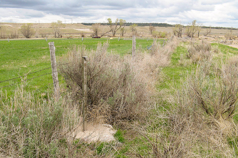
“Rock Creek station was established along the Oregon-California Trail in 1858 to sell supplies and other services to the emigrants. The station subsequently served as a relay station for the Pony Express, and finally as a stage station for the Overland stage. To the northwest of the old station site is the finest stretch of pristine trail ruts in southeastern Nebraska. These ruts, which cover 1600 feet, are quite dramatic in appearance.”
This location is almost exactly in the center of Adams County and the Thirty-Two Mile Creek Station name indicates the distance to Ft. Kearny. Russell, Majors, and Waddell formed the Leavenworth and Pikes Peak Express company in 1859 and most likely constructed the Thirty-Two Mile Station that year. Samuel Word kept a diary of his 1863 trip across the plains and the following words are from May 28: “We are now 32 miles from Fort Kearny. Am most anxious to reach Kearny for I expect to hear from home. Have just returned from a ranch close by, where immigrants and settlers to the number of 100 are congregated engaged in a genuine old-fashioned back woods dance. . . . The ranche was about 12 by 14 feet square covered with sod. . . . The house had what it would hold, the rest stood outside. . .many of the men were drunk from rifle whisky sold them by the proprietor of the ranche. His grocery was in one corner of the room. I left them dancing.” (Word in Renschler, 1997)
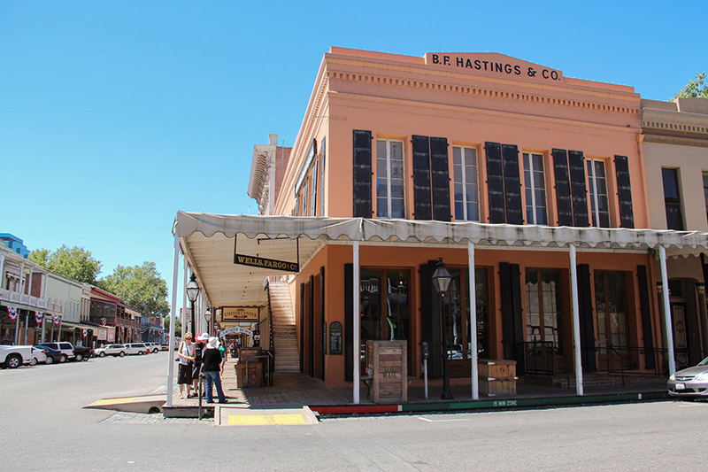
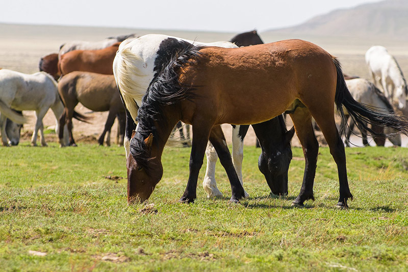
This area was possibly the driest and windiest section of the pull from the Little Blue to the Platte Valley. Summit Station may have been established in 1860 for use as a Pony Express Station. Joe Nardone (2008) refers to it as an “added station”. The station was abandoned after the Indian raids and never rebuilt. Frank Root in The Overland Stage to California (in Renschler, 1997)wrote:
The following lines rely extensively on the article by Randy Brown in the Spring, 2007, issue of Overland Journal, titled The Grave of Susan C. Haile. When I first visited this area in the late 1960s with Boy Scouts, it was generally known as the “Lone Grave.” Randy Brown writes, “Most assuredly, however, when Susan Haile died in 1852 hers was not a lone grave. This was in the midst of the ‘cholera corridor’, . . . .” Most likely there were dozens even hundreds of graves along the Thirty-two Mile Creek/Platte River Valley stretch, but we know only the Susan Haile grave location. We know of the Haile grave because of the existence of a headstone. Intriguing legends and questions accompany the Haile story. Who was she? How did she die? How was a gravestone transported to the spot?

The trail angled northwest across this steep drainage and must have been a hard pull after rains. This quarter section has been cultivated for decades and swales are not visible. D. W. Kingley, Jr. and Will Locke flew the trail in June in 1985 looking for faded color in the crops due to soil compaction from the trail traffic, but no crop color contrasts were observed. In steeper areas that had been left in native pasture swales were clearly evident. This marker was erected by the Niobrara Chapter of the DAR in 1912.


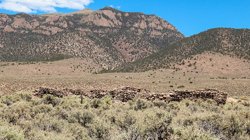
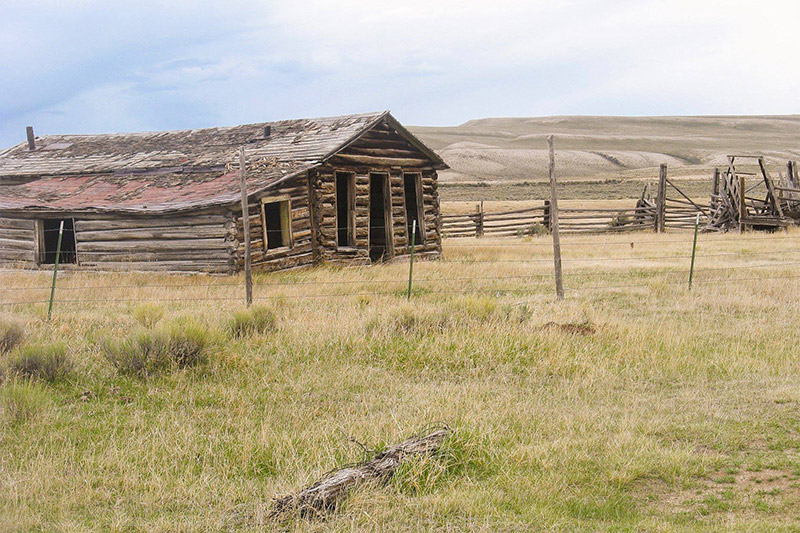
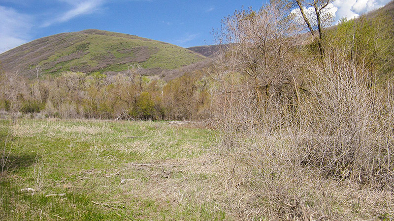
At the stage station marker look west across the small valley of Thirty-Two Mile Creek to the pasture and you will see several parallel swales climbing west out of the valley. Low angle light of early morning or late afternoon places these swales in shadow and they are easier to see. Light snows will make the swales stand out and during a thaw following deeper snows, snow will linger in the swales and one can see them clearly enough to count. Binoculars would be helpful as the “swales” are a half mile distant. This area must have been one of the tougher pulls of the Little Blue/Platte Valley trail segment. The first problem was the steep descent down into the valley. The brake mechanisms on the wagons were not very effective and the weight of the wagons would have pushed hard on the oxen. They could have run a pole through the rear wheels to provide additional braking action. Crossing the creek would have required the first wagon travelers of the season to dig ramps on both banks and perhaps to double team. Re-digging the ramps would be required after periods of high water. Once the pull out of the little valley was accomplished, the going was smooth until the crossing of the West Branch of Thirty-Two Mile Creek. Elm Creek Station was built by the Holladay Stage Line as a replacement for the Lone Tree Station which was burned during the Indian Raid of 1864. The marker was erected by ACHS in 1973. The granite stone came from the foundation of the old Hastings Post Office.

Sometimes this stretch is referred to as “Nine Mile Ridge.” The stone marker was erected by the State of Nebraska in 1912. Located at https://goo.gl/maps/EHArEhZmXwpZRR4EA.
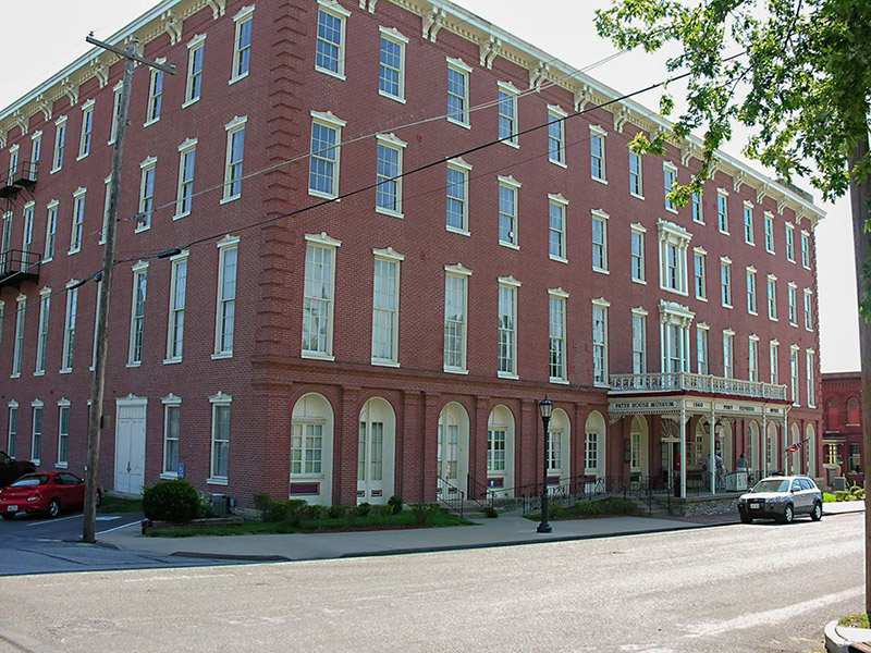
This section of the trail falls between branches of Thirty-Two Mile Creek and is very smooth. The inscription on the granite stone reads, “Oregon Trail Marked by the State of Nebraska 1912.” Scout troop 192 helped erect this marker.
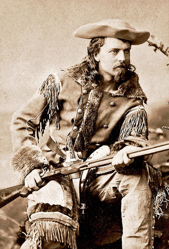
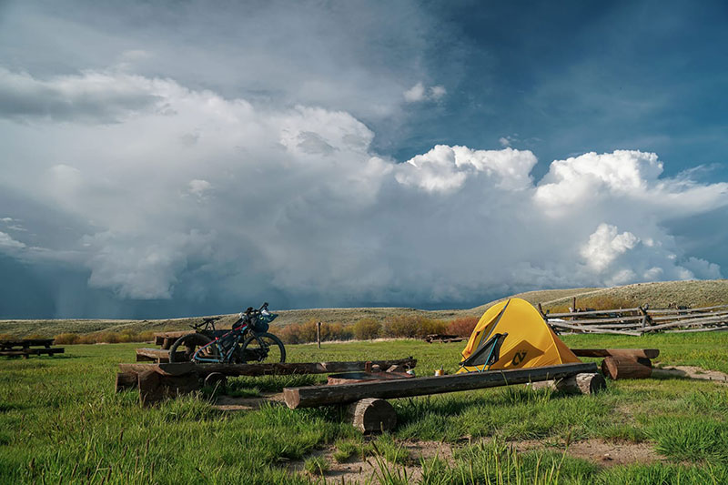
Just west of Kenesaw the trail jogged sharply west and then north to avoid a lagoon that is hardly visible today. John Klusman, while taking a break from planting in May, 2008, explained that the land had been leveled and drained in such a way that the lagoon that had previously been so prominent was no longer visible. The writer jogged this section of the trail in the late 1970s and recalls a large lagoon that obviously would have caused the wagons to detour. The goal was to get to Ft. Kearny with as little wear and tear on stock and equipment as possible; they were not going to get bogged down in a lagoon to save a mile. This marker was erected by the State of Nebraska in 1914.
“Casper is definitely on my list for an off day or two for anyone looking for suggestions. Good food, lots of bike shops, campground with cabins right in the middle of town, as well as plenty of hotels. There’s even a handfull of outdoor stores that stock things one would need to head off on a few days ride without real resupply options, which is a definite added bonus. It’s like Salt Lake City on the route in that regard, only smaller! Bonus points for renting a car and driving up to Devil’s Tower for the day one day. Definitely worth the drive (or as an addition to the whole route…hrmm).”