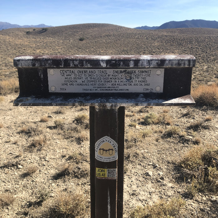
I scouted Smith Creek Summit to see if it could be an off-road alternate to Railroad Pass, just to the south. The short version is the route is fine. The Old Overland Road continues over the pass as an east to follow two-track. On the east side of the summit, the trail is soft in places, a little rocky in others. But nothing serious. The climb is steady. There is a marker at the top for the Overland Trail; I didn't see any signs of a Pony Express station or monument, but I could have just missed it somehow.
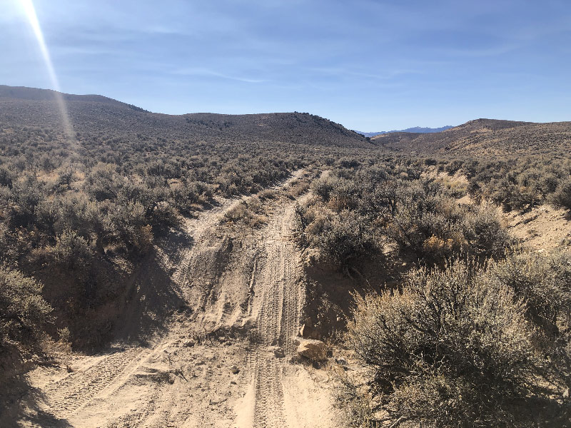
The west side of the summit is slightly more technical road. That is, it’s very weathered. Lots of loose sand and dirt, more rocks, more washes crossing the path. At one point, the road drops into a wide wash and follows it down nearly to the bottom of the canyon. The sand is particularly deep and loose in many spots along here. Nothing too bad; I didn’t have to pedal; just had to be careful not to dig the front tire on turns. I have no idea what this riverbed would be like during a rainy time of year. I have to believe that in the middle of a downpour it could be a dangerous waterway. When I rode (October 2020), and probably most rideable times of year, it’s not an issue. Riders should keep a waether eye out for thunderstorms. Of course, keeping n eye on weather is probably a good idea for the entire Pony Express Bikepacking Route.
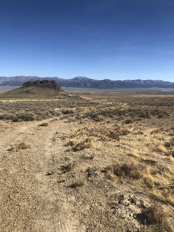
Once out of the canyon, the road south along the west edge of the mountains toward 722 is wide open, and slightly down hilll. The US TOPO map shows the Old Overland Road running southwest straight across the alkali flat, but I couldn't see a clear road and would not recommend that route, though an adventurous person might want to give it a try.
Washes crossing the trail are frequent in Nevada, and can catch you off guard if you aren't paying attention
At present (late-October 2020), the XP Bikepacking Route turns south just past Mile 1894 to get to Nevada State Route 2/722 and continue on pavement over Carroll Summit to Middlegate. Alternately, you can continue west and stay closer to the Old Overland Road and Pony Express Trail. If you take this alternate, you can go near Smith Creek Station, and visit the sites of Edwards Creek and Cold Springs Stations. The first part of this route is detailed in my post on Smith Creek and Basque Summit. It is also possible that sometime in the future the XP Bikepacking Route might be rerouted along this alternate route.