Yesterday (7/24/2020), I rode another short loop (20 miles) to compare the 2017 Centennial Route with the Pony Express Bikepacking Route between Pacific House and Pollock Pines (Miles 2122-2130). I was looking forward to this ride for three reasons.
- I wanted to see how bad the traffic was on the PX Route along Park Creek Road and Sly Park road;
- I was hoping the 2017 Centennial Route, which follows the El Dorado irrigation canal, would be a viable alternative;
- The 2017 Centennial Route crosses the American River at what looked on the map to be a ford. If the river was in fact fordable, it would allow riders to follow the Pony Express Route along a dirt road east of Pacific House instead of riding the shoulder of US 50, where the PX Bikepacking Route currently runs.
As it turned out, the alternatives to the PX Bikepacking Route were not superior enough for me to recommend them. And sadly, the American River is not fordable at the point designated on the 2017 Centennial Route.
Eastbound from Pollock Pines
As with my earlier scouting trips, I started from the western-most point on the loop, mostly because (1) it's a shorter drive from my house, and (2) it meant riding uphill on the outbound leg and downhill coming back.
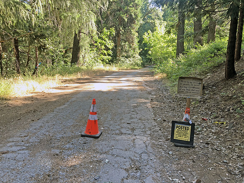
I ran into trouble about a mile down the road, where there were traffic cones and "No Trespassing" signs. After scouting for an alternate way around this section and not finding one, a local rider happened by. He's lived in the area since the early-70s, and explained that an owner on property further down that road posted the signs recently to keep people away, but that in fact the road (the continuation of the Pony Express Trail, which is the paved main drag through Pollock Pines) was old US 50 and is a public right of way. He told me about a couple of other apparent barriers to entry further up, assured me there were no access restrictions for bikes, and gave me general directions. So I continued on.
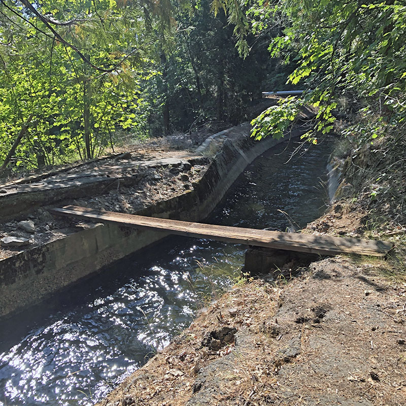
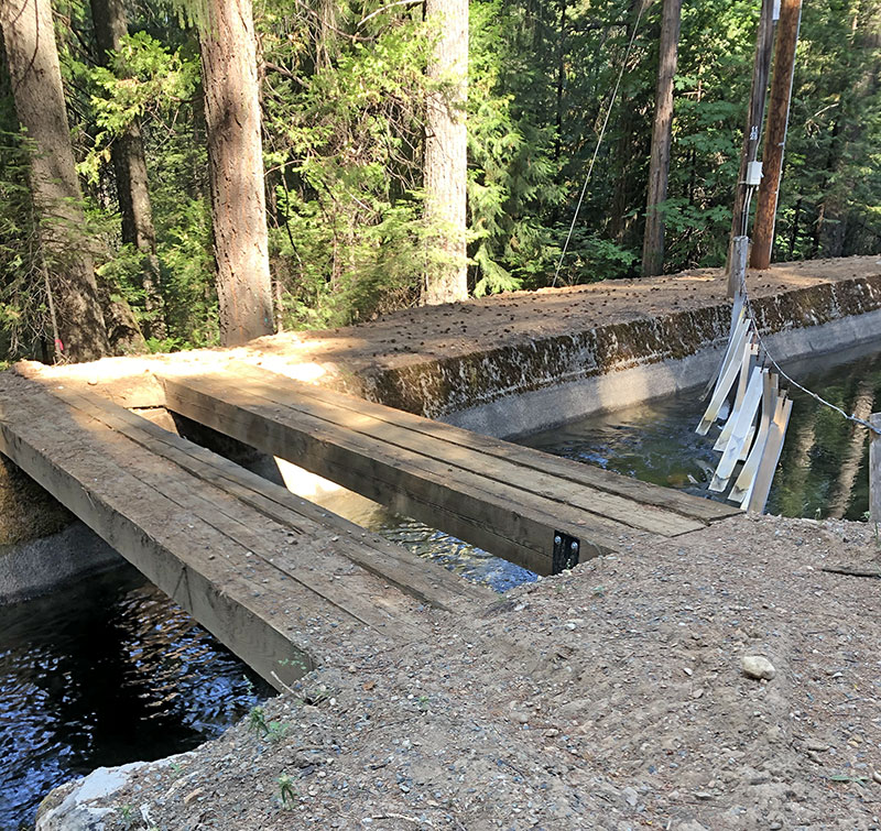
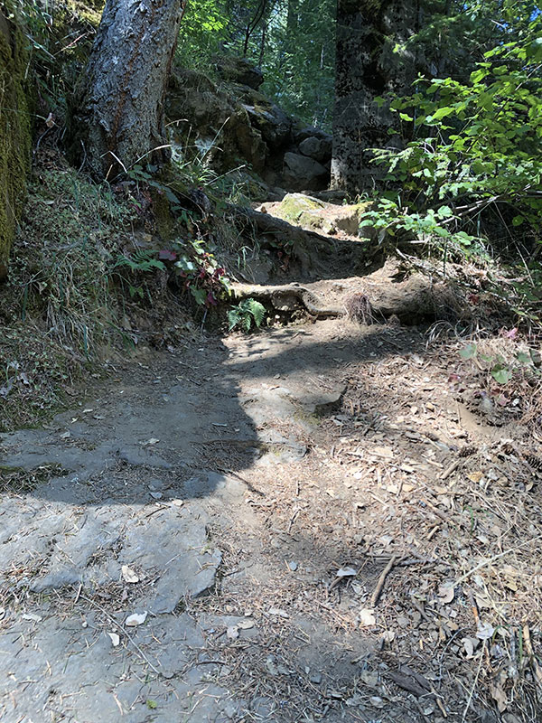
Eventually, I wound downhill on steep trails to the irrigation canal. The side of the canal I was on was impassible; the passable trail was on the opposite bank. I backtracked a short distance along the canal until I found a bridge, then crossed easily enough. But soon after, the trail gave way to a catwalk perched on the edge of the canal, which itself hugs the shoulder of a ridge. In other words, there was no room to go around the narrow section of catwalk. The catwalk itself seems pretty clearly made for walkers, not bikes. Probably someone riding a gravel bike with narrower bars could navigate the narrow space, but with my wide MTB bars, and a steep drop into the cold canal water if I hit the railing, convinced my after a few attempts just to walk this section.
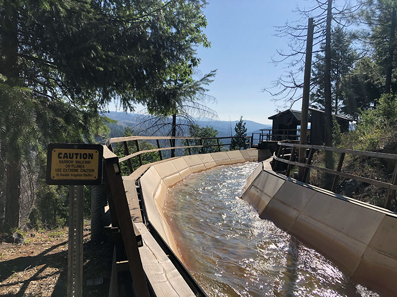
After a time, the catwalk gave way to path, but then went back to catwalk, and the alternating pattern continued for a stretch of about two miles. It was very slow going. At one point, I had to recross the canal on an improvised bridge: two 2" x8" planks side-by-side, and not secured together or at either end. Every step I took, the board on which my foot landed sagged. It was not pleasant.
This section of the canal goes under US 50, but there is no room for pedestrians or riders. So I climbed to the shoulder of US 50, waited for a break in traffic, and sped across. The crossing was on a curve with limited visibility in both directions. Enough, as it turned out, but not comfortably so.
In short, there was nothing about this portion of the trail I would recommend for a bikepacker with a fully-loaded rig. Which is too bad, because the PX Bikepacking Route enters Pollock Pines from the east on Sly Park Road, which (in my opinion) is hazardous. More on that later.
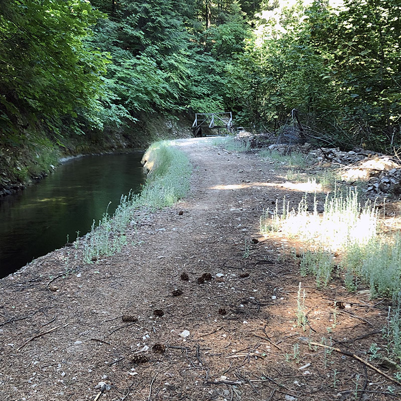
South of US 50, the canal trail is wonderful. As with the trail west of Pollock Pines (reviewed in my last scouting trip here), the trail was wide, for the most past smooth, shady, and lovely. There were one or two very short catwalk sections. You could ride around these (which I did), but the sections are across gullies with steep sides. I don't think I would be able to climb them full loaded. Maybe a stronger rider could. otherwise, you always have the catwalks.
Pacific House
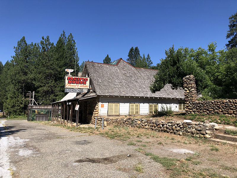
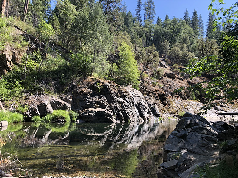
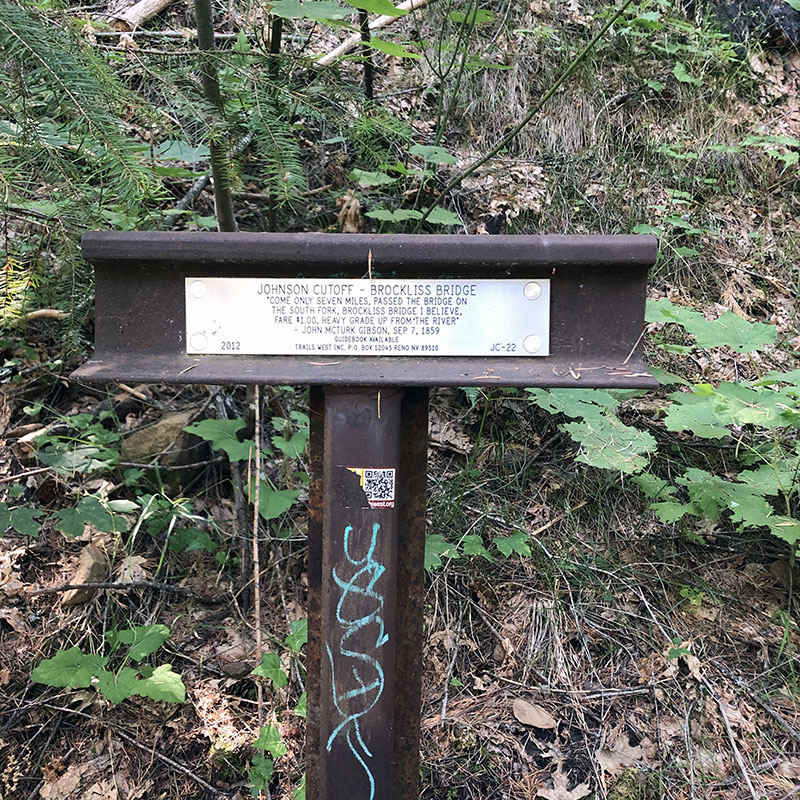
My turnaround point was Pacific House, a station on the Johnson Cutoff (where, everyone mentions, Mark Twain once stayed). Actually, my true turnaround point was just beyond, where the original trail (Johnson's Cutoff and Pony Express) meets the American River. So I took the trail down almost to the river. Almost, because after a certain point, the trail was impassible. I had to walk the rest of the way down. As it turns out, there is no ford here at all. It is the former site of Brockliss Bridge, a bridge built in 1855 which was destroyed in 1869, rebuilt in 1926 (as the Blair Bridge), then torn down as beyond repair in 1988-89. Apparently, the missing bridge creates the only gap in the original Pony Express trail. The riders who reenact the Pony Express ride on horses every year ride down to the banks, rig a pulley system for the mochilla (mail pouch), then drive around to the other bank to continue their journey. (There is a nice writeup of the process here.)
The river here is beautiful. But there is no ford. Even if a rider could get down the bank (very difficult), and cross the river (hazardous), there is no way to climb the rock face on the other side. It's an absolute dead end. Even climbing back up along the old bridge abutment without a bike was difficult. As it turns out, the 2017 Centennial Route I have been following is a "proposed" route. Obviously, they didn't go this way. I've contacted the ride leader, who told me they did not follow the proposed route all the way, but am still waiting to get details on their actual route.
The biggest downside for me is that the PX Bikepacking Route east of this point is on US 50 Mile 2118-2122. Now that I know there is no route north of US 50 along this stretch, I plan to go back soon and look for alternates on the south side. Technically they are farther from the original Pony Express trail, but as far as that goes, if (1) the original trail is not accessible at this point, and (2) the PX Route doesn't follow it along this short stretch anyway, an extra hundred yards or so south doesn't seem to me to be that much of a deviation.
Pacific House to Pollock Pines
I was dreading the first part of the return route, as it is climb from the highway (or in my case, the river, which lies even lower) to the ridge up Hazel Valley Road. It's a climb, no doubt (on sketchy pavement, but not so bad I couldn't bomb it on the way down), but not overly long (about one mile). Park Creek Road turns west off Hazel Valley Road a little past (i.e., uphill) of the irrigation canal, and at that point is a dirt road (it's marked with a National Park number, which I failed to get a picture of, not a street sign–you can see on my ride map that I missed the turnoff and had to backtrack). It continues to climb, and is not the best roadbed. It has some deep, soft dirt in places, and quite a lot of small rocks in others. The continues on in that vein for its entire length. Unlike the canal trail, which is a smooth, steady climb (eastbound) and descent (westbound), Park Creek Road is fairly rough, fully exposed, and undulates. Between the two, I'd opt for the canal trail.

The problem with the canal trail is getting off it at the west end before it hits US 50, as everything after that point makes it not worth taking. As it turns out, there is a paved road that runs between the canal trail and Park Creek Road. It's Old Carson Road. If you were to follow the canal trail until about 100 yards south of US 50, Old Carson Road crosses at that point. If you took it, it would land you back on the PX Bikepacking Route at just about Mile 2127. This is the route I would take. The only downside is that the climb from the canal to Park Creek Road is steep (it maxes out at over 10%). But it is well-paved with very light traffic. (On my ride map, you'll see that I rode down to the canal and back to scout this section).
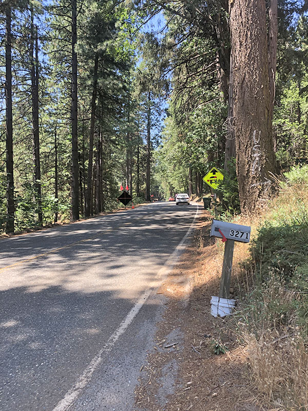
Whichever of the two routes you take west from Pacific House, Park Creek Road dumps you onto Sly Park Road, which is another fast-moving two-lane with a shoulder that comes and goes. I found this section nerve-wracking, but other riders less car adverse than me might have no problem with it. This is about a two-mile stretch, so I imagine most people will put up with it. As far as I can tell, it is currently the only viable road into Pollock Pines from the east (not counting US 50).
That being said, at the junction of Park Creek Road and Old Carson Road is a California Trail sign designating the old trail, and a faint path going up the hill. I plan to go back and see if that doesn't somehow lead to a nicer way back to town.
More Pictures from the ride: