July 7, 2021
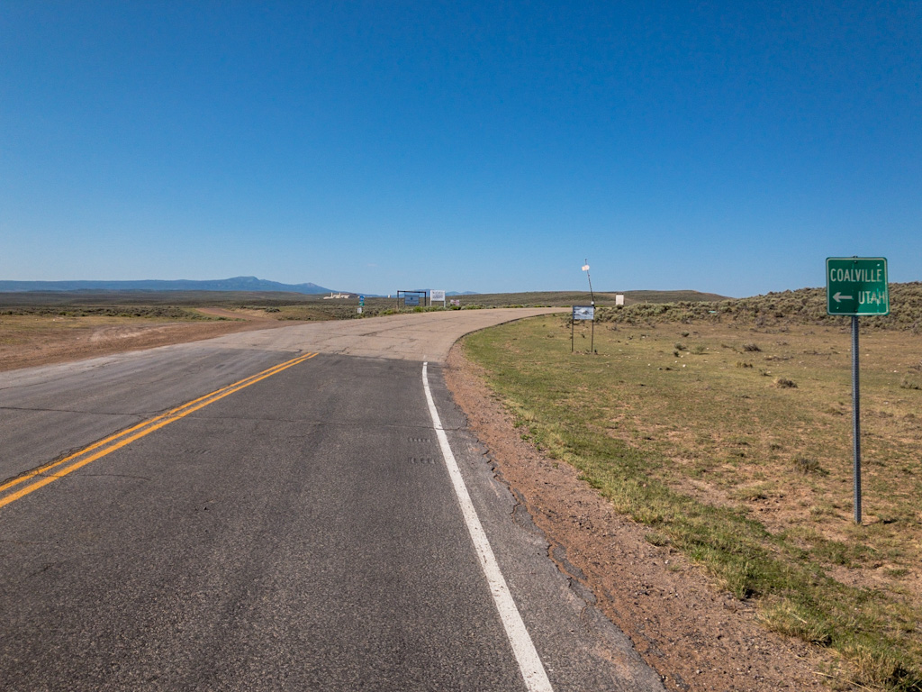
Evanston, WY to Coalville, UT
48 miles/1,473 feet
Mid-90s/winds variable to 15/tail and headwind
https://ridewithgps.com/trips/70756724
I was a little worried this morning because looking forward, the last two days of my ride were both going to be on the longer side (55 miles or so). The last one in particular had a lot of climbing. High temps were forecast, which usually brings high winds. No rain at least. No thunderstorms. But still.
The night before I had decided to take a look at the remainder of the route on the larger screen of the hotel’s computer in the business center. Only then did I realize I did not have to retrace the road to where I’d deviated from the Pony Express Route (back up Highway 150, which wasn’t particularly attractive); rather, I could take a more direct route, Yellow Creek Road. This route would be less retrograde as it ran a little west of south, rather than east of south as on 150, and so would shave some miles as well as save some time. I also recalled that I had at one time actually considered riding this road as it has a Pony Express Station on it, one that the Pony Express Bikepacking Route bypasses. But this point of the ride was so near the end I had forgotten all about that idea while dealing with the previous thirty-plus rides.
So I edited the route for the next day and downloaded it into all my devices.
(I’m not sure if I’ve mentioned this before, but at a few points on this trip I’ve used a hotel computer to edit my route. I have not been able to figure out how to do it on the iPhone or iPad, so these hotel computers have really been handy that way.)
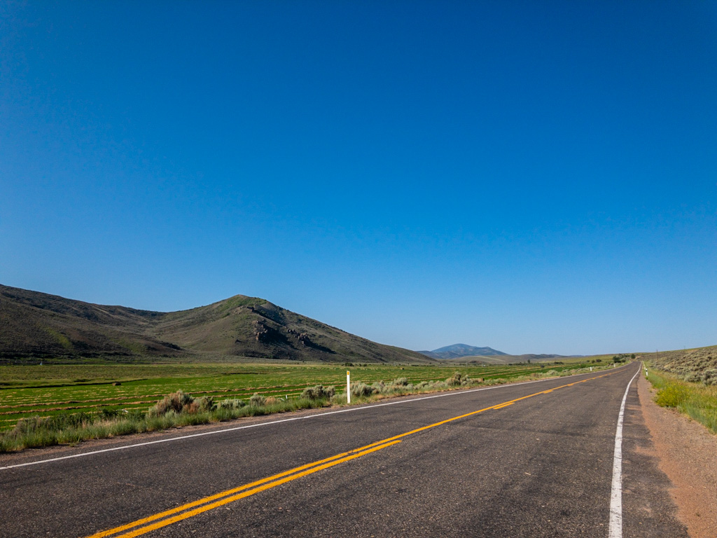
I had another large, mediocre breakfast at the hotel restaurant, supplemented by my Pete’s raisin cinnamon roll from the day before (still good), and left by eight, figuring the Yellow Creek route probably took an hour off the route I’d originally planned for the day. The ride profile looked promising: Picture a caret (^), or chevron. It looked like that, only not so steep, with a shorter uphill side and a longer downhill. It seemed too good to be true. Being by nature an optimist who is skeptical of his optimism, I suspected issues would likely arise instead from poor road conditions and adverse wind direction.
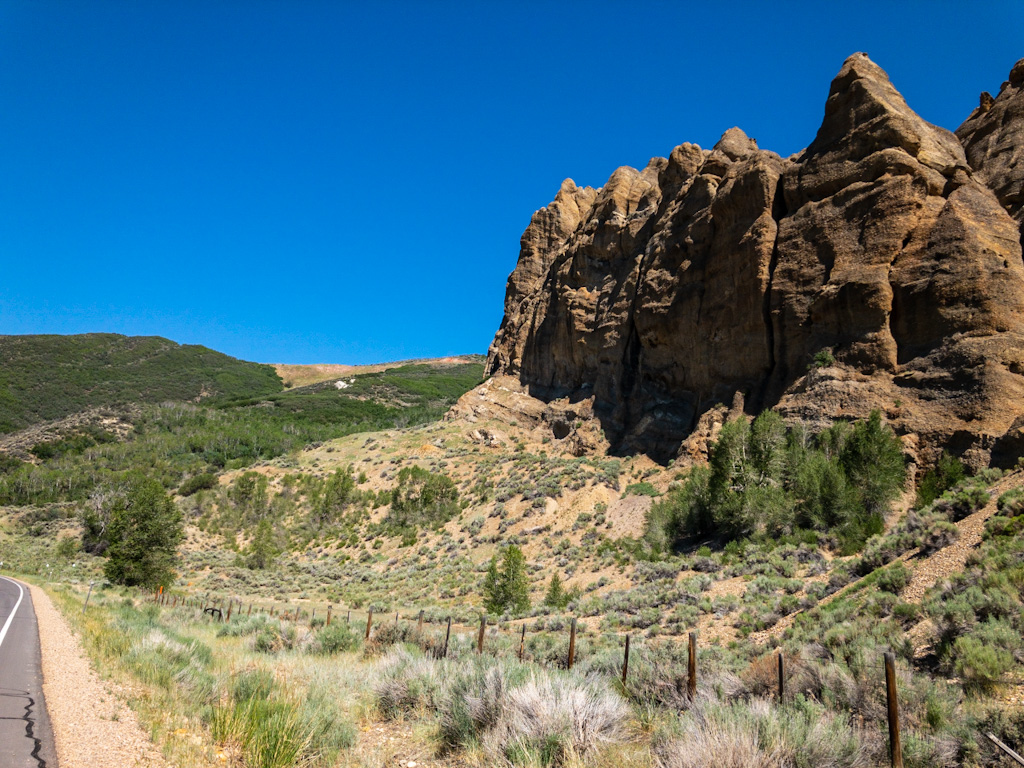
The uphill part of the caret was on Yellow Creek Road, which followed Yellow Creek (naturally), crossing from Wyoming into Utah and back again until it reached Chalk Creek Basin. It could have been a railroad route as it was such a steady ride. The incline was smooth, with some uphill pitches, but overall nicely paved, lightly trafficked and just . . . Pleasant. About ten miles from Evanston was a landmark called Needle Rocks, or sometimes, The Needles. Like Cathedral Rocks south of Granger, this was a landmark that was not so much striking in itself as different from the surrounding area, and to that extent easy to spot. In other words, a good place for a Pony Express station. Burton described the landmark as:
After fording Bear River . . . [we] were shown on a ridge to the right a huge Stonehenge, a crown of broken and somewhat lanceolate perpendicular conglomerates or cemented pudding-stones called not inappropriately Needle Rocks.
Richard Burton, The City of Saints, p. 183
I would describe it as Rocky outcropping on a descending ridge among otherwise smooth, grassy hills. Then again, I’ve never had occasion to use “lanceolate” in a sentence. There is not much information about this station. If I’m not mistaken, the original Pony Express route ran perpendicular to Yellow Creek, leading from Bear Valley Station (near Highway 150, to the east), through Needle Rock Station, to Echo canyon (to the west).
There was only a very small sign marking a viewing spot for Needle Rocks, but it was a good reason to take a short break and a few pictures. The breeze was still light, and what little there was, followed me up the canyon. I wondered if Wyoming was apologizing for the last two weeks; or maybe just giving me a good send off to fool me into thinking Wyoming wind wasn’t so bad after all. At the same time, it struck me that if the wind was following me up this canyon, it would probably be rising up the next river canyon, which meant a headwind, which in turn meant I should get going before it had too much time to build.
A few miles further up the pavement gave way to a hard-packed gravel road. Then I came to a junction. The county highway I was on turned left and deteriorated; the hard-pack turned right, up a steep hill. My route told me to go right, but it looked like there was private land for a mining operation thereabout. I could see on my nav app that the county highway went through, but the route was longer. I opted for the better, shorter, steeper road, hoping it wasn’t blocked to public use further along.
It turned out to be open the entire way, but there were some tough climbs. I assume the county highway continued to follow the creek, so that might have been the better call. But too late; after a long downhill I had rejoined the the Pony Express Bikepacking Route. There were some steep climbs over the next couple of miles here as well, but they were short. Soon enough I picked up Chalk Creek Road, which I would take me all the way down to Coalville on the eastern end of Echo Reservoir.
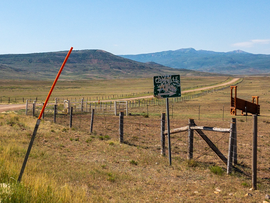
There were no historical markers after Needle Rocks station because this was not the primary emigrant route. That route lay though Echo Canyon, to the east, which is occupied by Interstate 80 (and off-limits to bikes, or so I’m told). That being said, the Chalk Creek route does have a history separate from the emigration and Pony Express:
This route was the US Army wagon road from Ft. Bridger to Camp Floyd (Fairfield), Utah surveyed by Capt. James Simpson in 1858. Due to hostilities with the Mormon population of the Territory of Utah, the occupying US Army wanted a more secure supply road established that bypassed the Mormon Trail thru Echo Canyon (which could be easily blocked by militia). Simpson’s connection to the Pony Express Trail is critical because he surveyed a wagon route west from Salt Lake City across Nevada to California in 1859. His route would become the Overland Stage and Pony Express route a year later. For more info, refer to “A Route for the Overland Stage” by Jesse Petersen (USU Press, 2008).
So the Chalk Creek-Coalville route is indirectly related to the early history of Utah and the rest of the Pony Express Trail and continued to be used by freighters as a short cut into Utah County along the Provo River.
From Jan Bennett’s notes on the Pony Express Bikepacking Route
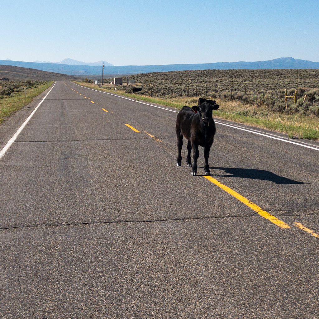
What the route lacked in historical markers, it made up for in increasing grandeur. I was getting further into the east side of the Wasatch Mountains. Rocky outcroppings and larger formations seemed to increase as I went along. The valley was beautiful, and even more to my taste, trended downhill. As I suspected, the wind rushed up it to greet me, and there were some uphill sections where the road tended away from the creek and had to mount a rise, so my ride was not quite as fast and effortless as I might have hoped. Nevertheless, overall it was very pleasant.
I saw my first road cyclists here since . . . I don’t know if I’d seen any since just west of Scottsbluff. Two couples, separated by miles so not together, out for a day’s exercise, clad in Lycra, not carrying anything beyond what they needed for a few hours on the road. I assumed they’d reach a point behind me then turn around and catch up, but they never did.
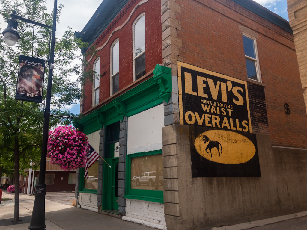
I rode into Coalville around 12:30. I would like to have found a cafe to hang out in, but there weren’t any. I am not sure if that’s because it is a predominantly Mormon town, but regardless, I had to find some other place that would allow a sweaty, dirty, probably stinky cyclist to escape the mid-90s heat for a couple of hours until i could check in to the hotel. I chose Denise’s Home Plate, a restaurant proudly operated from inside an old house.
The setup was like the Main Street Cafe in Evanston: menu on the wall, order at the counter. Maybe that’s just a thing out here. Davisville has a couple of restaurants with the same setup, but I’ve never thought of those as diners. I suppose it means I just need to adjust the preconceived notions I base on restaurant names and my unrealistic desire for authentic small-townness. Not to mention pie.
As per usual, the only non-meat item was a “super” grilled cheese, so long as I asked them to leave the veggies and hold the bacon. I ordered that and a coffee, which the woman told me they’d have to brew. Fifteen minutes later, when I still had neither, I realized there would be no problem occupying a table as long as possible so long as I was patient. I wrote a postcard, then addressed and stamped it and walked down to the post office to drop it in the mail and when I returned my table was still empty. But the place had cold water to drink, as well as restrooms and air conditioning, and it offered me a clear view of my bike. All well worth practicing the virtue of patience.
The sandwich came, and while it was tasty, it made me miss Jessica’s cooking. The coffee was fine, and just what I needed even after the relatively easy ride I’d had. After lunch, I went back to the counter for pie. I had to settle for ice cream, which is fine by me, and ordered a large chocolate shake, which was very satisfying after the toasted bread and hot coffee.
By and by two o’clock rolled around and I decided to go by the hotel and try to check in early. It turned out to be no problem: they were virtually empty. The clerk told me there was a country-music concert to be held in town the next night, and that the motel was booked. But by the time most of those guests arrived, I’d be in Salt Lake City.
So, my usual routine: charge devices, shower, change, short nap. Then off to sit at a table in the breakfast area and write. A few hours later I wandered to the gas station c-store and bought some chocolate for the evening and drinks for the next day. Back to the room to pre-pack and double-check so I would have the fewest items to repack in the morning. As evening fell I found I wasn’t very hungry, so I skipped dinner again.
I took a look at my route for the next day—three mountain passes—and thought I should get to bed early. Then I realized that the route I was following would take me into downtown Salt Lake City, but my actual destination was at Connie and Mike’s house, south of town. So I went to the hotel business center and updated the route and downloaded the maps on all my devices. So much easier to do that here in the cool hotel than to figure it out on the fly after riding fifty miles. Part of me congratulated myself on catching that oversight; another part wondered how I ever missed it in the first place. There but for the grace of the navigational gods . . .
Everything ready, route all set, I watched a movie until it was time to go to bed.
Reading over this entry, my afternoon and evening sound so civilized—showering, writing, watching a movie, using a business center to update electronic maps. Of course there is no comparison to emigrant times, or to the Pony Express. But in a way there is also no comparison to the riding part of my day either, when everything is about the immediate present, the right now: Paying attention to the pavement to make sure I don’t run over anything that will cause a flat, or worse, to crash; staying attuned to the wind, which, especially in these canyons, often changes direction to go around obstacles and could push me into the road or off the narrow shoulder; listening for the sound of cars approaching from behind, trying to hear them even before the radar warns me they are there; watching the cars ahead to make sure they see me and are staying in their lane; scanning the clouds as they gather for signs of rain, or lightening, anticipating the direction and strength of the wind they push ahead of themselves; gauging my hunger, my thirst, my need to pee; monitoring any pain in my arms or butt or legs; and all the while trying to take in scenery that is ever changing, now that I am out of the desert, trying to record it mentally, deciding whether it’s worth taking a picture . . . A constant cycle of gauging and checking while I cycle along.
I have caught myself at times losing focus, mostly while fiddling with the navigation app on my handlebars. The phrase that struck me was that I was more concerned with where I was headed than where I was going. Which is dangerous. Luckily, straying in the fantasyland of how far ahead my next turn might be has not yet led me not to watch carefully enough where I was going, so I’ve managed to keep the wheels on the road, at least so far.
But that immersiveness, the absolute presence that cycling requires is one of the things that makes cycling so addictive. It can be a complete escape from your other preoccupations. And in the same sense, getting completely away from the immediacy of cycling at the end of the day—the neediness of it, like a crying child you can’t ignore—getting far enough away to gather up all of the mental energy you have stored all day long, the ideas and the memories as well as the data points of your constantly running checklist of sensory bombardment, and to dump it out in the form of writing while sitting in a comfortable place is, for me anyway, the perfect antidote, the ideal counterweight to balance out the day.
I did not intend to write so much or so often. I never would have thought I’d have the energy or motivation. But now that I’ve done it for so many days, I realize that the days after I write I am more relaxed, more present, than the days I’ve had to skip (with the exception of my ride with the boys from Sixth Crossing, which was the closest to pure fun I’ve had on this trip).
I realize I am not a dyed-in-the-wool bikepacker. I am a writer who rides bikes, and not the other way around. Because I have been cursed with a lack of self-knowledge all of my adult life, it has taken me almost six weeks and some thirteen hundred miles to come to that realization. But now that I get it, I have to say it’s a good thing to know. Going forward, maybe I’ll even gain the wisdom to plan and act accordingly.


I went to a writing workshop that had a sign on the wall that says “We write to understand, not to be understood.” This post seems to reflect that maxim. Perhaps my favorite entry yet.
I like that. I did actually start posting for myself so I could remember the details later. As people subscribed, I became aware of having readers and that may have changed my style some. But the last part of this entry was definitely more for me, a way of remembering this belated realization and how that felt.
I think the satisfaction in writing is making what is impermanent permanent. I really like that photo of the sheep; they look serene and protected in that bowl of grass below the sky.
I thought they almost looked painted there, little yellow cotton balls in the green valley.