June 29, 2021
Independence Rock, WY to Jeffrey City, WY
41.4 miles/1,200 ft.
mid-70s/northeast wind 10 mph
https://ridewithgps.com/trips/70251698
First, a confession. I adapted this post’s title from Bernard De Vito (“Anabasis in Homespun”). His chapter and this post have to do with the Mormon migration to Salt Lake City. His story covers their violent expulsion from Nauvoo, Illinois (and elsewhere), and the subsequent search for a new home in 1846-47. Mine covers a different aspect of that migration. The so-called “Handcart” migration of the mid 1850s.
The reason I’m focusing on the handcart migration is that I spent two hours at the Mormon Handcart Historical Site this morning. Also, I’ve been putting off talking about the Mormon emigration even though it is intertwined with the California and Oregon emigrations. The subject is just so huge, but this might be a good time to start. But before we get to the Mormons . . .
Last night was interesting. I slept on ranch land across the highway from the rest stop at Independence Rock. I couldn’t see the rest stop, but its lights lit one side of my tent all night. Also, I could hear it. Traffic on the highway, of course. But also, one of the trucks parked there was apparently hauling pigs, and every so often, one or more of them would make its/their objection (to be being penned up?) known by squealing loudly and for prolonged periods of time. Also, it turns out that cattle graze on Independence Rock land and on the ranch land. Occasionally it seemed like they were communicating across the highway. I don’t know how close they got to my tent, but I fell asleep to the sound of low-range mooing, which wasn’t entirely unpleasant. I admit that was concerned they might object to this green blob of tent that had appeared in their range. But they left me alone.
This morning I got up, packed everything, then went across the highway to the rest stop to cook (no fires allowed on the ranch land) and spread the tent fly out to dry. I hoped to get on the road by 8, but didn’t make it until 8:30. No biggie. Clear sky, moderate temperatures and tailwinds in the forecast.
What I didn’t realize at the time, was that I had now entered South Pass, the gateway through the Rockies. The actual summit is still 60 miles west. But to those who know these things, the eastern edge of the Pass starts at Independence Rock, from the time the trail starts up the Sweetwater River.
Based on the nature of the modern landscape and its historic significance, South Pass extends west from Independence Rock to the Little Sandy Crossing, 122 miles over the old Oregon Trail or about a hundred-mile flight for a crow. . .
I think the true pass starts further up, but here in Jeffrey City I am at 6335’ altitude (and you may recall that Casper was 5100’), so I’m definitely climbing.
I started off on the highway (70 mph speed limit, not too pleasant). After a few miles I turned off the new highway to the old highway, which goes through Rattlesnake Pass (or so on person called it; I need to check that). I think the surrounding hills were called the Rattlesnake Hills in Emigration days (or maybe Sweetwater Hills; I need to straighten that out, too). But I like the theme: Poison Spider Road yesterday, Rattlesnake Pass today. Right at the turnoff, there was a sign saying the bridge is out. Jan’s route notes say it’s probably okay for bikes. So I took a chance. In case you’re wondering, it was.
Along the side of the road were more white carsonite posts that mark the emigrant trail. I passed a protected grave in the Pass from an emigrant, one of few identified graves. Estimates of emigrant deaths from 1840 to 1860 range from 10,000 to 30,000 (one source says, “historians have estimated that 30,000 persons died on the trail between 1842 and 1860 (an average of 15 per mile”)). But as the years of the emigration went on, and as the fatigue of each emigrant’s trip grew, marked graves became fewer. There were other reasons to leave them unmarked, too:
[E]migrants ‘had a horror of being buried without a coffin,’ but this dismal piece of furniture was too cumbersome to take along ‘just in case.’ While still within reach of timber, along creeks in eastern Kansas, crude coffins could be constructed. Out on the Plains a ‘rude box’ might be made from tail gates or packing boxes, but this source was soon gone, and the departed was fortunate if he was wrapped in so much as a blanket. . . .
The graves were promptly invaded by wild animals. Succeeding emigrants were greeted, not only with scattered bones, buttons, and bits of clothing, but hands, feet, and various other parts of the human anatomy in varying stages of decomposition, with ‘prairie wolves howling over their loathsome repast.’
Horrified by the desecration and havoc wrought by wild animals, the emigrants experimented with methods of protecting the mortal remains, covering and lining the grave where possible with rocks, stone slabs, or timbers. . . .
[G]raves were not always marked. Polly Purcell recalled that Indians robbed emigrant graves. To forestall this practice, efforts were made to conceal graves by driving back and forth over them, in some cases going so far as to replace sod, prickly pear, and other vegetation. . . . In 1849 and later . . . Indians had a healthy respect for epidemics and left the graves to the mournful coyote.
Merrill J. Mattes, The Great Platte River Road, p. 88-89
Pretty grim, I know.
Just down Rattlesnake Pass and over the condemned bridge sat the Mormon Handcart Historical Center I mentioned above (there is a more formal entrance off the new highway, of course). Now, normally, I might stop and take a few pictures and be on my way. But here’s the thing: I think I am now a guest of the Latter Day Saints, or at least Elder Cook, through this part of Wyoming. Here’s how it happened (Stop me if I’ve told you this already. I can’t keep track of what I’ve written anymore, and I’m too pressed for time to reread everything).
Back in Davisville, when I was researching the route, I despaired over the stretch from Casper to Salt Lake City. Not only were there few towns; there were fewer motels and even fewer campgrounds (i.e., none in Wyoming until you get to the very southwest corner of the state). I could stay for free on BLM land, but identifying public land from private, plus trying to map out the distances between water, wondering how to resupply, etc., was daunting and full of uncertainty. If there is one thing I’ve learned about myself on this trip, it’s that I REALLY like knowing where I’m going to spend the next night.
As it turns out, there are a few historical sites run by the LDS (Latter Day Saints, or Mormons, in case that isn’t obvious), between Independence Rock and Farson—the emptiest 150 miles of this final leg—and that it might be possible to stay at one or more of them. A lot of searching for someone to contact turned up only Facebook page for one of the sites. I used Messenger to contact the site and ask about camping. A few messages and missed phone calls later, we finally talked.
Long story short, Elder Cook, who I think runs the Willie Handcart Center (about 20 miles down the road) used to live near Davisville. He and his wife, Ann, are also cyclists. A short while later, we discovered that the three of us rode in a 24-hour event together in 2010. We were part of a five tandem team (I was on a separate tandem, of course) that rode in a flèche put on by the San Francisco Randonneurs.
I have no personal memory of Keith or Ann, no incident that stands out. In fact, I have very little memory of that 24-hour, 360-mile ride (other than leaving a Denny’s in Petaluma at about two in the morning and freezing: fleches traditionally are held in April, over Easter weekend). But I did remember the ride, and the five tandems barreling down the empty Sonoma County roads in the middle of the night, as did Keith.
And as weird as it may sound, I took that as an omen. As a sign that as remote as this part of the world seemed to me, as difficult as it seemed to plan the minutiae of what to eat and where to sleep in the backwater of Wyoming six or eight weeks ahead of time, it would be okay. Somehow, knowing that I knew someone in Wyoming who knew me is what convinced me that riding from Casper to Salt Lake City was doable.
Keith got a big kick out of the coincidence, too. He doesn’t live in Wyoming, but is here temporarily as part of his service to the church. The timing of my coming here while he’s serving is just fortuitous. They’re going back home in the fall.
He immediately told me about places we could ride to that were on private property. He made it sound like we’d just have a great mountain bike adventure in the middle of my Pony Express adventure. I don’t know if I’m physically up for that, but it sounds like a hoot.
I think in addition to showing me around, so to speak, I somehow became Keith’s charge. Because another thing he told me was that the people at the Handcart Center near Independence Rock would be looking out for my arrival.
And sure enough, when I rode up right at 9am this morning, opening time, I met Elder Goodman who told me they were expecting me. He and I spoke for a few minutes, and soon we were joined by what I have to believe was the entire volunteer staff of the site. It was very sweet, very welcoming. I say volunteer because everyone I have spoken with so far is out here in Wyoming is on “service” for a period of months. In any case, we were a group of about 10, and they welcomed me with a bottle of Gatorade and asked questions about my bike and the ride until it became clear that I was to be handed off to Elder and Sister Hill, at which point everyone else filtered away back to whatever they were doing before, wishing me a safe journey.
The Hills took me through the visitor’s center, housed in an old ranch house from the Sun Ranch (which sold this property to the church) starting with the fireplace (all objects found on the ranch site, including petrified wood, mammoth tusks, and Native American grinding stones), some of the artifacts. From there, we went on a thorough tour of the center and Mormon handcart history.
While the Mormons were migrating to Utah in the late 1840s, they were also sending out missions to Europe. For better or worse, a number of people, primarily from the British Isles, converted and came across the Atlantic to help settle the Salt Lake Valley. The “worse” part of that scenario is that many were destitute, or nearly so, and the LDS Church was also not flush with funds to help pay their emigration expenses. So they hit upon the happy idea of rather than purchasing wagons, which were expensive, they would purchase handcarts at about 1/10th of the cost. And rather than purchasing oxen, the people themselves would haul their goods across the prairie and plains to Utah.
For the most part, the scheme worked. But in 1856, two handcart companies got a late start. As a result, they were hit by winter storms. One company (the Martin Company) was trapped near the area of the Historic Site. They made their way to a semi-protected area about five miles away, now called Martin’s Cove, and awaited rescue from Salt Lake. A second company, the Willie Company, also became stuck. They were rescued at what’s known as the Sixth Crossing of the Sweetwater, which is where I’ll meet Keith and Ann tomorrow. All told, “[a] modern historian counted 67 deaths in the Willie Company, a rate of around 14 percent, and 135 to 150 in the Martin Company, a rate of around 25 percent of the company’s members.” (https://www.wyohistory.org/encyclopedia/journey-martins-cove-mormon-handcart-tragedy-1856)
The story of the handcarts is far more complex, and obviously this is just a thumbnail sketch. But as it turns out, Elder Hill has ancestors (great, great, and maybe one more great grand parents) who were part of these handcart migrations. He also has a great, great, and maybe another great grandfather who was a Pony Express rider in Utah. The end result was that I received a long, personal, guided tour through the center. The kind of thing you don’t normally get, I wouldn’t think. It was special, and I have to believe that Keith had a hand in making that happen.
Afterward, I took the most mosquito-infested walk I’ve ever had in my life to view one of the wonders of the trail for emigrants: Devil’s Gate. It is a place where the Sweetwater River has cut a 70 feet deep, 1,500 feet long gorge through the Rattlesnake (or Sweetwater) Hills. It’s quite striking, but the mosquitoes were so voracious I pointed my phone, snapped a pic, and ran back toward the Historic Site swatting mosquitoes off my legs and arms as I went.
I went back and said my goodbyes. It seems Elder Goodman (a very fit-looking 75-year old) wants to ride his bike across the US, so he called Sister Goodman over and had me try to convince her it was a good idea. She told him he should have done it when he was my age. And here I am thinking I should have done it when I was Kazu’s age.
Anyway, it was already 11 a.m. when I got back on the road headed to Jeffrey City, still another 40 miles away. I had stayed much longer than I should have.
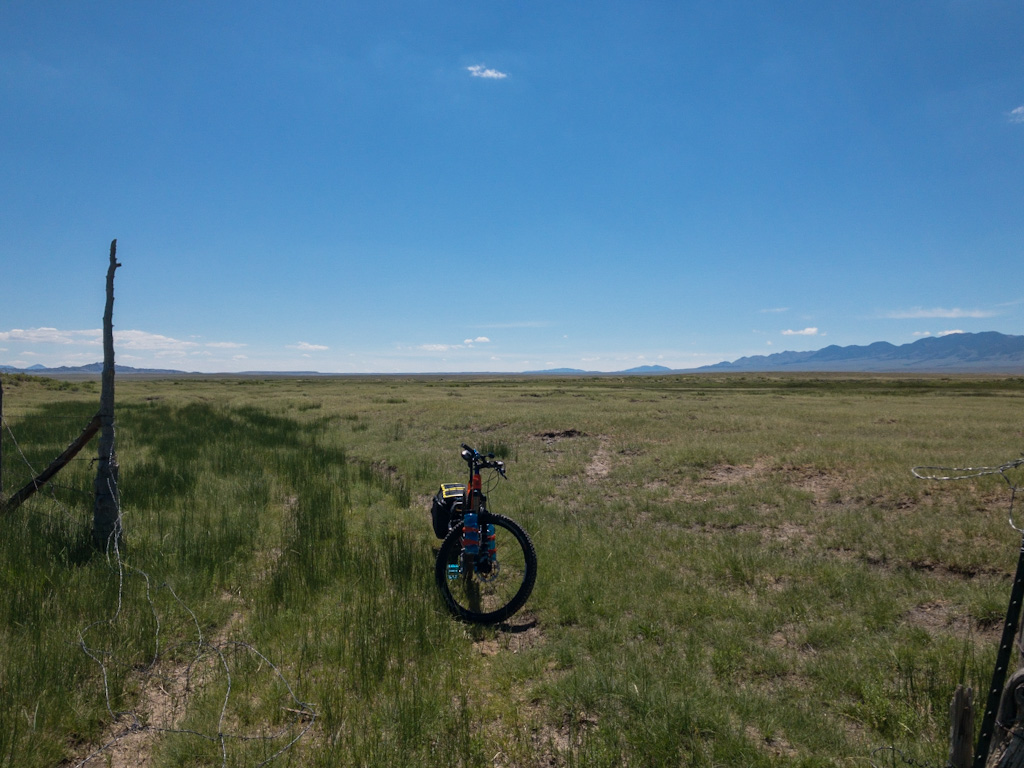
Soon after leaving the Handcart Site, the Pony Express Bikepacking Route turned off the nice paved/gravel road I was on and started doing that thing it did yesterday: follow the emigrant trails, becoming slow, difficult, and physically draining to ride. Don’t get me wrong; it was gorgeous, if very isolated. It is a singular experience to ride next to a historical trail made a hundred and sixty-or-so years ago, and to do it at somewhere between ox-driven-wagon speed and Pony Express horseback speed over a barely visible trail, at times only discernible because the wild grass is a slightly different color than the grass surrounding it, amid the sagebrush and prickly pear and antelopes and the massive granite mountains of Wyoming.
The emigrant trail markers were sometimes next to the road, sometimes further away. In places, the swales left by the passage of oxen and wagons were easily visible. A friend recently asked me how anyone can tell these tracks are THE trail tracks, how can they still exist after so many winter snows and summer rains. All I can suggest is that the claim is, in the words of my Contracts teacher, Professor Jack Ayer, nondisconfirmable. I’m not sure if he coined or cribbed that word (he is equally adept at both skills), but it fits. For someone like me just passing through at a pace not much faster than the wagons of yore, there’s no way to prove they aren’t.
Anyway, long, slow ride over deep sand, around yet more alkali puddles, dodging prickly pear cactus lying in wait by the side of the trail to puncture my tires, passing through private land clearly marked No Trespassing because it must be okay because this route is on Jan’s map. Climbing sandy hills, negotiating steep, rocky descents, and all the time trying to take in this really breathtaking desert mountain scenery. The entire time I was on this stretch of the road I was absolutely schizophrenic, one part of my brain saying, This is amazing and you get to see it because you’re riding your bike; you can’t drive here, no one other than people on these ranches sees this; drink it in; this is what you came all this way for; appreciate what you’re doing here, man. And the other half saying, I cannot wait to get back to the highway. I don’t care if they’re doing 70 mph, I can handle the noise. This is too remote; the last house was five miles ago; what if something breaks? I can’t believe I’ve only ridden 1/4 mile since the last time I checked. Do I have enough water? How far is the highway again?
Back and forth for the however many hours it took me to ride through this trail section.
I finally arrived at the motel. There is more to say about that, and about dinner at the Split Rock Cafe. And about Split Rock for that matter. But it’s late (11:00), and I still need to do pictures. So I guess this will be a two-parter, just like Day 28. Again, sorry about that.
Awesome journey. Looking forward to meeting and reuniting with you today.
Keith Cook
Wallace Stegner’s “The Gathering of Zion: The Story of the Mormon Trail” includes a lot of info about the handcarts.
You just gave me a flash of driving across the country. By the time we got to Kentucky, I remember taking in the beauty of the countryside and thinking “This is nice, but I can’t wait to get to New York!” Not the same, I know, but similar cognitive dissonance. Anyway, I’m glad you’re seeing those nondisconfirmable wagon tracks, and hope you’re not running across any hands, feet, or other body parts.
Wow. Best post yet. Ok, so continuing past Casper makes a bit more sense.