This is the second of three reports on the route between Sand Springs and Carson Sink Stations. Part 1 ("Sand Springs Station to Simpson Pass") is here, and part 3 ("Carson Sink Station") is here.
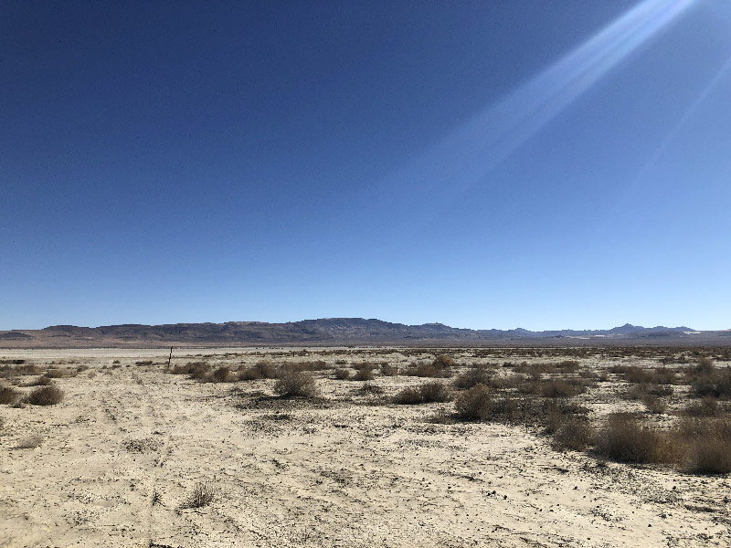
As there is a dry lake to deal with between US 50 and Simpson Pass, there is also one to deal with between the Pass and Highway 95. It's Bass Flat. Like Fourmile Flat, it sits squarely in the way; unlike Fourmile, it is a little harder to get around.
Simpson Pass to Sand Hill Station
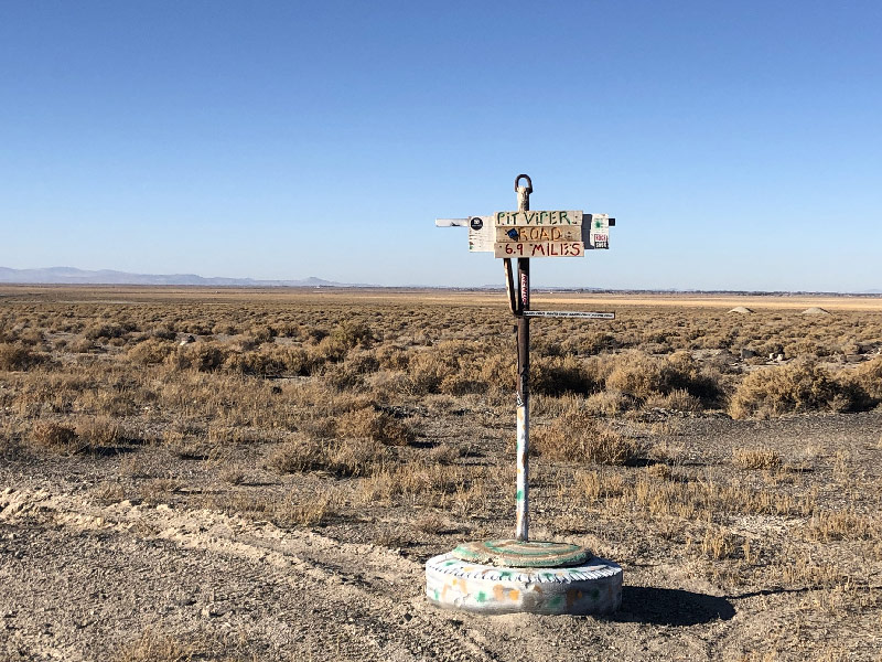
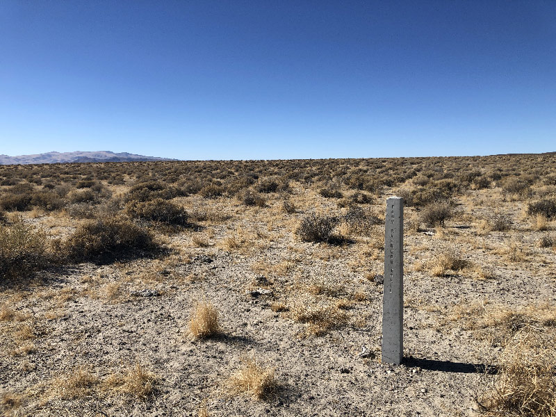
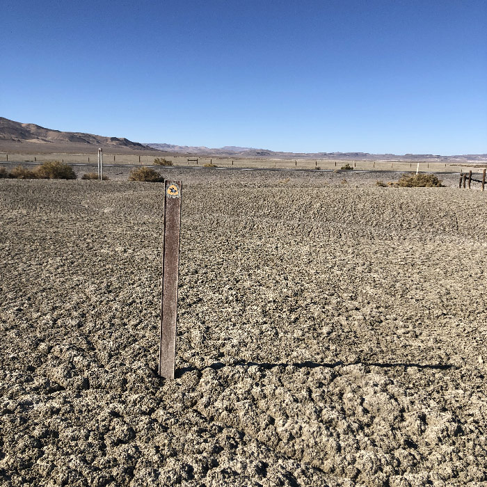
Between Simpson Pass and Bass Flat is the site of Sand Hill Station. There is a short obelisk here, more or less identical to the one at Simpson Pass. The trail between the Pass and this station marker is largely sand. Unlike the east side of the pass, however, the slope here is steeper. I rode this section as an out-and-back from Highway 95, and on my eastbound leg, had to walk the entire climb once the trail turned up to the Pass. Riding west, I had to pedal to keep the bike rolling downhill.
Notice the theme here? Sand Springs, Sand Hill? There's a reason for that. And an interesting historical note. James Simpson never actually went over Simpson Pass. On the expedition's westbound leg, his scout, John Reese, mistook Carson Sink for Walker Lake, which lies to the south. As a result of Reese's error, Simpson turned northwest from the future site of Sand Springs Station to get back on course. He later discovered the mistake, and travelled near Simpson Pass on the return trip. But Resse reported that the pass was too sandy to be viable as a wagon road, so Simpson didn't bother exploring it. It is true that the stagecoach, mail, and Pony Express used this pass, proving it wasn't too sandy. But as I leaned against the XP marker at the top of the pass and emptied the sand out of my shoes and socks, it struck me that Reese was not altogether wrong.
Sand Hill Station to Wildcat Station
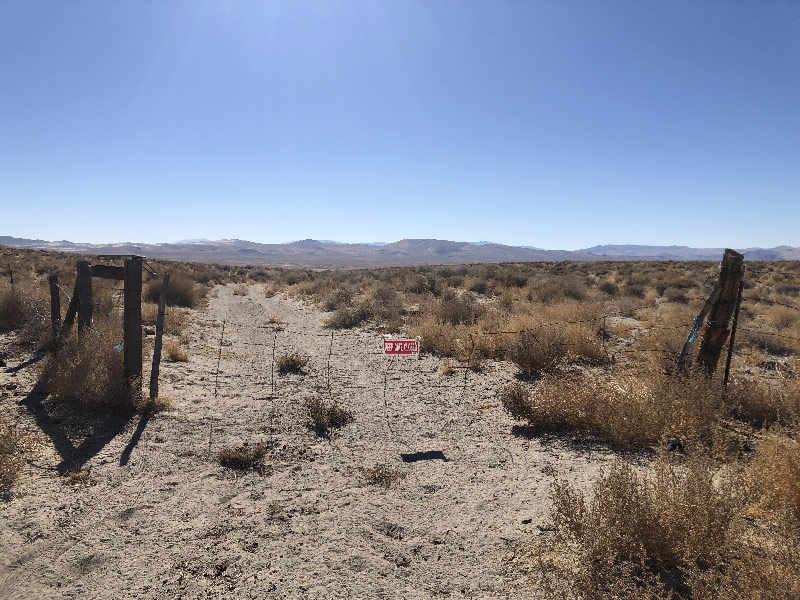
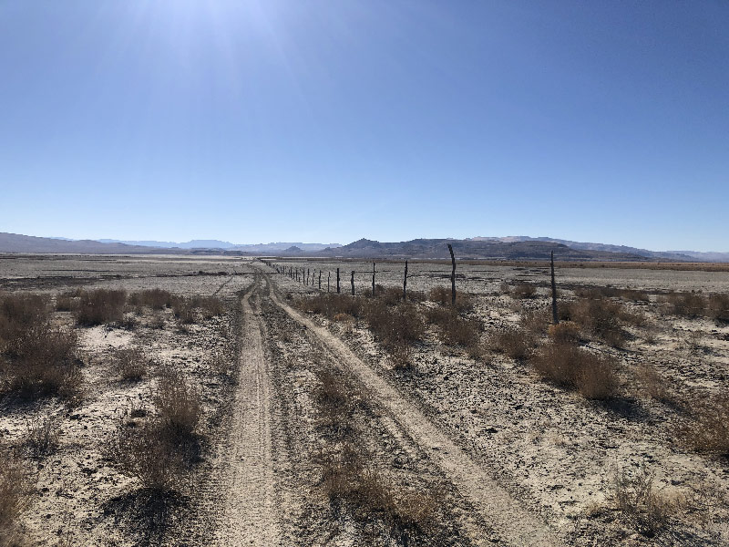
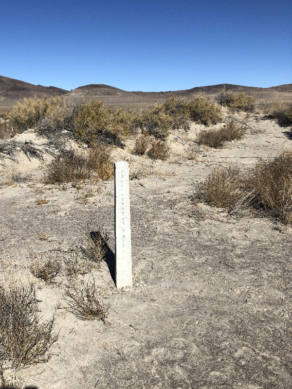
After passing Sand Hill Station (riding east to west), the trail runs into a wide, well-graded pipeline road that runs north/south along the east edge of Bass Flat. And this is where you have to make a decision: The Pony Express Trail continues straight across the flat; the American Discovery Trail takes the pipeline road north to the top of Bass Flat before turning west and then south again along the western edge; also, the pipeline road continues south, though no official trail runs in that direction. Just west of Sand Hill Station, you need to decide which of these trails or roads you want to take.
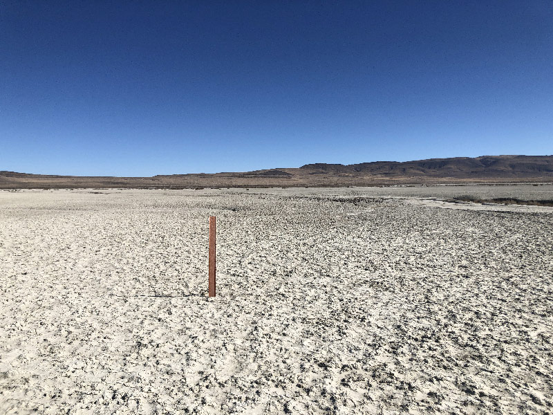
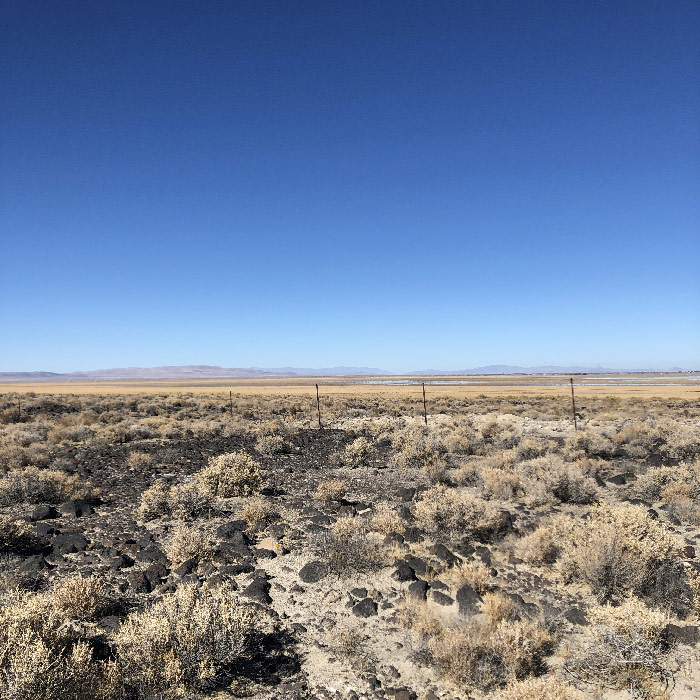
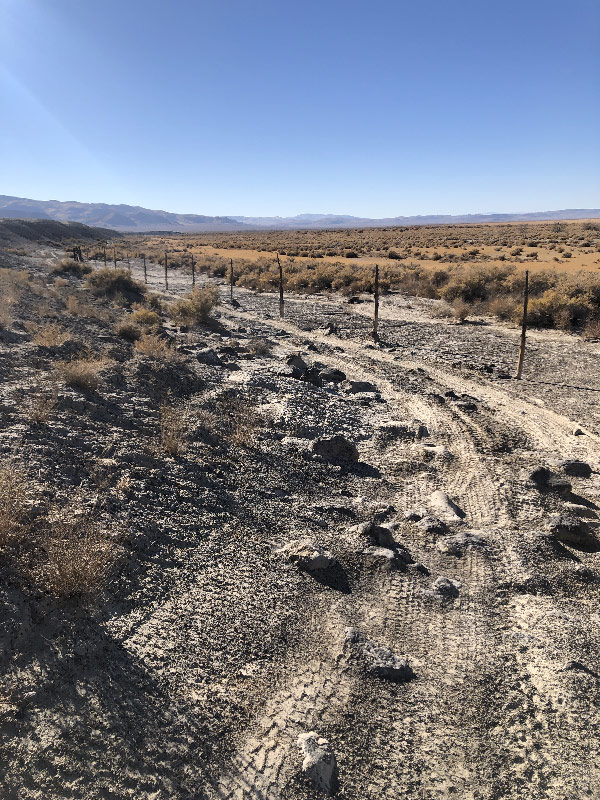
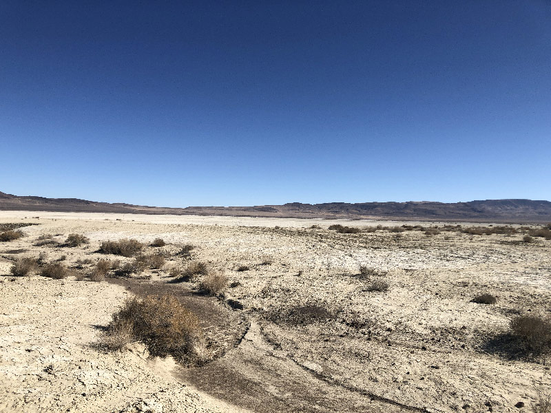
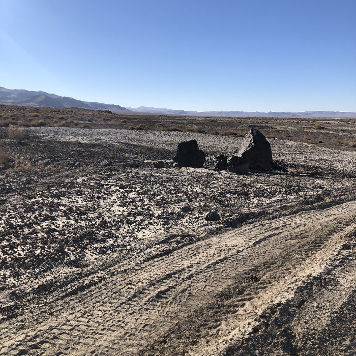
I followed the XP Trail straight across Bass Flat on my eastbound leg, and took the ADT Trail around the north of the the Flat on my westbound leg. Both were passable, but neither were ideal. Even though the Flat was as dry as it gets (October 2020), it was a difficult surface to ride. It isn't sandy, but like sand, it grabs at your tires and bogs you down. Crossing the Flat on the XP Trail, I found that if I followed tire tracks made by OHVs, or in the absence of those, followed dry rivulets, that I could make decent time, albeit not always on a direct course. Happily, there are orange XP markers placed at intervals across the Flat to steer by. Nevertheless, as with Fourmile Flat, I have to believe that this dry lake would be impassible on a bike when wet.
I took the ADT Trail north around the Flat on my return leg. This road was high and dry . . . until it wasn't. As mentioned above, the road turns south along the western edge of Bass Flat. On this leg it is hard up against a fence (the eastern boundary of Carson Sink Meadows), and there is nowhere for the road to go but into Bass Flat. Even dry, it was slow going in places. Again, I have to believe it would not be rideable if wet.
Unfortunately, I didn't have enough daylight to explore the roads south of Bass Flat. Looking at a map, they clearly connect at the same spot on west of the Flat where the ADT and XP Trail connect, and stay out of the Flat basin area. The only question is whether any of these southern roads are blocked by fences. I doubt it, but without having ridden there, I cannot be certain. Similarly, the pipeline road continues north, and it appears possible to ride it to other roads that lead to Fallon. Again, I did not ride these roads, so I don't know if you can get all the way through.
Which means that your real decision point is way back on US 50 near Sand Springs Station. If you want to stick to the XP Trail, you have to be prepared for the possibility that Bass Flat is impassable, and that while it is likely you can go around to the south of the Flat, or alternately, head north to get back to US 50 and Fallon, you may end up running into a lot of dead-ends and eventually have to backtrack, possibly all the way to Sand Springs Station. I think this is unlikely, and may represent a worst-case scenario. But until someone scouts this area in wet weather and rides the roads I wasn't able to, it is a scenario each rider needs to take into account.
There is a video of riding east across Bass Flat (on my outbound leg), then south along the western edge (on my return leg back to Highway 95), at the bottom of this page. I don't think it conveys how difficult the passage across Bass Flat would be if wet, but might give you some idea.
Wildcat Station to Highway 95
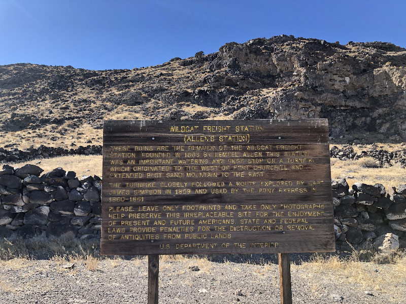 As mentioned above, all of the roads and trails meet on the west side of Bass Flat: the XP Trail from the east, the ADT trail from the north, and unscouted roads from the south. At this point you are on the XP Trail again, heading west. On your left is the Wildcat Scarp, named after the Wildcat Freight Station, whose ruins are about one and a half miles west. While not part of the Pony Express, the ruins are kind of interesting in their own right.
About three miles west of Wildcat Freight Station the two-track splits off from the XP Trail. The Trail continues along the fence, while the two-track veers south to stay closer to the hills. The XP trail continues for about two miles to a gate, and there is an XP marker beyond the gate (between it and Highway 95). The two-track winds a little to the south, and ends up on Highway 95 about a half-mile south of the XP marker. Though less direct, I recommend you stay on the two-track.
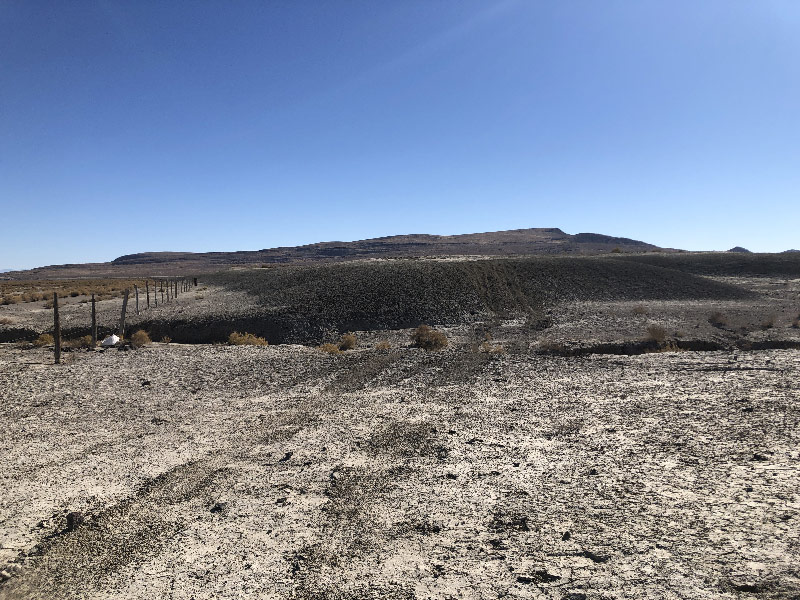
When I started out on this trail from Highway 95 in the morning, I started from the gate and marker on the XP Trail. As I mentioned, it sticks hard by a fence (the southern border of Carson Sink Meadows). The land south of the Trail, part of Wildcat Scarp, is very much like the dry lake bed, in that it has a thin crust that covers a soft underlayer. But unlike the lake bed, here it is piled in mounds separated by gullies scoured out but running water.
The entire plain for these two miles, until it meets the two-track coming in from the south, is slowly moving, or maybe oozing is a better word, to the north. As a result, the mounds now push up to and through the fence, and to stay on the trail, you have to ride down and up vertical drops and climbs into and out of gullies between large mounds of exceedingly soft ground. Which means you have to walk up the mounds.
Picture moguls on your favorite ski slope, ranging from six to twelve feet in height. Now picture yourself not riding downhill through the spaces in between, but going sideways up and over the top of each one. And the snow is soft powder. It's kind of like that. I wish I had taken the time to get better pictures of the trail in this section, but I was too worried about how long it was taking me to get through this section, so I neglected to document it photographically.
 While I was climbing up one of these, I noticed the dust from a vehicle to the south. I rode cross-country to the source of the dust and found the two-track mentioned earlier, and followed that the rest of the way east, and all the way back to Highway 95 on my way back west. Afterward, I re-read Kurstin's account of this section: "I crossed the highway [95 from west to east] and continued along the alluvium that washed out of the White Throne Mountains. I stubbornly want to stay on the 'dashed line' of the approximate route but the contours I was having to cross were a fight. Local ATV’s had made their routes out of necessity around these vertical ditches so eventually I followed their lead." (Kurstin's ride report from Buckland Station to Sand Springs is here.)
For what it's worth, that makes two of us who recommend you consider doing the same.