I have been putting around Casper, WY, all day. I thought I would be hunkered inside, hiding from thunderstorms, but they aren’t due in now until late tonight. Fortunately, there are paths along the river, so I have figured out how to get most places I want around town without having to brave the local traffic.
First thing I did was head out to powerwash the sand and grit out of my bike. I had to ride a few miles to get to a self-service car wash, further than I wanted to ride, but unlike yesterday, there was only a very light wind. In fact, it’s now 3:30 in the afternoon and there has only been a light wind all day. I guess I missed the call on that one. Maybe I should have stayed the night in Glenrock and had an easier ride today.
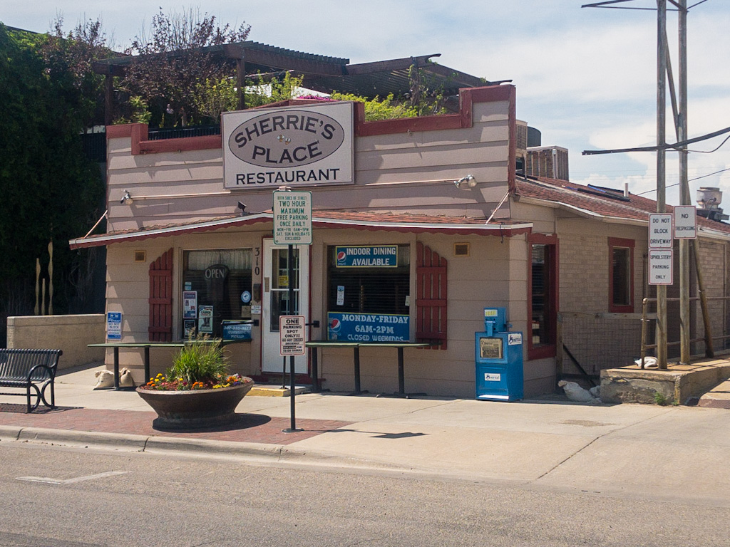
After washing the bike, I went to breakfast. I found a restaurant near downtown called Sherrie’s Place. It’s on a street called Yosemite Highway that, despite its name, seems like a quiet corner of Casper. There were a few tables outside. All full. Inside, the place was packed as well. The waitress told me that a woman sitting at one of the tables outside was waiting to sit inside, so I could have her table when she moved if I wanted it. I approached the woman, from across the table to maintain space, told her what the waitress told me, then asked if she’d mind if I sat as it seemed she was going to be seated inside in a moment. She said no problem, then stood and backed away. I apologized and said I didn’t mean to steal her table, and she said it was okay, no worries. So I set my pack down on the chair and we stood at opposite ends of the table and talked for a brief moment until she was seated inside.

I asked the waitress if they were always this busy on weekdays and she told me that Thursdays were Donut Day, which always packed them in. She said they’d sold eight dozen donuts already that morning. (Does any restaurant in Davisville make its own donuts? Is this an east-of-the-Rockies thing?) I had a huge breakfast, too large for a non-riding day. Even so, I bought a maple pecan donut to go (choosing that over the maple bacon) and had it as a snack after lunch. And yes, it was a very good donut. As good as the one in Gurley, you ask? I couldn’t say.
While I ate, a few people asked me about my bike and about the ride. I had a long discussion with a rancher about the route to the west of Casper. He did not have a particularly high opinion of California, but we had a nice chat. At one point a woman came out to look at my bike, saying she’d noticed it from inside. She asked how the ride was going, and I told her okay, except for the wind. She nodded and smiled—everyone to whom I mention the wind around here kind of has the same reaction, the knowing smile—then she said you can always tell someone’s from Wyoming because they walk like this, and she pantomimed a person blown back on their heels, arms reaching out in front to keep from falling over backward.
As I was finishing up, the waitress picked up my bill. It turns out that the woman I’d unintentionally evicted from her table paid for my breakfast. Right? I couldn’t believe it either. I should have bought her breakfast. The waitress told me it happened all the time there, and that in fact someone had paid for the woman’s breakfast, too. The rancher said I’ll bet that never happens in California.

I felt so good after that huge meal and the random Casper good will that I rode back to the hotel and passed out for about an hour. After I woke I walked up the hill to the National Historic Trails Center and poked around. It’s a nice facility run by the Bureau of Land Management. Free admission, great views over Casper and the mountains beyond. From there, I got back on the bike to go take a gander at Fort Caspar, which sits only a few miles away from where I’m staying.
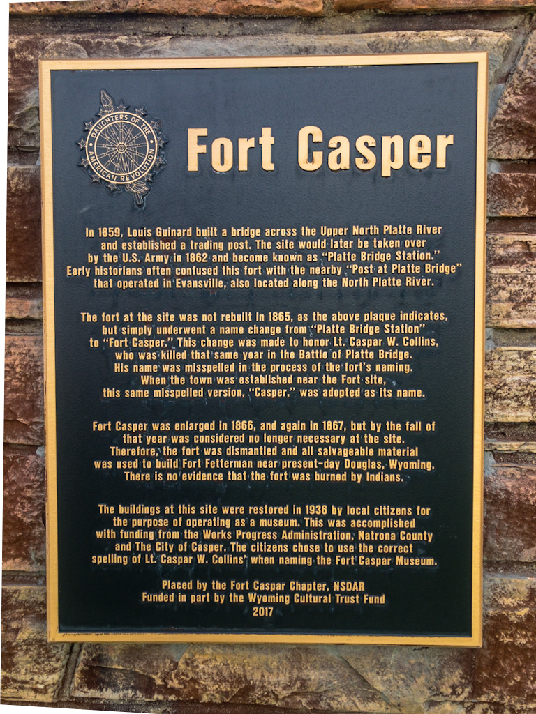
You may notice that (in most cases) the fort (Caspar) is spelled differently from the town (Casper). The fort was named after 2nd Lieutenant Caspar Collins, a U.S. Army officer killed in the 1865 Battle of the Platte Bridge Station against the Lakota and Cheyenne. The good people who named the town misspelled it (as did the the people who named Kearney, NE; the spelling of General Steven Watts Kearny’s name lacks the added “e”). As for the history:
Site of Fort Caspar/Platte Bridge Station, Fort Caspar Museum, 1847 Mormon Ferry, and Guinard Bridge. Fort Casper was a focus of 19th century emigration, commercial, and military activity. In 1847, Brigham Young’s Mormon pioneer party made a difficult crossing the North Platte River near this location, then left behind a small party to establish a ferry service there. Later, a toll bridge, trading post, Pony Express relay station, and telegraph office were built nearby. In 1862, the Army established a small military post at the station.
National Park Service, Auto Tour Route Interpretive Guide–Wyoming
And . . .
Twenty-eight miles from Deer Creek was the Upper or Mormon Ferry on the North Platte, near modern Casper. The earliest travelers found it, of course, in a state of nature and were utterly dependent on their own efforts. Tradition tells us that the crossing selected in pre-prairie-schooner days was three miles down from the later ferry site.
It was a favorite with the Indians, who would make rafts of their lodgepoles, pile them with household goods and attach thongs of buffalo hide, with which swimming braves towed them across the river. The fur traders usually waited for a favorable day and crossed with their goods packed in bullboats, floating the heavy carts.
Irene D. Paden, The Wake of the Prairie Schooner, p. 195
The Mormon ferry across the river was advertised by one of the earliest billboards along the emigrant trail:
[In 1847] at Deer Creek [Glenrock, WY], you saw a billboard! Of course, it was a poor thing compared those magnificent ones now lining our highways over the mountains and across the deserts, giving our city-dwelling drivers a feeling of comfort and security. Still, great oaks can only grow from little acorns, and this beginning at Deer Creek stood thus:
Notice
The ferry 28 ms the ferry
good and safe, maned by experienced
men, black smithing, horse and ox
shoing done also a wheel rightThis was the Mormon ferry, near the site of present Casper, Wyoming, established by order of Brigham Young on June 18, thus to turn an honest penny for the benefit of the Saints.
George R. Stewart, The California Trail, p. 187-88
The reason for all the ferries and bridges in the area is that just a little west of here the inconsiderate North Platte River turns south. As with the Lower and Upper California Crossings of the Platte (near Ogallala and Julesburg, respectively), anyone wanting to continue west needed to cross the North Platte. The area from about three miles east of Casper (now Evansville) to about twelve miles southwest (Bessemer Bend) was the last chance to cross before you started heading in the wrong direction.
So if you’re keeping count, we’re talking about three important river crossings so far (not counting the Missouri):
- Crossing from the south bank of the South Platte River to the south bank of the North Platte River (Lower and Upper California Crossings);
- Crossing from the south bank of the North Platte River to the north bank of the same river at Casper (to make a dry crossing to the Sweetwater River, but more on that as we progress);
- A third crossing, which is actually two different crossings, near Fort Laramie.
Actually, we’ve only talked about the first two. My bad. Regarding this third crossing, near Fort Laramie: the fort stands near the junction of the Laramie River and the North Platte River. Emigrants, Pony Express riders, et al., traveling along the south bank of the North Platte had to cross the Laramie River to continue west. Mormons, at first, and later other travelers who also went along the north bank of the North Platte crossed the North Platte River here to the south bank because it was thought that the north bank was impassible from that point west.
In the early years of the emigration, the terrain on the north side of the river was thought to be impassable west of Fort Laramie. Mormon emigrants and others entering Wyoming on the north-bank road were forced to ford the deep, swift North Platte near the fort. Starting in 1850, north-side emigrants had the option of loading their wagons onto a ramshackle flatboat and pulling the contraption along a rope stretched across the river — unassisted, and at the outrageous fare of $1 per wagon. The price of passage drove some offended emigrants to blaze a new trail, Child’s Cutoff (also called Chiles’s Route), which continued west on the north side of the river. Travelers who stayed on the north bank via Child’s Cutoff could avoid crossing the North Platte altogether, while those following the original south-bank road had to cross upstream, near today’s city of Casper. By 1852, most wagons arriving on the north side continued up Child’s Cutoff, though many travelers still crossed the river to visit Fort Laramie [to buy supplies, mail letters, etc.]. A graceful iron military bridge, built in 1875, still spans one of four emigrant crossings of the North Platte near the fort.
National Park Service, Auto Tour Route Interpretive Guide–Wyoming, p. 9
Conceivably, one could avoid all three river crossings simply by starting out from the Missouri River on the north bank of the Platte River. Even so, there were still rivers to cross, and apparently Child’s Cutoff (above Ft. Laramie) was no picnic:
Travelers on both the north and south sides of the North Platte had to swing away from the river to bypass the impassable canyons. South-side travelers had to pass through the Black Hills. North-side travelers after 1850 could stay on the north side of the river along a route called Child’s Cutoff. Either way was rough.
Keith Heyer Meldahl, Hard Road West, p. 78, n. 2
Let’s face it: there was just no easy way to get to South Pass, the gateway through the Rockies where everybody was headed.

I have been spending some time along the North Platte these last few days, and I have to tell you, it looks like it moves pretty swiftly through these parts. It is not a river I’d like to have to swim across, let alone try to get oxen, wagons, kids, and whatever else across safely. In the 1850s it was even wider, especially in spring, or when swollen after a storm. People kayak the river today, and there are stations all along the bike path with PFDs (personal floatation devices) for the public, so maybe it’s not as bad as it seems. But I would still be apprehensive.
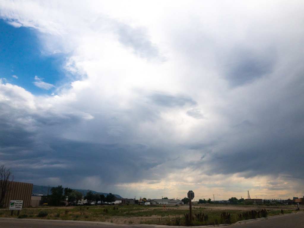
[Weather update: 4:30 pm, the clouds have moved in and the winds are now as nasty as yesterday. Feeling a little better about pushing the last two days to get here.]
You may have noticed that the Mormons were pretty assiduous about setting up ferry crossings at key places. When they migrated west to establish a new home in the great Salt Lake Valley, they did not have much cash. They needed money to buy machinery (such as mills), and to help successive waves of Mormon emigrants who came across the plains to Deseret (the Mormon name for the Great Salt Lake Valley, and in fact, most of the Western US, which Brigham Young intended to become Mormon lands) in the ensuing years. Ferries were one way to generate some quick cash, and Brigham Young made sure to establish ferries wherever he could to raise funds for the church coffers.
From here through to Salt Lake City I will be traveling through the heart of Mormon emigrant history. I plan to fill in more background on that history as I pass through the area. It’s very interesting, albeit tragic.
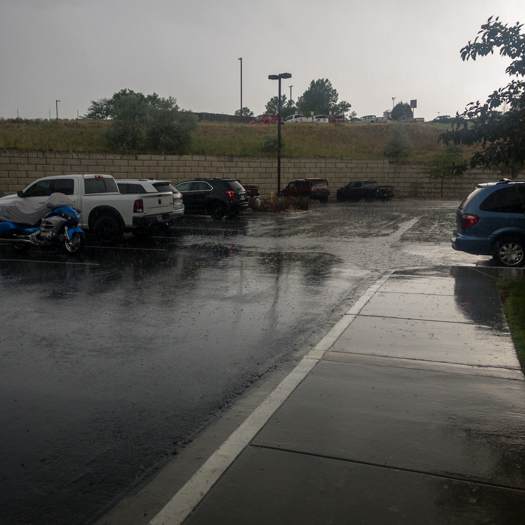
[5:30 pm. Pouring outside now. This is the storm I fought the wind to avoid. I don’t feel so dumb now.]

After visiting Fort Caspar I headed back to Bourgeois Pig for coffee and a smoothie and to start this blog. (I think all told I rode around 20 miles today.) I have a contact in the Wild West reaches of Wyoming, so I reached out to let him know my plans. Yes, I think I want to continue on to Salt Lake City. But not just yet. The weather looks unsettled for the next few days. I plan to stay put until the worst of it passes. I don’t know what I’ll do in Casper all that time, but after the rain demonstration this afternoon (whipping winds; profuse, fat drops of water crashing down), plus the prospect of the squalls turning into actual thunderstorms . . . and knowing there is nowhere to hide once I leave here, I think I’d prefer a little boredom to a good soaking.
[6:30. The rain has stopped. For now. Thunderstorms forecast for late tonight.]
[Sorry, no gallery. I put the few pictures I took today in the body of the post.]
That feeling of having made the right decision is like no other. Smugness tempered with humility. Enjoy Casper. Find pie. —Babz
And gratitude.
I love hearing about all the interesting folks you’re meeting on this adventure! brenda
I’m glad. Meeting all sorts of people along the way has been the most interesting part of the trip.
Glad you beat the rain to Casper (Caspar?). I might need a field trip to Vallejo to scout out Scotty’s Cafe.
I know. Dinner and donuts!
Fun fact: The Lantern in Davisville served donuts in the evening, in the same oil used for cooking fried chicken for dinner that night. It was a great late hangout in the early-to-mid 70’s.
Good writing and experiences again today, Scott.
Hilarious. Definitely before my time in Davisville. It even predates my first tour from 1986-89.
Try Scotty’s Cafe in Vallejo for a diner that serves a full meal but also has a decent donut selection!
I’ve never heard of it. But it sounds worthwhile. Thanks!